| Rating | ★★★★☆(4/5) |
| Overall Difficulty | Easy |
| Navigation Difficulty | Easy |
| Distance | 2.2 miles roundtrip |
| Time | 1.5 hours |
| Terrain | Hilly |
| Best Seasons | All |
| Family Friendly | Yes |
| Dog Friendly | Yes |
| Accessible | No |
Highlights
- Great views from the highest point in the park
- Beautiful rolling, grassy hills
Hike Summary
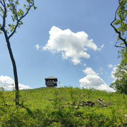
I was unfamiliar with the western part of Minnesota until a friend suggested I look up pictures of Glacial Lakes State Park, and those picturesque grassy green hills were enough to inspire me to make a stop here on a drive out to Theodore Roosevelt National Park. Millions of years ago, glaciers covered this area, carving the rounded landscape and creating many lakes between the hills when the ice melted. This hike travels to the highest point in the entire park, which unsurprisingly also hosts the best view in the park. If you only have time for one hike in the park, this is the one to do.
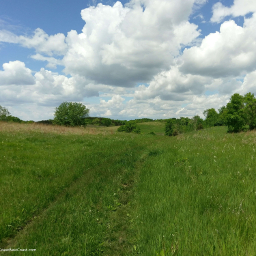
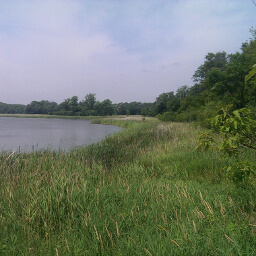
This loop trail makes a wonky figure 8 and is best completed clockwise -- in this direction, the highpoint is slightly more than halfway through the hike, making the return trip seem much shorter when you're already tired. The loop starts as one trail at the parking area and splits after a tenth of a mile. Simply stay left at each fork along the way to keep doing the loop clockwise. On the right side of the trail, you'll see some of the fantastic hills created by glaciers, as pictured below. This image really captures the essence of the park, showing the prairie grass and wildflowers in the foreground, pockets of trees in the middle, and rounded green hills in the background.
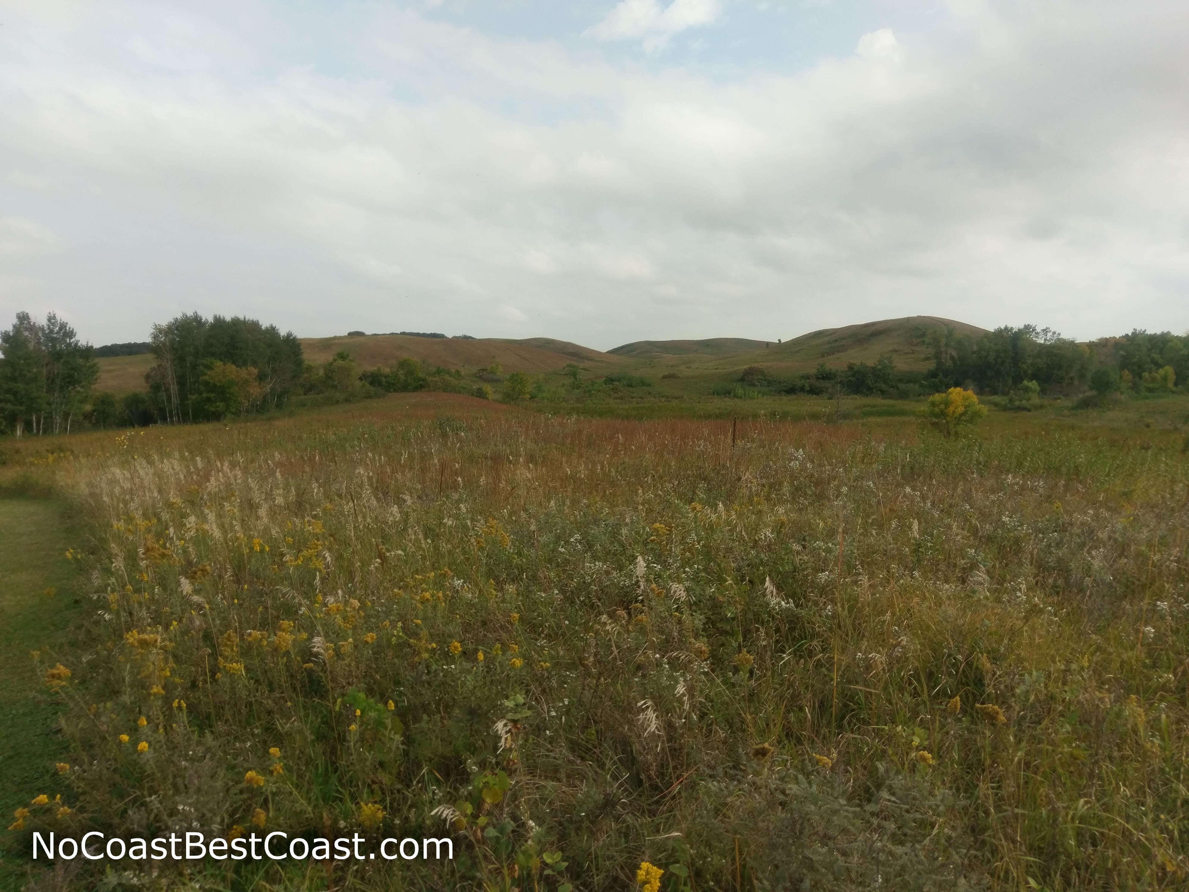
The grassy, glacier-carved hills in the distance

A variety of wildflowers grow in the tall grass here

Goldenrods in bloom on the lakeshore

The hilly view from the park's high point

The winding trail on top of the ridge
Important Information
Dogs are allowed on leash. The High Peak Trail is part of the Minnesota Department of Natural Resources Hiking Club program, which is a fun way to introduce kids to hiking; each Minnesota State Park has a designated Hiking Club Trail, generally an easy but scenic hike, where you can find a sign with a secret password related to something in the park or on the hike. If you buy the official hiking club booklet, you can record every password and earn rewards and free nights of camping after certain milestones. You can hike this trail in every season since none of the park's trails are groomed for skiing in the winter. However, this trail is not recommended on a particularly hot summer day since much of it lacks shade (it was 85, cloudy, and muggy when I hiked it, and I couldn't imagine attempting it on a sunny day with those temperatures). Be sure to bring bug spray or you will be eaten alive. I visited on a Friday afternoon and didn't see more than a couple people hiking, but I'm not going to make any claims about how crowded it might be on a nice weekend in early summer.
Directions
There are many turns to reach this park from the interstate, so using a navigation app is highly recommended -- click the link below this paragraph for Google Maps directions. From the Twin Cities, take Interstate 94 west past St. Cloud and take the exit for U.S. Highway 71 in Sauk Center. Turn left, then turn right onto Minnesota Highway 28 shortly after crossing over the interstate. Turn left onto 15th Street (just before the ramps to Minnesota Highway 55), then turn left again on Frontage Road. Turn right onto 190th street, then left onto Minnesota Highway 104. Turn right onto County Road 18, then left onto Minnesota Highway 29. Right as the road starts curving to the west, turn left onto County Road 41. Pay the fee at the park entrance building, then take the first left and follow the road through the campground to the parking area between sites 30 and 31. Note that on busy weekends, parking may be full or even restricted or reserved for backpackers; in this case, you'll have to start from the group campsite (adds 1 additional mile roundtrip) or the day use area (adds about 2 additional miles roundtrip).
Google Maps Directions
Parking, Fees, and Facilities
Like all Minnesota State Parks and Recreation Areas, you must pay a vehicle entry fee of $7 per day or $35 for an annual pass (highly recommended if you frequently go to Minnesota State Parks). There are both pit toilets available in the campground.
Nearby Hikes
Sibley State Park, Minnesota
★★★☆☆(3/5)
Sibley State Park, Minnesota
★★★★☆(4/5)
Crow Wing State Park, Minnesota
★★★★☆(4/5)
Lake Maria State Park, Minnesota
★★★★☆(4/5)