| Rating | ★★★★★(5/5) |
| Overall Difficulty | Easy |
| Navigation Difficulty | Easy |
| Distance | 1.6 miles roundtrip |
| Time | 1 hour |
| Terrain | Hilly |
| Best Seasons | All |
| Family Friendly | Yes |
| Dog Friendly | Yes |
| Accessible | No |
Highlights
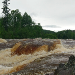
- Thundering rapids and powerful waterfalls
- Plenty of photo opportunities
Hike Summary
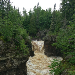
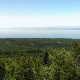
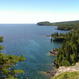
The North Shore of Lake Superior offers some of the best scenery in Minnesota, and Temperance River State Park doesn't disappoint. Unlike the name "temperance" suggests, this river rages through a narrow gorge with spectacular rapids and cascades. This is the perfect place to stop to stretch your legs on a long journey up the North Shore, or you can spend the night and explore the park with hikes like Carlton Peak. Either way, this park shouldn't be missed.
Dogs are allowed on leash. Like most Hiking Club trails, this is an excellent family friendly hike and an opportunity for you to collect another Hiking Club password to work toward winning that free night of camping. This route is available year round, though trails are not maintained or groomed in winter. The first quarter mile or so is usually quite busy (even on a Thursday!), but there will be fewer people after you pass the bridge over the gorge.
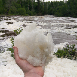
The trail starts on the north side of the highway and is paved for a short section leading to an accessible viewing platform. There is another short water access trail that starts near here, but signs should say this trail does not lead to the waterfalls; you'll know you're on the wrong trail if it dead ends at the river. After the viewing platform, the trail becomes unpaved and circles the pool at the base of the falls. All of that churning water makes huge swaths of foam covering the surface of this pool -- you can see me holding a ball of it in my hand in the picture below. Soon after rounding the pool you will begin a short but steep climb to the top of the rocky gorge.

Directions
From Duluth, take Minnesota Highway 61 north for about one and a half hours. Watch for signs for Temperance River State Park, and there will be parking spaces on both sides of the highway.
Google Maps Directions
Parking, Fees, and Facilities
Parking along the highway is free! Note that a state parks permit is required if you park anywhere within the park. There are no facilities directly adjacent to the parking area on the highway, but a trail leads to the park office where there are flush toilets.
Nearby Hikes
Superior National Forest, Minnesota
★★★★☆(4/5)
Superior National Forest, Minnesota
★★★★★(5/5)
Superior National Forest, Minnesota
★★★★★(5/5)
Tettegouche State Park, Minnesota
★★★★★(5/5)