| Rating | ★★★★☆(4/5) |
| Overall Difficulty | Moderate |
| Navigation Difficulty | Easy |
| Distance | 4.5 miles roundtrip |
| Time | 3 hours |
| Terrain | Hilly |
| Best Seasons | Spring, Summer, Fall |
| Family Friendly | No |
| Dog Friendly | Yes |
| Accessible | No |
Highlights
- More private than the High Falls
- Fun hike with an adventurous feel
- Views of Lake Superior
Hike Summary
First piece of advice: do this hike before visiting the High Falls or you will be severely disappointed. This hike's difficulty took me by surprise, and finally reaching the waterfall felt sweet knowing that I had earned it. However, if I had visited the High Falls first, I doubt I would have felt the same way.
The hike starts by following the paved High Falls trail for half a mile. There will be a trail junction, with a pit toilet and the unpaved Middle Falls Trail continuing on your left. A sign at the start of the trail cautions hikers about the distance and difficulty of this trail (I initially shrugged this off as a warning aimed at the average unprepared patron hoping for another easy trail to a waterfall). I soon found out I had underestimated the trail and was in for a real adventure!
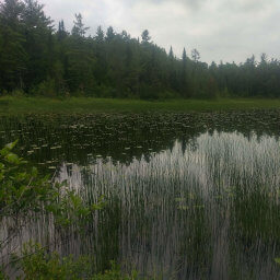
It had been raining excessively on the North Shore in the past week, so the trails were thoroughly drenched -- picture puddles of the gooiest muck, globs dripping off your shoes. Some areas even had an inch of standing water (see image below). At first, I attempted to avoid puddles and walking in deep mud to save my shoes and feet, but soon realized this was futile. If you don't care about how your shoes look and have another pair of shoes in the car, I recommend you forget trying to avoid the mud and walk through everything carefree.

That's not a muddy creek, that's the trail
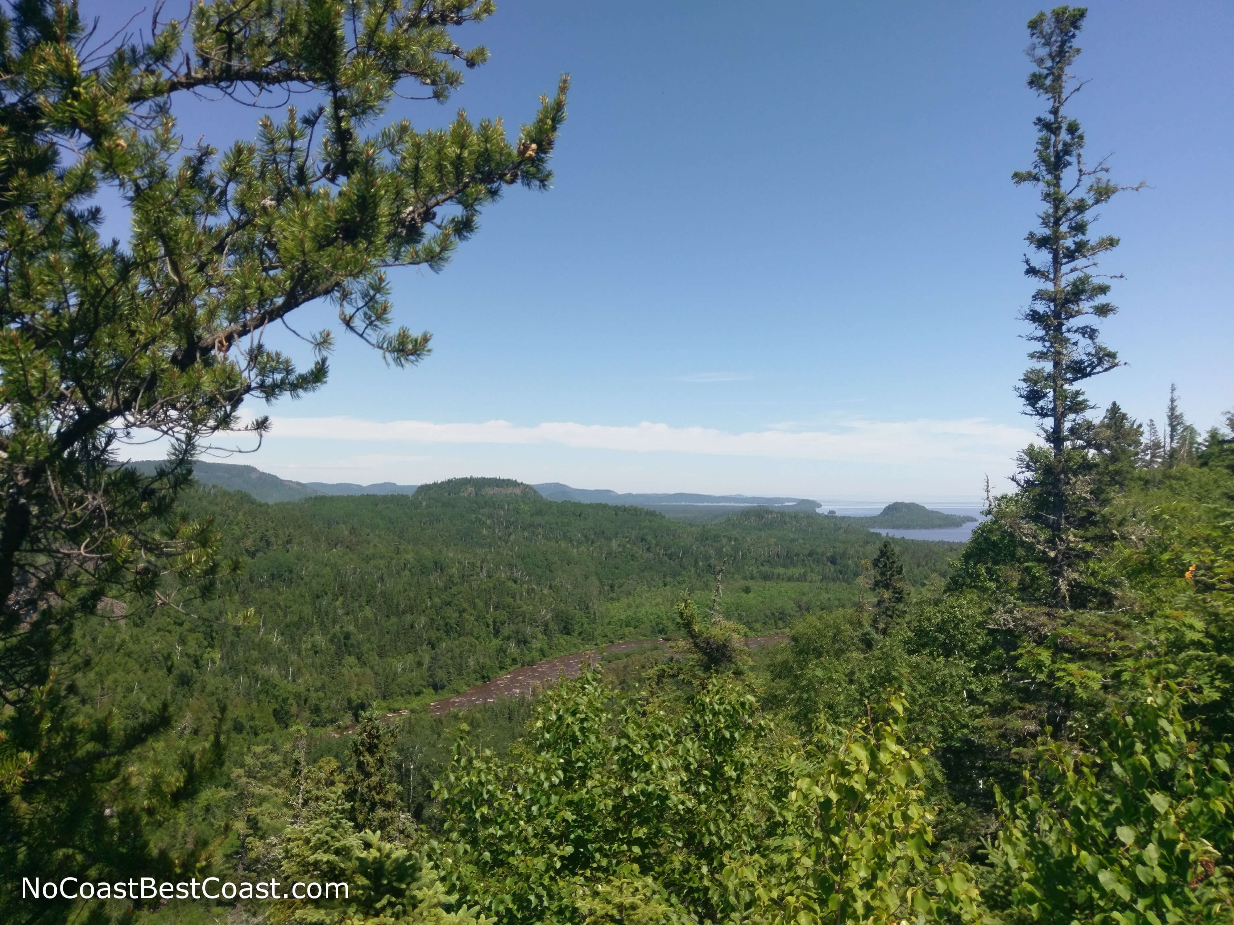
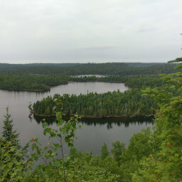
View of Lake Superior from the overlook
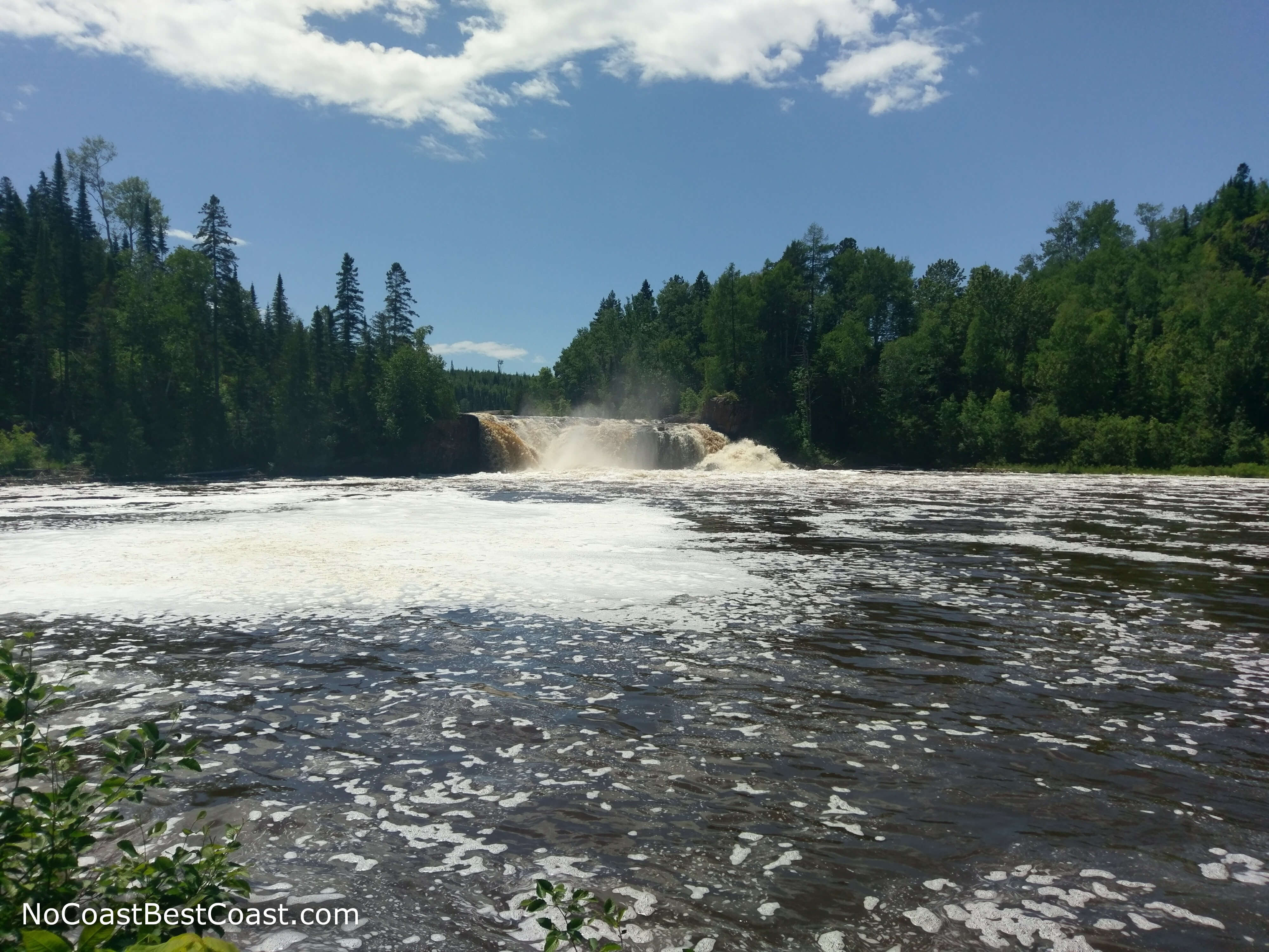
The reward for your adventure through the woods: Middle Falls
Upon finishing, check out the High Falls (and don't mind the hordes of tourists staring at you looking and smelling like a swamp monster). What an adventure! Walking uphill both ways through the mud and thickets of undergrowth while being eaten by bugs, just like grandpa on his way to school back in the day.
Important Information
This is not a family friendly hike; several people that I passed in the beginning did not make it all the way to the falls. Dogs are allowed on leash. This trail can be terribly muddy and overgrown, so be prepared by wearing pants and leaving an extra pair of shoes in the car.
Directions
From Duluth, Minnesota take Minnesota Highway 61 north towards the Canadian Border. Look for the sign for Grand Portage State Park just before the border crossing, then turn left into the parking lot.
Google Maps Directions
Parking, Fees, and Facilities
Unlike other Minnesota State Parks, there is no vehicle fee! This park functions as a highway rest area, so there is a picnic area, travel information center, and flush toilets near the large, paved lot.
Nearby Hikes
Grand Portage State Park, Minnesota
★★★★★(5/5)
Kakabeka Falls Provincial Park, Ontario
★★★★★(5/5)
Superior National Forest, Minnesota
★★★☆☆(3/5)
Superior National Forest, Minnesota
★★★★★(5/5)