| Rating | ★★★★☆(4/5) |
| Overall Difficulty | Moderate |
| Navigation Difficulty | Easy |
| Distance | 3.2 miles roundtrip |
| Time | 2 hours |
| Terrain | Hilly, 450 feet of elevation gain |
| Best Seasons | Spring, Fall |
| Dog Friendly | Yes |
| Accessible | Yes |
Highlights
- Visiting the highest point in the state of Missouri
- The highest waterfall in Missouri, Mina Sauk Falls
- Shady creekside trail and mountain views
Hike Summary
This trip to Taum Sauk Mountain marks my 10th state highpoint. The journey is a bit anticlimactic, since you drive most of the way to the top and follow a flat, paved path to the actual highpoint which is shrouded in forest. But while the view from the top isn't anything to write home about and the hike is simple, continuing on the trail to Mina Sauk Falls is an aesthetically-worthy and challenging trip. On this loop, you'll enjoy the highest waterfall in Missouri and a handful of overlooks of the surrounding St. Francois Mountains.
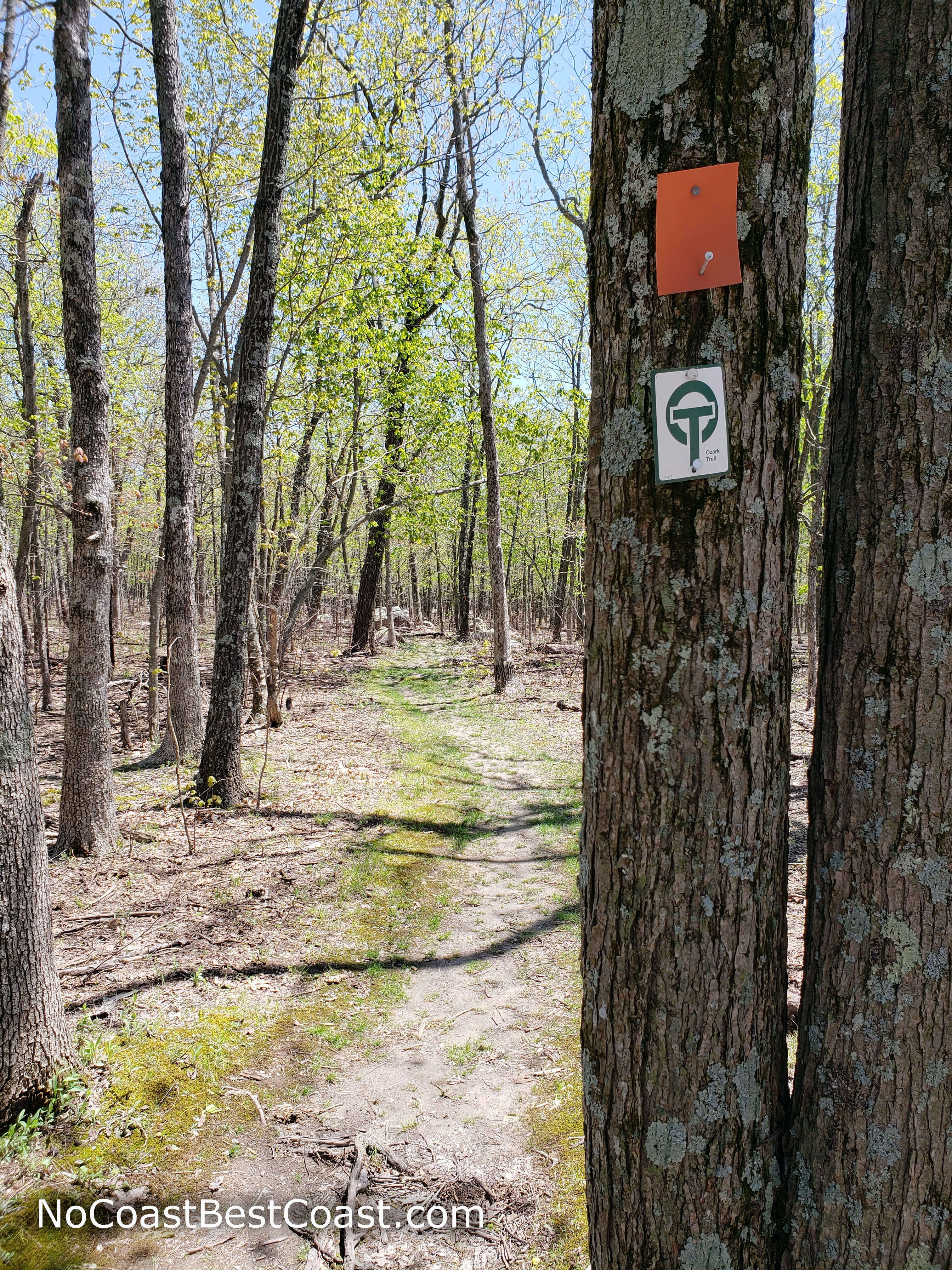
From the parking lot, follow the paved path as it winds through the woods (as pictured below). In a little under 0.2 miles, you'll turn left at onto a spur trail signed for the highpoint. A few more steps later, and you'll reach the top of Taum Sauk Mountain.
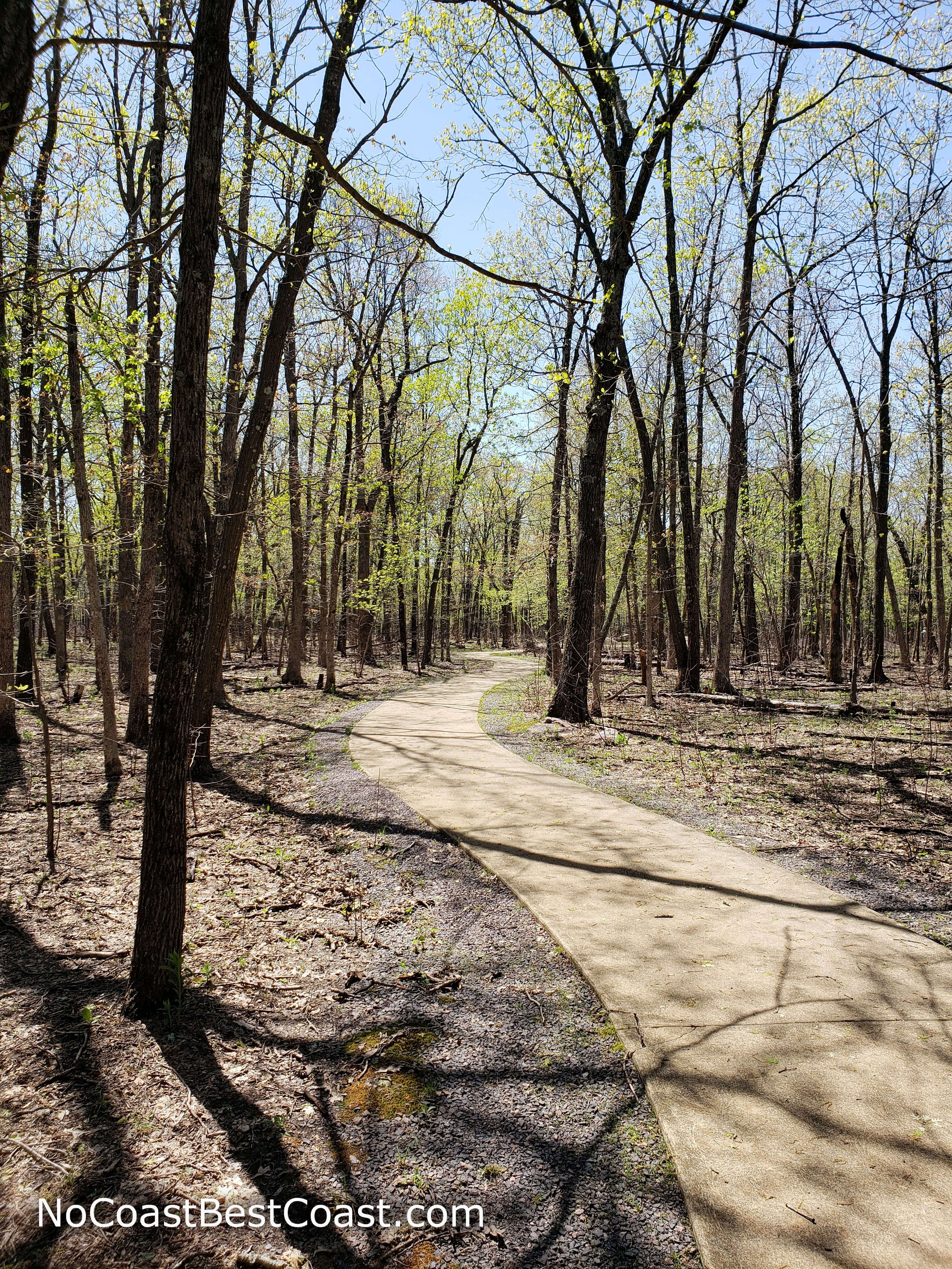
The winding concrete path to the highest point in Missouri
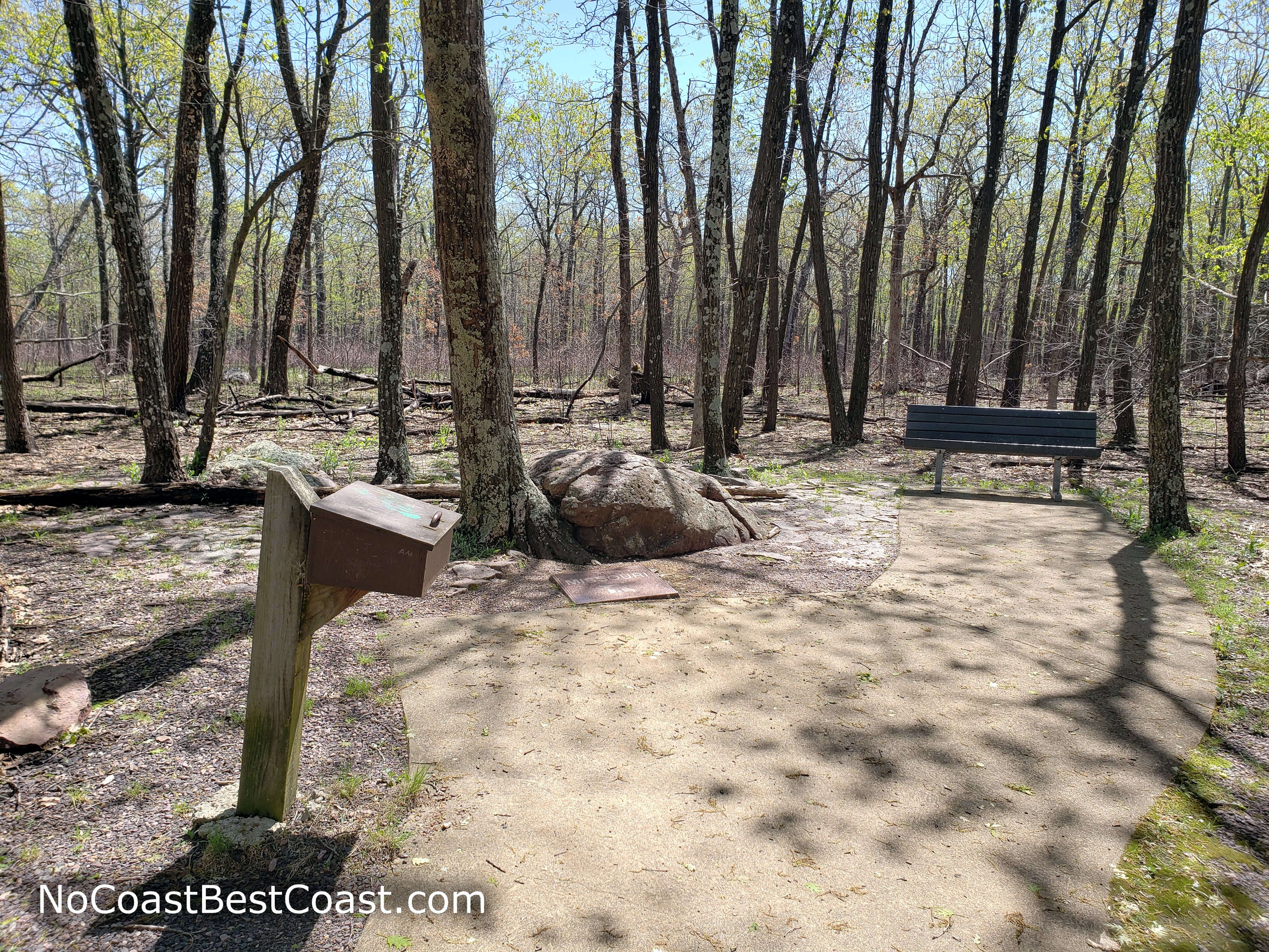
The highpoint area with a bench, plaque, and box with souvenir stickers
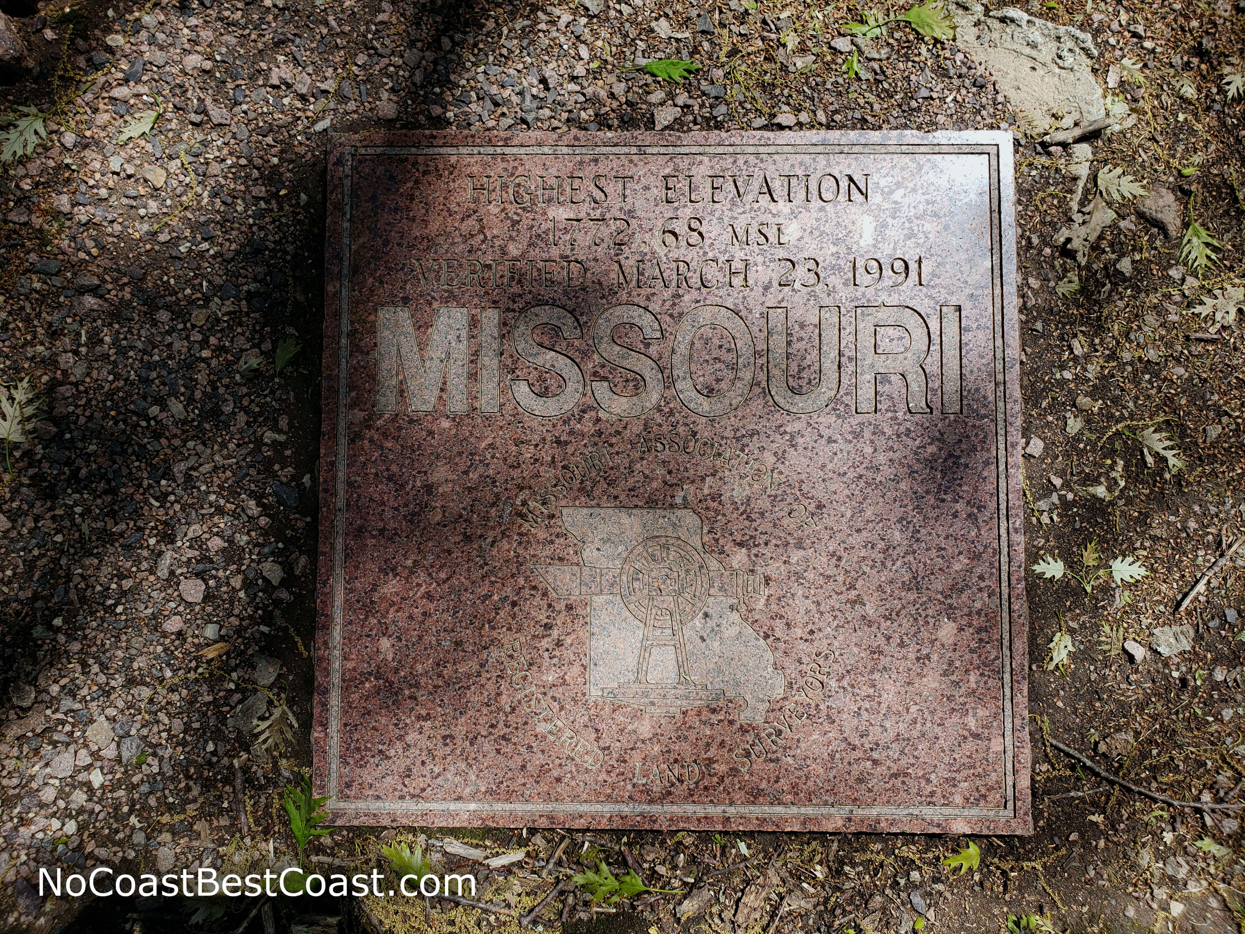
The plaque marking the highest point on Taum Sauk Mountain
Enjoy the crushed stone path while you can! The trail eventually becomes steep and rocky. After periods of heavy rain (like on my springtime visit), the trail is prone to flooding, and you'll have to tread carefully if you don't want to wet your boots. Sturdy footwear is absolutely essential on this hike -- it's easy to twist an ankle if you're not careful on the rocks.
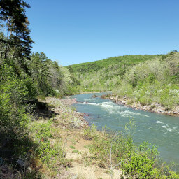
At several points before the falls, glades of rocks and shrubs will replace the trees, unveiling splendid views of the surrounding mountains and valleys, as pictured below. Because the mountains in this area are so tall (at least for Missouri), the valley you see here is the deepest in Missouri, spanning 700 vertical feet from the mountaintops to Taum Sauk Creek at the bottom.
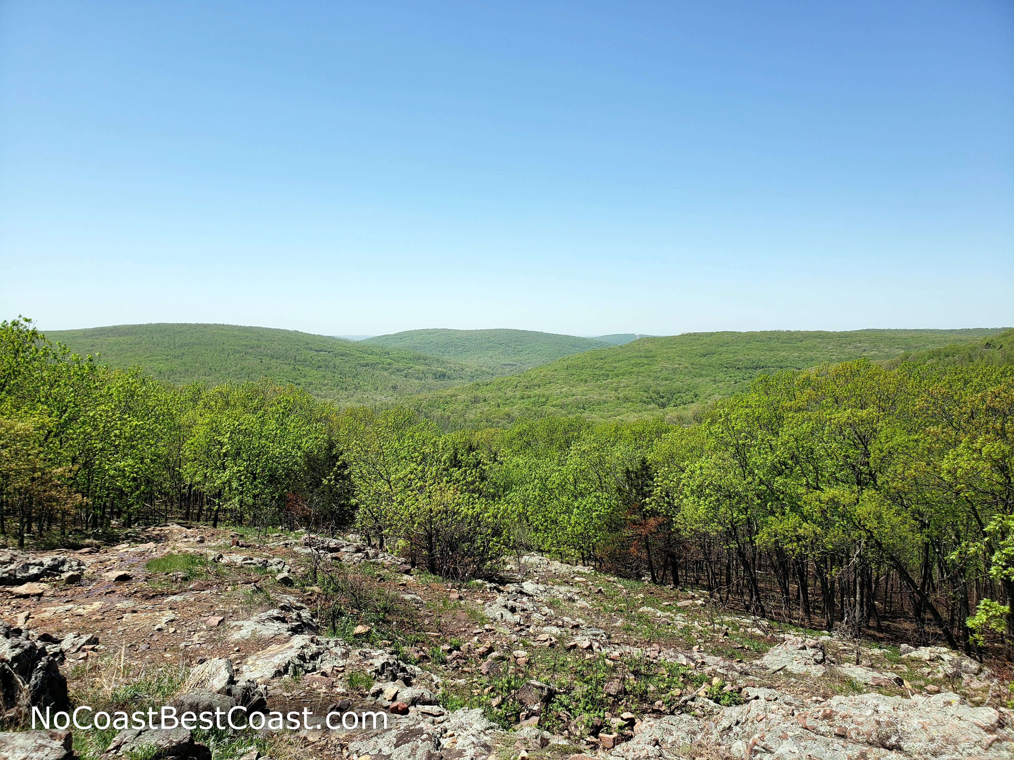
The rolling green Ozarks from a glade on the Mina Sauk Trail
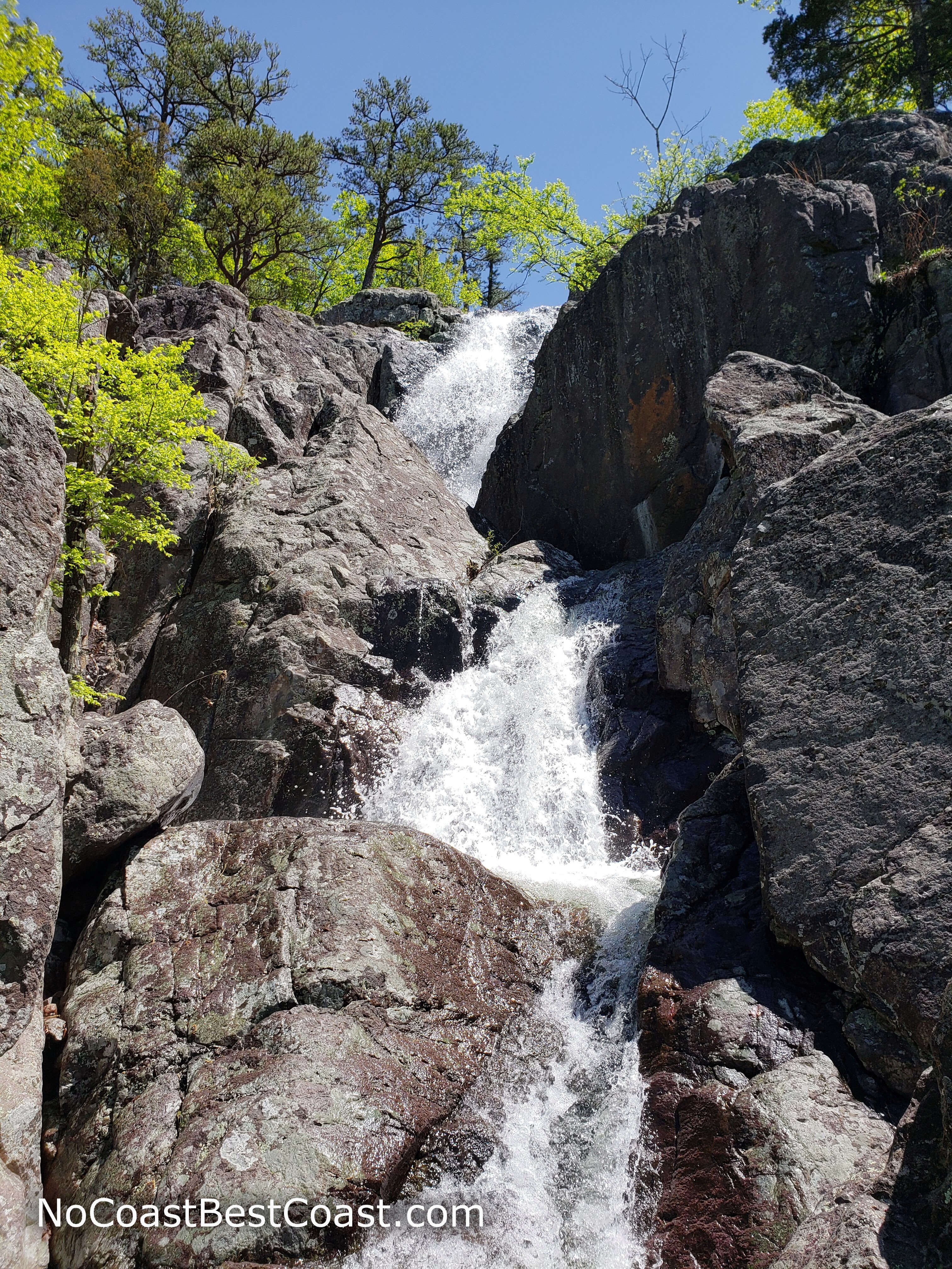
Looking up at the volcanic rocks of Mina Sauk Falls
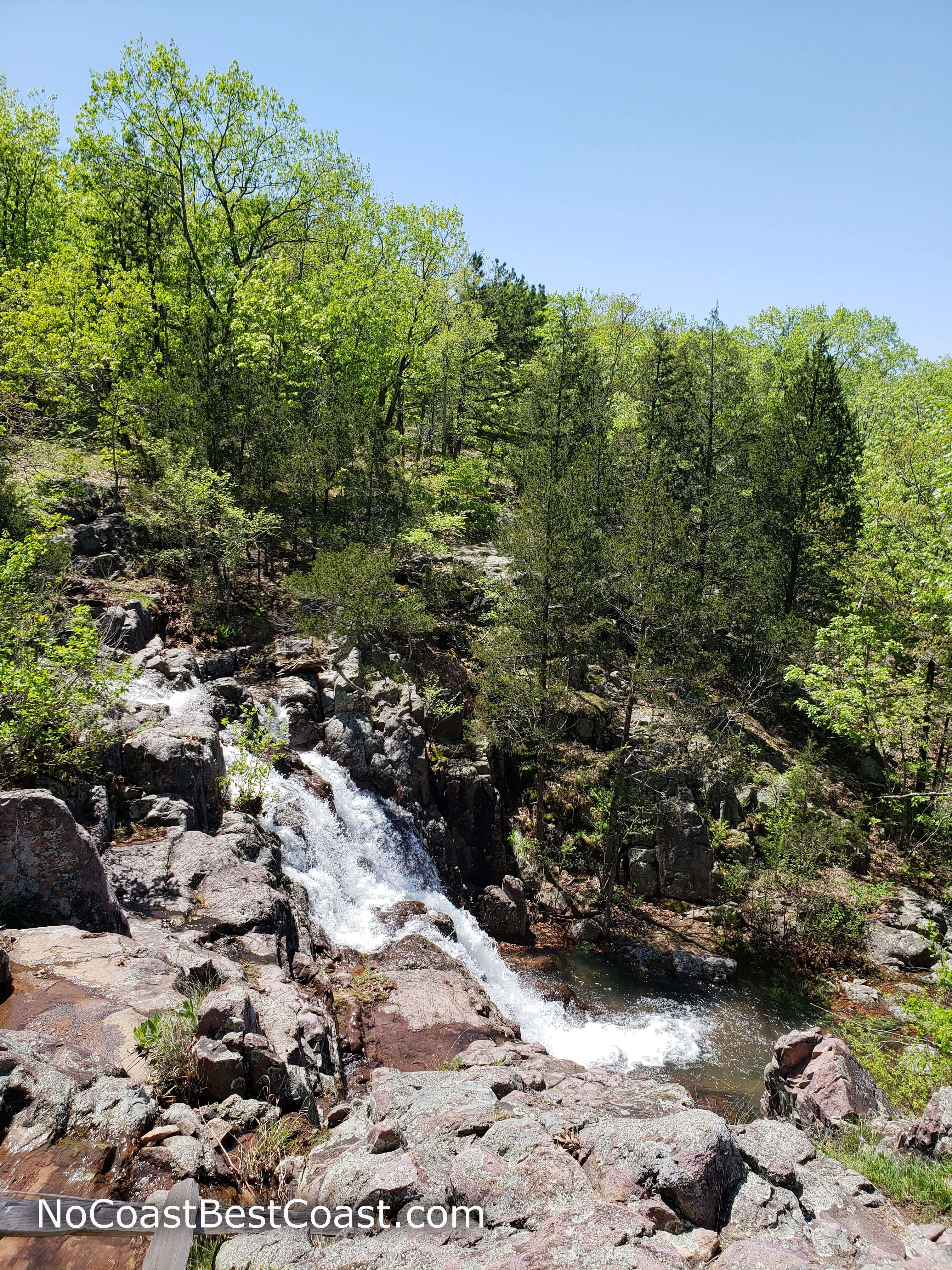
Trail markers for the Ozark Trail (white and green) and the Mina Sauk Trail (orange/red)
Mina Sauk Falls from behind the fence along the trail
Overall, this is a lovely place to spend an afternoon, with beautiful forest, scenic overlooks, and a mighty waterfall. Stop by the overlook alongside the park road on you way out for even more scenery. Connect with me using the social media links below and share your adventures!
Hiked on Friday, April 26th, 2019 by Ricky Holzer
Important Information
Dogs are allowed on leash. The path to the highpoint of Taum Sauk Mountain is paved and accessible, as is the glade overlook along the main park road, but the entire loop is not accessible. The trail to Mina Sauk Falls is rocky and steep, and is not kid-friendly; instead, take your kids to nearby Johnson's Shut-Ins State Park where there are easier trails and a scenic swimming area. Fall and spring are the two best seasons to visit; summer would be doable since the trail is mostly shaded and the ascent follows a cooling creek, but winter weather may leave the rocky trail icy and dangerous. Expect to see other people on the trail, especially when the weather is nice.
Directions
From St. Louis, take Interstate 55 south. Take the exit for U.S. Highway 67 south toward Bonne Terre/Farmington. After about 35 miles, take the exit for Missouri Highway 221 and head right. In Pilot Knob, turn left onto Missouri Highway 21. In about 7 miles, turn right onto State Highway CC. This road starts paved as you wind up the mountain but turns to gravel near the top; it's perfectly doable in a sedan but drive slowly and watch for potholes -- there were some gnarly potholes during my drive. Continue until the road ends at the trailhead parking area.
Google Maps Directions
Parking, Fees, and Facilities
Parking is free! There are pit toilets near the parking area.
Nearby Hikes
Elephant Rocks State Park, Missouri
★★★☆☆(3/5)
Johnson's Shut-Ins State Park, Missouri
★★★★★(5/5)