| Rating | ★★★★☆(4/5) |
| Overall Difficulty | Easy |
| Navigation Difficulty | Easy |
| Distance | 3 miles roundtrip |
| Time | 1.5 hours |
| Terrain | A few hills |
| Best Seasons | All |
| Family Friendly | Yes |
| Dog Friendly | Yes |
| Accessible | No |
Highlights
- Beautiful restored prairie
- Vistas of rolling hills
Hike Summary
After hiking a rather difficult trail at this park's main trailhead a few months prior, this easy hike is a testament to the variety of trail difficulties available here. Unlike the densely forested area near the main trailhead, this part of the park is mainly restored prairie and rolling hills. This hike is excellent for a quick weekend trip or even for a weeknight stroll if you live in the south suburbs of the Twin Cities.
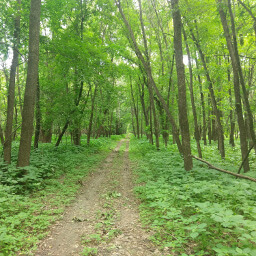
From the parking lot, walk down the stairs to the trail. You can choose to go either direction since this is a loop; I chose to head right and will describe the route going in that direction. On most lakeside hikes, the lake is usually the most prominent or scenic feature. To my surprise, the rolling prairie stole the show because the lake views are mostly blocked by vegetation. See for yourself the pretty restored prairie, as pictured below.
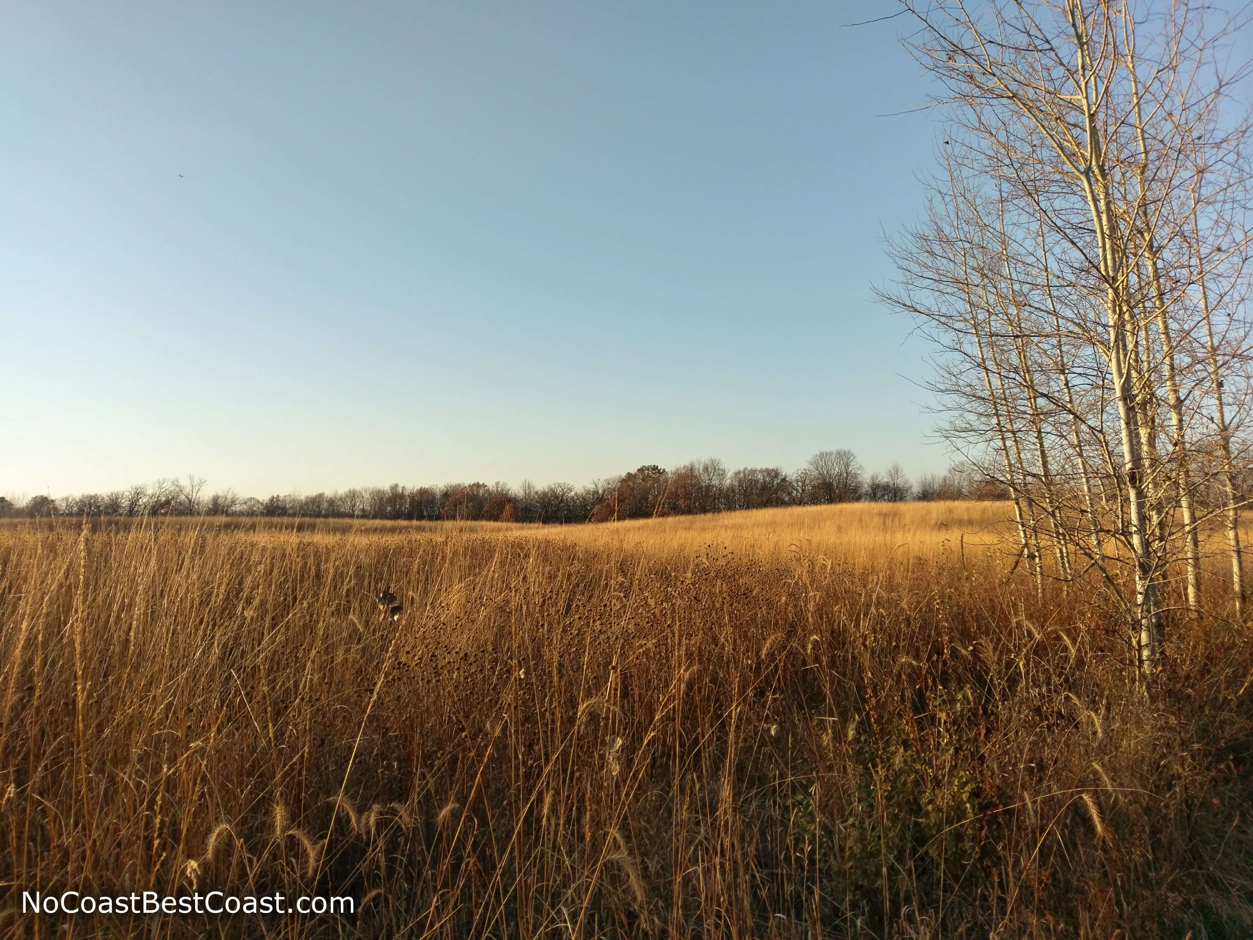
The restored prairie is the best part of this hike
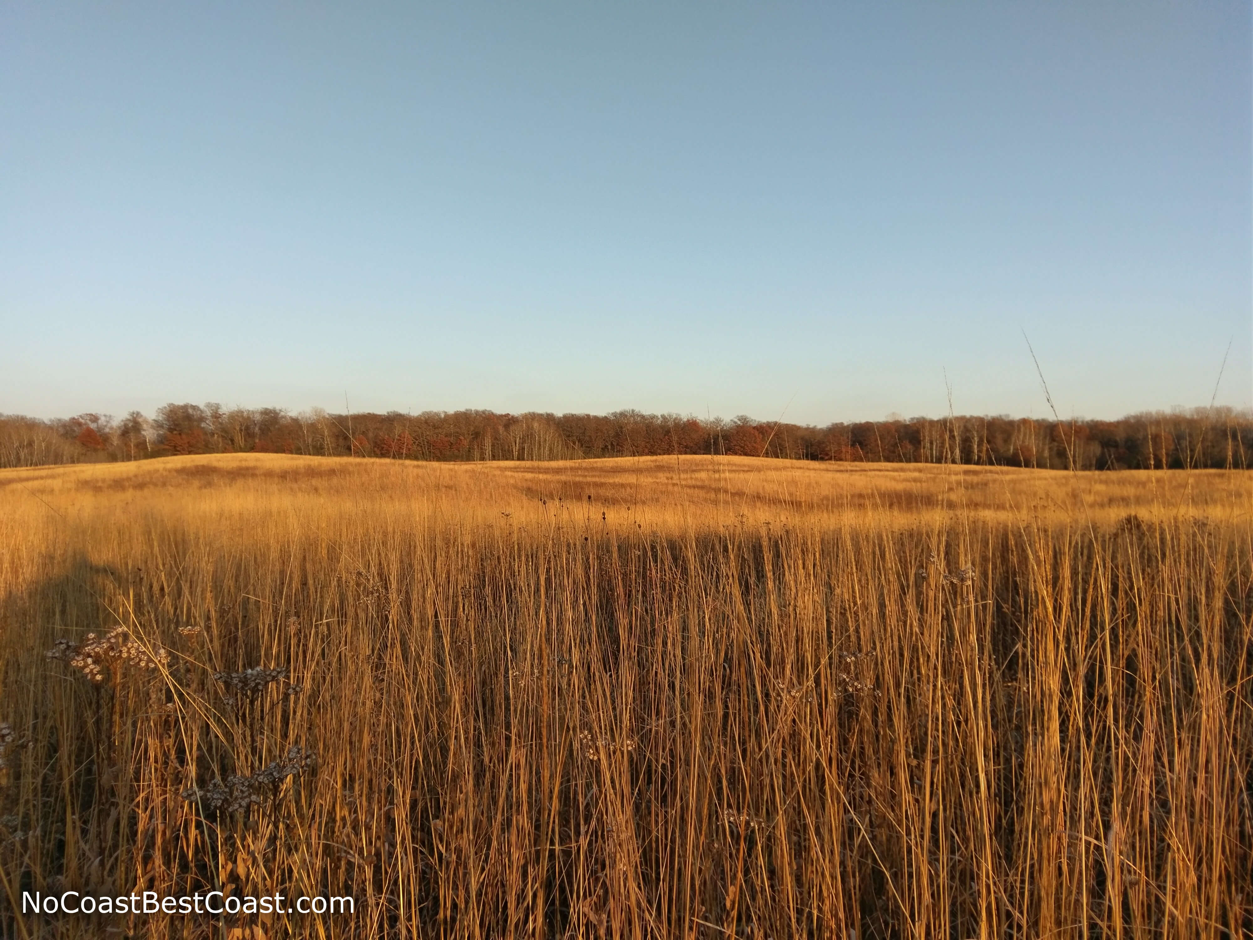
Looking across the vast prairie from the top of the hill
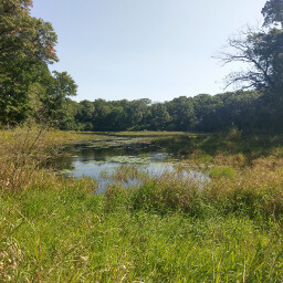
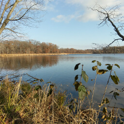
Turn left at intersection 40, and the trail flattens out. Turn right at intersection 38, and you'll see Minnregs Lake again on your left. About halfway between intersection 38 and the end you'll cross a creek and have the stunning views in the two pictures below. The first picture shows an old bridge where I presume the trail originally crossed.

An old bridge across the partially frozen creek

The creek merges with the wetlands of Minnregs Lake
Important Information
Dogs are allowed on leash for about 80% of this route, but they are not allowed on the short segment between trail intersections 40 and 38 (as displayed on the official map linked at the bottom of the page). To avoid that prohibited stretch of trail, I suggest either turning around at intersection 36 or staying left at intersection 38 and skipping the top circle of this figure 8 shaped route. Of the many dog walkers I saw on the hike, most of them chose the latter option.
While there are a few hills here, none are very tall and this hike is easy enough for the whole family; you can also opt to shorten the route by staying left at intersection 38. All of this route is available in the three warm seasons, and most of this route is available for hiking in the winter -- only the portion between intersections 40 and 38 is closed to hiking (the same section closed to dogs all year as mentioned previously). Amend your winter route as suggested to dog owners earlier in this paragraph. I saw plenty of people on the portion around Minnregs Lake, and fewer in the prairie further away from the trailhead. My impression is that this is a popular trail, especially for dog walkers and probably even on weekdays.
Directions
From the Twin Cities, take Interstate 35 south and exit at 185th Street -- a few miles south of where Interstates 35E and 35W join. Turn right onto 185th Street, then turn right on Judicial Road; pay close attention because the street signs are small and the speed limit is high on 185th Street. Look for the Three Rivers Park District sign on the left just past the country club, then turn left into the dirt parking lot.
Google Maps Directions
Parking, Fees, and Facilities
Parking is free at all Three Rivers Park District parks and trails. There are no facilities at this lot.
Nearby Hikes
Murphy-Hanrehan Park Reserve, Minnesota
★★★★☆(4/5)
Hyland Lake Park Reserve, Minnesota
★★★☆☆(3/5)
Lebanon Hills Regional Park, Minnesota
★★★★☆(4/5)
Minnesota Valley National Wildlife Refuge, Minnesota
★★★★☆(4/5)