| Rating | ★★★★★(5/5) |
| Overall Difficulty | Moderate |
| Navigation Difficulty | Easy |
| Distance | 8.5 miles roundtrip |
| Time | 5 hours |
| Terrain | Hilly |
| Best Seasons | Spring, Summer, Fall |
| Family Friendly | No |
| Dog Friendly | Yes |
| Accessible | No |
Highlights
- Five uniquely beautiful waterfalls
- Pristine forest along the North Country National Scenic Trail
Hike Summary
This hike is a contender for one of my top five hikes of 2018 (see my favorites from 2016 or 2017). As I've gladly discovered, the Upper Peninsula is the land of abundant waterfalls, where ample precipitation combined combines with interesting topography in spectacular fashion. On this hike, you'll encounter not one, not two, but five unique waterfalls! Elsewhere in the Midwest, each of these waterfalls would be significant enough to be the centerpiece of their own eponymous state park. Technically, each of these waterfalls has a parking lot and a only short hike to reach a viewpoint, but it's much more fun to earn your waterfalls with this long, rewarding hike!
The first stop on this hike is the best viewpoint of Rainbow Falls. While you can see Rainbow Falls from an observation deck on the trail south of the parking lot, the falls is angled such that the rocks and trees obstruct most of the view. So, from the parking area at Black River Harbor, head north on the paved path across the historic suspension bridge to reach the trail heading uphill to Rainbow Falls. Hopefully you don't mind stairs, because the steps in the first picture below are just the beginning -- every single waterfall has its own set of steps required for access! At the top of the hill, Lake Superior peeks through the trees as shown in the second picture below.

You must conquer a separate set of stairs at some point near all five waterfalls

A glimpse of Lake Superior through the trees

Rainbow Falls as seen from the east side of the Black River
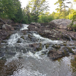
You'll emerge from the forest back to the road. Walk north along the side of the road here to reach the start of the short trail to Sandstone Falls -- there will be a road sign pointing to the parking area for the falls. Head down the stairs, and you'll find the smallest of the five waterfalls on this journey, Sandstone Falls, as pictured below. Unlike the other falls along this trail, there isn't a designated viewing platform and you are free to wander on the rocks to find the best vantage point of the falls.

The small but turbulent Sandstone Falls

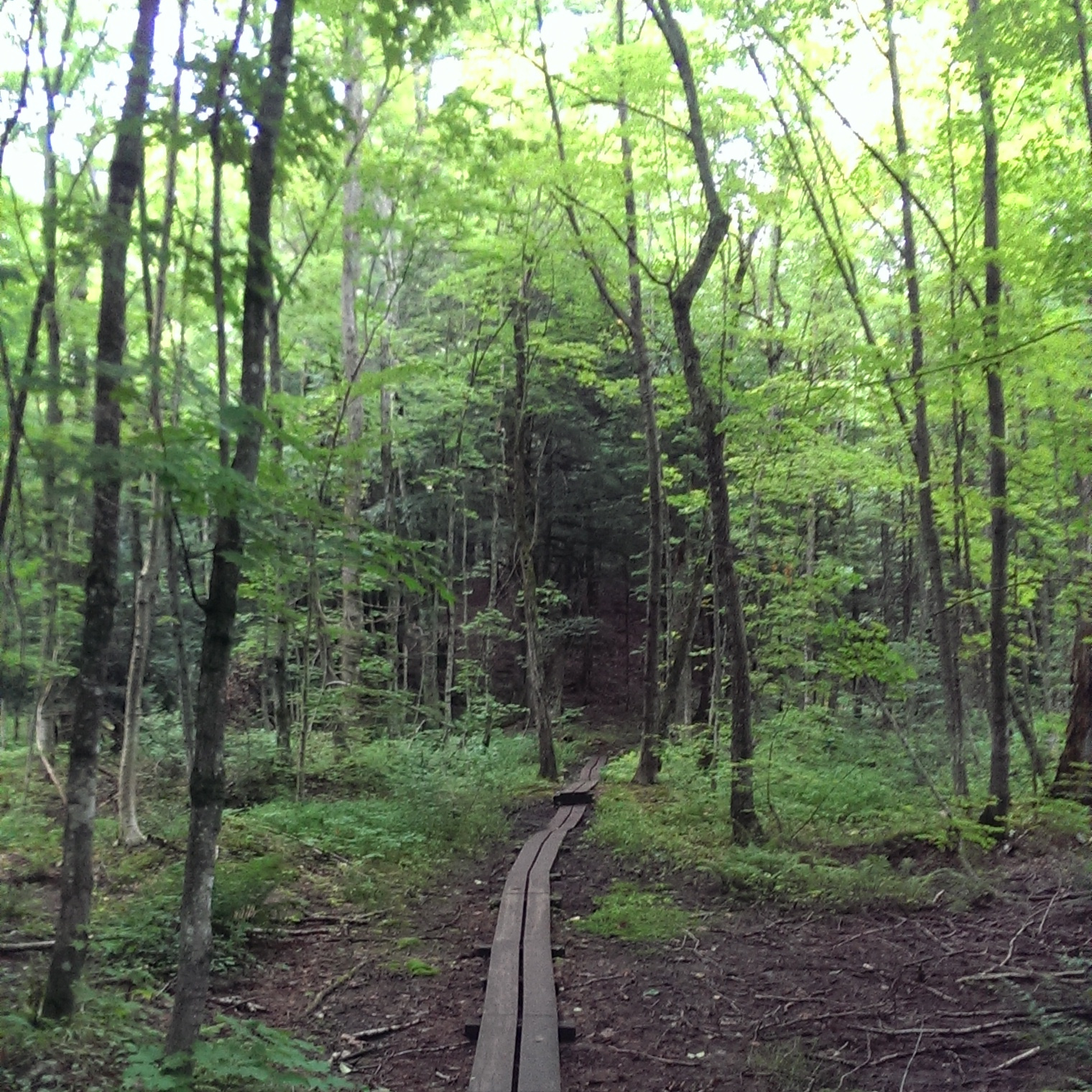
Wooden planks and stumps help you cross otherwise muddy areas highly susceptible to erosion

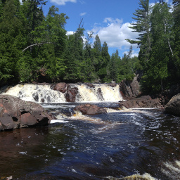
Gorge Falls as it cascades through the narrow rocky channel

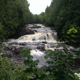
The mighty two-tiered Potawatomi Falls

One half of Great Conglomerate Falls
Important Information
There are no specific rules about dogs in the Ottawa National Forest, but keeping your dog on leash is highly recommended since this is a popular area, especially around each of the waterfalls. Doing this whole hike is much too long for children, especially considering the amount of stairs; instead, pick a couple of the waterfalls and drive to them (seeing all five would be pretty difficult since there is quite a bit of stair climbing at each). You can definitely visit during the three warm seasons, but in the winter icy stairs may be treacherous -- proceed at your own risk. Bug spray is imperative in all other seasons! There will be people near you at each waterfall you reach, but the trail in between will be quiet and mostly empty. Peak summer weekends will see larger crowds.
Directions
From Ironwood, take U.S. Highway 2 east to Bessemer. Turn left onto Powderhorn Road, then turn left onto Black River Road. Continue straight until the road ends at the parking area for Black River Harbor.
Google Maps Directions
Parking, Fees, and Facilities
It seems that they used to charge for parking in the past, but now parking is free! There are bathrooms, a picnic area, and beach access near this lot.
Nearby Hikes
Porcupine Mountains Wilderness State Park, Michigan
★★★★★(5/5)
Porcupine Mountains Wilderness State Park, Michigan
★★★★☆(4/5)
Ottawa National Forest, Michigan
★★★★★(5/5)
Copper Falls State Park, Wisconsin
★★★★★(5/5)