| Rating | ★★★★☆(4/5) |
| Overall Difficulty | Easy |
| Navigation Difficulty | Easy |
| Distance | 3 miles roundtrip |
| Time | 1.5 hours |
| Terrain | Mostly flat |
| Best Seasons | Spring, Summer, Fall |
| Family Friendly | Yes |
| Dog Friendly | Yes |
| Accessible | No |
Highlights
- Centrally located in the Twin Cities
- Gigantic trees with holes and nooks to hide in
- Easy access by bicycle
Hike Summary
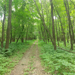
Fort Snelling is one of those places that is really close to your houses but forget exists. I've probably hiked upwards of 10 other state parks, most of them much further away from my house, before realizing there was one within easy biking distance. The trail on the island was masterfully designed so that you can choose to do a 1, 2, or 3 mile loop. This hike is great for the whole family, and dogs are allowed on leash.
This hike is a part of the Hiking Club program, where you can purchase a kit and look for passwords on the designated Hiking Club trail (most state parks have one) and receive awards for reaching milestones. I recently purchased a kit myself since I always have fun trying to guess the password -- usually I'm wrong and the password is something even more obvious than what I thought.
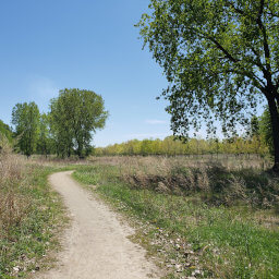
The trail starts from the southeast end of the parking lot and heads to the river. Turn left at the T intersection, then turn right at the next intersection to cross the bridge onto Pike Island. Once you're on the island, I suggest turning right to go around counterclockwise -- the trail is slightly longer on this side, so when you get to the natural stopping point at the tip of the island you will be more than halfway done. The hike is very straightforward, just do a loop around the island, then cross the bridge and head back to the parking lot.
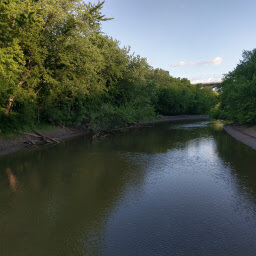
Looking at the river from the bridge to Pike Island
View full size
Directions
By Bike
There are ample paved trails to Fort Snelling and a bike rack by the trailhead, so biking is the ideal way to get to this hike. There is also a Nice Ride (bikeshare program in Minneapolis/St. Paul) station near the trailhead.
From the Minnehaha Park area, head south on the bike path running along Minnehaha Dr. Cross the road and look for the "MRT" bike trail sign and take the trail heading into the forest -- this upcoming section of trail is one of my favorites in the Twin Cities, especially in the fall. Follow this trail the entire way to the trailhead and parking lot.
From St. Paul, take the bike trail along Mississippi River Blvd to the Minnesota Highway 5 bridge across the river. There are stairways with narrow metal ramps for your bike to take you to the bridge, then back up to the path on the other side. Once across, follow the trail. Just before the Mendota Bridge (Minnesota Highway 55), turn left onto the trail descending into the valley. At the bottom of the hill, turn left and follow the trail to the bike rack in front of the visitor center.
By Car
The road to access this trailhead is not connected to the area by the historic fort and requires a separate exit from the highway. From your starting point, head towards MSP Airport. On Minnesota Highway 5, look for the exit for Post Rd/Snelling Lake Rd -- this is the exit between Interstate 494 and the exit for MSP Airport. After exiting, head east towards the river, then turn left onto Snelling Lake Rd. The road ends at the parking lot and the Thomas C. Savage Visitor Center.
Google Maps Directions
Parking, Fees, and Facilities
Like all Minnesota State Parks and Recreation Areas, you must pay a vehicle entry fee of $7 per day or $35 for an annual pass (highly recommended if you frequently go to Minnesota State Parks) by going into the visitor center. There are bathrooms in the visitor center.
Nearby Hikes
Crosby Farm Regional Park, Minnesota
★★★★☆(4/5)
Hidden Falls Regional Park, Minnesota
★☆☆☆☆(1/5)
Minnesota Valley National Wildlife Refuge, Minnesota
★★★★☆(4/5)
Bruce Vento Nature Sanctuary, Minnesota
★★★☆☆(3/5)