| Rating | ★★★★★(5/5) |
| Overall Difficulty | Hard |
| Navigation Difficulty | Easy |
| Distance | 13.6 miles roundtrip |
| Time | 7 hours |
| Terrain | Strenuous climbing, 1000 feet of elevation gain |
| Best Seasons | Spring, Summer, Fall |
| Family Friendly | No |
| Dog Friendly | Yes |
| Accessible | No |
Highlights
- Signature hike of Sleeping Giant Provincial Park
- Impressive cliffside views of Thunder Bay and Lake Superior
- Feeling accomplished after a tough climb
Hike Summary
This hike is the main event at Sleeping Giant Provincial Park -- pictures of the iconic Chimney (in the image at the top of the page) were enough to encourage me to book a campsite and drive over 7 hours to experience this place for myself. This is truly a rare hike in the Midwest because a tough climb to an impressive view accompanied by a feeling of accomplishment are hard to find. The cliffs here are approximately 1000 feet above Lake Superior, and since the hike starts at lake level, that means you will have to climb that entire vertical distance in addition to the nearly 14 mile roundtrip horizontal distance. Exacerbating that fact is that the climb occurs mostly in one extremely steep mile. To put this in perspective, to climb to the top of the tallest point in Minnesota, Eagle Mountain, you the 750 feet of elevation gain is spread throughout the entire 3-mile hike to the top. Embrace the challenge of this hike!
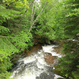
The hike starts on the Kabeyun Trail, a 4-mile walk on mostly flat terrain. The trail can be very muddy, especially where the dense tree canopy blocks the sun from drying the rain. Although this section is a nice warm-up before starting the climb, this part will become a neverending slog on the return trip. Many people opt to use mountain bikes on this section; the Kabeyun Trail is also a mountain bike trail and there is a bike rack at the intersection with the Talus Lake Trail. Some might call biking cheating, but after hiking the entire trail, I think it is the better option.
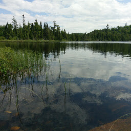
After about 1.5 hours, you will reach Tee Harbor, the perfect spot to stop for a snack with its sandy beaches and logs to sit on. The harbor is named for the "T" shape of the peninsula, which you will witness yourself as you stand on the Top of the Giant. Shortly after leaving Tee Harbor, you will turn right on the Talus Lake Trail, signed with a bright pink pole thanks to the Friends of Sleeping Giant. If you want to go to the private Lehtinen's Bay for stunning views of the Sleeping Giant, continue on the Kabeyun Trail a little longer. I opted to go here after climbing to the Top of the Giant, but I'm crazy and you probably won't want to keep hiking more at that point -- go here before attempting the climb, it's definitely worth it, as evidenced by the beautiful cliffs pictured below. From Lehtinen's Bay, simply retrace your steps back to the Talus Lake Trail to continue on track to the Giant.
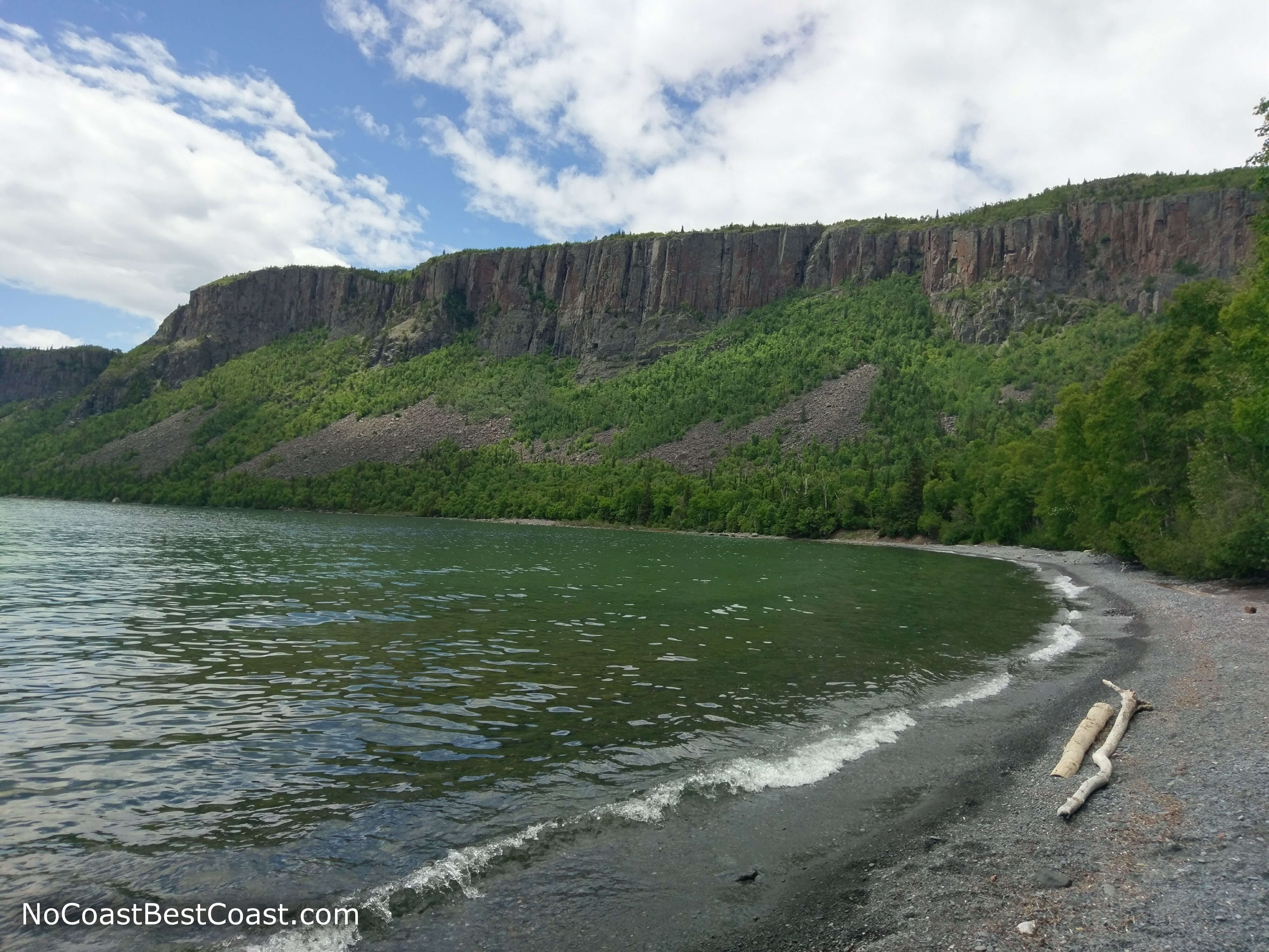
The cliffs of the Sleeping Giant as seen from Lehtinen's Bay
After passing a nice lake on the right side, the climb begins. You will need a breather at some point on this climb, so don't be ashamed of stopping for a short break. The trail is extremely steep and rocky, and many sections are like climbing large stone steps. Take your time, and you will arrive at the top soon enough.
Your climbing will end at an anticlimactic sign in the middle of forest with no views stating you have reached the Top of the Giant. But wait, there's more! Your hiking adventure has just begun! This is the best part of the hike because it winds through the forest with some slight ups and downs on a narrow trail -- very fun and adventurous feeling. There will be several rocky overlooks on the left side, giving you the view of Tee Harbor I told you about earlier (see the picture below).
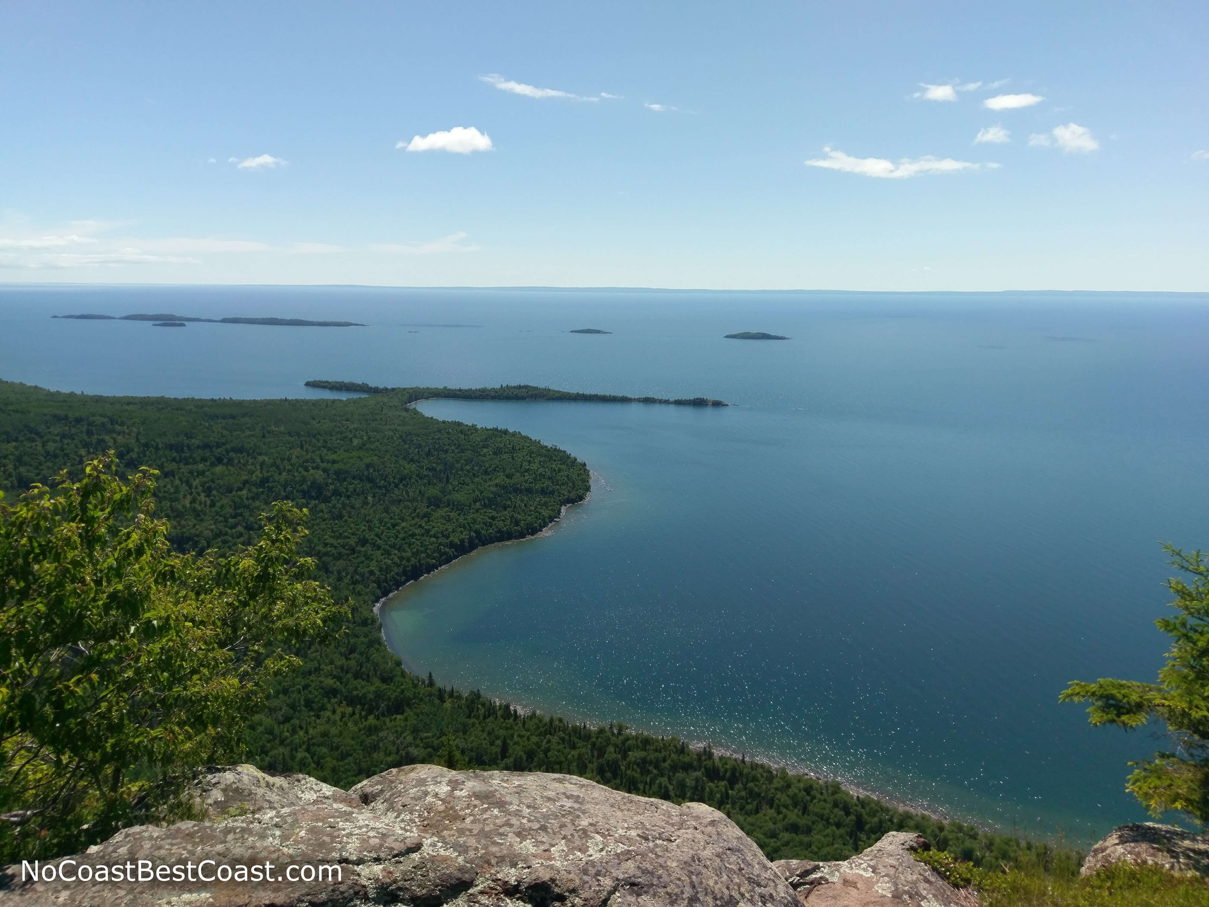
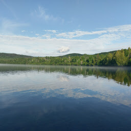
Tee Harbor jutting out into Lake Superior as seen from the Top of the Giant
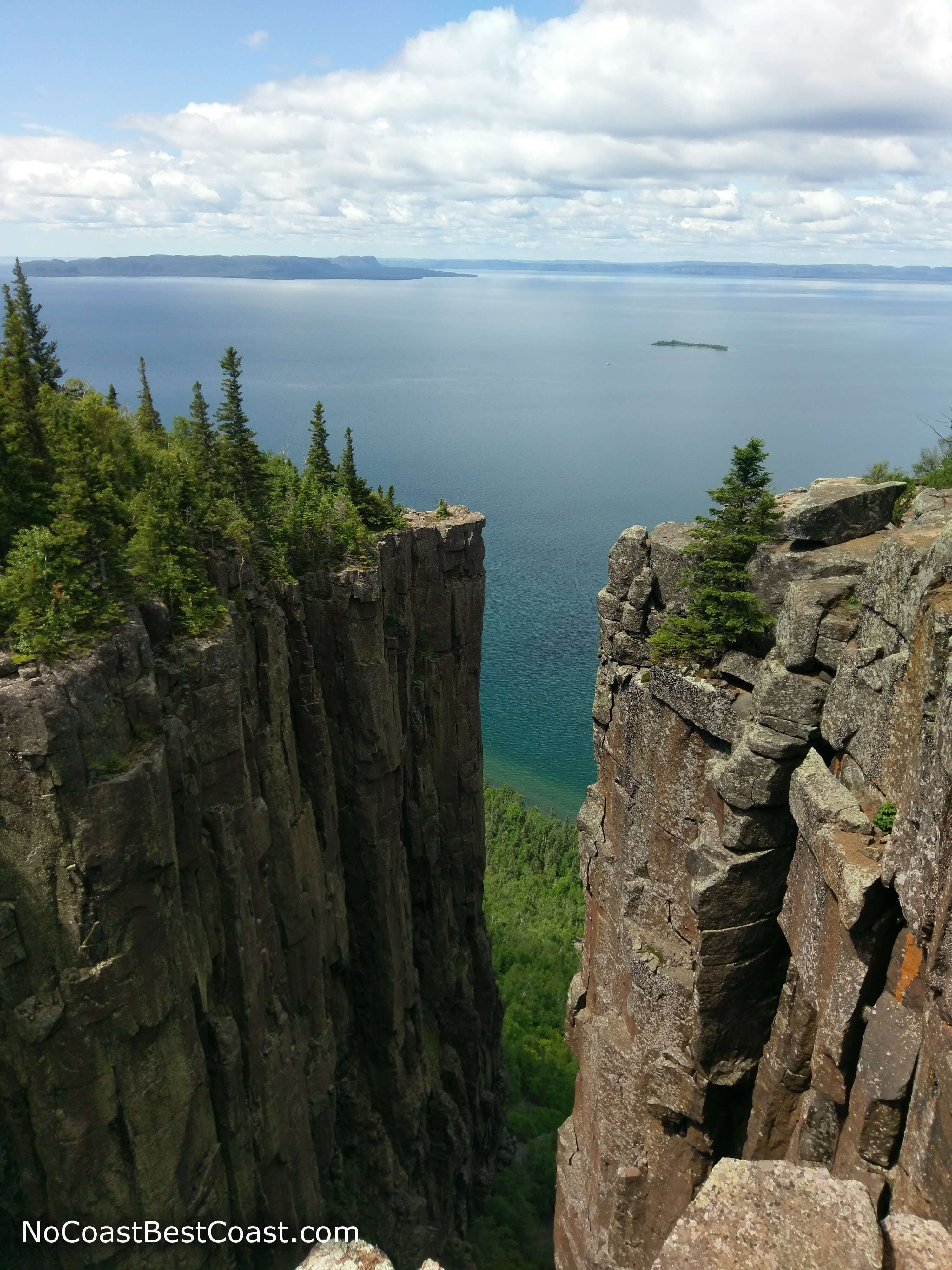
The vertical rock face of the Chimney dropping almost to the shore of Lake Superior
Important Information
Dogs are allowed on leash, but do consider the distance required on this hike -- you don't want to have to carry your furry friend 7 miles back to the parking lot. I saw a few families with middle school aged children attempting this hike, and I didn't see if they made it the whole way (to tell the truth it was usually the parents struggling up the hill). Spring, summer, and fall are the best seasons to hike -- I can't imagine trudging uphill in the snow would be very fun. Unlike other trails in this park, you are very unlikely to be alone on this hike; despite the long distance, this is still a popular hike, but the people do not take away from your experience here. Be sure to bring plenty of water (I had three liters in my camelback), snacks to fuel yourself for the long haul, and bug spray.
Directions
From Thunder Bay, follow the Trans-Canada Highway (Ontario Highway 11/17) east; if you are coming from Minnesota, Minnesota Highway 61 turns into Ontario Highway 61 once you cross the Canadian border, and this highway turns into the Trans-Canada Highway. After about half an hour, turn right onto Ontario Highway 587 (Pass Lake Road); this highway is the main road through the park, and once inside the park, there will be brown signs indicating turnoffs for trailheads and other points of interest. You must first pay the vehicle fee before parking at this trailhead, either at the day use area closer to the entrance of the park (there will be a $ symbol on the sign indicating you can pay here) or at the park office in the campground just before this trailhead. Once you've paid, continue south on 587 until you see the signed turnoff for the Kabeyun Trailhead on the right.
Google Maps Directions
Parking, Fees, and Facilities
It is important to note that this is a provincial park and does not belong to the Canadian National Parks System, thus any national parks pass you may have is not valid admission here. Parking in Ontario Parks requires a $11.25 (Canadian) vehicle fee for day use, $175 (Canadian) for an annual pass, or $125 (Canadian) for a summer pass (valid April to November). This fee is included with a camping reservation. The parking area for this hike is a large dirt lot off the main road through the park and has a pit toilet and picnic shelter with one table.
Nearby Hikes
Sleeping Giant Provincial Park, Ontario
★★★★★(5/5)
Sleeping Giant Provincial Park, Ontario
★★★☆☆(3/5)
Sleeping Giant Provincial Park, Ontario
★☆☆☆☆(1/5)
Sleeping Giant Provincial Park, Ontario
★★★★★(5/5)