| Rating | ★★★★★(5/5) |
| Overall Difficulty | Moderate |
| Navigation Difficulty | Medium |
| Distance | 4 miles roundtrip |
| Time | 2 hours |
| Terrain | Hilly |
| Best Seasons | All |
| Family Friendly | No |
| Dog Friendly | Yes |
| Accessible | No |
Highlights
- The perfect stop on a road trip to Duluth or other locations up north
- Secluded waterfall
- Explore historic quarry ruins
Hike Summary
Banning State Park is expertly positioned as the perfect halfway point on the drive up I-35 between the Twin Cities and Duluth and is so close to the highway that you don't have to go out of your way to visit. Despite the proximity to the interstate, road noise isn't as much of a problem as you'd expect thanks to the roaring rapids of the Kettle River present on most hikes in the park. Like many other Minnesota State Parks (such as Frontenac and Blue Mounds), this area was once the site of a quarry; here you can explore ruins and read informational signs explaining the process of extracting the rock.
Forewarning: the trails in this park can be difficult to navigate. Although there are frequent maps posted on the trail and free park maps available (either for download at the link at the bottom of the page or in paper from the park office), the trails are very close together, have frequent intersections, and travel in similar directions. Pay attention to where you are and take an extra second at each intersection to make sure you go the right direction. It is unlikely you will be alone on these trails, so don't be afraid to ask someone for directions if you need help!
From the parking lot, follow the Quarry Loop Trail heading west rather than south towards the river. You can skip visiting Teacher's Overlook from late spring to early fall because the foliage blocks most of the view during this time period. Continue heading straight at the first intersection, and keep left at the next two intersections to stay on the Quarry Loop Trail. Turn right at the next intersection, then in 0.2 miles, turn right again. In a short distance, turn left onto the Wolf Creek Trail; follow this trail the rest of the way to the falls.

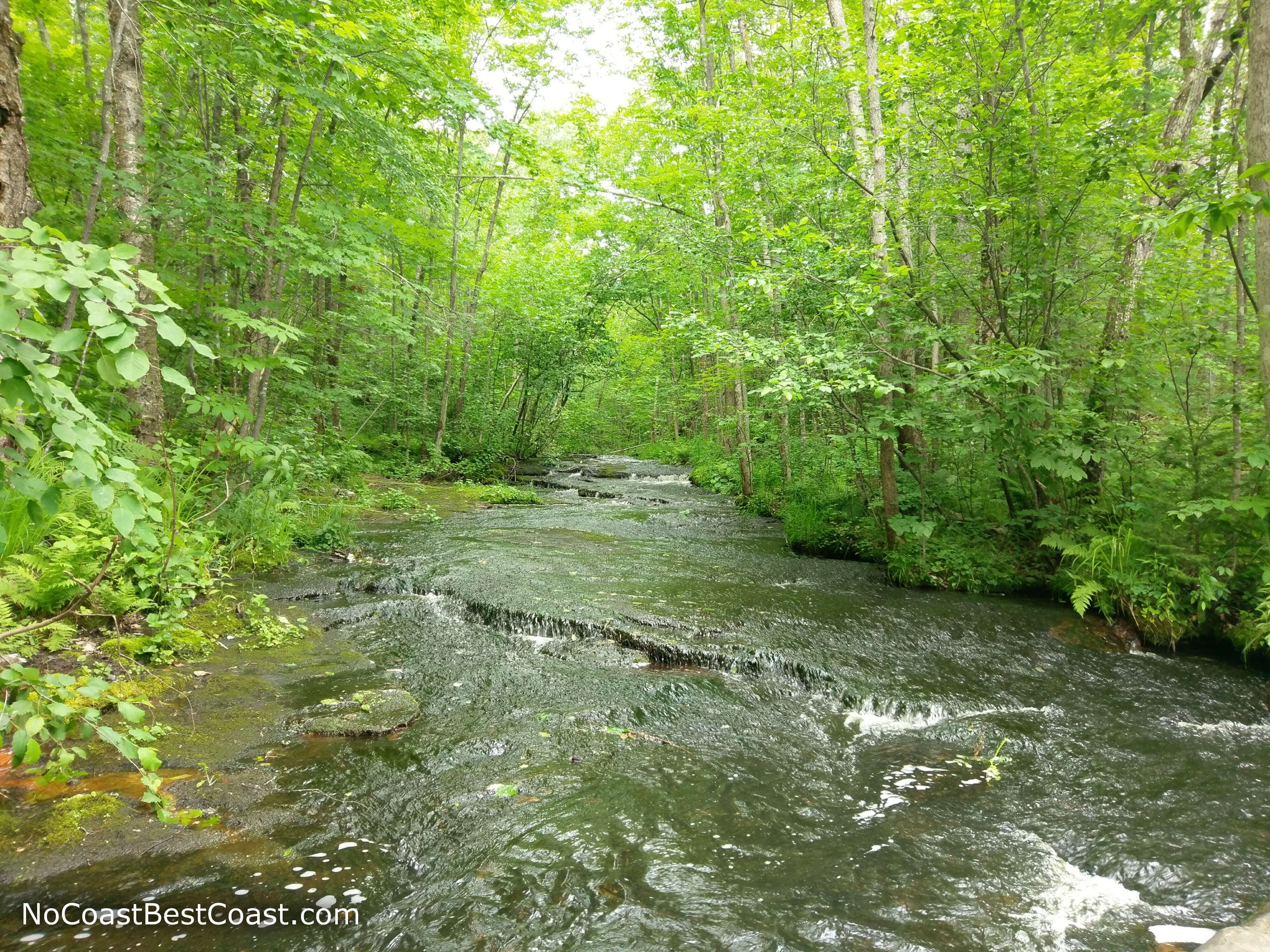
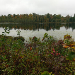
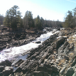
The trails on this hike parallel the turbulent Kettle River
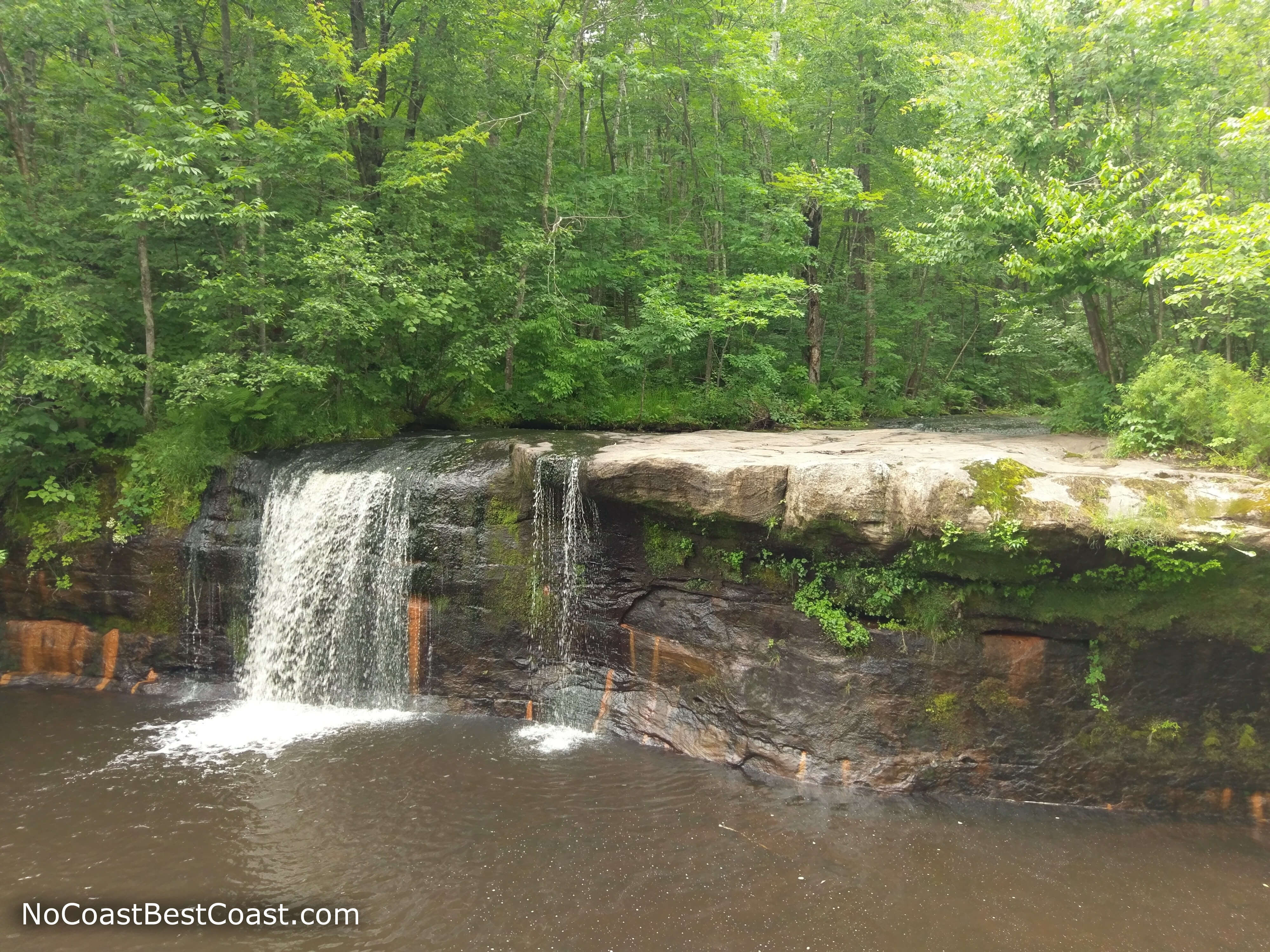
You too can eat lunch with this view of Wolf Creek Falls!
Wolf Creek just before the falls

The vertical rock face resulting from quarrying
The rest of the Quarry Loop Trail has a series of informational signs explaining the process of extracting rock and remnants of the buildings involved in this process. Some of the buildings are nothing more than a foundation, but some still stand and are ripe for exploration, like the building pictured below. This portion of the hike is especially fun in summer when the buildings are overgrown and you can pretend you are an explorer or archaeologist.

Just one of the remaining buildings from the old quarry
This truly is an excellent hike and is the perfect addition to any road trip on Interstate 35. There are many other trails in the park, so you can keep coming back again and again without having to do the same hike twice!
Important Information
Dogs are allowed on leash on all trails in this state park. While this entire hike is too long to label family friendly, there are other options within the park for kids to enjoy. As one option, you can skip the hike to the waterfall and do just the Quarry Loop Trail by itself for a 1.7 miles roundtrip (about an hour) hike that is a part of the Hiking Club program -- your kids will definitely enjoy exploring the ruins on this trail. Alternatively, you can drive to the other parking lot at the end of the park road to hike the short Blueberry Slide Trail, which has water access good for fishing and rock hopping (although the rapids aren't safe for swimming).
You can hike here in all seasons since the trails here are ungroomed in winter. As with most waterfall hikes, this is relatively popular trail, so expect to see other people especially on summer weekends.
Directions
This state park is ridiculously easy to get to. From the Twin Cities, take Interstate 35 north towards Duluth. Take exit 195 for Minnesota Highway 23 in Sandstone (be sure to take exit 195 -- there is another earlier exit for Minnesota Highway 23 that takes a more roundabout way to the park), then turn right. The entrance for the park is less than a half mile from the interstate on the right side. Pay the entrance fee, then continue down the main park road until it ends at a parking lot.
Google Maps Directions
Parking, Fees, and Facilities
Like all Minnesota State Parks and Recreation Areas, you must pay a vehicle entry fee of $7 per day or $35 for an annual pass (highly recommended if you frequently go to Minnesota State Parks). The parking lot has pit toilets.
Nearby Hikes
St. Croix State Park, Minnesota
★★★★☆(4/5)
Father Hennepin State Park, Minnesota
★★★☆☆(3/5)
Rice Lake National Wildlife Refuge, Minnesota
★★★★☆(4/5)
Jay Cooke State Park, Minnesota
★★★★☆(4/5)