| Rating | ★★★★★(5/5) |
| Overall Difficulty | Hard |
| Navigation Difficulty | Medium |
| Distance | 2.4 miles roundtrip |
| Time | 2 hours |
| Terrain | Strenuous climbing |
| Best Seasons | Spring, Fall, Winter |
| Dog Friendly | No |
| Accessible | No |
Highlights
- Beautiful Sonoran Desert wilderness and rare organ pipe cacti
- Adventurous hike to go underneath a natural stone arch
- Astounding views
Hike Summary
Arch Canyon was a nice surprise. Based on the information I found on the park's official site and other websites, I was expecting a flat, 1-mile roundtrip hike with views of a natural stone arch and of course organ pipe cacti. Instead, a sign at the trailhead encouraged a spontaneous decision to double my distance and climb a primitive trail to see the arch up close and personal. The National Park Service does not advertise the unmaintained latter half of the trail on their maps or website, but nevertheless it is often attempted (though most do not make it to the top). Whether you're looking for an easy but scenic trip into the canyon or a full-blown adventure up a rugged canyon slope, the Arch Canyon Trail is an ideal trip.
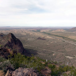
Although you can see the arch from the parking area, as pictured below, the hike is more than worth the small effort to travel through cactus-studded desert and into the sandstone-walled Arch Canyon. This first section slopes gradually into the canyon, so much that it will feel flat. Occasionally you'll pass through a wash, where you'll quickly go down into soft gravel and back up again.
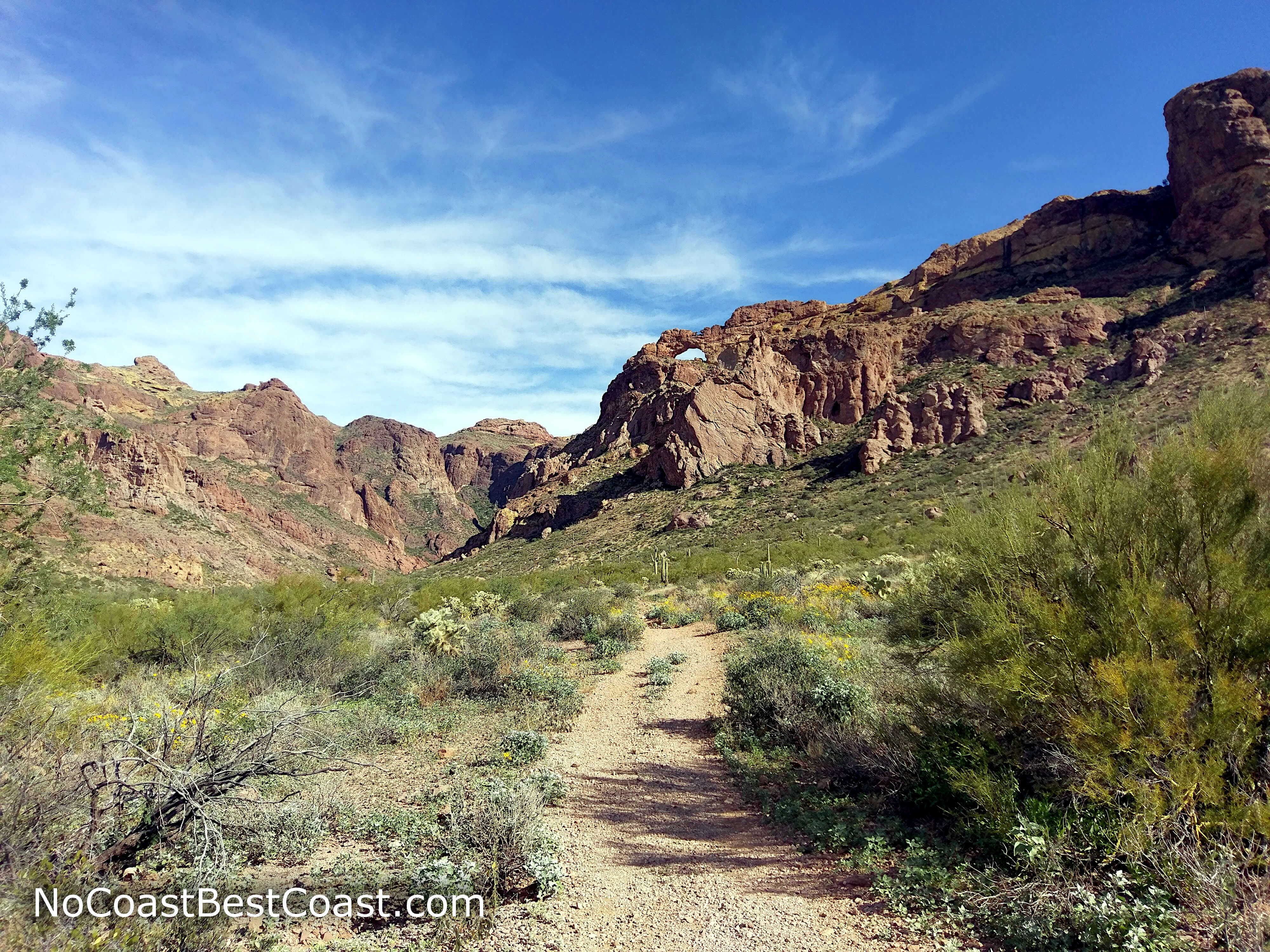
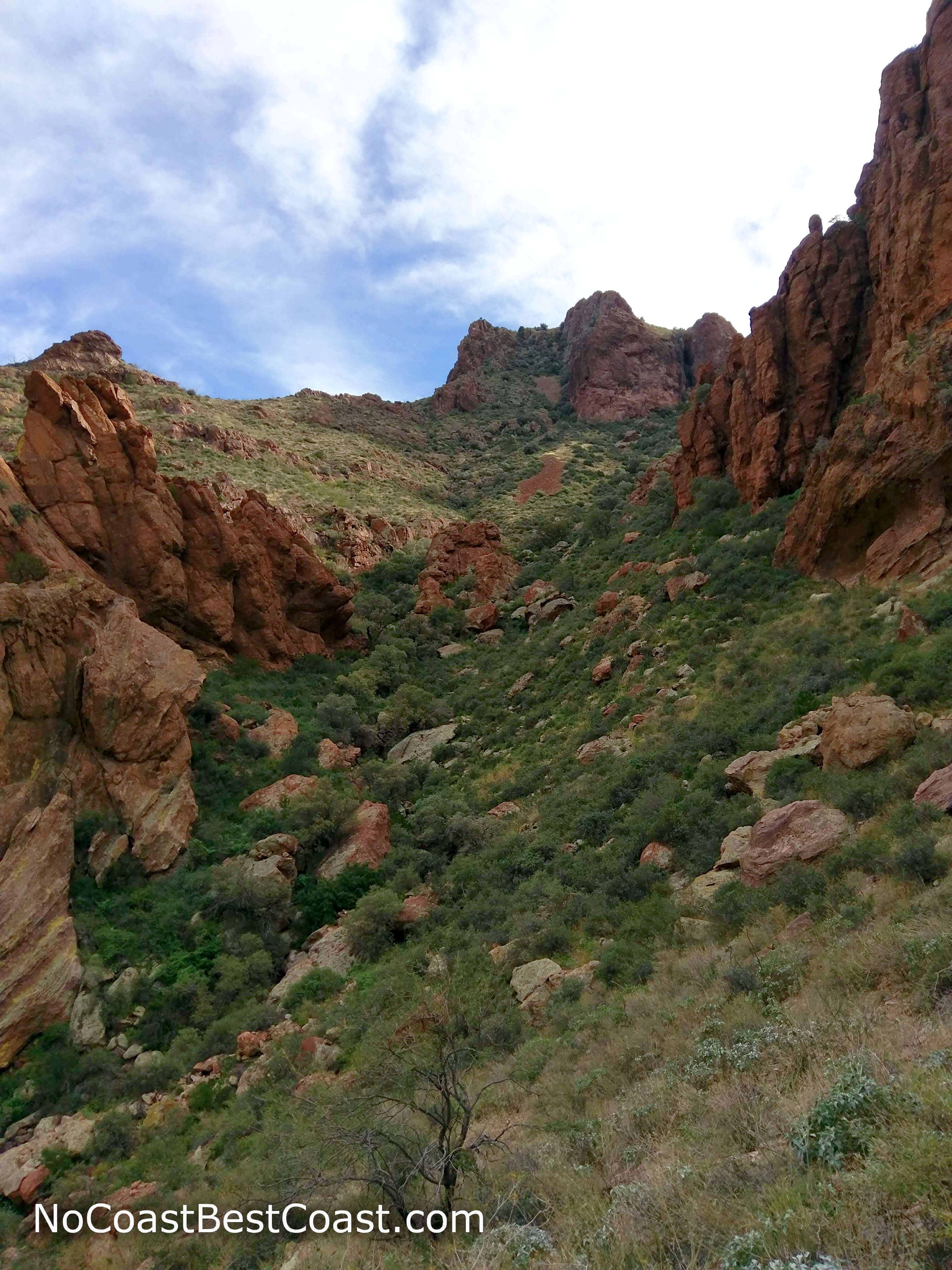
The trail as it heads into the canyon with the arch on top of high rocky cliffs
Looking back to the distant mountains and yellow brittlebush flowers
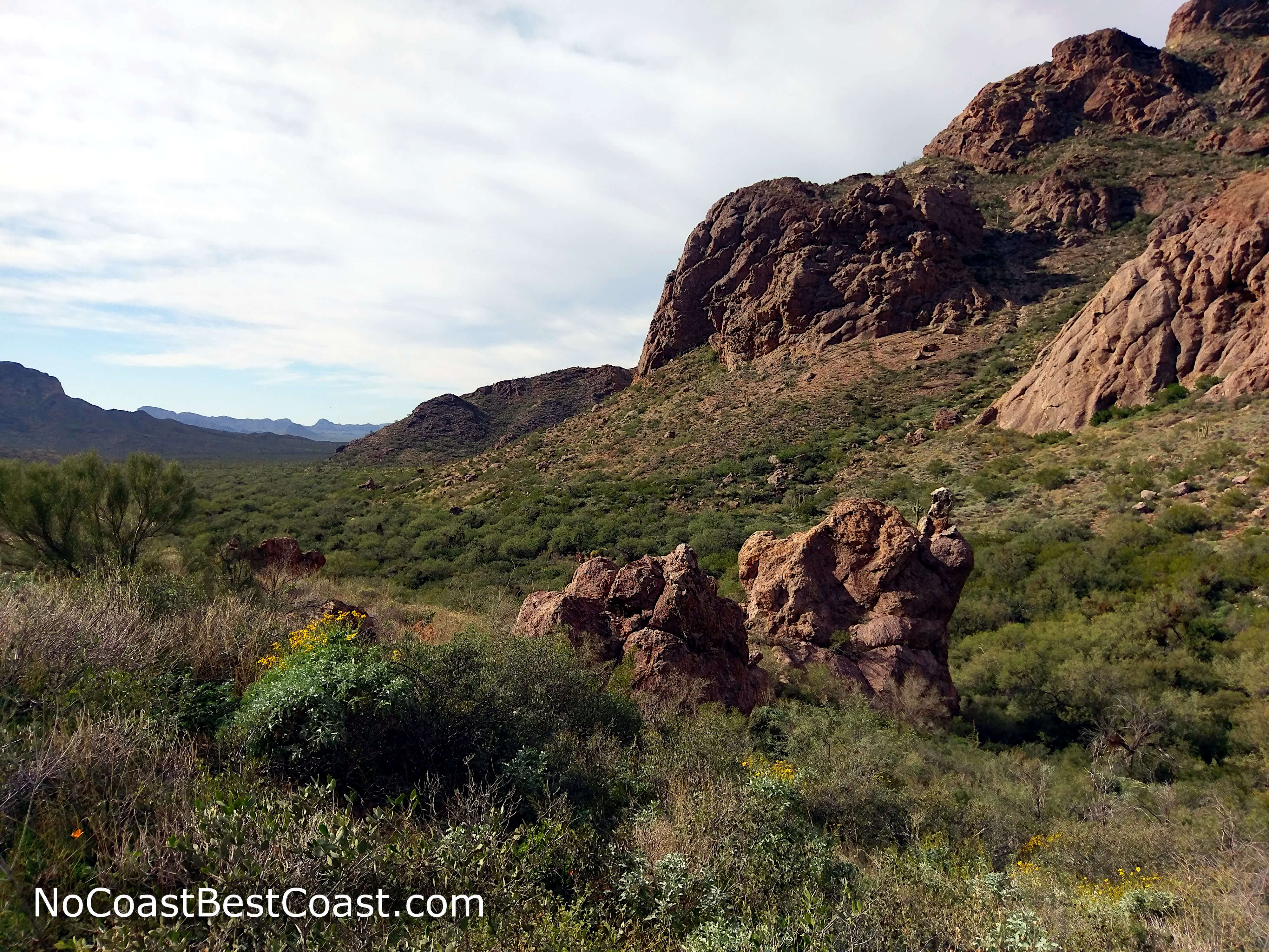
The rusty sandstone canyon walls soon surround you
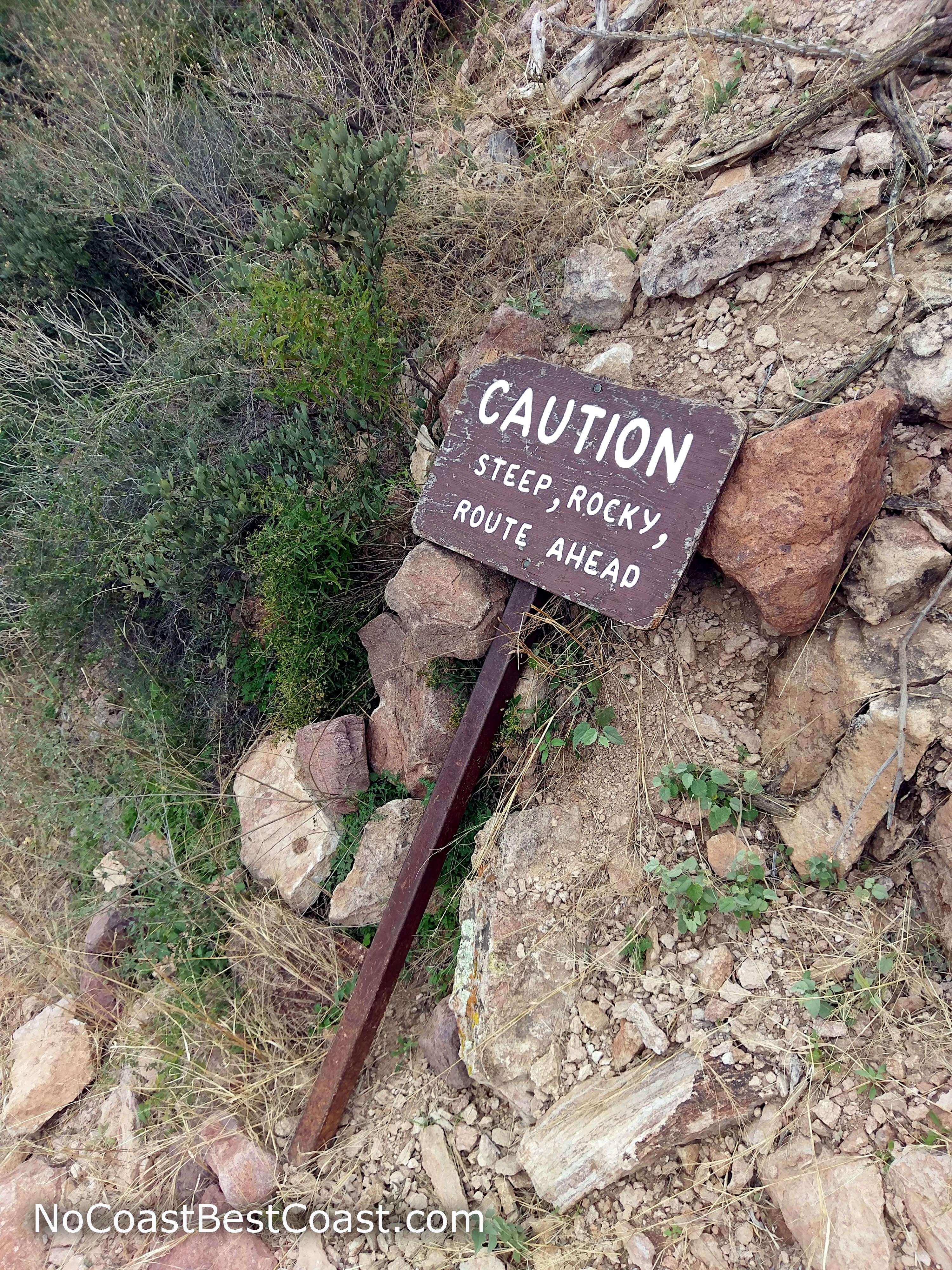
The downed trail sign warns of the dangerous route ahead
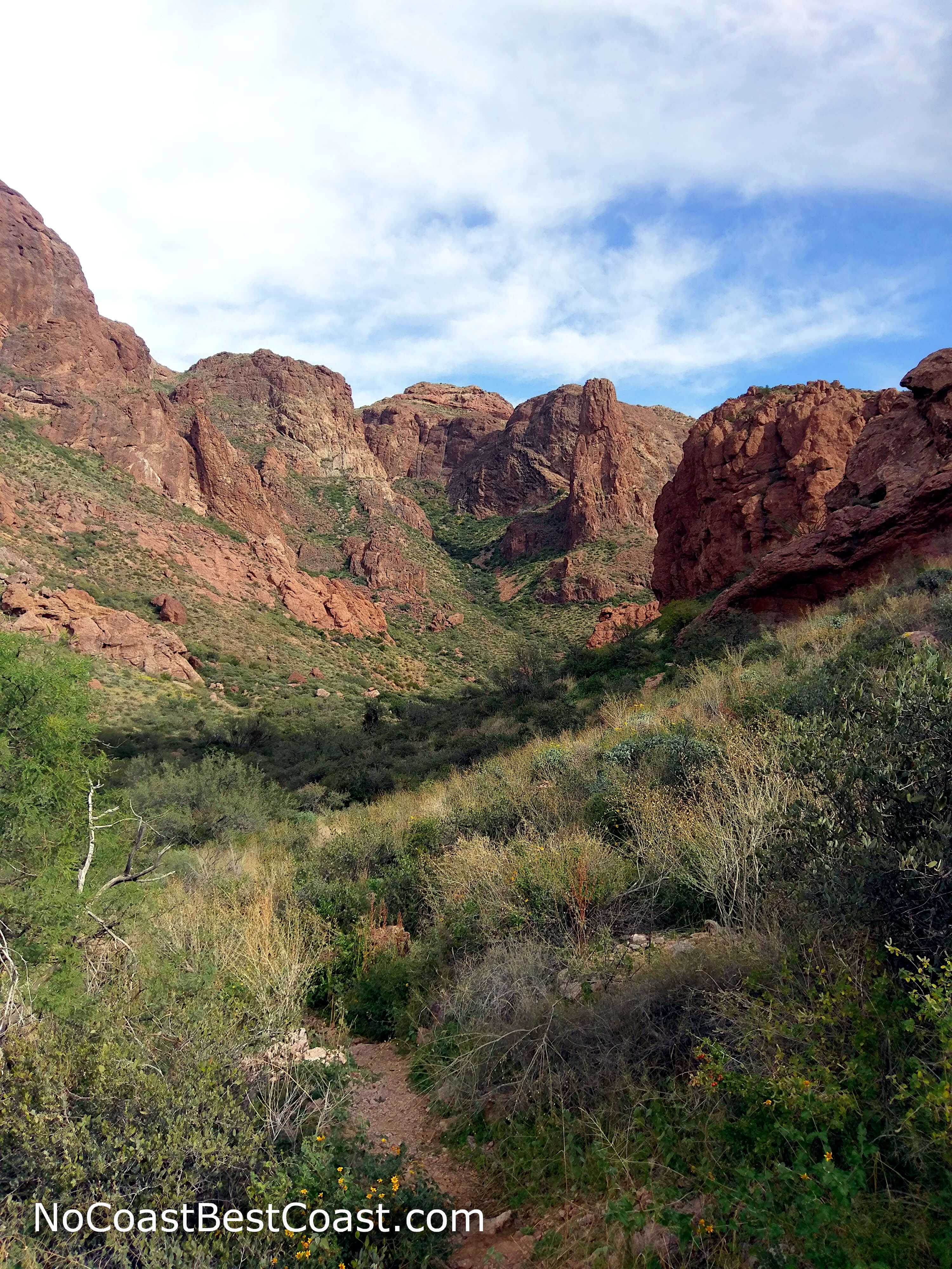
The lush slope on the shady side of the canyon
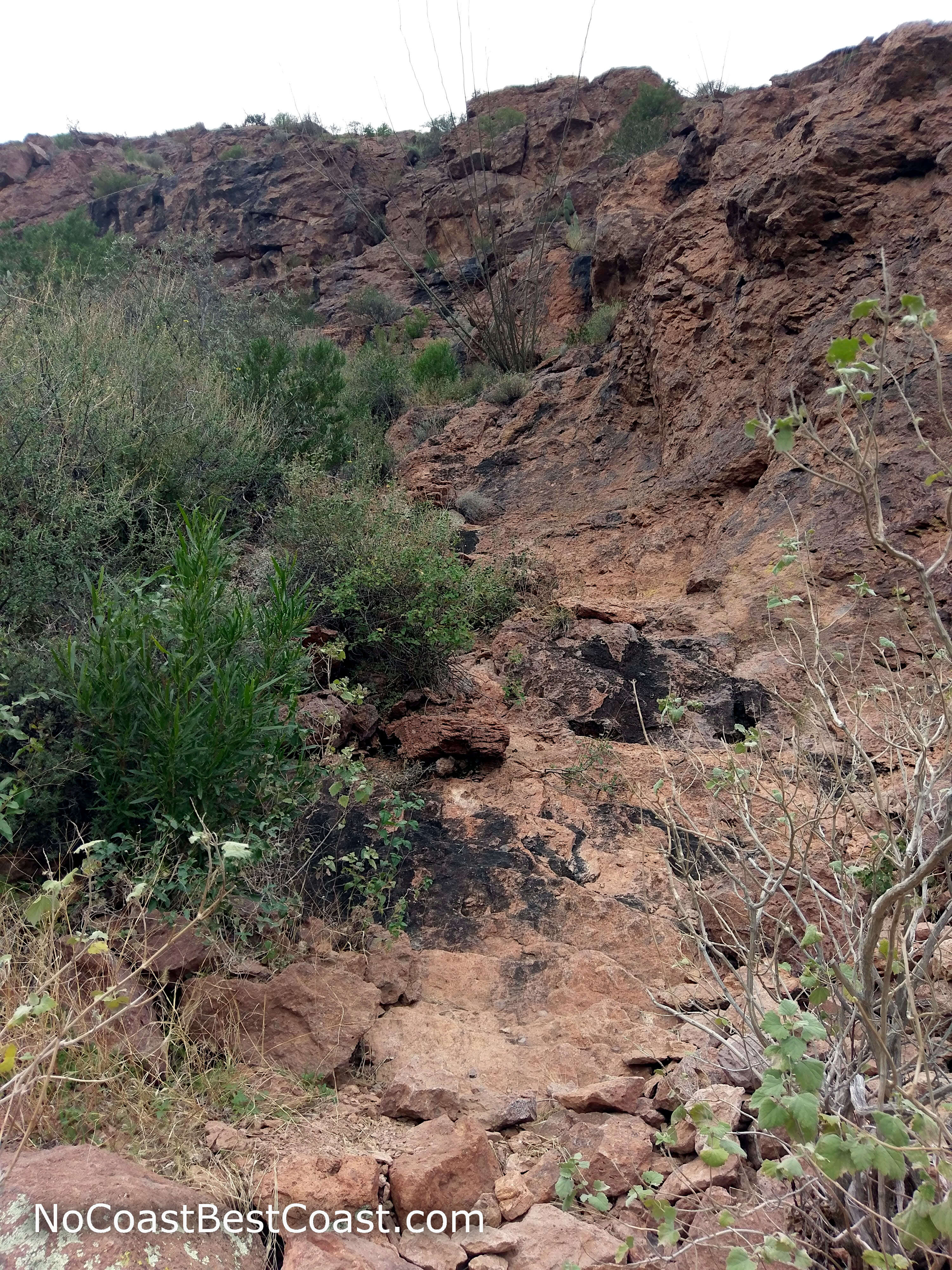
The entire latter half of the trail is steep, rocky, and overgrown like this
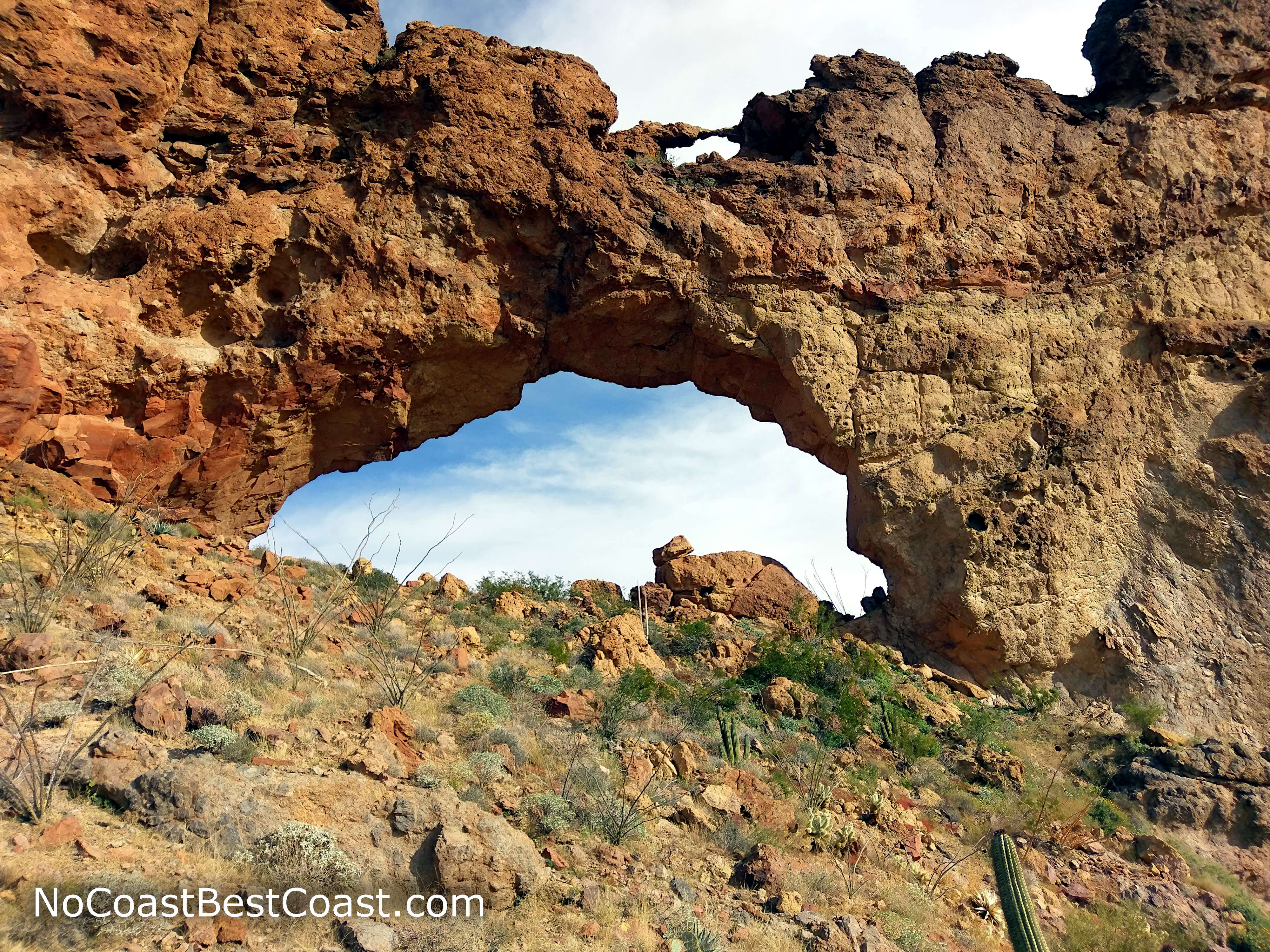
The arch looks much larger up close, and you can see a second smaller arch on top of it
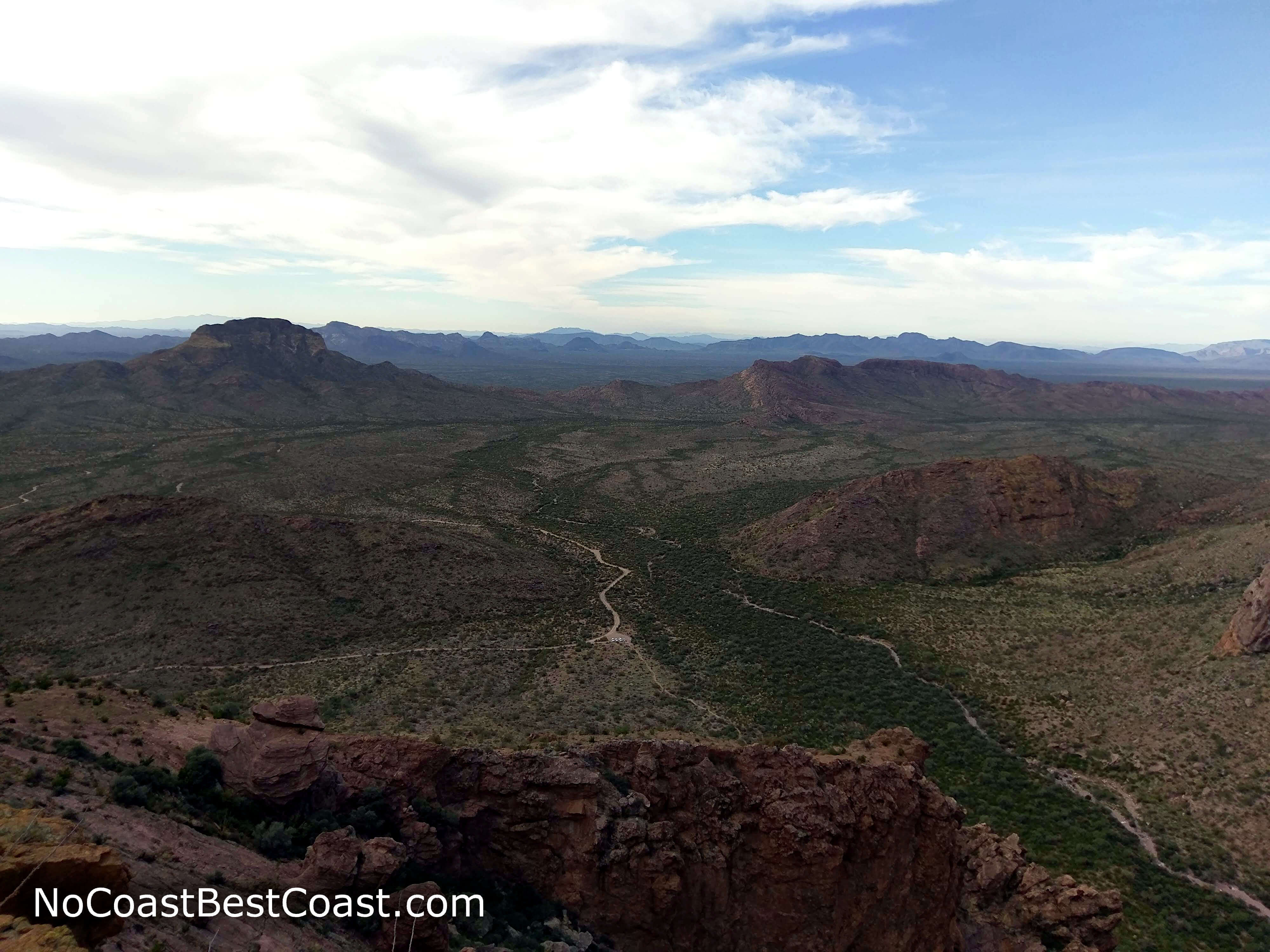
This view of Organ Pipe Cactus National Monument awaits you on the other side of the arch
This hike really packs a punch. With a short but difficult trail, you'll steeply ascend to a geological wonder and one of the best views in the entire park. Even if you choose not to go to the top, Arch Canyon is a beautiful Sonoran Desert landscape worth a stop while on the scenic Ajo Mountain Drive. Connect with me using the social media links below and share your adventures!
Hiked on Sunday, December 23rd, 2018 by Ricky Holzer
Important Information
As with most parks operated by the National Park Service, dogs are not allowed on this trail. The first part of this trail is certainly family friendly and a great way to leave the road behind and enter the Sonoran Desert wilderness; the second half is dangerously steep and difficult to navigate -- not a place for children.
You should avoid this park at all costs during the summer when scorching 110-degree temperatures are frequent. Instead, visit during spring, fall, and winter when temperatures are mild. Sun protection is vital during any season since there is no shade whatsoever during the first part of the trail, and ample water is essential for any desert hiking trip. If you intend on hiking all the way up to the arch, pants are highly recommended to protect your legs from the overgrown, itchy, spiky scrub lining the steep incline -- even when it's warm out, I suggest sweating in pants over shredding your legs in shorts.
The trail is relatively popular, and you'll definitely see others while on the flat section. While many attempt to reach the arch, most turn around either because they are too tired to continue up the steep grade or because they are unable to find the primitive trail. As such, you are likely to have the arch to yourself once you reach the top.
Directions
From Phoenix, take Interstate 10 west, then go south on Arizona Highway 85 towards Gila Bend and Interstate 8. In Gila Bend, follow signs to stay on Arizona Highway 85, turning right just before Interstate 8. At some point south of Gila Bend it's likely you'll encounter a Border Patrol checkpoint (I passed through two on Arizona Highway 85 on my way from the park to Phoenix). Continue straight through Ajo and Why and you'll reach the park.
From Tucson, take Interstate 19 south the Arizona Highway 86 (Ajo Way). Continue straight until you reach Why, then turn left onto Arizona Highway 85. You may encounter a Border Patrol checkpoint at some point along Arizona Highway 86, and possibly again on Arizona Highway 85 just before the park (I passed through two from Tucson to the park).
Once in the park, turn right to stop by the Kris Eggle Visitor Center to pay your entrance fee if you need to use a credit/debit card, otherwise turn left onto Ajo Mountain Road. The road becomes a narrow, one-way gravel road that may be rough in places, though it's perfectly doable in a sedan if you drive slowly. In any case, it's worth it to drive slow just because the scenery on Ajo Mountain Drive is absolutely fantastic and in my opinion better than what I saw on Puerto Blanco Drive. You'll pass gigantic old organ pipe and saguaro cacti as the road winds up and down through washes into the scenic Ajo Mountain Range. About halfway through the 21-mile scenic loop drive, you'll reach the small parking area for Arch Canyon.
Google Maps Directions
Parking, Fees, and Facilities
All vehicles must pay a $25 entrance fee good for 7 days, payable at the Kris Eggle Visitor Center (cash, card, or check) or the self-service stations at the beginning of Ajo Mountain Drive (cash or check only). Annual passes for Organ Pipe Cactus National Monument are available for $45; Interagency Passes are also accepted here and cost $80. More information about entrance fees is available on the park's website. There are no facilities at this trailhead, but there are restrooms and picnic tables at the Estes Canyon - Bull Pasture Trailhead further down the road.