| Rating | ★★★☆☆(3/5) |
| Overall Difficulty | Easy |
| Navigation Difficulty | Easy |
| Distance | 2.1 miles roundtrip |
| Time | 1 hour |
| Terrain | A few hills |
| Best Seasons | Spring, Summer, Fall |
| Family Friendly | Yes |
| Dog Friendly | Yes |
| Accessible | No |
Highlights
- The best park for hiking within St. Paul
- Varied terrain and landscape
Hike Summary
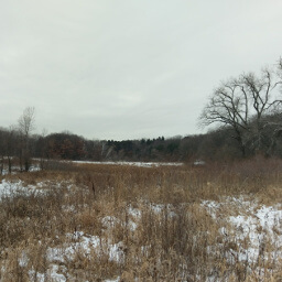
This park is another example of the high quality nature available in the Twin Cities, where you can escape the concrete jungle to a lovely forest environment. Super close to Downtown St. Paul, this hike is easily accessible and is great for a weekend afternoon or enjoying the late sunshine on a summer evening. While there isn't anything special about this hike, it's a decent place for a nature fix.
Dogs are allowed on leash, and this trail also starts near the entrance to the off leash area in the park. This is a short, gentle, paved loop good for the entire family. In the winter, this trail is groomed for cross country skiing and hiking is prohibited (although I went in wintry conditions, there wasn't quite enough snow on the ground for the trail to be officially opened for skiing). This is a popular park next to an urban area, so expect to see people on your hike.
From the parking lot, follow the paved trail southeast. You will see a pole marking the intersection ahead with green, circle shaped signs (if you've ever skied you'll recognize this as the symbol for the easiest routes) and arrows pointing in either direction. Since this is a loop, you can turn left or right, whichever you prefer (I went right and will describe it in that order). Every intersection hereafter will have one of these poles, and you will follow the arrows pointing you to the green trail throughout the rest of the hike (it also helps that the other trails aren't paved while this entire trail is). If you desire more of a challenge, try taking one of the blue marked routes.
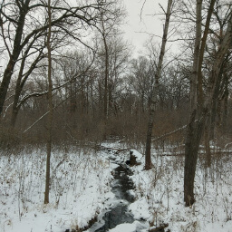
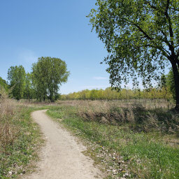
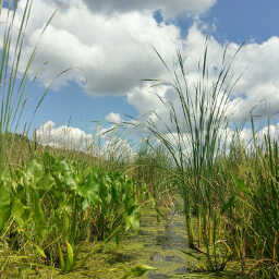
So, heading to the right, you will see happy dogs running freely in the dog park on the right side of the trail. After passing an intersection with some blue trails, you'll see some watery openings in the forest, which probably won't look like the white, flat, snowy area in the picture below when you hike, but you get the idea. The trail heads directly south through these pleasant woods until you reach a parking area. Then, the trail bends to the left and you'll pass the cute little creek in the second picture below.
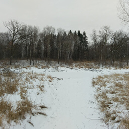
A typical landscape with grassy openings in the forest of both pine and hardwood trees
View full size
Directions
By Bike
There is a bike lane on Upper Afton Road that connects to the off-street trail along Mounds Boulevard. There is also an off-street trail on McKnight Road which connects to another off-street trail along Lower Afton Road -- you can follow this trail to another trail along Valley Creek Road that traverses Woodbury (note there is a short section without any bike facilities between the Lower Afton and Valley Creek trails).
By Bus
Metro Transit line 70 (traveling between Highland Park through Downtown St. Paul, then through East St. Paul to the Sun Ray Shopping Center) and line 63 (traveling from Raymond Station on University, down to Grand Avenue into Downtown St. Paul, then through East St. Paul and down McKnight Road) stop at the corner of McKnight Road and Upper Afton Road. Head to the southeast corner of the intersection then take the paved trail going southeast into the park to reach the parking area.
By Car
From Downtown St. Paul, take Interstate 94 east and exit at McKnight Road. Turn right, then turn left on Upper Afton Road. Look for the signs for the park, then turn right into the parking area.
Google Maps Directions
Parking, Fees, and Facilities
Parking is free! The entrance to the off leash dog park is near the lot. The closest bathroom facilities are at the larger lot for the Battle Creek Aquatic Center directly across Upper Afton Road.
Nearby Hikes
Indian Mounds Regional Park, Minnesota
★★★★☆(4/5)
Bruce Vento Nature Sanctuary, Minnesota
★★★☆☆(3/5)
Crosby Farm Regional Park, Minnesota
★★★★☆(4/5)
Fort Snelling State Park, Minnesota
★★★★☆(4/5)