| Rating | ★★★★★(5/5) |
| Overall Difficulty | Moderate |
| Navigation Difficulty | Easy |
| Distance | 5.5 miles roundtrip |
| Time | 2.5 hours |
| Terrain | Hilly |
| Best Seasons | Spring, Summer, Fall |
| Family Friendly | No |
| Dog Friendly | Yes |
| Accessible | No |
Highlights
- Views from the top of the Continental Divide
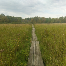
- Long boardwalk
- Learn about the historic Savanna Portage
Hike Summary
At over 5 miles long, this is one of the longest Hiking Club trails in Minnesota State Parks. However, the long distance is worth the effort as you climb to an overlook at the top of the Continental Divide through the beautiful north woods. I modified the official route slightly to include a side trip to the West Savanna River and to use the Savanna Portage Trail rather than the Anderson Road Trail. This increases the distance only slightly while still allowing you to collect your Hiking Club password (and since you hiked extra you don't have to feel guilty for not following the entire official route). Not only does this give you some additional scenery, it also follows the historic route that is the namesake of this park.
Dogs are allowed on leash. Usually Hiking Club trails are a go-to for family friendly hiking, but the distance and uphill climbing make this trail too difficult for most young children. If you only hike to the overlook on the Continental Divide Trail, you still must hike over 4 miles (at that distance it's almost not worth it to modify the route from a loop to a point-to-point route). So if you have young kids, stick to the Shumway Lake Trail. The trail is good for use in the three warm seasons; in the winter, these trails become snowmobile routes, so hiking and snowshoeing is not permitted. I hiked this on a Saturday morning, and only saw a couple people. Expect to see more people on the Continental Divide Trail during the high season, though the other trails probably won't see as much use. Be sure to bring bug spray, or be eaten alive in the long expanses of marshland on this hike.
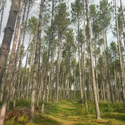
From the parking lot, look for the trailhead with the blue Hiking Club signs on the end of the lot opposite the lake. At the intersection ahead, turn to the right. After walking past a nice stand of tall pines and some gradual changes in elevation, you will arrive at a possibly confusing 5 way intersection. Look for the blue Hiking Club sign straight ahead and continue in that direction.
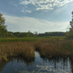
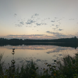
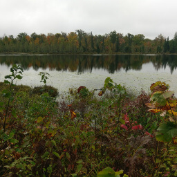
The trail soon begins the ascent to the top of the Continental Divide, a glacial ridge that separates the Mississippi River watershed from the Great Lakes and St. Lawrence River watershed. They say on a rainy day you can watch water trickle down either side of the hill, with one side heading for the Gulf of Mexico, and the other side to Lake Superior. Once you reach the top you will see a wooden viewing platform on the right featuring the best view in the park, as pictured at the top of the page.
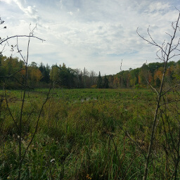
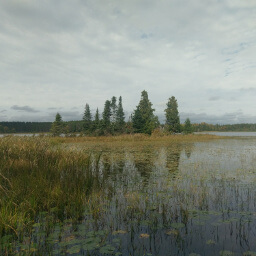
Continuing down the trail, turn sharply to the left at the next intersection to take the Old Schoolhouse Trail. This section isn't very noteworthy, so I didn't take any pictures here. Eventually, the trail meets a dirt road. Follow this road to the south, passing the nice marsh pictured below on your left, until you see a large, colorful, informational sign designating the Savanna Portage Trail on your right (you can't miss it).
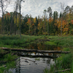
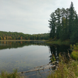
The East Savanna River doesn't look like much here, but it eventually reaches the Mississippi
View full size
Directions
From the Twin Cities, take Interstate 35W north to U.S. Highway 10 west. In Blaine, exit for Minnesota Highway 65 (Central Avenue) and turn right. Follow Minnesota Highway 65 north for about 2 hours. In McGregor, turn left, then turn right to stay on Minnesota Highway 65. Turn right on Lake Ave (County Road 14) and continue straight until the park. Pay your fee at the park office on the right, then turn right and follow the dirt road approximately 1.5 miles to the boat launch area and parking lot.
Google Maps Directions
Parking, Fees, and Facilities
Like all Minnesota State Parks and Recreation Areas, you must pay a vehicle entry fee of $7 per day or $35 for an annual pass (highly recommended if you frequently go to Minnesota State Parks). There is a vault toilet, boat launch, fishing dock, and several canoes and small boats for rent (pay at the park office) near this lot.
Nearby Hikes
Savanna Portage State Park, Minnesota
★★★★★(5/5)
Savanna Portage State Park, Minnesota
★★★★☆(4/5)
Savanna Portage State Forest, Minnesota
★★★★☆(4/5)
Rice Lake National Wildlife Refuge, Minnesota
★★★★☆(4/5)