| Rating | ★★★★☆(4/5) |
| Overall Difficulty | Moderate |
| Navigation Difficulty | Easy |
| Distance | 6.3 miles roundtrip |
| Time | 3 hours |
| Terrain | Hilly |
| Best Seasons | Spring, Summer, Fall |
| Dog Friendly | Yes |
| Accessible | No |
Highlights
- Excellent for seeing fall colors
- Hilltop views at the Prairie Overlook
- Only an hour from the Twin Cities
Hike Summary
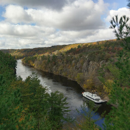
One of the closest Minnesota State Parks to the Twin Cities, this park is the ideal escape to nature without requiring a long drive. The hike described here is the best way to see what the park has to offer since it circles through a large area of the park with diverse landscapes ranging from prairie to wetlands to hardwood forest. This is the extended version of the Hiking Club Trail, adding the Hardwood Hills Trail and Wedge Hill Savanna Trail for some extra mileage and hills -- it's only one extra mile, and totally worth it.
Dogs are allowed on leash. Although Hiking Club Trails are usually family friendly, the trail here is one of the longest in the Hiking Club program in Minnesota State Parks, even without my added diversions. For a family friendly hike, head to the day use area and do the 1.6 mile Riverside Trail Loop; you can swim at the beach afterward or rent canoes, kayaks, or paddleboards. You can only hike this route in the three warm seasons since it is reserved for cross country skiing in the winter. The proximity to the Twin Cities means that there are usually people on the trails, especially on weekends. You'll have more solitude the further you hike away from the parking lot and the campground.
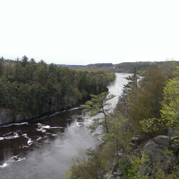
From the parking lot, head north on the trail near the interpretive center. Stay straight at the next intersection, and you'll soon be passing the Savanna Campground on your right. After the campground, you'll walk through some wetlands before reaching the cool tunnel under the railroad pictured below. Go through the tunnel to continue the hike.

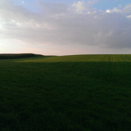
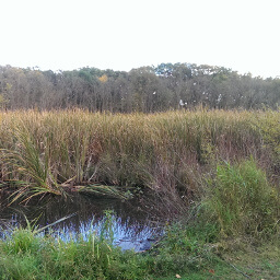
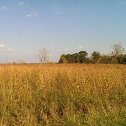
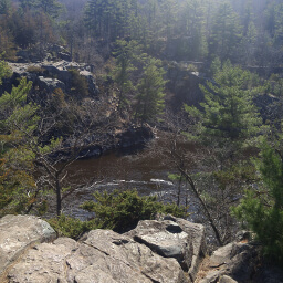
Continue down the hill, then turn right at the intersection ahead. The trail crosses the railroad tracks (the same ones from the tunnel earlier) and merges with the Wetland Trail. Again, no surprises as you walk through the marshy area like pictured below. When the trail splits, stay to the right. Turn right at the following intersection onto the Wedge Hill Savanna Trail. You will begin climbing uphill to another prairie, like pictured below. The trail curves around through the prairie, then meets the main trail once again. Turn right and continue straight until you reach the parking area. I hope you enjoyed this trip around William O'Brien State Park. There is some splendid nature here, and the varied landscape and terrain keeps the hike interesting. Let me know what you think in the comments section below, and be sure to use #nocoastbestcoast on Twitter and Instagram!
Hiked on Saturday, September 27th, 2014 by Ricky Holzer
Directions
From the Twin Cities, take Interstate 35 north and exit at Minnesota Highway 97. Turn right, and follow the signs for Minnesota Highway 97 at the two traffic circles ahead. Stay on Minnesota Highway 97, then turn right onto Minnesota Highway 95 (St. Croix Trail). Look for signs for the park, then turn right. Pay your fee at the park entrance, then turn left at the stop sign ahead and turn right soon after to reach the parking lot by the interpretive center.
Google Maps Directions
Parking, Fees, and Facilities
Like all Minnesota State Parks and Recreation Areas, you must pay a vehicle entry fee of $7 per day or $35 for an annual pass (highly recommended if you frequently go to Minnesota State Parks). There are flush toilets and educational exhibits in the interpretive center.
Nearby Hikes
William O'Brien State Park, Minnesota
★★★☆☆(3/5)
Interstate State Park, Wisconsin
★★★★★(5/5)
Interstate State Park, Minnesota
★★★★☆(4/5)
Interstate State Park, Minnesota
★★★★☆(4/5)