| Rating | ★★★☆☆(3/5) |
| Overall Difficulty | Moderate |
| Navigation Difficulty | Easy |
| Distance | 3.5 miles roundtrip |
| Time | 2 hours |
| Terrain | Hilly |
| Best Seasons | Spring, Summer, Fall |
| Dog Friendly | Yes |
| Accessible | Yes |
Highlights
- 360 degree views from atop the observation tower
- Dense, shady forest
- Easy connections to other trails for a longer hike
Hike Summary
Sibley State Park is pretty much par for the course for a Minnesota State Park; it has lakes, forest, and a bit of prairie. Mount Tom is the highlight of this park, and as the highest point for 50 miles with an observation tower on top, you will have tremendous panoramic views. The forest canopy will keep you nice and cool on a hot summer days, and once you're done with the hike you can cool off in Lake Andrew. If you're visiting Sibley State Park, this hike is a must do.
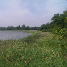
This hike begins near the day use area by the beach. Follow the Lakeview Trail along the lakefront, looking for signs for the "Mount Tom Trail". The park simplified routefinding by placing maps at most trail intersections and numbering trails so you can find each trail on the map more easily -- the Mount Tom Trail is #3, see the official map link at the bottom of the page. You have two route options for this hike: turn left onto the Mount Tom Trail at the first intersection and do a lollipop loop, or continue on the Lakeview Trail for another 0.4 miles before turning left onto the second intersection with the Mount Tom Trail. I opted for the first choice since I didn't realize it would only add 0.1 miles to do a true loop.
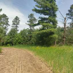
Should you choose the first option and start down the Mount Tom Trail, take a right at the T intersection with the Oak Hills Trail to go through dense, hilly forest. Then, turn left onto the Mount Tom Trail at the next intersection and follow that to the final destination. If you choose the other option, just follow the Lakeview Trail until you see another sign for the Mount Tom Trail, then turn left. Remain on this trail until you reach Mount Tom.
The trail has a few hills that you ascend and descend, and at one point it seemed as if I was already at the tallest point since there were no taller trees around. You'll know you're getting close when the trail starts curving. Eventually you'll arrive in a parking lot with some pit toilets and see the paved trail and observation tower on top of Mount Tom pictured below.
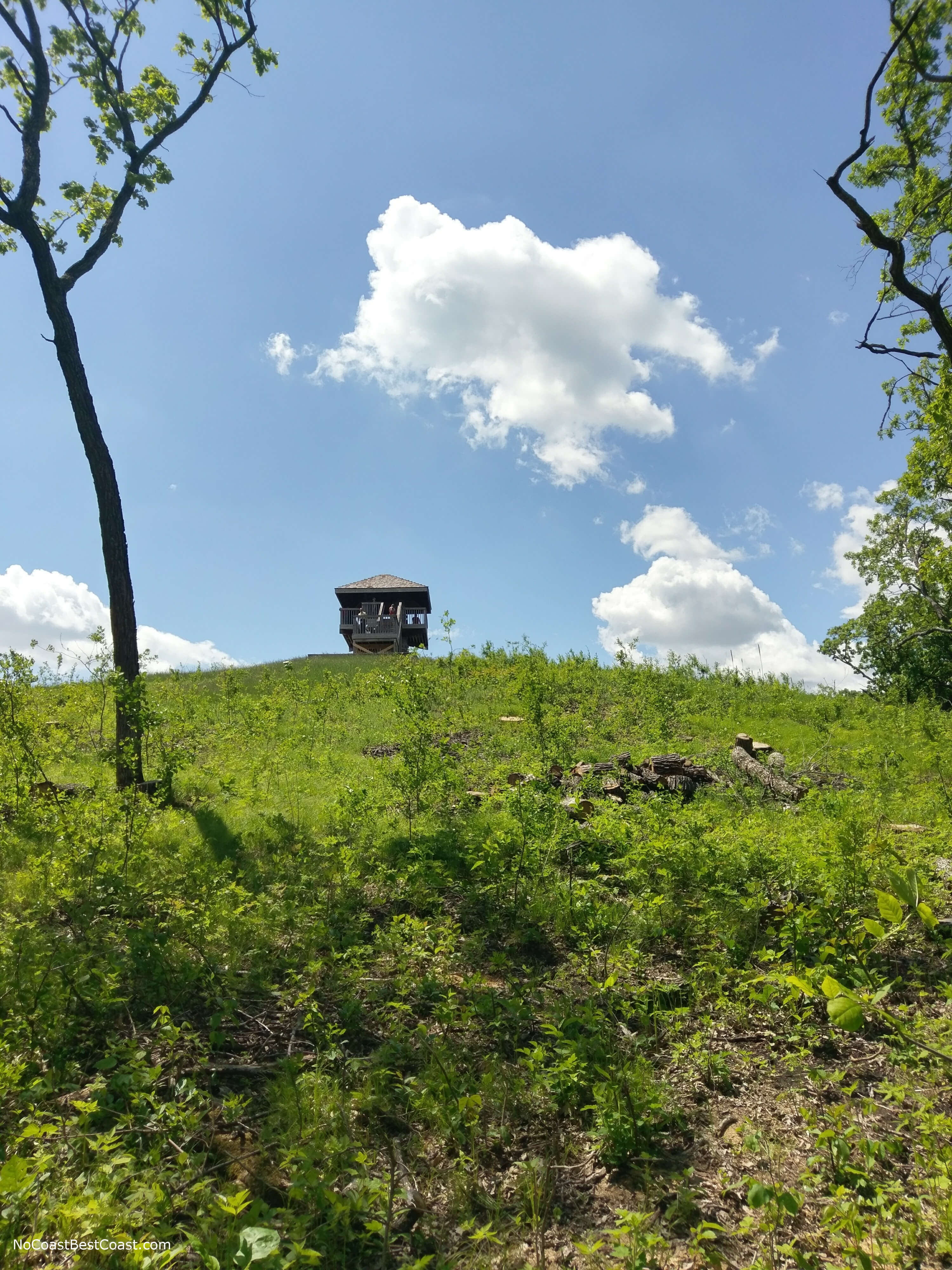
The observation tower on top of Mount Tom
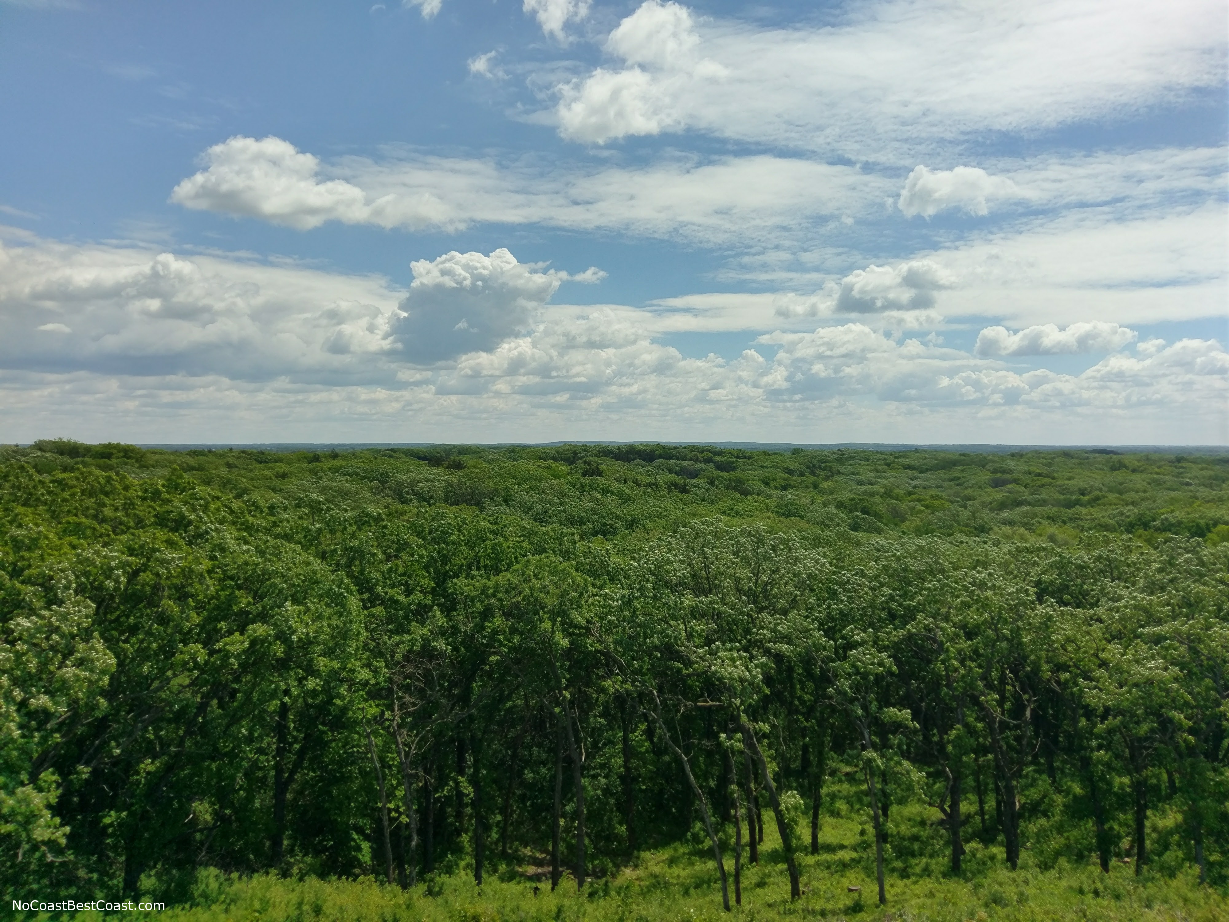
One view from atop the Mount Tom observation tower.
Further down the trail, you can also choose to take a very short side trail to the top of Badger Hill, which is also another great photo opportunity and a chance to rest for a bit. After Badger Hill, you will come to a trail intersection; turn right here. You will cross the main road, then end at the trail you started at. All in all, this was a pretty rewarding hike and a worthwhile way to spend an afternoon. Connect with me using the social media links below and share your adventures!
Hiked on Sunday, May 28th, 2017 by Ricky Holzer
Important Information
Dogs are allowed on leash. While this trail is a bit longer than most other family friendly hikes on this site, it should be doable for older kids. For families with younger children, drive to the parking lot at the base of Mount Tom instead and cut out 95% of the hiking involved. This trail is only available during the Spring, Summer, and Fall; during the winter the trail system changes routes significantly and trails are designated for cross country skiing only. In addition, the trail to Mount Tom from the nearby parking lot is technically closed during the winter (though I'm sure you could still climb to the top). Be on the lookout for stinging nettle, especially if you choose to hike any of the less-maintained trails in the park. We were extremely lucky that we didn't need to use bug spray at all on this trip, but it is a good idea to bring some just in case. Also check yourself for ticks after the hike -- I found two lurking on my pant leg.
Directions
Sibley State Park is about 2 hours from the Twin Cities near the town of New London. I highly recommend taking Minnesota Highway 55 -- it's a two lane highway with very little traffic (even over Memorial Day weekend). Once you get to Paynesville, take Minnesota Highway 23 towards Willmar, then turn right onto Minnesota Highway 9 to go through New London. Turn left on County Road 148 and continue straight when you come to the intersection with U.S. Highway 71. The ranger station will soon be on your right.
Google Maps Directions
Parking, Fees, and Facilities
Like all Minnesota State Parks and Recreation Areas, you must pay a vehicle entry fee of $7 per day or $35 for an annual pass (highly recommended if you frequently go to Minnesota State Parks). If you actually want to hike, park in the lot near the beach by the Lakeview Campground. If you want to cheat, you can drive up the road next to the ranger station to a parking lot at the bottom of Mount Tom.
Nearby Hikes
Sibley State Park, Minnesota
★★★★☆(4/5)
Glacial Lakes State Park, Minnesota
★★★★☆(4/5)
Lake Maria State Park, Minnesota
★★★★☆(4/5)
Sand Dunes State Forest, Minnesota
★★☆☆☆(2/5)