| Rating | ★★★★★(5/5) |
| Overall Difficulty | Easy |
| Navigation Difficulty | Easy |
| Distance | 1.5 miles roundtrip |
| Time | 1 hour |
| Terrain | A few hills |
| Best Seasons | Spring, Summer, Fall |
| Dog Friendly | Yes |
| Accessible | No |
Highlights
- Cool rock formation
- Short side trails to beaches
Hike Summary
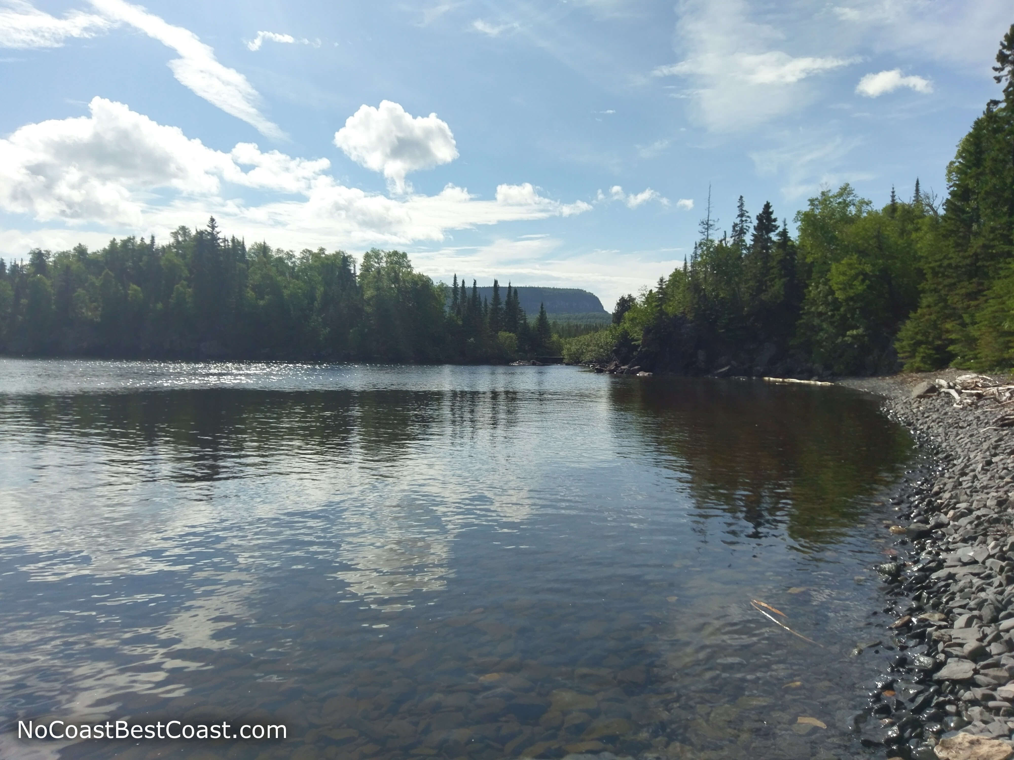
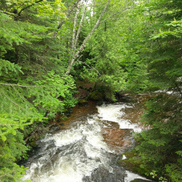
This is one of the most popular hikes in the entire park, and for good reason. The terrain is varied with some slight hills and the scenery changes from dense forest to the dazzling blue waters of Lake Superior with fascinating rock formations and a view of the Sleeping Giant in the distance.
From the parking lot, follow the trail that starts next to the picnic shelter and head west. This beginning part is all slightly downhill, which you probably won't realize until it's time to go back up. Continue straight past the Sawyer Bay Trail junction, then turn left at the signs pointing to the Sea Lion near where the trail approaches the water.
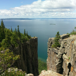
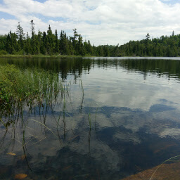
The next section of trail is rocky and has a couple steeper sections. Take your time, and you will have no problems. Soon you will arrive at a flat area on top of the cliffs with wooden railings and a view of the Sea Lion rock formation to your right. Signs will attempt to explain how it resembles a sitting lion, but I still am not convinced even after seeing the picture of what it used to look like before a large chunk broke off. Off in the distance you can see impressive sheer cliffs rising above Lake Superior, the namesake of this provincial park, the Sleeping Giant. The water below is so beautifully clear that you can see the smooth rocks on the bottom!
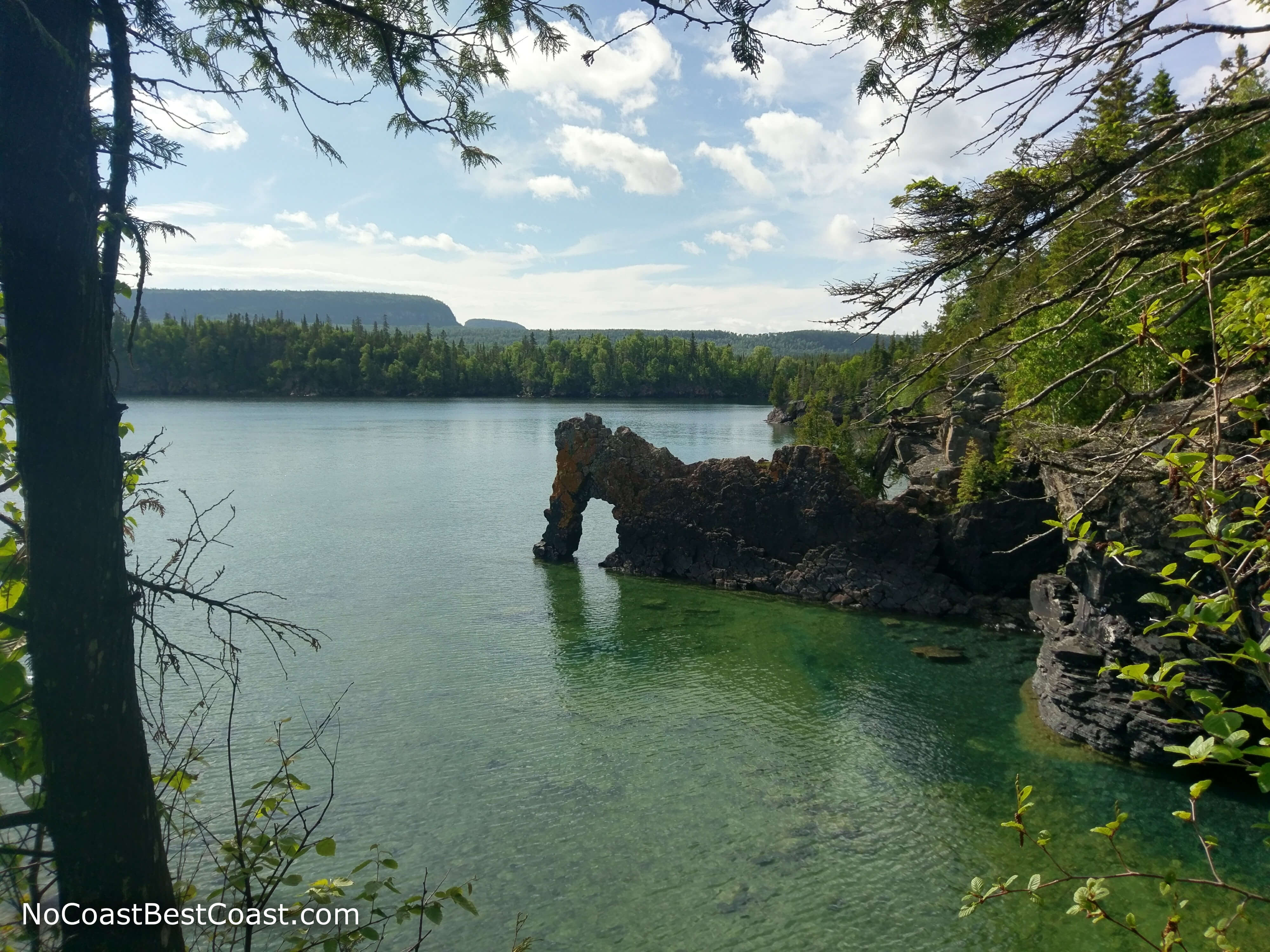
The iconic rock formation called the Sea Lion (I still don't see how they thought it looks like a sitting lion)
The mirror-like waters of Lake Superior with the Sleeping Giant in the distance
Hiked on Friday, June 30th, 2017 by Ricky Holzer
Important Information
The short distance and rewarding scenery makes this an excellent hike for the whole family. Dogs are allowed on leash, and there are some side trails leading to the rocky beach that your dog will love. Be sure to bring bug spray because the mosquitoes and black flies will eat you alive without it. Come during the morning or evening (the sun doesn't set until 10pm in the summertime!) to beat the crowds and enjoy this spectacular place all to yourself. During peak times, you may struggle to find a parking space because this and many other popular hikes start from this trailhead.
Directions
From Thunder Bay, follow the Trans-Canada Highway (Ontario Highway 11/17) east; if you are coming from Minnesota, Minnesota Highway 61 turns into Ontario Highway 61 once you cross the Canadian border, and this highway turns into the Trans-Canada Highway. After about half an hour, turn right onto Ontario Highway 587 (Pass Lake Road); this highway is the main road through the park, and once inside the park, there will be brown signs indicating turnoffs for trailheads and other points of interest. You must first pay the vehicle fee before parking at this trailhead, either at the day use area closer to the entrance of the park (there will be a $ symbol on the sign indicating you can pay here) or at the park office in the campground just before this trailhead. Once you've paid, continue south on 587 until you see the signed turnoff for the Kabeyun Trailhead on the right.
Google Maps Directions
Parking, Fees, and Facilities
It is important to note that this is a provincial park and does not belong to the Canadian National Parks System, thus any national parks pass you may have is not valid admission here. Parking in Ontario Parks requires a $11.25 (Canadian) vehicle fee for day use, $175 (Canadian) for an annual pass, or $125 (Canadian) for a summer pass (valid April to November). This fee is included with a camping reservation. The parking area for this hike is a large dirt lot off the main road through the park and has a pit toilet and picnic shelter with one table.
Nearby Hikes
Sleeping Giant Provincial Park, Ontario
★★★★★(5/5)
Sleeping Giant Provincial Park, Ontario
★★★☆☆(3/5)
Sleeping Giant Provincial Park, Ontario
★☆☆☆☆(1/5)
Sleeping Giant Provincial Park, Ontario
★★★★★(5/5)