| Rating | ★★★★★(5/5) |
| Overall Difficulty | Moderate |
| Navigation Difficulty | Medium |
| Distance | 2 miles roundtrip |
| Time | 2 hours |
| Terrain | Strenuous climbing, 700 feet of elevation gain |
| Best Seasons | Spring, Fall, Winter |
| Dog Friendly | Yes |
| Accessible | No |
Highlights
- Exploring miles of sand dunes
- Views from the top of one of the highest dunes
Hike Summary
Great Sand Dunes National Park and Preserve offers the interesting juxtaposition of sand and snowy mountains (for those like me who answer both when asked beach or mountains), as shown in the picture below taken along the road to the park. The best way to experience the park is to travel into the trail-free dunefield, and the perfect destination is High Dune, one of the tallest dunes rising 700 feet above the scrub-covered basin (it falsely appears to be the tallest dune when looking from afar). From the top, you'll enjoy panoramic views of the dunes and surrounding mountains. Even if you don't think you can make it to the top, it's still worth an attempt just to get a better vantage point and then run or skip down the cushioned, sandy slopes.
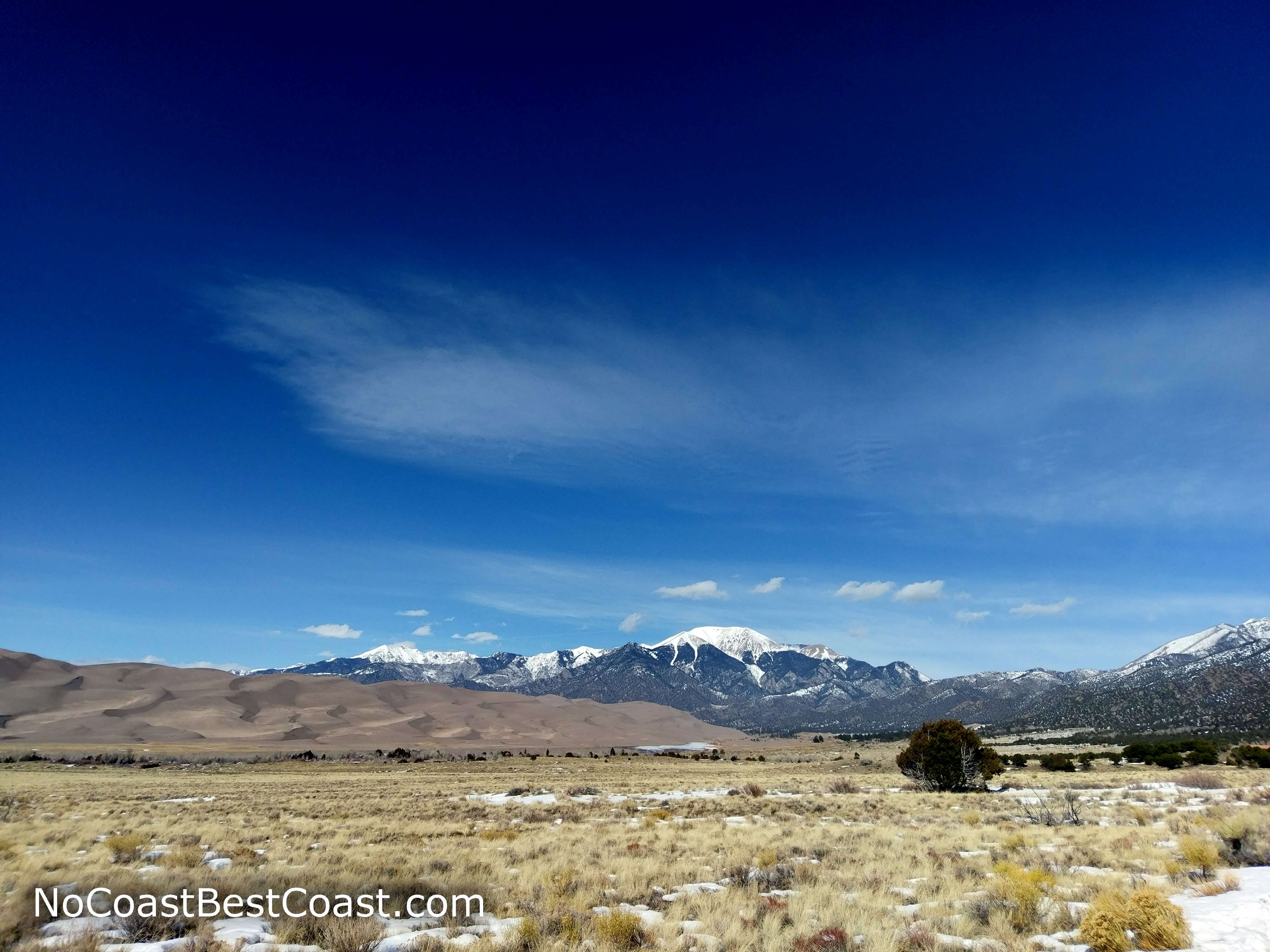
Massive sand dunes with snow capped peaks in the background
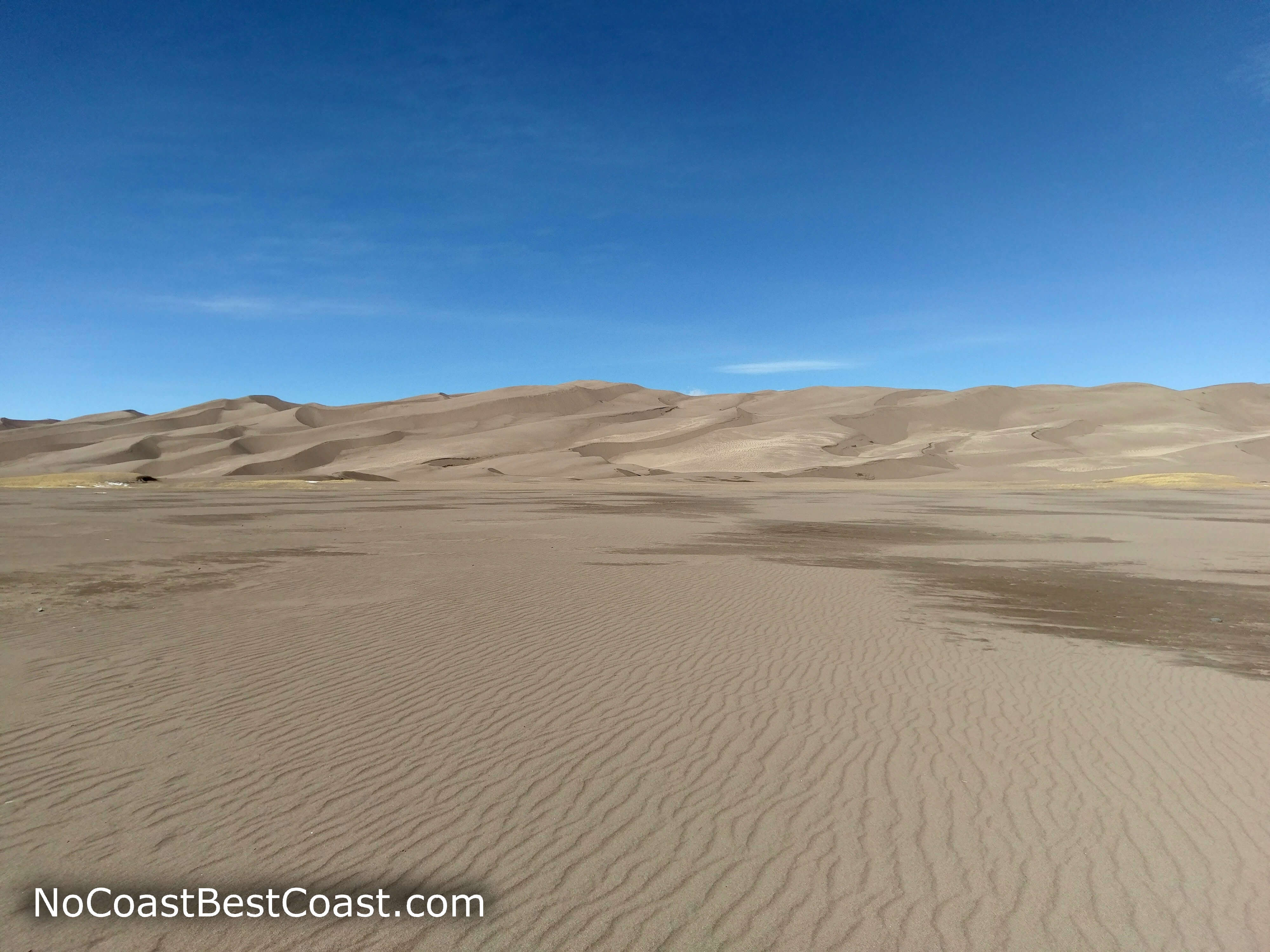
Ripples in the endless sand
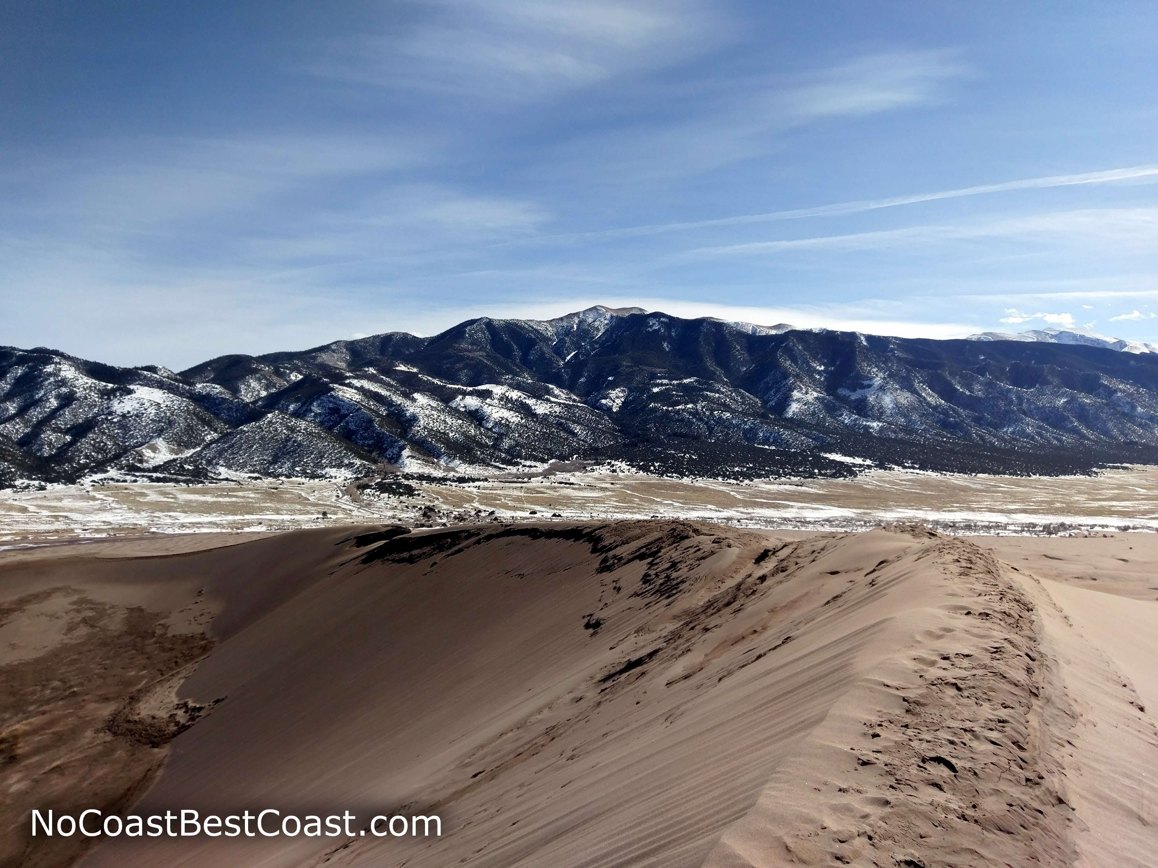
Mountains from the top of a dune
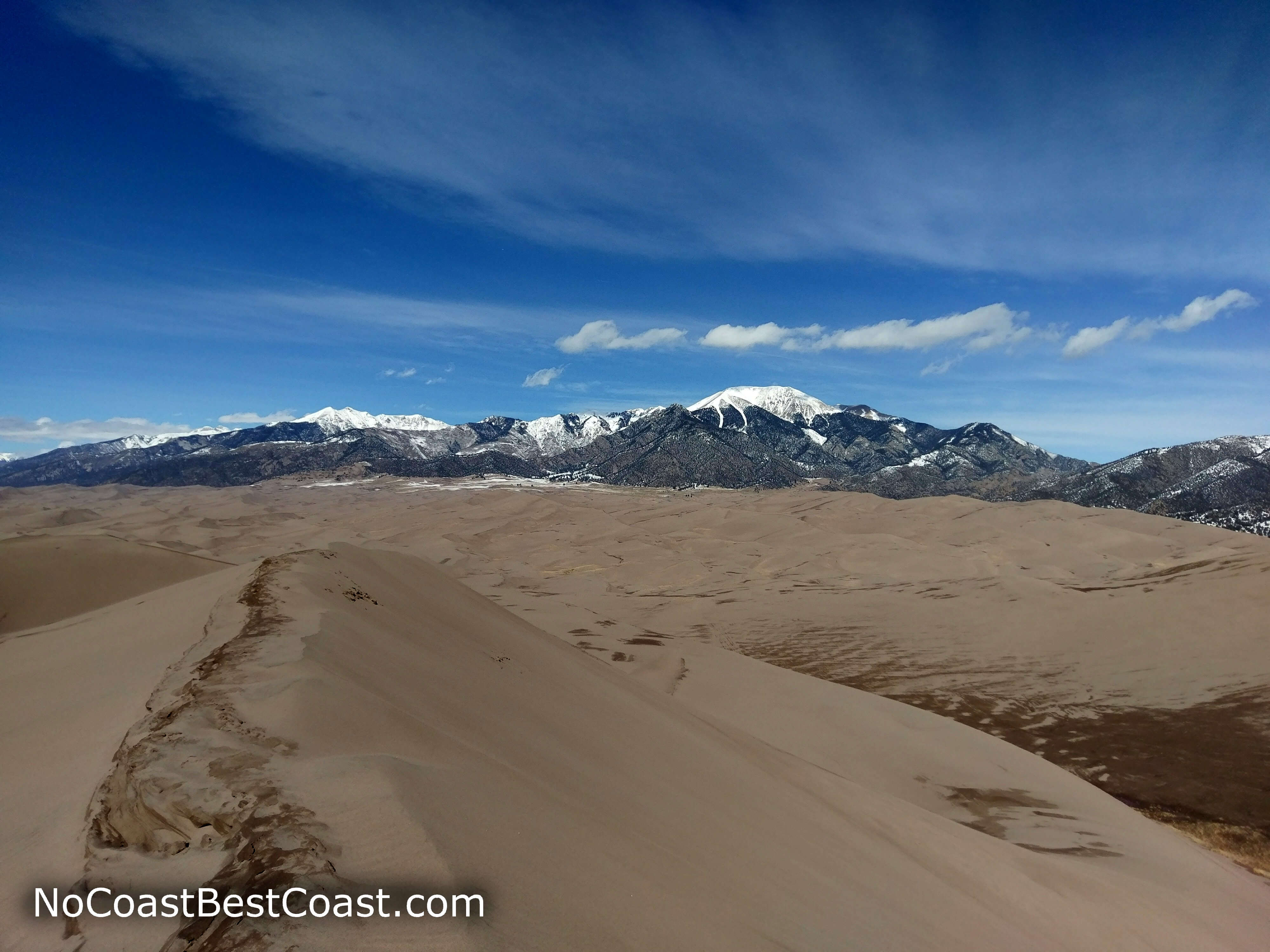
The dunefield stretches all the way to the mountains, as seen from High Dune
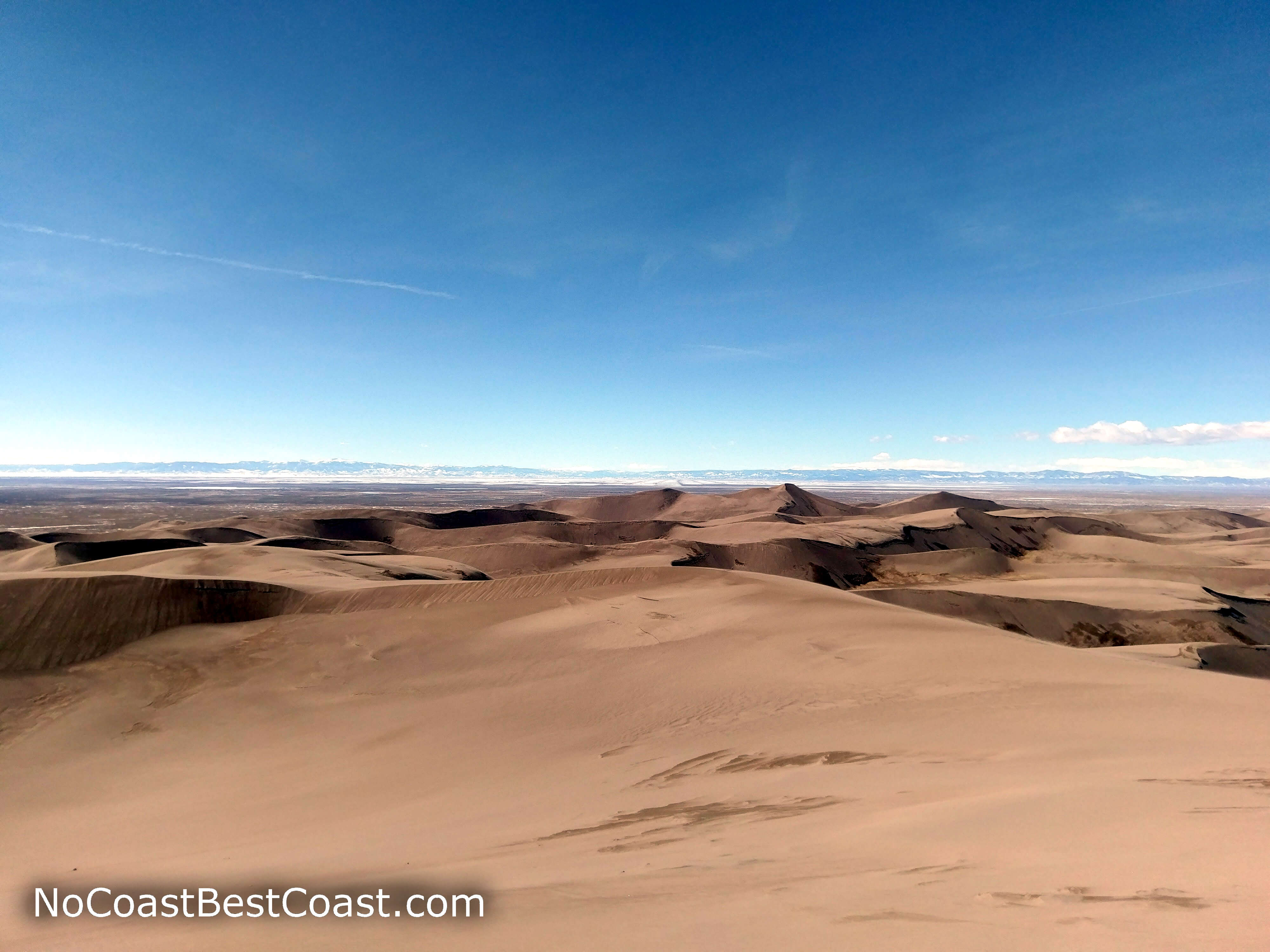
The view towards Alamosa from the top of High Dune
Despite the disappointment of not reaching Star Dune, this was an excellent hike and the perfect way to experience the Great Sand Dunes. Connect with me using the social media links below and share your adventures!
Hiked on Wednesday, February 8th, 2017 by Ricky Holzer
Important Information
Unlike many national parks, dogs are permitted on leash. Note that dogs are not allowed in the backcountry of the dunefield past High Dune, see the map and details on the park's website. It's surprisingly difficult to reach the top of High Dune, so it is not a family-friendly endeavor. However, you don't need to climb to the top to enjoy the sand, and kids will be happy to climb any dune and slide or run down. Spring, fall, and winter are the best seasons to visit since summer is hot and the sand is hotter. This is the primary place most people visit in this national park, so expect to see plenty of people. You can escape the crowds by traveling deeper into the dunefield.
Directions
From Denver, take Interstate 25 south past Pueblo to Walsenburg. Take the exit for U.S. Highway 160, then turn left. Go up and over the mountains, then look for the brown sign for Great Sand Dunes National Park and Preserve indicating the right turn onto Colorado Highway 150. Pay the fee at the entrance station, then continue past the visitor center and turn left towards the Great Sand Dunes Picnic Area.
Google Maps Directions
Parking, Fees, and Facilities
Fees are only charged when the entrance station is open. Vehicle entrance fees are $25 and are good for 7 days. Annual passes for Great Sand Dunes National Park and Preserve are available for $45, and Interagency passes are also accepted. There are restrooms, water, outdoor showers for cleaning off sand, and vending machines in a building adjacent to the lot.