| Rating | ★★★★★(5/5) |
| Overall Difficulty | Hard |
| Navigation Difficulty | Medium |
| Distance | 7 miles roundtrip |
| Time | 5 hours |
| Terrain | Strenuous climbing |
| Best Seasons | All |
| Family Friendly | No |
| Dog Friendly | Yes |
| Accessible | No |
Highlights
- Multiple viewpoints of Boundary Waters lakes from atop cliffs
- Truly adventurous feelings on a wilderness trail
- Impressive waterfall and swimming opportunities at the end
Hike Summary
All I can say about this trail is "wow". This is the kind of all day excursion that is the reason why I enjoy hiking. The scenery is astounding with overlooks of lakes abound; the trail is rough, overgrown like a jungle, and just hard enough to find that it isn't frustrating but still feels like you're using your navigation skills; and the hike ends with a decent sized waterfall draining into a lake that looks into Canada. If you're up to the challenge, this is a truly rewarding experience.
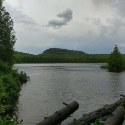
If you are planning on hiking all the way to Rose Falls, you must first fill out a free wilderness permit at the trailhead kiosk and carry it with you. You will be ticketed if caught without one! The hike starts off with a bang, and after hiking only 3/4 of a mile (mostly uphill), you encounter the view of West Bearskin Lake pictured below. After about a mile beyond this overlook, you will have an excellent view of Moss Lake. Up until the Moss Lake overlook, the trail is relatively well-traveled and easy to follow.
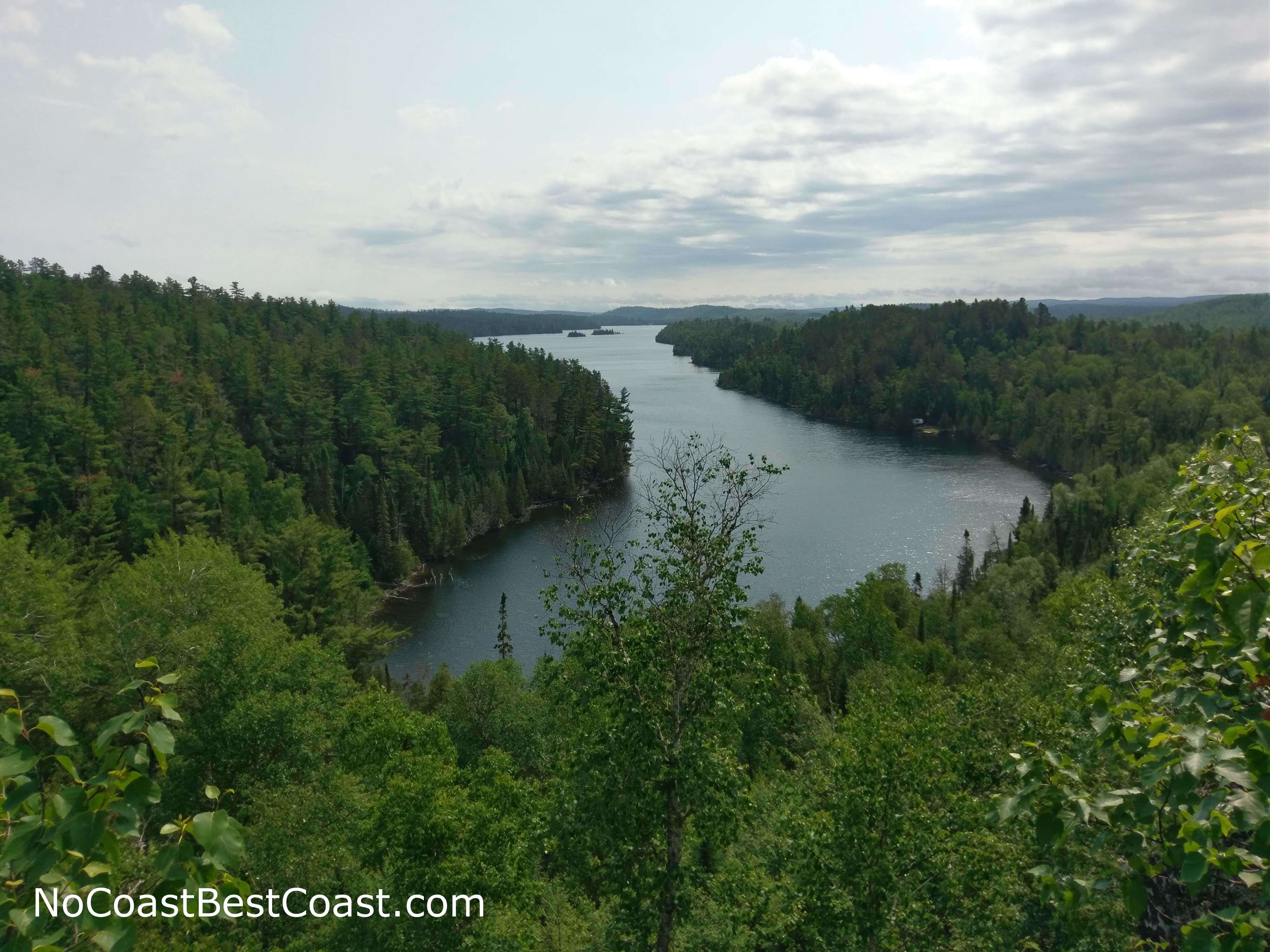
This hike is filled with overlooks of secluded lakes, like this view of West Bearskin Lake
After passing the portage intersection, the trail will begin a steep ascent up a hill. At the top, turn left; it may look like there is a trail continuing to the right, but that is not a mapped trail. There will be fluorescent markers on trees in this next section to help you navigate across stretches of bare rock where a trail isn't apparent. Almost as soon as you reach the top, you will start descending this hill on another dangerously steep and eroded path.
Once you reach the bottom of the hill, the trail will become hard to find thanks to a seemingly desert landscape of deadfall. Look closely for orange ribbons hanging from the few trees still stand here to guide your way. One group I ran into struggled to find the trail here and turned around in frustration; they kept following a use-trail that ended at Duncan Lake. You'll know you're on the right path when the trail starts ascending yet another steep hill.
At the top of the hill, you'll want to break out your safari hat and machete because the next section will be so overgrown in place you'll feel like you're blazing a new trail (the trail is still there though, however faint it may be). The trail probably used to be much straighter here, but all of the deadfall has produced some creative reroutes. After this adventure, you will descend towards Duncan Lake, following its shore to a creek that drains into Rose Lake via Rose Falls.
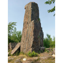
Finally, the Caribou Rock Trail that you've been following will end at a T intersection with the Border Route Trail, where you will turn left and cross a short wooden bridge. Follow the sound of raging water to the right and descend the Stairway Portage, a series of wooden stairways (the longest flight pictured below) that paddlers use to connect Duncan Lake to Rose Lake (unless they know how to canoe up a waterfall).

The dreaded Stairway Portage (and this isn't the only set of stairs!)
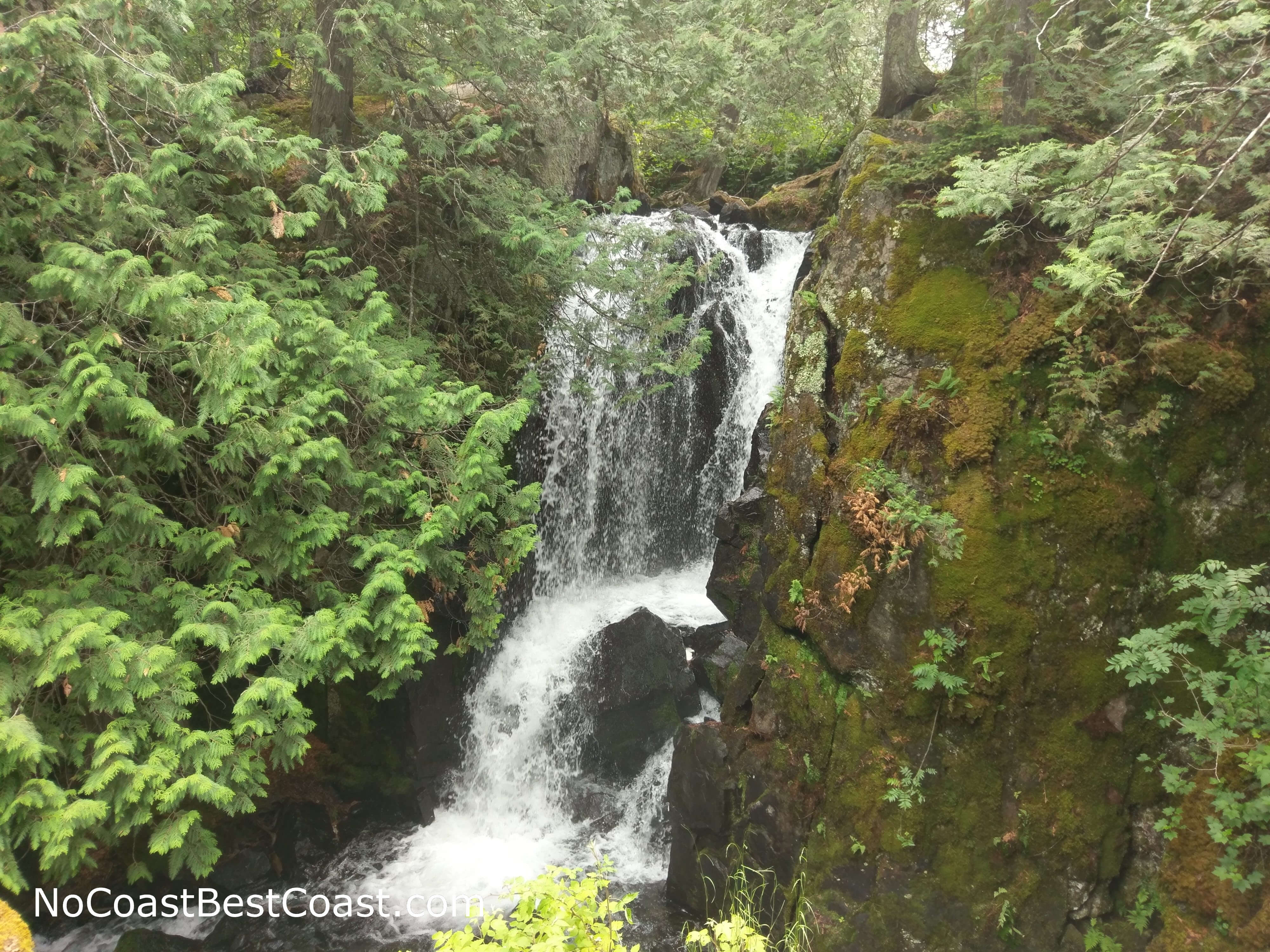
Rose Falls in all its beauty

You can see Canada from across Rose Lake

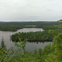
The change in lighting between this and the first picture illustrates how long it takes to complete this hike
Important Information
You must fill out a free permit to hike all the way to Rose Falls since it is part of the Boundary Waters Canoe Area Wilderness. Forms and instructions are located at the trailhead kiosk. Dogs are allowed, and regulations don't explicitly state whether or not a leash is required, just that your dog remain "under control". The rugged nature of this wilderness trail means this isn't a family friendly hike. If you have kids, I suggest driving further down the Gunflint Trail to the Chik-Wauk Nature Center where there are plenty of easy trails and an educational museum and nature center. You could also cut this hike short, since the first part of the trail is well-traveled and after 3/4 of a mile you will reach the overlook in the first picture (and fifth picture) above; this 1.5 mile roundtrip option is closer to family friendly, but since it's still a wilderness trail I wouldn't recommend it for younger children.
When they say this is a wilderness trail, they mean it. Not only is there little to no maintenance on the trail, severe storms blew down what seems like a whole forest of large trees about halfway through the trail, making routefinding especially difficult. One group I met turned around because they were tired of looking for the correct trail, and another group of backpackers had to amend their travel plans due to the Border Route Trail that connects to this trail being nearly impossible to follow. Although the most difficult parts to navigate have blazes or fluorescent ribbons on the trees, they are often hard to notice and are no substitute for understanding how to use a map and compass.
Wearing pants is almost a requirement for this trail, unless you don't mind having your legs shredded by the overgrown brush and many dead tree limbs lining (and sometimes covering) the trail. Proper footwear is also a must; the trail is covered in rocks and exposed tree roots, and the uphill and downhill segments are extremely steep. Bug spray is an essential, and I also suggest wearing a hat or another head covering to keep annoying flies off your head. Bring ample food and water -- you will need the energy and hydration to survive the many hills you must climb up and over.
Directions
From Grand Marais, drive up the Gunflint Trail (Cook County Highway 12) for about 28 miles. Look for the signs for Cook County Highway 65 (Hungry Jack Road), then turn right. Continue straight for about two miles, and park in the pullout on the right side.
Google Maps Directions
Parking, Fees, and Facilities
Parking is free! There are no facilities near the lot.
Nearby Hikes
Superior National Forest, Minnesota
★★★★★(5/5)
Superior National Forest, Minnesota
★★★☆☆(3/5)
Superior National Forest, Minnesota
★★★★★(5/5)
Superior National Forest, Minnesota
★★★★★(5/5)