| Rating | ★★★★☆(4/5) |
| Overall Difficulty | Easy |
| Navigation Difficulty | Easy |
| Distance | 1 mile roundtrip |
| Time | 1 hour |
| Terrain | Mostly flat |
| Best Seasons | All |
| Family Friendly | Yes |
| Dog Friendly | Yes |
| Accessible | No |
Highlights
- See the glacial potholes
- Walk into the Bake Oven Pothole
- View the beautiful St. Croix River
Hike Summary
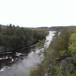
Interstate State Park is only about an hour from the Twin Cities, making it a perfect destination for a day trip or as a stopping point to stretch your legs on a longer journey up north. This is a great hike for kids with many opportunities to explore the nooks and crannies -- once you reach the main pothole area, the trail diverges to several short trips to viewpoints overlooking the St. Croix (as pictured below) and to sights with fun names like Bottomless Pit and Bake Oven Pothole. The trail begins at the south end of the parking lot and is easy to find. There should be plenty of people around, especially if the weather is nice.

An overlook of the St. Croix River
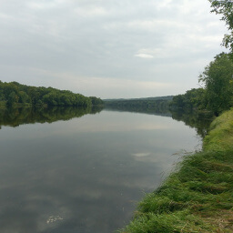
If you want to stay longer, I suggest continuing your hike by following the River Trail and making a loop by taking the Railroad Trail on the way back for a distance of 3 miles roundtrip. The southern portion of the park has a picnic area and campground and can be accessed via the River Trail or by driving south on U.S. Highway 8.
Important Information
Dogs are allowed on leash. This is an ideal hike for a family given its close proximity to the Twin Cities, short distance, and plenty to explore. You can hike here all year, but be careful on the icy rocks in winter! No matter when you go, there will probably be plenty of people, especially if the weather is nice.
Directions
Interstate State Park is located in Taylors Falls, Minnesota on the border with Wisconsin. From the Twin Cities, take Interstate 35 north, then go east on U.S. Highway 8. Normally, you can follow U.S. Highway 8 the entire way to the park, but when I went road construction closed a portion of the highway. If the road is still closed, on U.S. Highway 8 just past Lindstrom, turn left on Andrews Ave. then turn right on Louise Ave. You can contine on this road all the way to Taylors Falls, and signs should direct you to the park once in town. If you cross the river into Wisconsin, you have gone too far.
Google Maps Directions
Parking, Fees, and Facilities
Like all Minnesota State Parks and Recreation Areas, you must pay a vehicle entry fee of $7 per day or $35 for an annual pass (highly recommended if you frequently go to Minnesota State Parks). Parking is in a paved lot adjacent to the visitor center with flush toilets and water.
Nearby Hikes
Interstate State Park, Minnesota
★★★★☆(4/5)
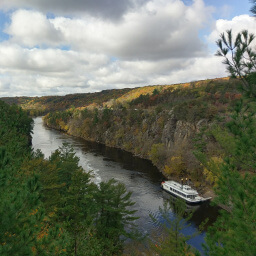
Interstate State Park, Wisconsin
★★★★★(5/5)
Wild River State Park, Minnesota
★★★★☆(4/5)
William O'Brien State Park, Minnesota
★★★★☆(4/5)