| Rating | ★★★★☆(4/5) |
| Overall Difficulty | Easy |
| Navigation Difficulty | Easy |
| Distance | 1 mile roundtrip |
| Time | 1 hour |
| Terrain | Mostly flat |
| Best Seasons | All |
| Dog Friendly | Yes |
| Accessible | Yes |
Highlights
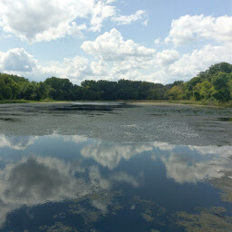
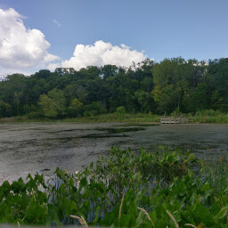
- Floating wood boardwalk through the marsh
- Interpretive signs to learn about Crosby Farm and native wildlife
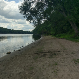
- Mississippi River views
Hike Summary
This is probably one of the most beautiful places in the entire city of St. Paul. Thanks to the high bluffs and floodplain adjacent to the Mississippi River, urban development was not desirable. This area was originally a farm owned by Thomas Crosby and operated by other families until 1962, when the land eventually became the park you see today.
This trail is perfect for all ages and dogs are allowed on leash. The entire trail is flat and paved with a boardwalk in one section and is accessible. However, the pavement on the north side of Upper Lake is in rough shape and not advisable for those in a wheelchair; instead, hike on the opposite side of the lake and turn left to do the boardwalk segment, then turn around to continue the rest of the hike. Be mindful that most of this trail is shared with cyclists and is especially popular on warm summer weekends.
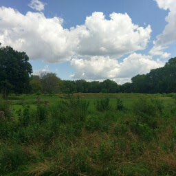
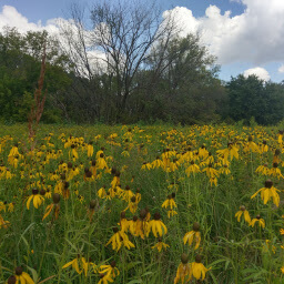
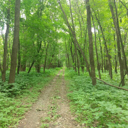
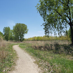
From the parking lot, follow the paved trail east into the open grassland that looks like the picture below. Depending on the time of year, prairie flowers may be in bloom like the black-eyed Susans in the second picture below. On the left side of the trail, you will see the first of several educational signs posted throughout the hike to inform you about the history of Crosby Farm and the wildlife within.
Hiked on Friday, August 11th, 2017 by Ricky Holzer
Directions
By Bike
This is an excellent destination for arriving by bike. You can access Crosby Farm Regional Park from the bike trail on Shepard Road (an extension of the trail on East River Road/Mississippi River Blvd); this trail runs from Downtown St. Paul adjacent to the Mississippi River all the way to Northeast Minneapolis and connects with many of the main bike trails throughout the Twin Cities. From Shepard Road, head downhill on the bike trail on the right side of Crosby Farm Road -- this is near the giant airport parking garage on Davern Street -- all the way to the trailhead. Once you finish hiking, there are several beautiful and tree covered bike trails in the park for you to try!
By Transit
Metro Transit Bus Line 84 stops near the corner of Davern Street and Shepard Road. It is a half mile walk to the trailhead. Cross Shepard Road at the crosswalk, then turn right on the multi-use path. Follow the path and use the crosswalk to cross Crosby Farm Road, then turn left to continue on the multi-use path down the hill to the trailhead.
By Car
The entrance is off Shepard Road just to the west of Davern Street, easily accessible from Minnesota Highway 5 or Interstate 35E. There is no designated turn lane for Crosby Farm Road on either side of the road, so pay close attention and look for signage for the park. Note there is another parking area for Crosby Farm Regional Park also on Shepard Road closer to Interstate 35E; this is a little cul-de-sac shaped lot on the top of the hill and has a paved trail that eventually connects with the hike described below after 1 mile.
Google Maps Directions
Parking, Fees, and Facilities
Parking is free! There is a picnic shelter with flush toilets and a fire pit adjacent to the lot.
Nearby Hikes
Fort Snelling State Park, Minnesota
★★★★☆(4/5)
Hidden Falls Regional Park, Minnesota
★☆☆☆☆(1/5)
Minnesota Valley National Wildlife Refuge, Minnesota
★★★★☆(4/5)
Bruce Vento Nature Sanctuary, Minnesota
★★★☆☆(3/5)