| Rating | ★★★★★(5/5) |
| Overall Difficulty | Moderate |
| Navigation Difficulty | Easy |
| Distance | 5 miles roundtrip |
| Time | 3 hours |
| Terrain | Hilly |
| Best Seasons | Spring, Fall, Winter |
| Dog Friendly | Yes |
| Accessible | No |
Highlights
- Escape the crowds into untouched sand dunes
- The stark beauty of endless white sand
Hike Summary
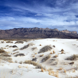
Hands down, the Alkali Flat Loop is the best hike you can do at White Sands National Monument. This 5-mile trek takes you deep into pristine white sand dunes, untouched by the hordes you'll see on other trails and along the road as you drive in. Halfway through, you'll reach the edge of the dunefield at Alkali Flat, a dry lake bed that feeds gypsum sand to the dunes. While you may have seen sand dunes elsewhere, there is nothing else that compares to being surrounded by the snow-white dunes and mountains here.
This entire loop is entirely on sand. If you've ever been to the beach, you'll understand that walking on soft sand is much more strenuous than pavement or a hard dirt trail. Compared to other dunes I've hiked like those in Great Sand Dunes National Park, the sand here was more compacted and didn't sink as much with my steps (however, this could have been because of recent rains). In addition, you'll want to wear sunglasses to protect your eyes from blowing sand -- the wind here is constant.
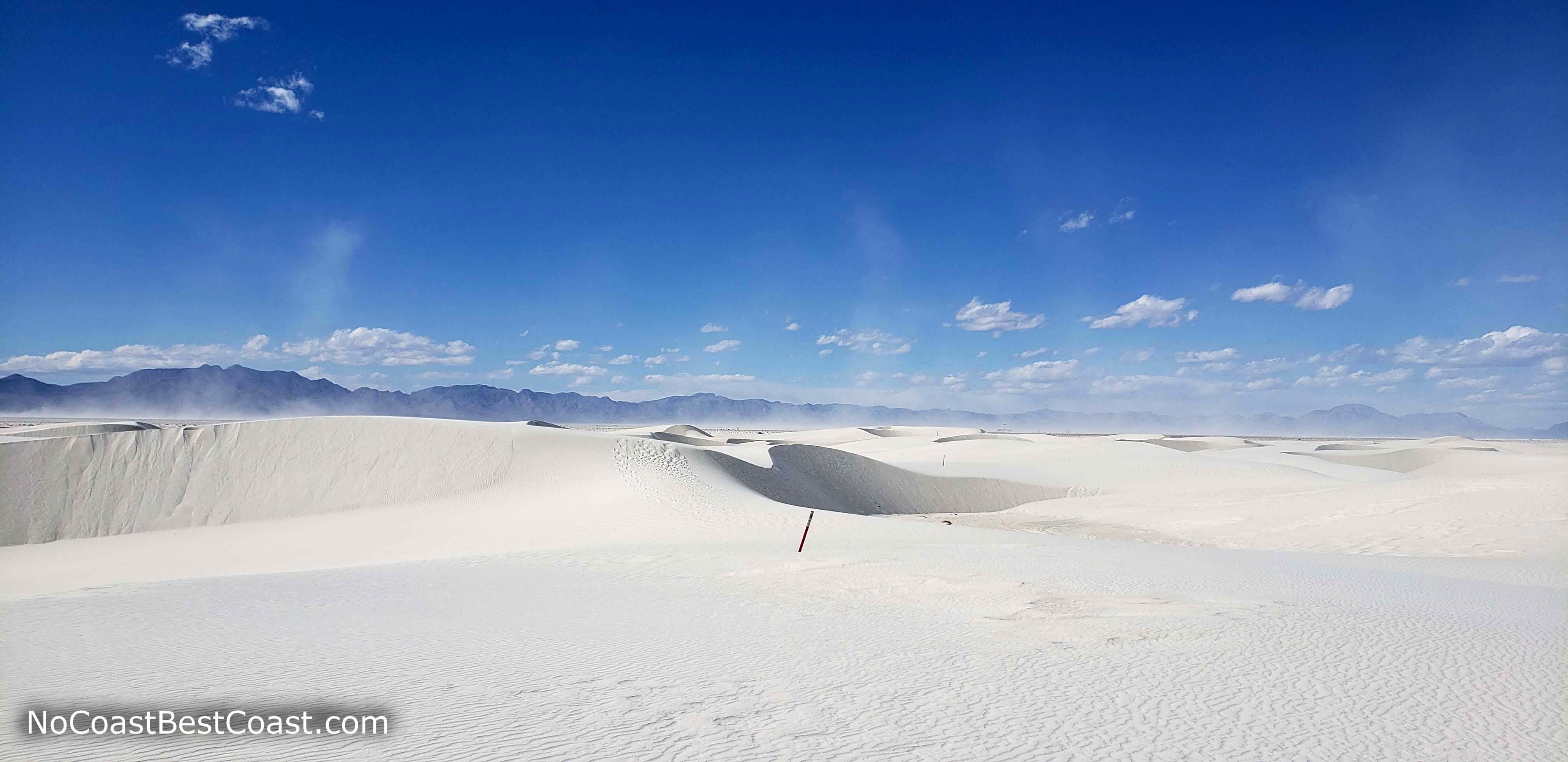
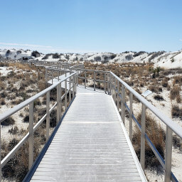
Starting from the trailhead, you'll walk along an obvious path until the trail splits. You can choose to go either direction -- difficulty doesn't change either way. Red markers about 3 feet tall with a diamond emblem will mark the looping route through the dunes. Standing at a marker, you can usually see 2 or 3 markers in the distance, so you won't have to worry about being lost in endless sand as long as you don't wander far. It's up to you to determine the best route between each marker. The undulating terrain like pictured below means the straightest path is often not the path of least resistance, and you'll find yourself following the curves of the dune crests rather than descending into the troughs and back up the dune again.
Red markers guide you through the trail-less white dunefield
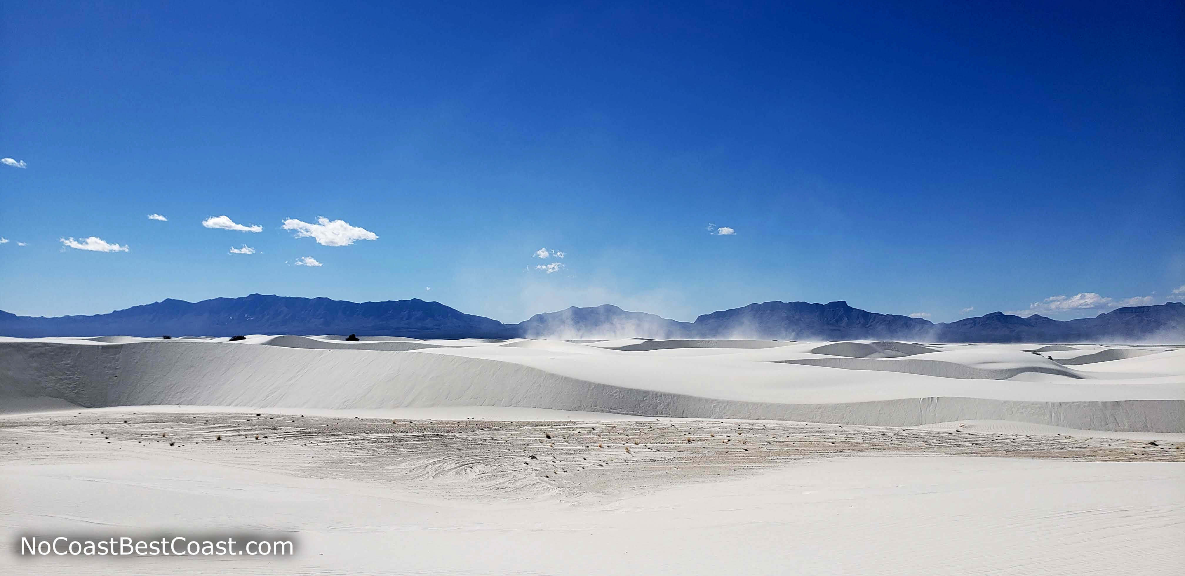
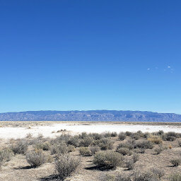
The San Andres Mountains beyond the blowing white sand
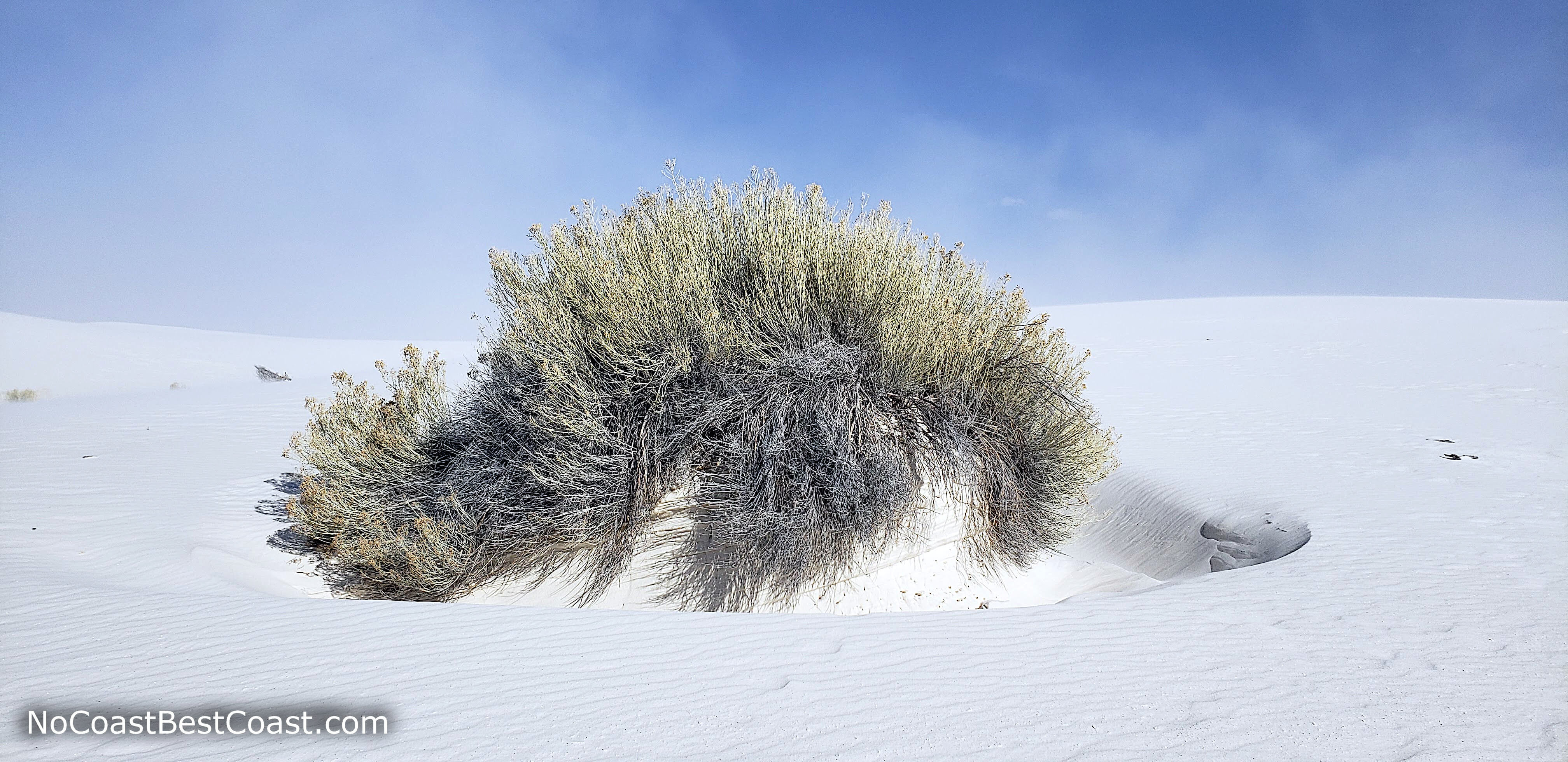
Uniquely adapted plants grow in the sand
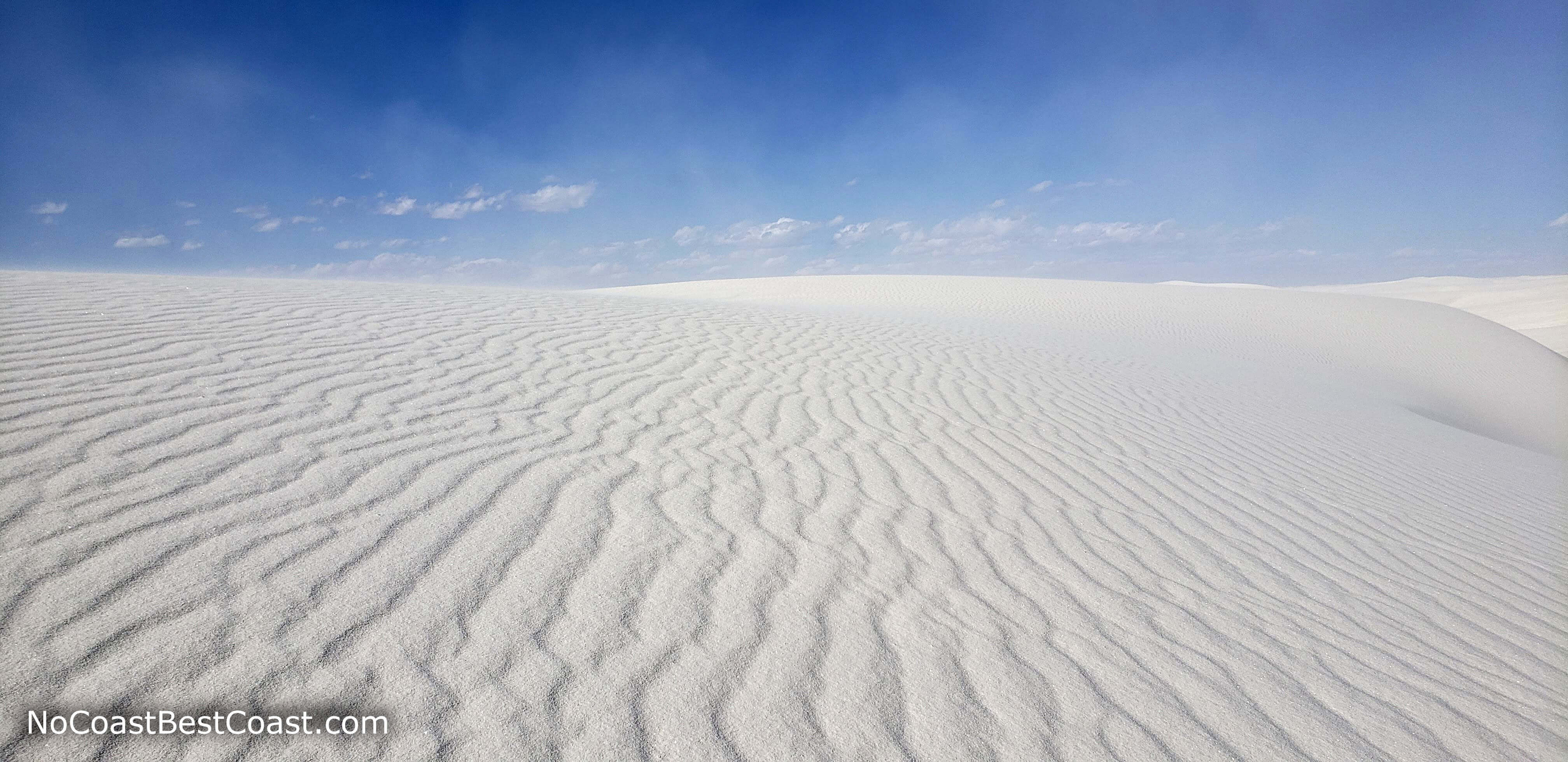
Wind forms ripples like ocean waves in the sand
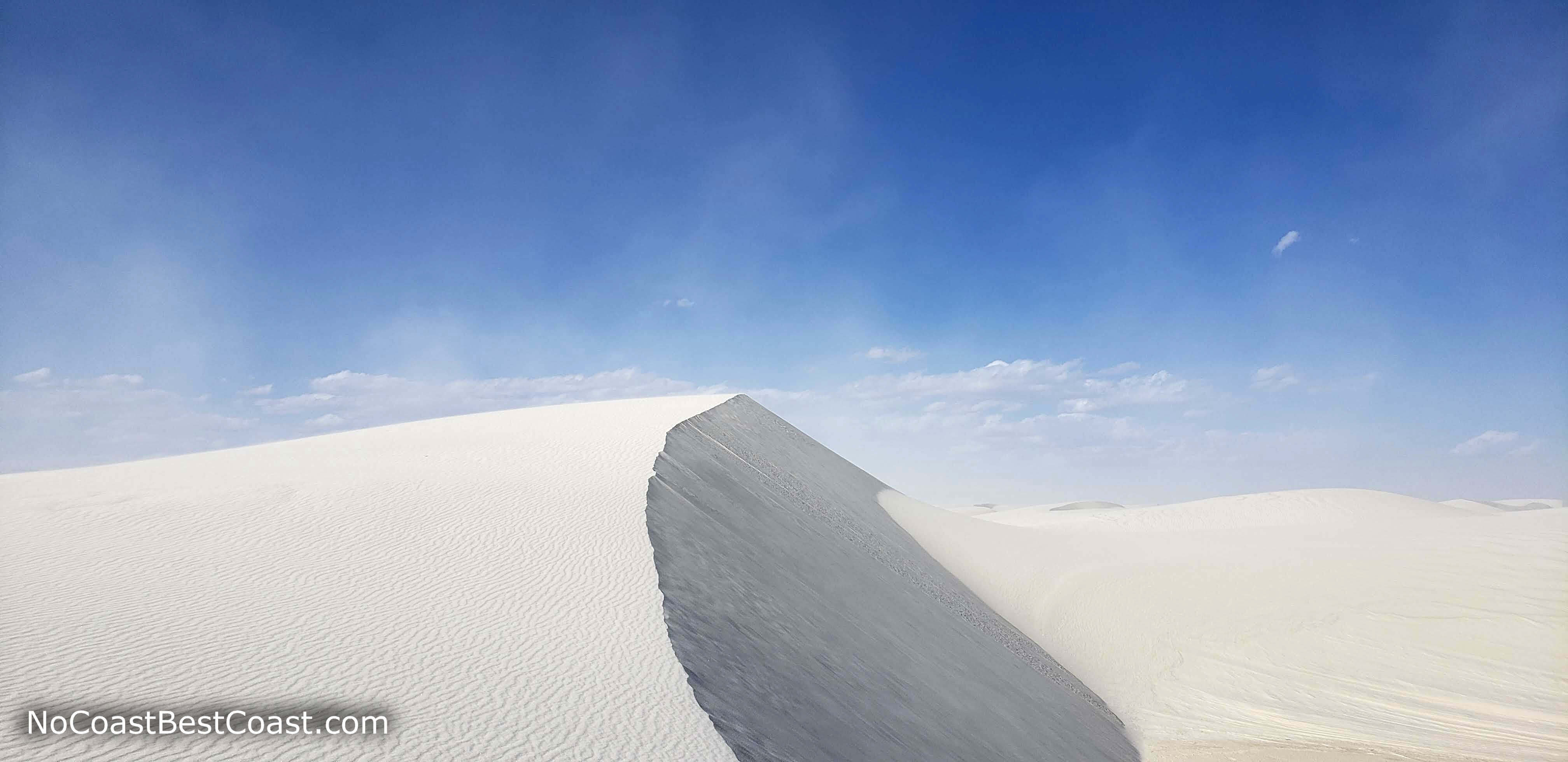
The crest of one tall dune
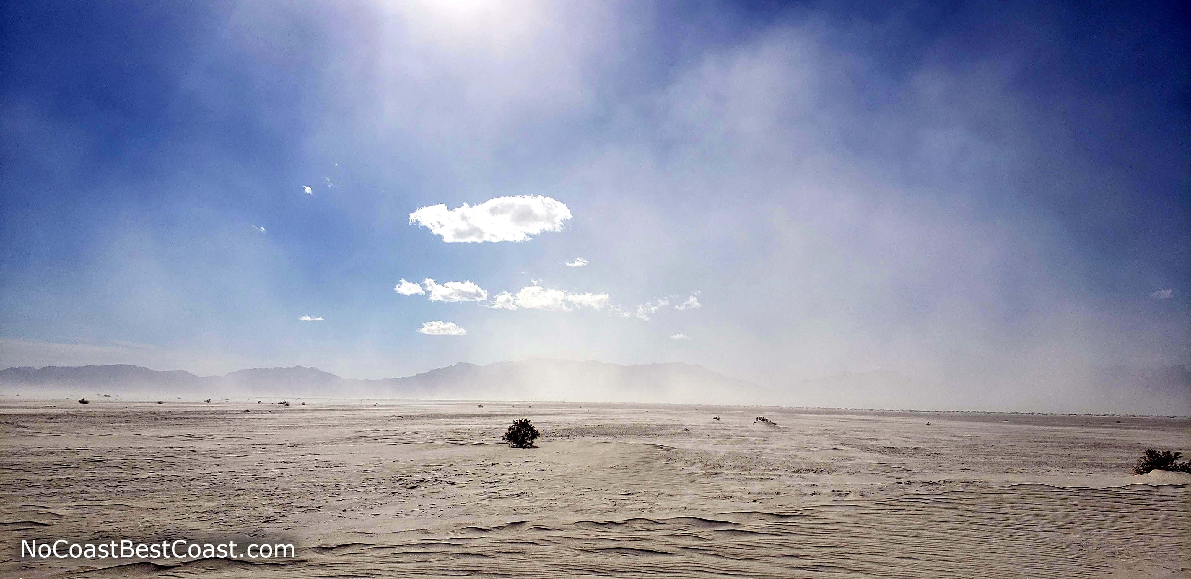
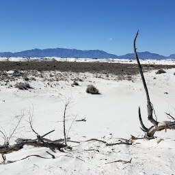
A lone shrub on the barren Alkali Flat with dust clouds obscuring the San Andres Mountains
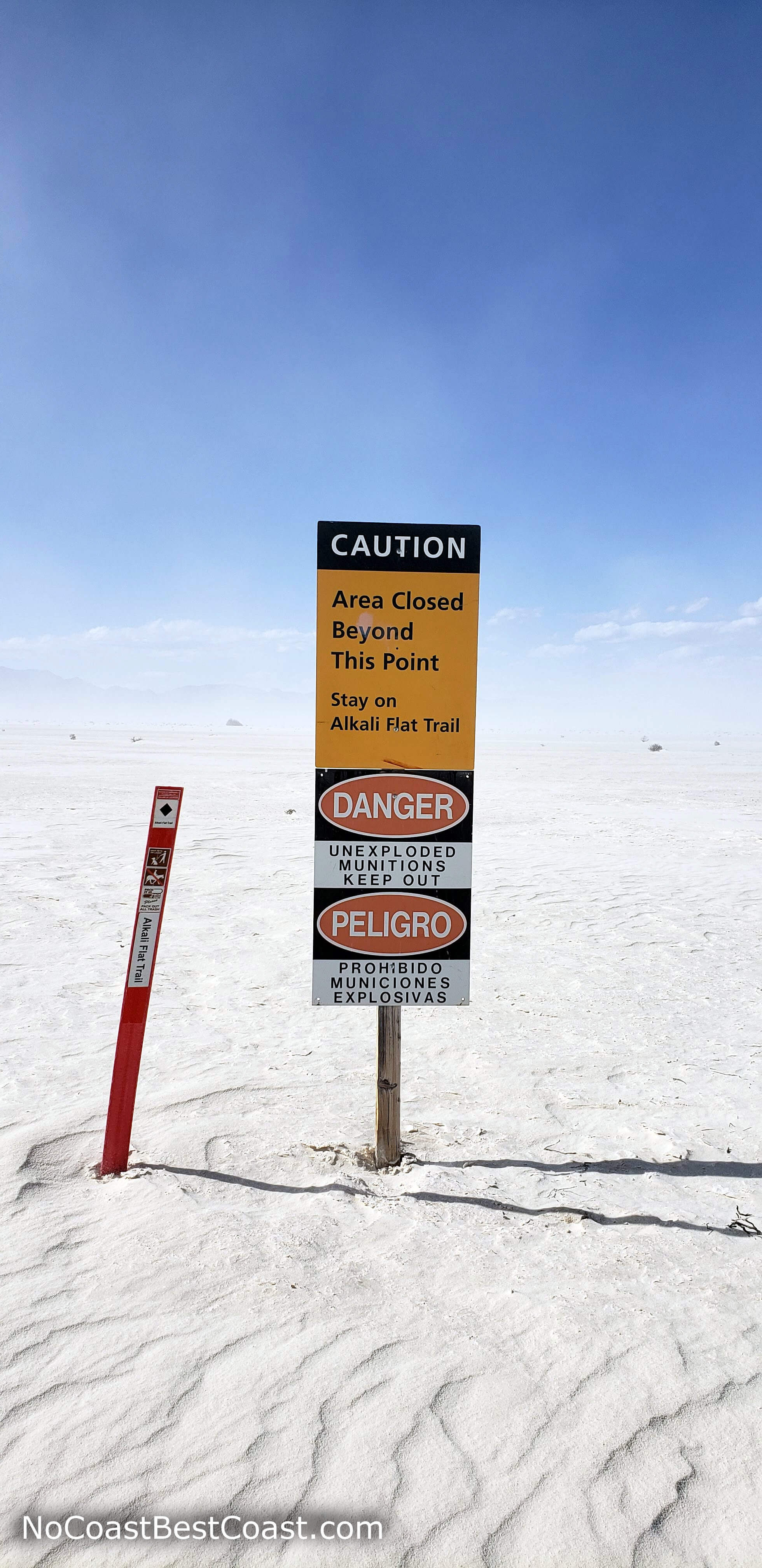
The warning sign at the edge of the White Sands Missile Range
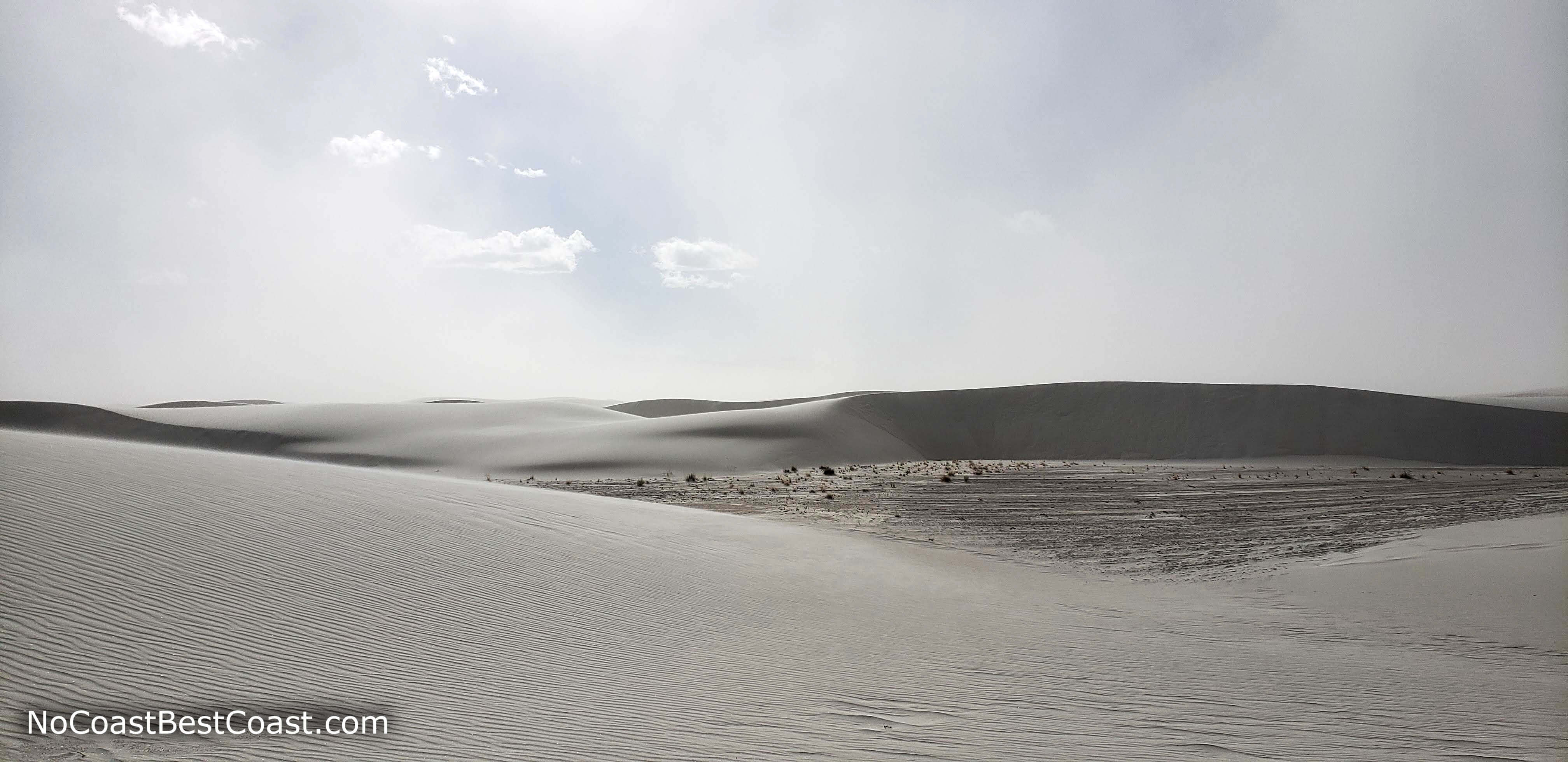
A sandstorm nearly blocks out the blue sky
Hiked on Sunday, February 17th, 2019 by Ricky Holzer
Important Information
Dogs are allowed on leash (this is one of the few Park Service properties that allows pets). This is not a family-friendly trail; instead, head to the Dune Life Nature Trail or find an area along the road to play in the sand. Spring, fall, and winter are the best seasons to visit. Summer should be avoided due to the extreme heat exacerbated by the hot sand and lack of shade. Though the rest of the park may be crowded, most do not attempt this trail, and many of those who do attempt it do not hike the entire 5 miles. I visited during President's Day weekend with gorgeous weather and only saw a handful of people (and only one person once I was deeper in the dunefield).
Directions
From El Paso, take Interstate 10 west to Las Cruces. Continue onto Interstate 25 north, then take the exit for U.S. Highway 70 heading east. After about 45 minutes, turn left to enter White Sands National Monument. Pay the fee at the entrance station, and continue straight following signs for the Alkali Flat Trailhead.
Google Maps Directions
Parking, Fees, and Facilities
The entrance fee is $20 per vehicle per day and annual passes for White Sands National Monument are available for $40. Interagency passes are also accepted here. There is plenty of parking at the Alkali Flat Trailhead, and pit toilets are the only amenity -- fill up on water at the visitor center before entering the park.
Nearby Hikes
White Sands National Park, New Mexico
★★★☆☆(3/5)
White Sands National Park, New Mexico
★★☆☆☆(2/5)
White Sands National Park, New Mexico
★★★★☆(4/5)
Guadalupe Mountains National Park, Texas
★★★★☆(4/5)