| Rating | ★★★★★(5/5) |
| Overall Difficulty | Easy |
| Navigation Difficulty | Easy |
| Distance | 1.5 miles roundtrip |
| Time | 1 hour |
| Terrain | A few hills |
| Best Seasons | All |
| Dog Friendly | Yes |
| Accessible | Yes |
Highlights
- Possibly the best waterfall in all of Michigan
- Many smaller falls upriver
- Additional recreation opportunities at the Bond Falls Flowage
Hike Summary
While Bond Falls is one of the biggest tourist attractions in the western part of the Upper Peninsula, it's still one of the most beautiful sights you can see in all of Michigan. The water here tumbles 50 feet over craggy rocks that create an array of cascades. Upstream from Bond Falls you'll find even more smaller waterfalls, so many that you might tire of taking pictures. Even further upstream is the vast Bond Falls Flowage, a giant reservoir with opportunities for boating, fishing, and camping along the shore.
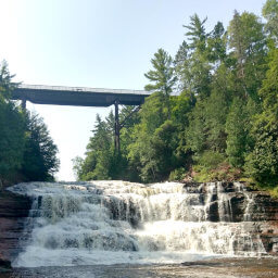
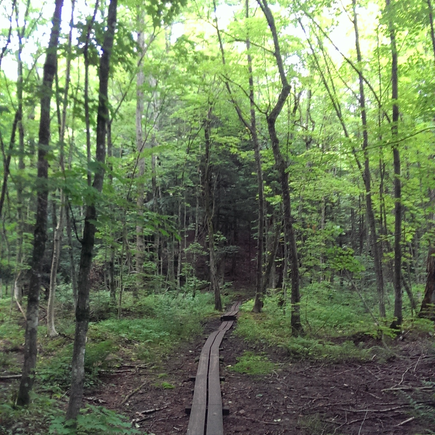
Starting from the "official" Bond Falls Scenic Site (read more about how you can park elsewhere for free in the parking section below), follow the gently graded paved trail down to the accessible boardwalk. Almost instantly you'll have a view of the expansive Bond Falls, pictured below. Head left for more views of the falls and to find the best camera angle. Bond Falls is so wide you can't capture the entire width using a standard smartphone camera -- you can see maybe 2/3rds of the falls in the picture below with another hidden third to the right of the tree on the right side.
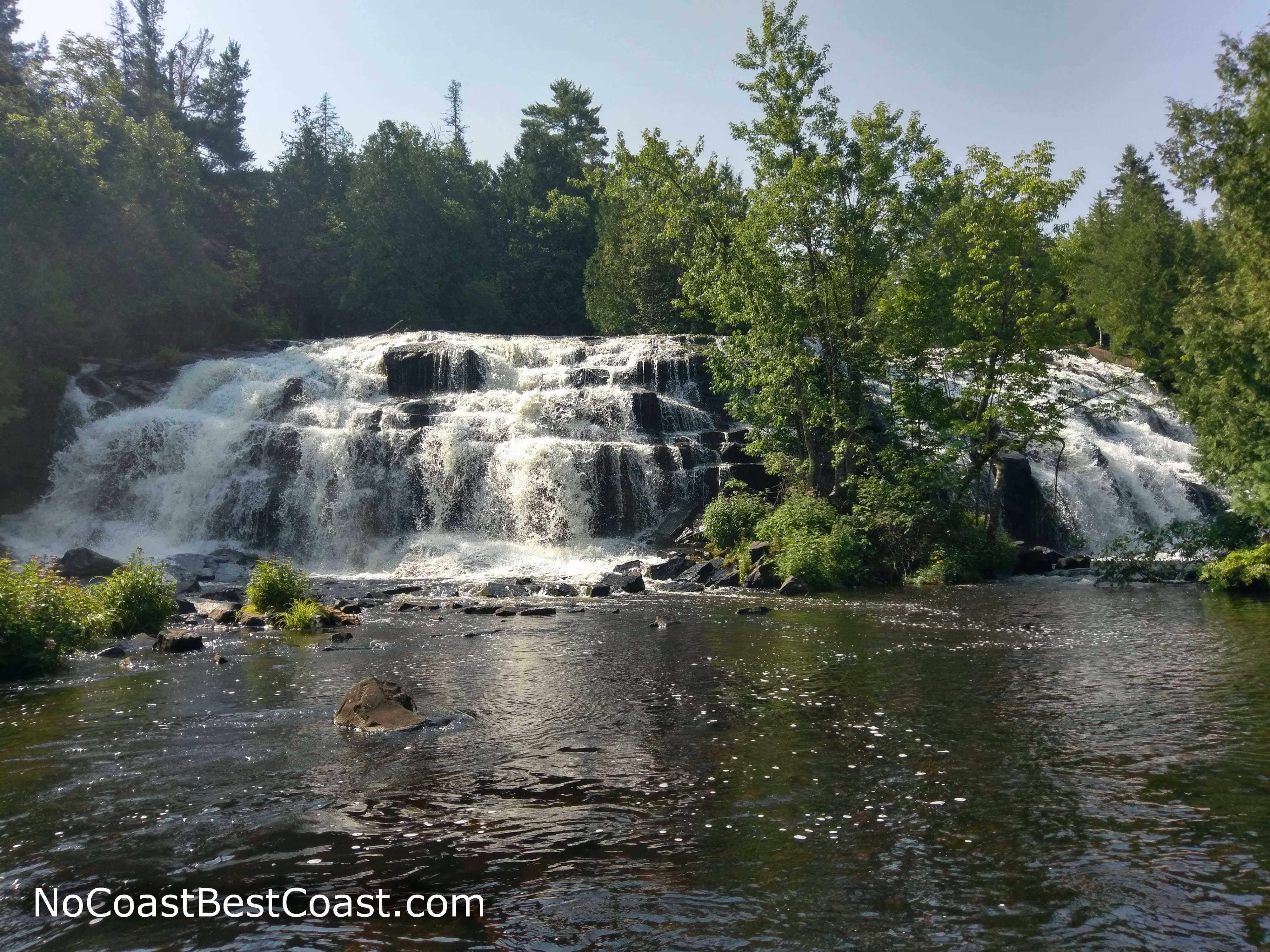
The majestic Bond Falls from the accessible viewing platform
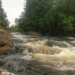
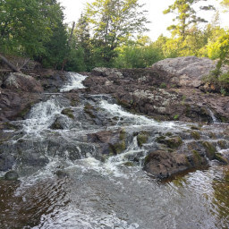
You'll pass several openings with views of smaller waterfalls like pictured in the two images below (I didn't take pictures of all of these small waterfalls, so know there are more than 2). Some of the falls are natural like in the first picture, but some are man-made like in the second picture -- can you tell the difference?
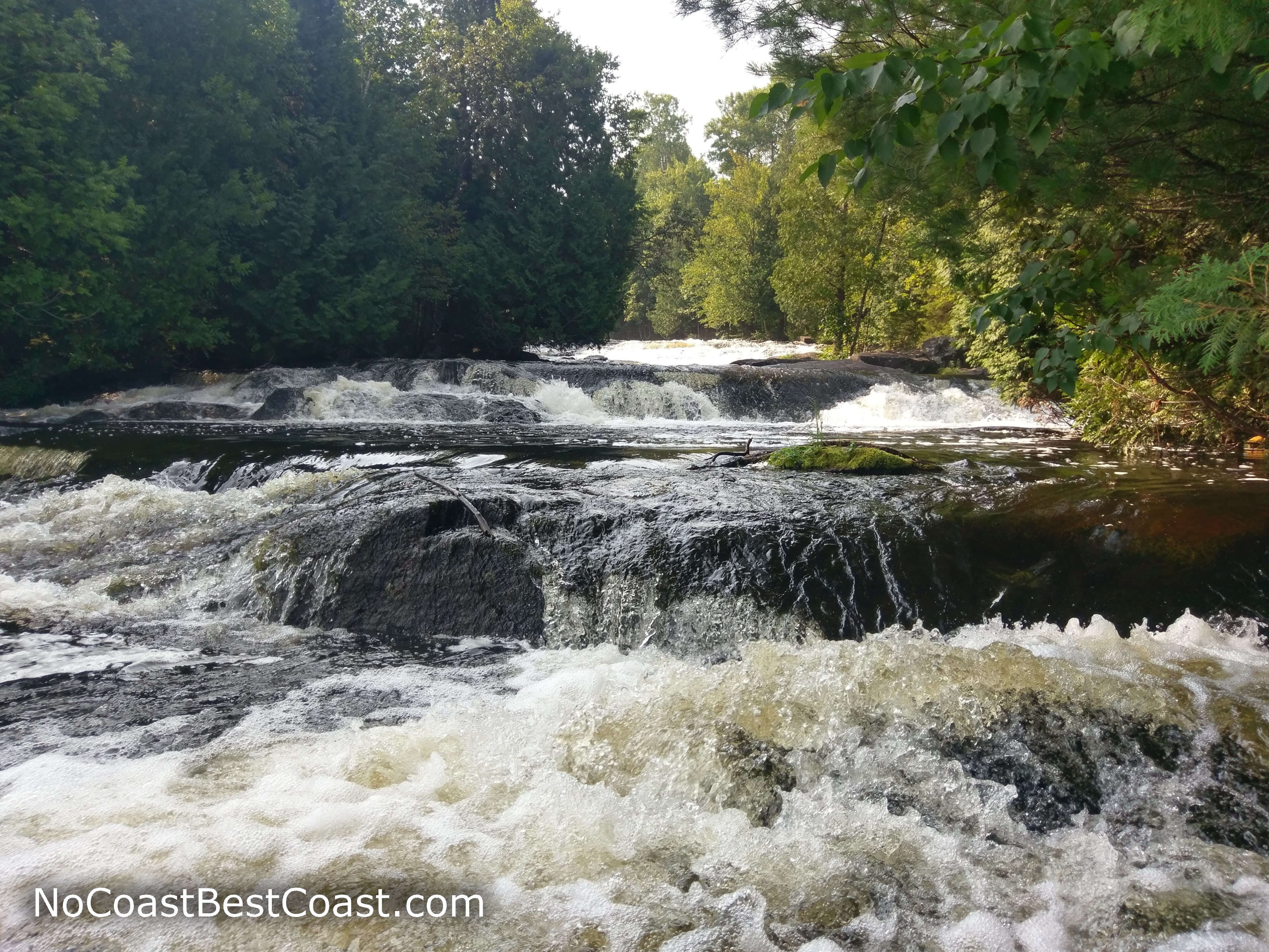
A small natural waterfall upstream from Bond Falls
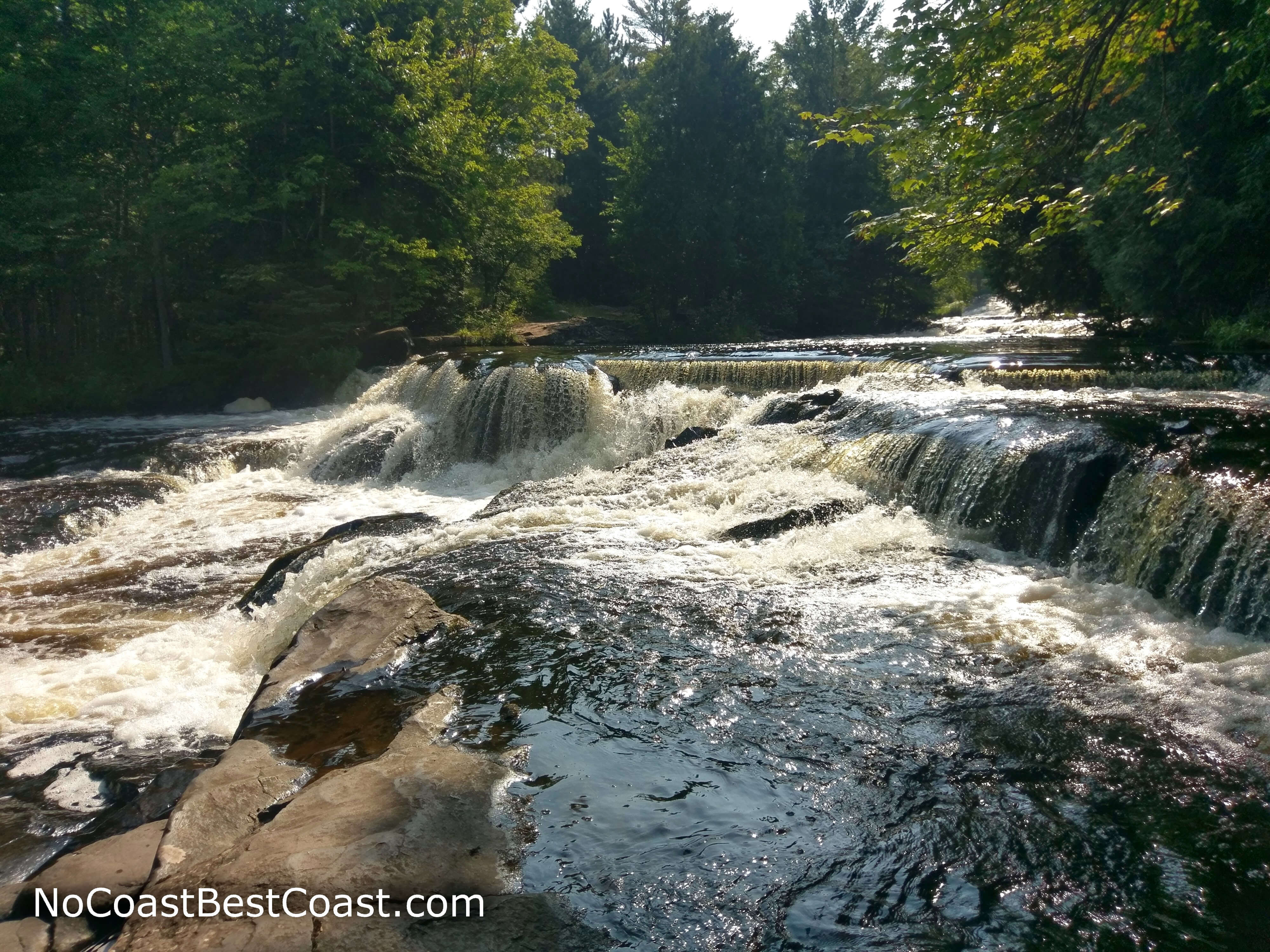
A man-made waterfall upstream from Bond Falls
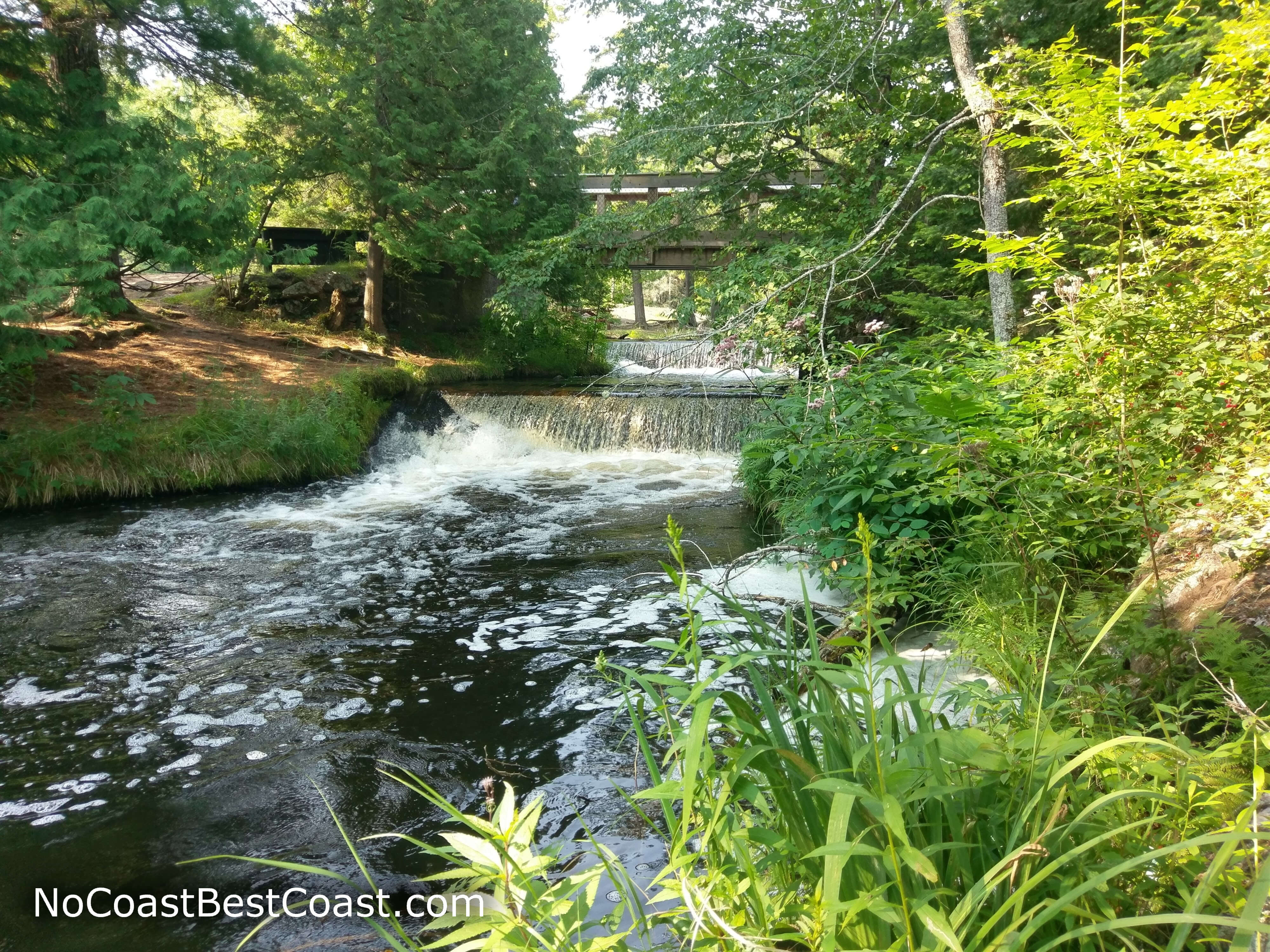
A man-made waterfall underneath the footbridge
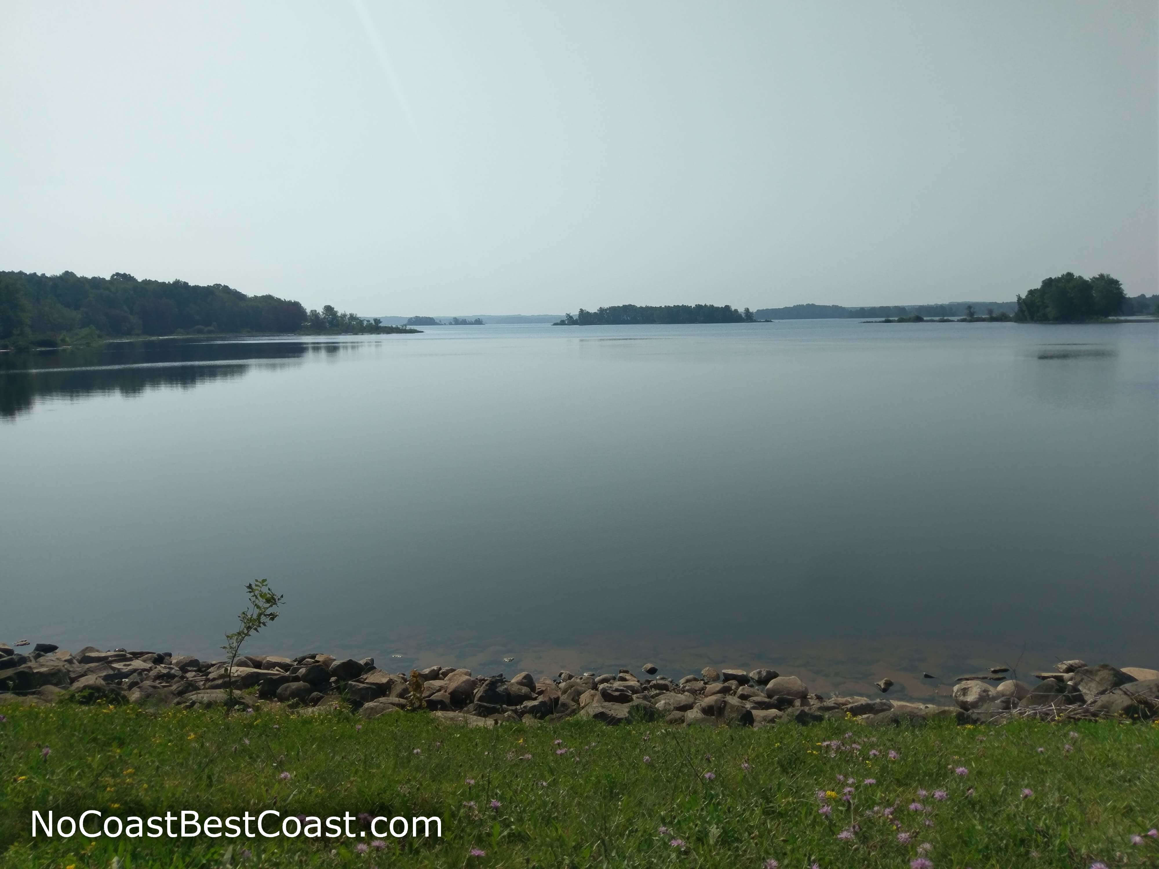
The Bond Falls Flowage from the top of the dam
Hiked on Saturday, August 11th, 2018 by Ricky Holzer
Important Information
The land is owned by the Upper Peninsula Power Company, which allows dogs on leash only on the trail and in their campgrounds. This is a perfect hike for the whole family since the first part is paved and accessible (great for strollers in addition to wheelchairs), and the ample waterfalls upriver make this hike exciting the entire duration. You can view this waterfall year round, and each season provides a unique experience: the frozen falls of winter, higher flowage from snowmelt and rain in the spring, lush greenery in the summer, and astounding foliage in fall. This is a popular destination for tourists, so expect to share this site with plenty of people.
Directions
From the Ottawa National Forest Visitor Center in Watersmeet, take U.S. Highway 45 north to Paulding. Turn right on Bond Falls Road. Turn left as indicated by the sign for the Bond Falls Scenic Site if you require the accessible trail to the falls, otherwise continue straight and park by the Bond Falls Outpost -- read the parking section below for more details about where to park.
Google Maps Directions
Parking, Fees, and Facilities
There are two options for parking here: paying at the lot for the Bond Falls Scenic Site or parking for free by the Bond Falls Outpost. The Michigan DNR really capitalized on unknowing tourists here by making their lot -- the "official" lot -- cost money when you can access the same trail from the free parking by the Bond Falls Outpost. However, the pay lot is necessary for those with accessibility needs, kids in strollers, and small children unable to do the whole hike from the top (unless you're willing to shuttle between the two lots). The pay lot also has pit toilets available year round. You don't have to be a customer of the Bond Falls Outpost to park for free since this is also the parking for a public park and access to the Bond Falls Flowage. The Bond Falls Outpost may or may not have restrooms (I didn't check myself), and there are picnic tables off the trail just by the road.
A Michigan Department of Natural Resources Recreation Passport is necessary to park in the "official" lot, more details about specific pricing are available on the Recreation Passport webpage. If you don't already have an annual passport for your vehicle -- $11 for Michigan residents at the time of license plate renewal or $16 at a Michigan State Park, or $32 for non-residents available online -- you must pay cash (bring exact change!) using the paper envelopes provided at the kiosk near the trailhead and place the stub on your dashboard. Michigan residents must purchase a $16 annual passport; non-residents must either pay $9 for a daily pass or $32 for an annual pass. Any annual pass purchased will be mailed to the address you write on the envelope, but honestly if you're planning on getting an annual pass, buy it ahead of time either at another state park or online (non-residents only).
Nearby Hikes
Ottawa National Forest, Michigan
★★★★★(5/5)
Ottawa National Forest, Michigan
★☆☆☆☆(1/5)
Ottawa National Forest, Michigan
★★★★★(5/5)
Porcupine Mountains Wilderness State Park, Michigan
★★★★☆(4/5)