| Rating | ★★★★☆(4/5) |
| Overall Difficulty | Moderate |
| Navigation Difficulty | Easy |
| Distance | 1 mile roundtrip |
| Time | 30 minutes |
| Terrain | Hilly, 200 feet of elevation gain |
| Best Seasons | All |
| Dog Friendly | No |
| Accessible | No |
Highlights
- Views of the San Francisco peaks and surrounding desert
- Learning about Ben Doney, the namesake of this mountain
Hike Summary
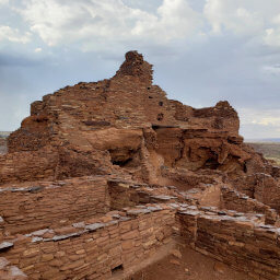
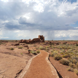
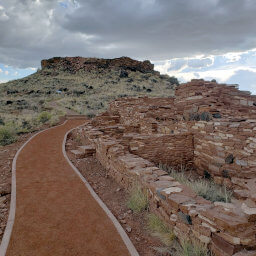
An extinct cinder cone volcano, Doney Mountain rises above the Colorado Plateau, providing unobstructed, 360-degree views of the surrounding desert. During your ascent of this peak, interpretive signs will inform you about the area's ecology and history. This hike is a scenic stop and excellent addition to your journey within Wupatki National Monument.
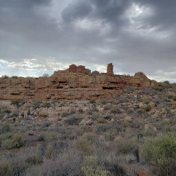
Follow the trail at the south end of the parking lot near the bathroom. It may be difficult to find the "actual" trail as you approach the base of the mountain since the gravel looks the same all around you. Luckily, the trail becomes obvious once you're on the mountain. Straight in front of you and to the right, you can see Doney Mountain rise 200 feet above the ground with the San Francisco Peaks in the distance, as pictured below.
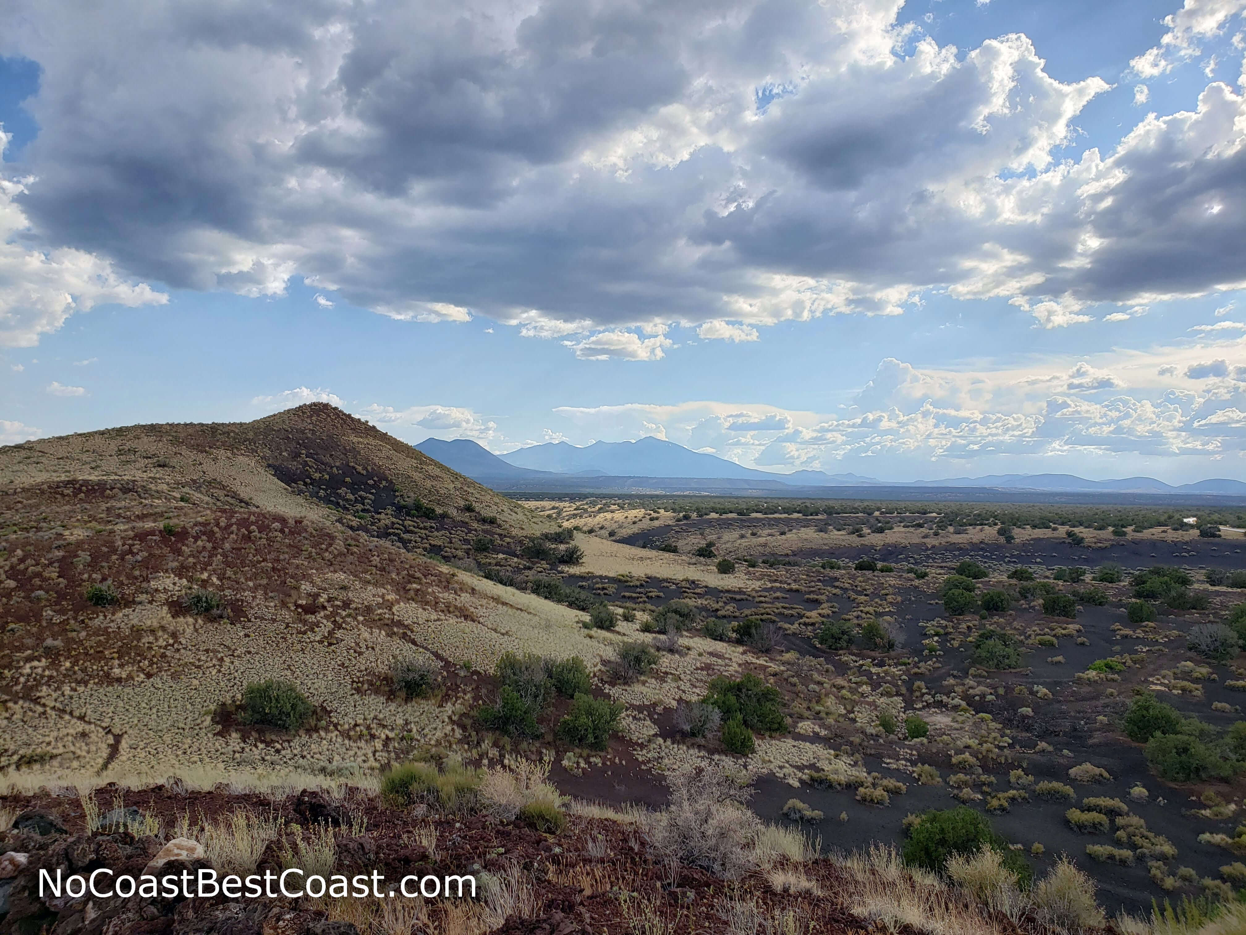
Doney Mountain with the San Francisco Peaks in the background
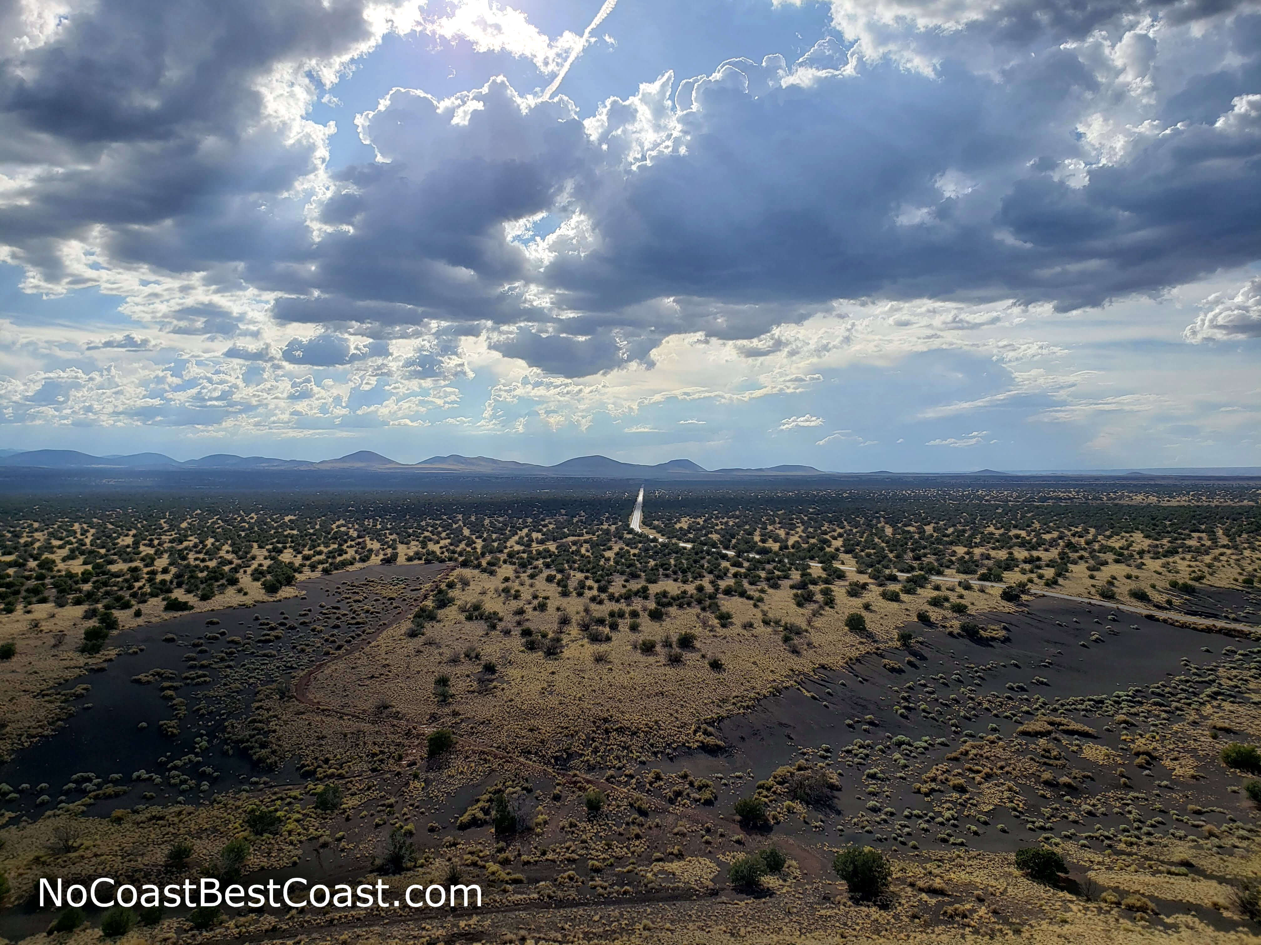
The empty road cutting through the vast desert as seen from the top of another peak on the way to Doney Mountain
At the top, you can enjoy the panoramic views from a bench. To the north, the land of sun baked grasses and sagebrush dotted with dark green juniper seems to extend forever, as pictured below. On summer afternoons, approaching rainclouds create interesting shadows and streak the distant sky with lines of rain.
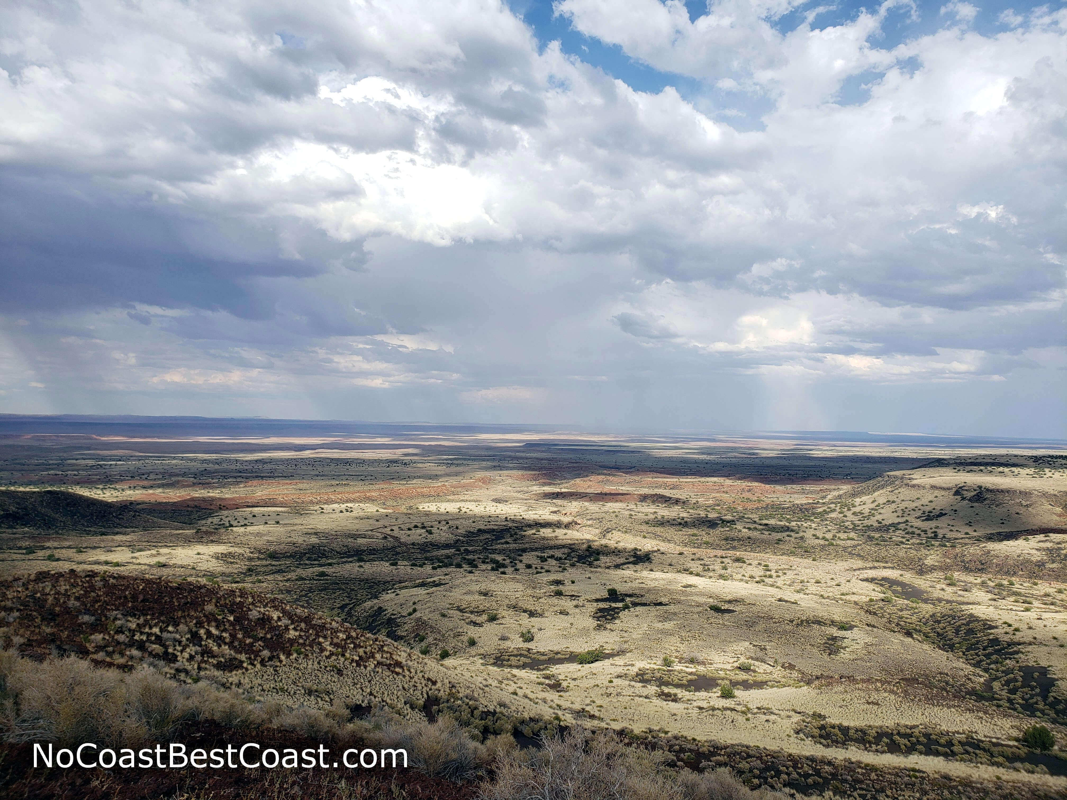
Clouds and shadows on the barren plateau
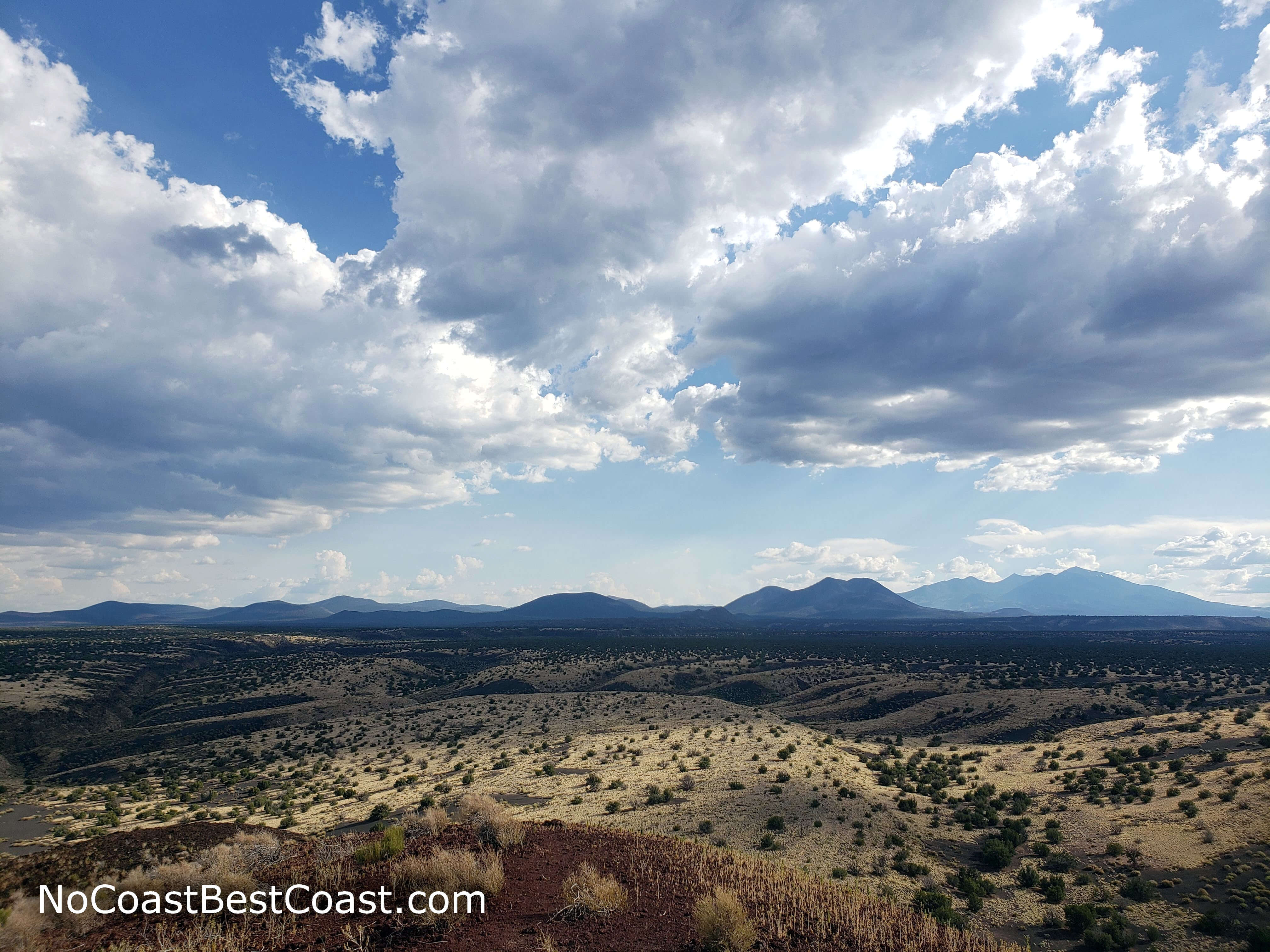
The view of the San Francisco Peaks and O'Leary Peak from the summit of Doney Mountain
This hike is a nice break from viewing the ruins in Wupatki National Monument and lets you enjoy the natural beauty of the area. You'll definitely agree the mild challenge is worth the views at the top. Connect with me using the social media links below and share your adventures!
Hiked on Thursday, July 25th, 2019 by Ricky Holzer
Important Information
Dogs are not allowed on any trails in the park; it's best to leave your dog at home since desert temperatures can kill dogs waiting in cars. The hike is short but steep, so it may not be suitable for children. You can visit during any season, but be prepared for wind, especially at the top. In the summer, temperatures can exceed 100 degrees and afternoon thunderstorms are common. Winter and early spring may bring snow, but not nearly as much as in nearby Flagstaff. This trail is not as busy as the nearby trails to pueblo ruins, and you may have the mountain to yourself.
Directions
From Flagstaff, take Interstate 40 east. Take the exit for U.S. Highway 89, then turn left. Turn right onto U.S. Highway 89. Continue straight on U.S. Highway 89 for about 26 miles, turning right near mile marker 444, as indicated by a brown sign for Wupatki National Monument. Watch for the Coconino National Forest sign for Doney Picnic Area, then turn right. Park in the lot at the end of the road.
Google Maps Directions
Parking, Fees, and Facilities
Since this trail is technically in the Coconino National Forest, no fee is required to park. However, in the likely case that you want to see other parts of the surrounding Wupatki National Monument, you must pay $25 per vehicle, which permits access for 7 days to both Wupatki National Monument and Sunset Crater Volcano National Monument. Interagency passes are also honored here. Visit the park's fees page for more information.
There are pit toilets and picnic tables here. Continue to Wupatki National Monument's staffed visitor center for flush toilets and water in addition to educational exhibits and a gift shop.
Nearby Hikes
Wupatki National Monument, Arizona
★★★★☆(4/5)
Wupatki National Monument, Arizona
★★★★☆(4/5)
Wupatki National Monument, Arizona
★★★★☆(4/5)
Wupatki National Monument, Arizona
★★★★☆(4/5)