| Rating | ★★★☆☆(3/5) |
| Overall Difficulty | Moderate |
| Navigation Difficulty | Easy |
| Distance | 4 miles roundtrip |
| Time | 2 hours |
| Terrain | A few hills |
| Best Seasons | Spring, Summer, Fall |
| Dog Friendly | Yes |
| Accessible | No |
Highlights
- Wide expanses of dry prairie
- Overlook of the St. Croix River Valley
- Swimming beach
Hike Summary
A quick trip from the Twin Cities, this park is just across the St. Croix from Afton State Park in Minnesota. The scenery is quite varied and features river bluffs, sandy beaches, hardwood forest, and prairie. This hike is a taster of the many different colored trails you can find in this park (see the official park map linked at the bottom of the page); you can follow the exact route I did or use this description as a guide to determine which color routes are best suited to your athletic needs and scenic desires.
Dogs are allowed on leash, but they are not permitted on the beach at the bottom of the Black Trail. This route covering multiple trails is too long to be family friendly, but each of the trails hiked individually are short and comfortable loops. Only the Red, Brown, Blue, Pink, and Black Trails are open to hiking during the winter, but you can hike any of the trails in the park during the other three seasons. Since this park is only about 10 minutes from Hudson and within easy driving distance of the Twin Cities, expect to see a good number of people on the trail, especially near the St. Croix Picnic Area.
The hike starts with the Brown Trail, 0.2 miles roundtrip up a hill to nowhere. I'm really unsure what the purpose of this trail is given its short distance and lack of scenic value. Perhaps this trail is intended mainly for winter use on skis or sleds? You can just skip this trail.
Next, follow the Blue Trail. The trail has a few hills, but the proximity to the road and lack of scenery makes this another trail you can skip unless you want to make your hike more difficult. I speak only for the half of the Blue Trail west of the Brown Trail, but I presume the eastern half is more or less the same.
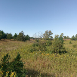
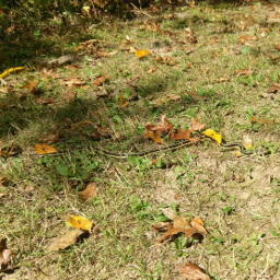
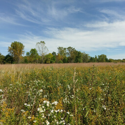
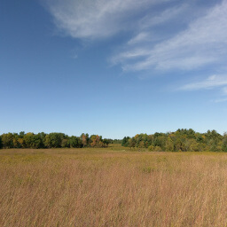
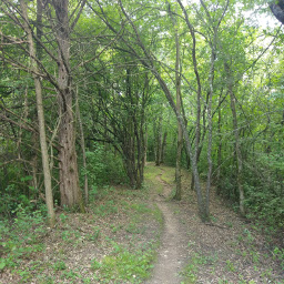
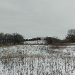
Based on this experience, you should really just start hiking at the parking lot for the Yellow and Orange Trails. The Orange Trail parallels a portion of the Yellow Trail and is hillier. Both travel through the forest, though the Yellow Trail has some prairie views in the beginning, as pictured below. The sunny spots on the trail are perfect places for cute little garter snakes (completely harmless) to warm their cold-blooded bodies (see second picture below).
Hiked on Sunday, September 17th, 2017 by Ricky Holzer
Directions
From the Twin Cities, take Interstate 94 east to Hudson. Exit at Carmichael Road, then turn right. Follow this road straight -- the name changes to County Road F. Turn right on 820th Avenue (there should be a sign for Kinnickinnic State Park), then turn left into the park. Pay the fee at the park office, then turn right at the intersection ahead. After driving past the service drive on the right, park in the next lot on the left.
Google Maps Directions
Parking, Fees, and Facilities
If you have Wisconsin license plates on your vehicle, parking is $8 for the day or $28 for an annual pass valid at all Wisconsin State Parks and Forests. If you are from out of state, parking is $11 for the day or $38 for an annual pass (you recoup your cost after just 4 visits!). See details about parking here. There are no facilities at this lot.
Nearby Hikes
Kinnickinnic State Park, Wisconsin
★★★★☆(4/5)
Afton State Park, Minnesota
★★★★☆(4/5)
Willow River State Park, Wisconsin
★★★★☆(4/5)
Battle Creek Regional Park, Minnesota
★★★☆☆(3/5)