| Rating | ★★★★★(5/5) |
| Overall Difficulty | Hard |
| Navigation Difficulty | Easy |
| Distance | 3 miles roundtrip |
| Time | 2 hours |
| Terrain | Strenuous climbing |
| Best Seasons | All |
| Dog Friendly | Yes |
| Accessible | No |
Highlights
- Panoramic views from the top
- Great workout
Hike Summary
Only a short distance from Little Rock, Pinnacle Mountain towers over the surrounding landscape -- 756 feet above the surrounding area to an elevation of 1,011 feet above sea level -- providing fantastic views of Lake Maumelle and a glimpse of the tall buildings in downtown rising subtly above the horizon. Although the climb itself is quite a challenge, the overall trail length is short and the views are rewarding. Unlike climbing tall peaks in the west, there isn't much of a time commitment involved here, making it possible to do this hike after work on a weekday or leaving you plenty of time to relax the rest of your weekend.
Before describing my hike, I want to discuss the merits of the different trails involved. I hiked this loop starting from the West Summit Trail, then descended the East Summit Trail and went around the north side of the mountain on the Base Trail to return to the parking area. After this experience I will say that the Base Trail is rather boring, though maybe my opinion was skewed by the brownness of the early spring landscape. You're not really missing anything if you go up and down the same trail instead of doing this loop. If you do decide to do the entire loop, I suggest ascending via the East Summit Trail since descending the West Summit Trail is much easier.
The West Summit Trail is the more popular route up, with stair-like rocks and a couple rest areas with benches to catch your breath. The East Summit Trail is much more rugged than the West Summit Trail, starting out with a relatively gentle uphill grade leading to a steep, rocky climb where you will definitely have to use your hands to assist you up on more than one occasion. Below I've summarized the differences between the two trails to help you decide which is best for you:
West Summit Trail
- More aerobic hiking
- More developed with benches, markers, and "stairs"
- More crowded
- More technical hiking
- Rocky and rugged, harder to navigate
- More quiet
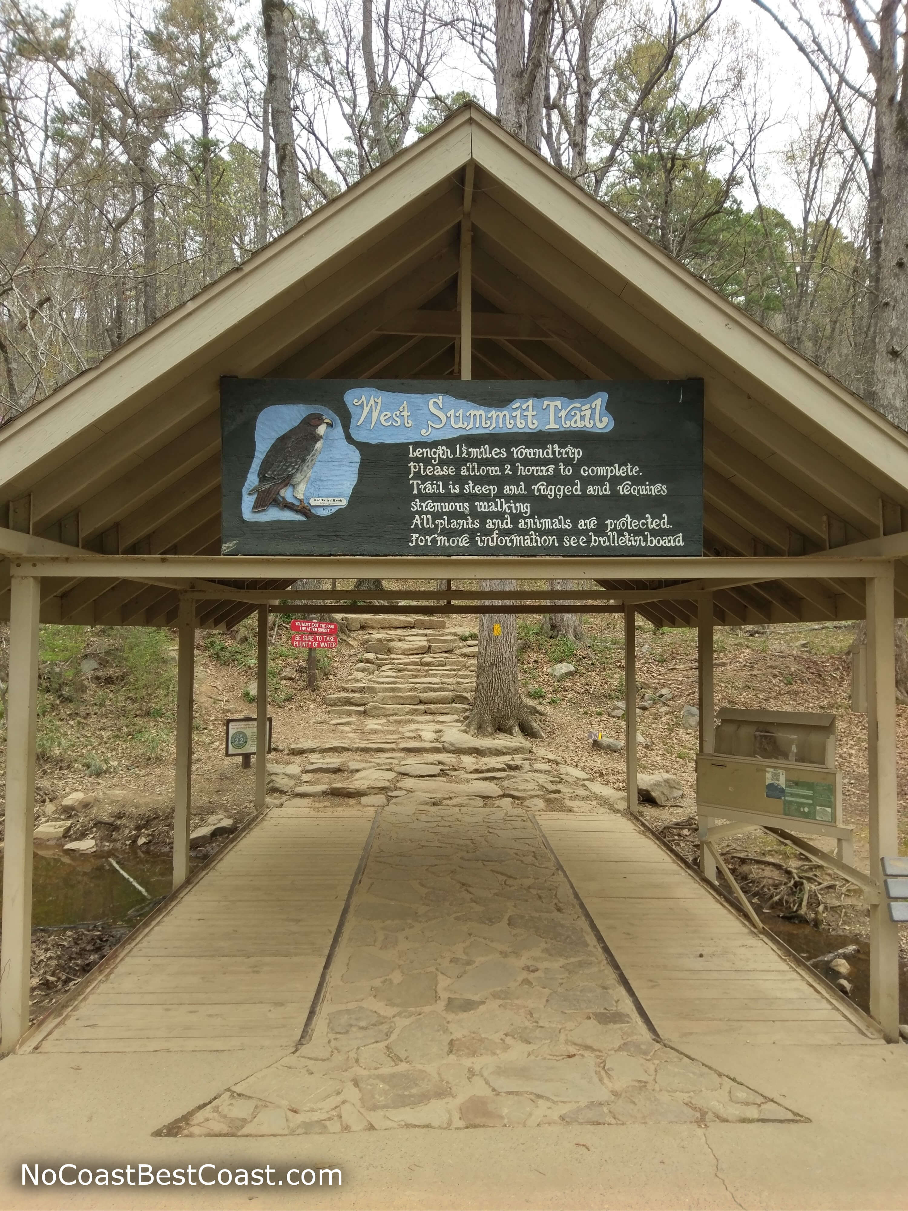
The West Summit Trail entrance
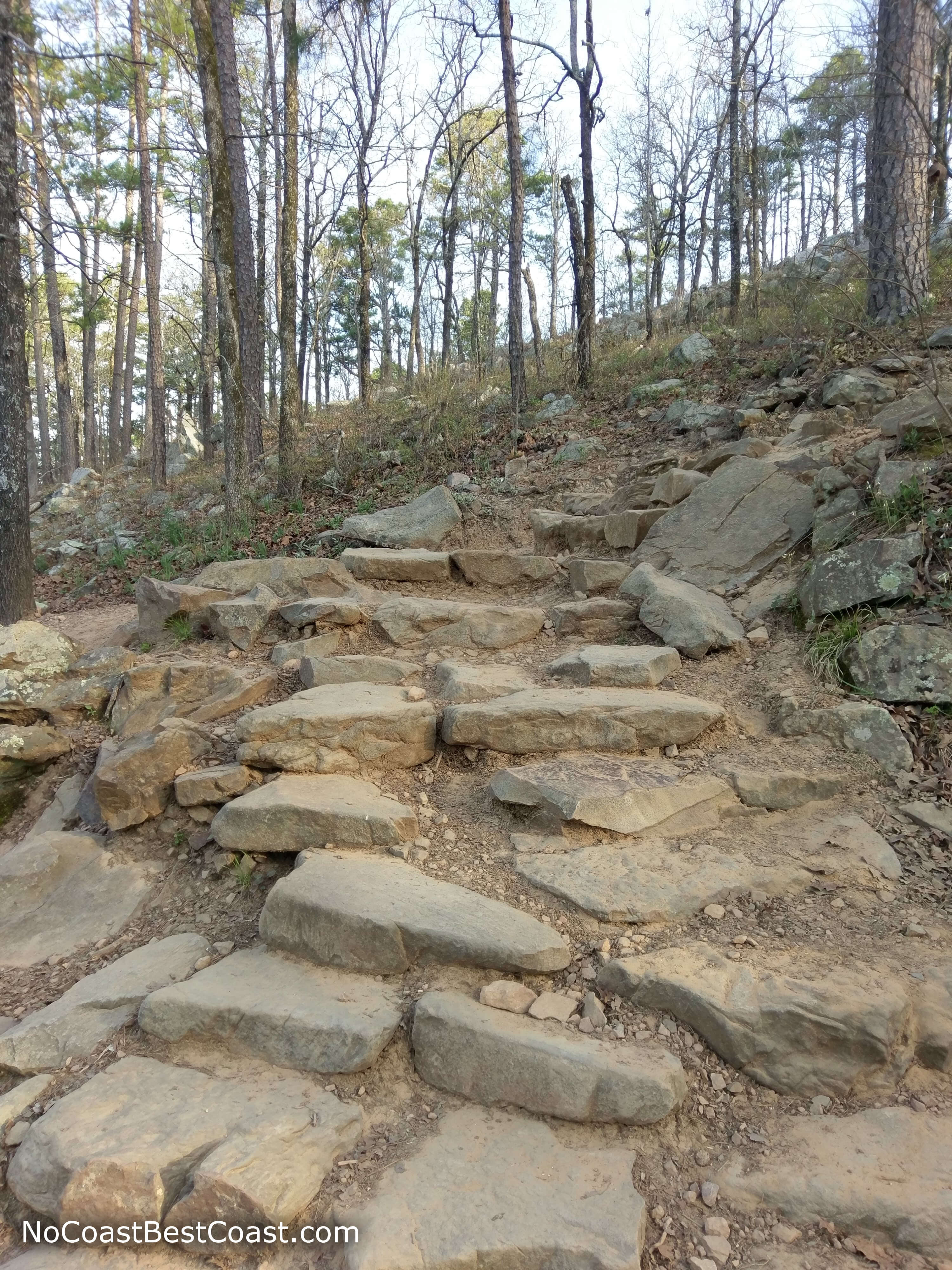
The West Summit Trail soon turns to rock stairs
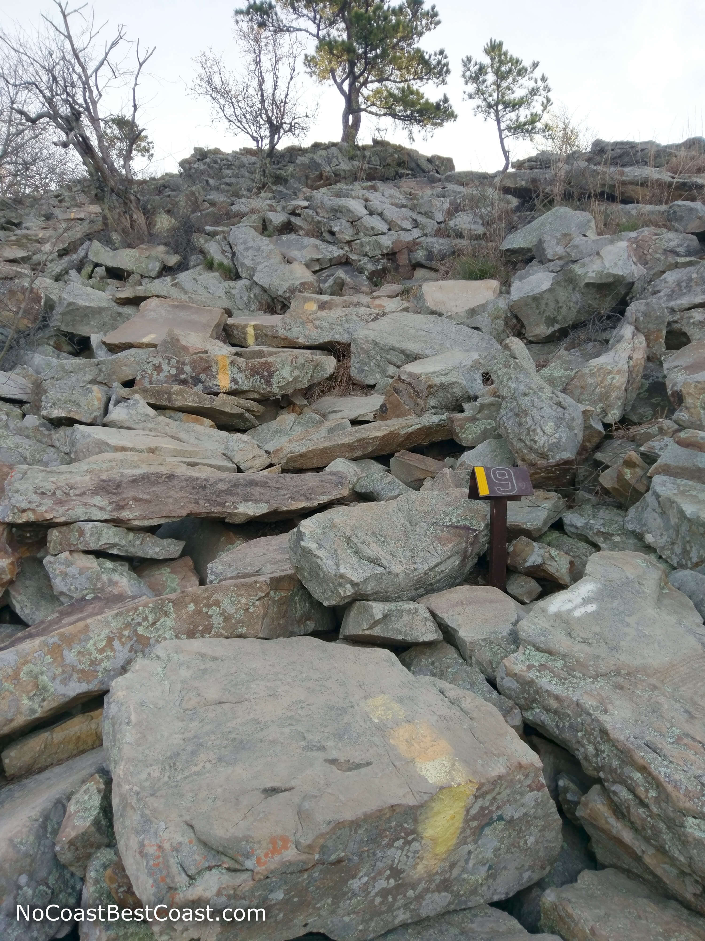
The rock stairs turn to this rocky landscape at marker #9 -- notice the yellow paint marking the correct route
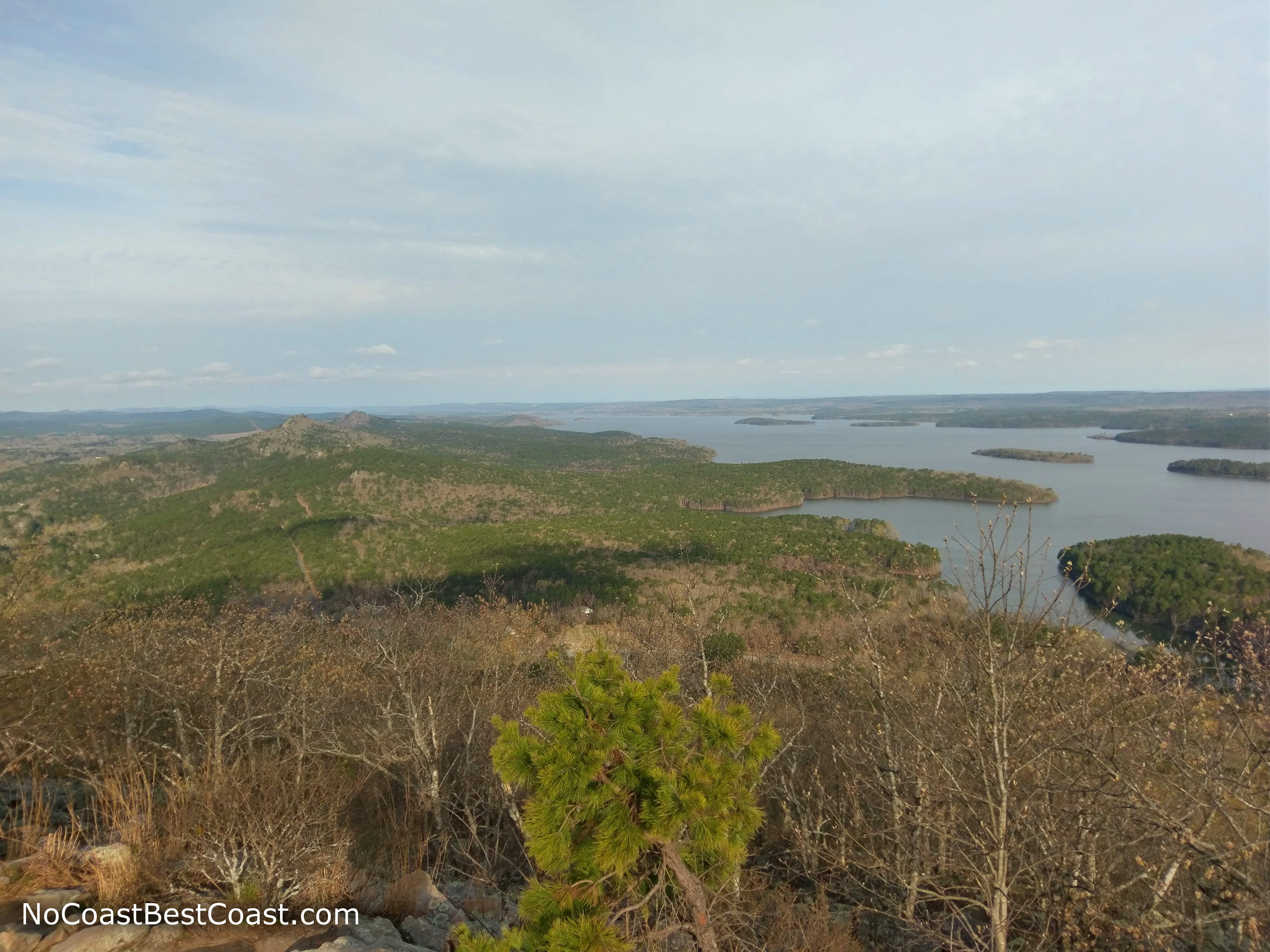
Lake Maumelle as viewed from the summit
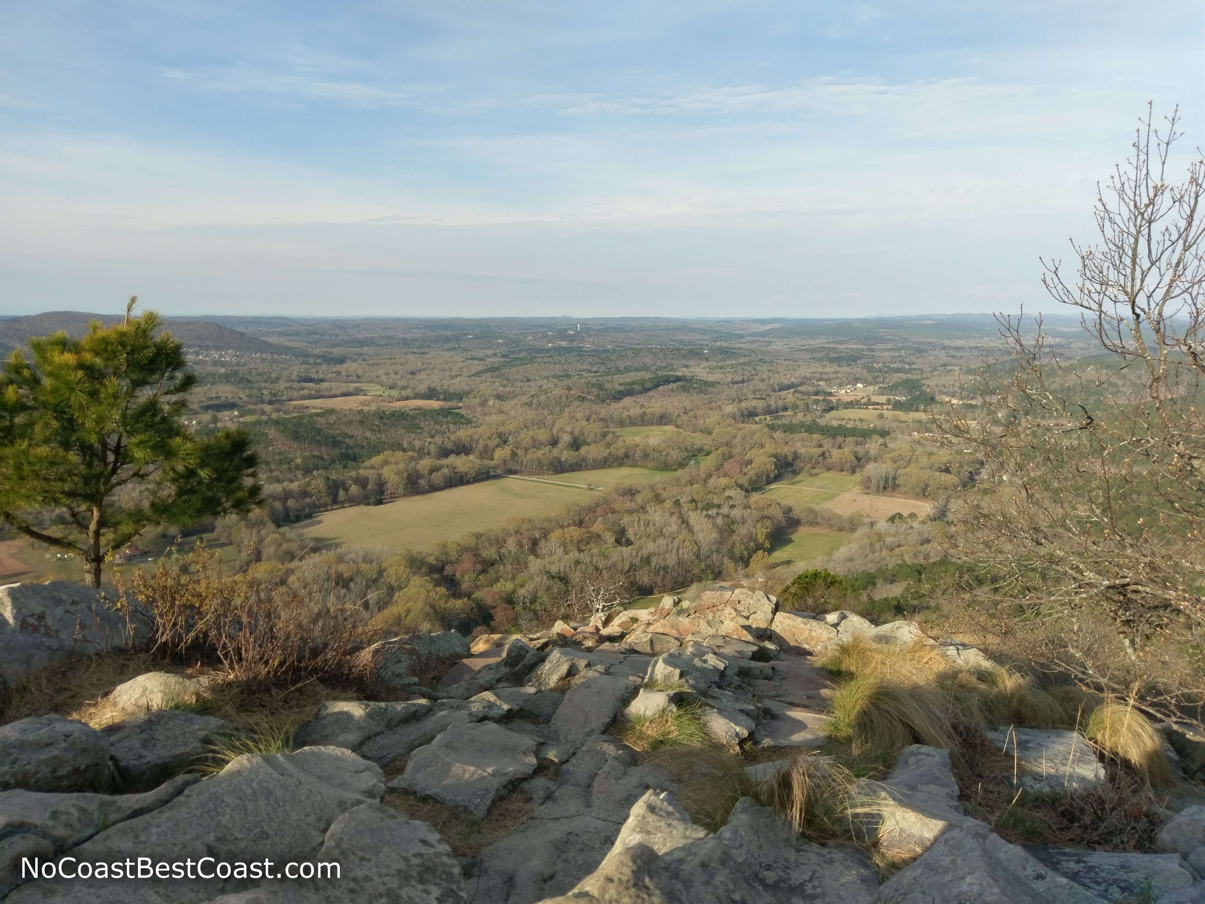
The view from the summit as you face southwest
Going down the East Summit Trail is quite a slow process since it is so steep and rocky, requiring using your hands or sitting down on the rocks to safely reach the ground below. The route is marked with a red and white bullseye symbol painted on the rocks and trees, but it's up to you to determine the best rocks to climb on between each symbol. Once you reach the end of the rocks, the rest of the hike is only slightly downhill on a dirt trail, but it's still labeled with the bullseyes for navigation as pictured below.
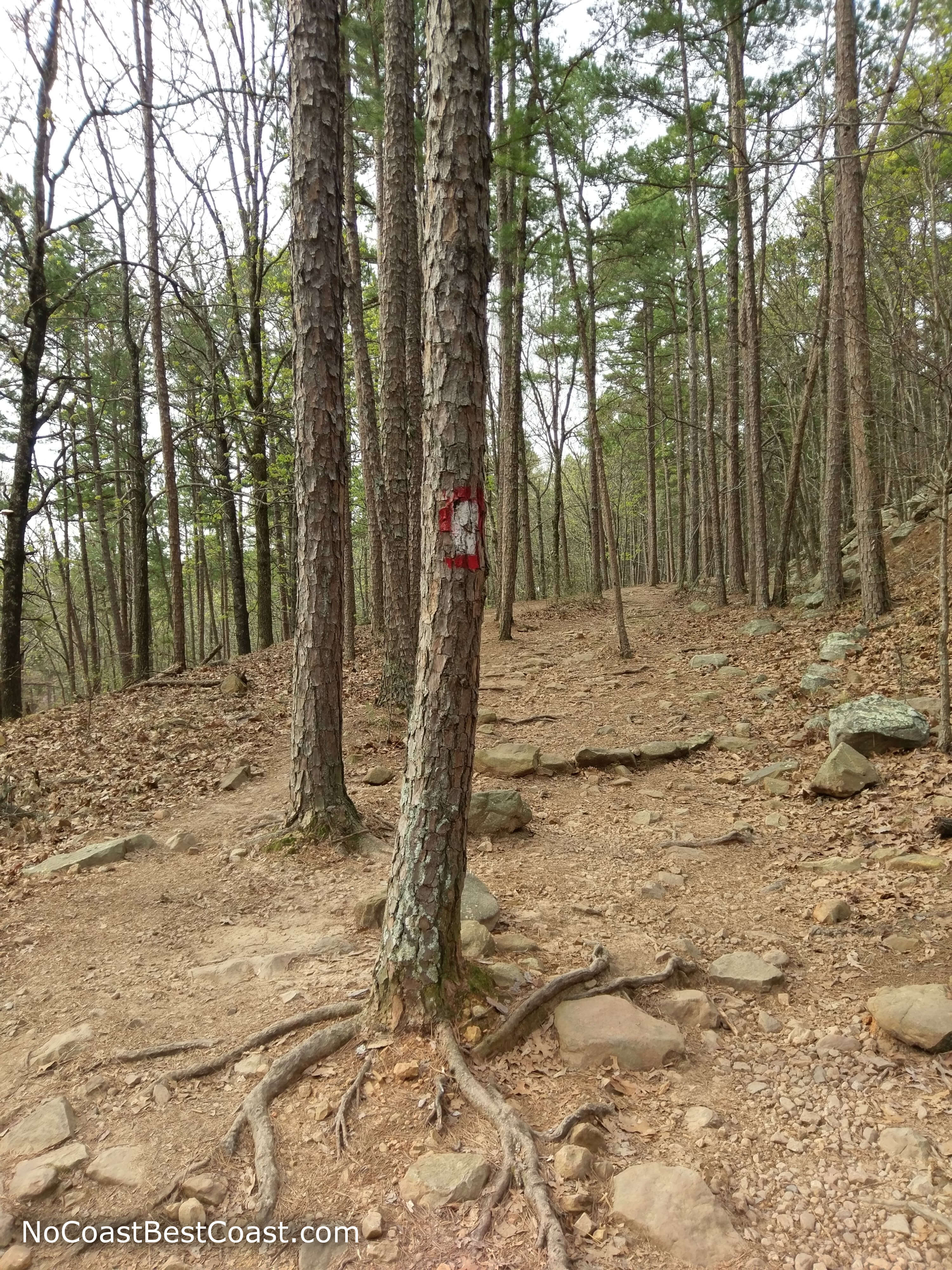
Red and white bullseyes mark the East Summit Trail
Overall, this hike was a great addition to my trip to Little Rock. With all that exercise, I didn't feel any guilt when I stuffed myself with fried chicken later. Whether you're a local or just in town for the weekend, I recommend you do this hike. When you go, be sure to use #nocoastbestcoast on Twitter and Instagram, and let me know about your experience with this hike in the comments below!
Hiked on Sunday, March 25th, 2018 by Ricky Holzer
Important Information
Dogs are allowed on leash. The hike is too difficult to be family friendly, although I did see some families with older children at the summit; for a family friendly option, do the Kingfisher Trail or Rocky Valley Trail. This trail is extremely popular, so if you want to avoid the crowds climb as early in the morning as possible. You can hike this trail all year round, but given the strenuous nature of the climb it is best to avoid this hike in the heat of summer.
Directions
From Little Rock, take Interstate 630 westbound to Interstate 430 northbound. Exit at Arkansas Highway 10/Cantrell Road and turn left. Continue straight, then turn right onto Chenal Parkway which eventually merges onto Arkansas Highway 300. On the right side of the road, you will have an excellent view of Pinnacle Mountain across an open field, as pictured below. Shortly after crossing over the Little Maumelle River, turn right to reach the parking area for the West Summit Trail.
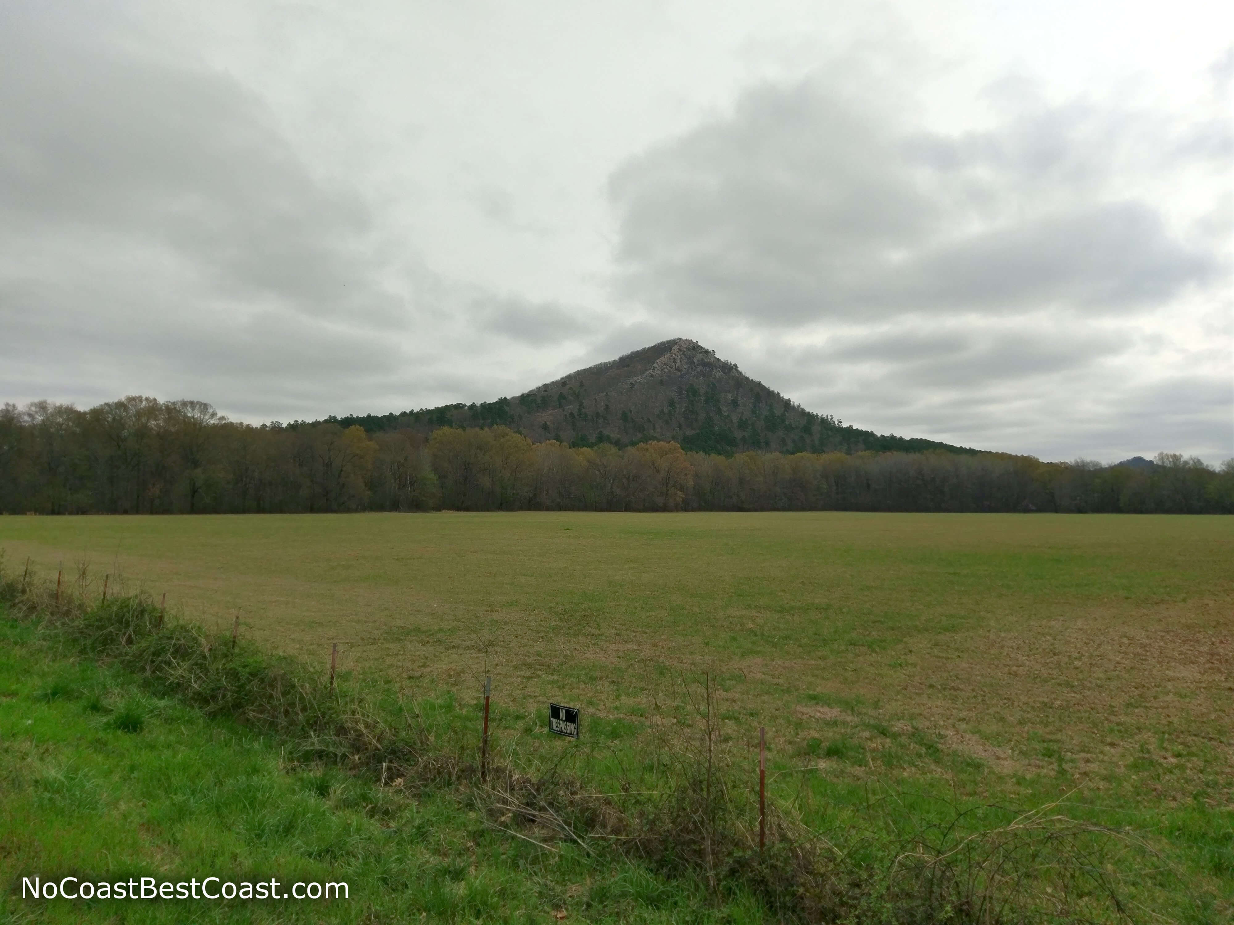
Don't miss this shot of Pinnacle Mountain on your drive to the trailhead!
Google Maps Directions
Parking, Fees, and Facilities
Parking is free! The West Summit Trail parking area is more developed, with bathrooms, a playground, picnic area, pavilion, and boat launch while the East Summit Trail parking area does not have facilities.
Nearby Hikes
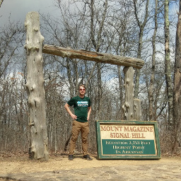
Mount Magazine State Park, Arkansas
★★★★★(5/5)
Mount Magazine State Park, Arkansas
★★★☆☆(3/5)