| Rating | ★★★★☆(4/5) |
| Overall Difficulty | Easy |
| Navigation Difficulty | Easy |
| Distance | 0.3 miles roundtrip |
| Time | 30 minutes |
| Terrain | Mostly flat |
| Best Seasons | All |
| Dog Friendly | No |
| Accessible | Yes |
Highlights
- Close up view of the presidents' faces
- Educational signs about the presidents
Hike Summary
Mount Rushmore is one of the most famous sights in the entire U.S. Originally crafted to attract tourists to South Dakota, the venture was undoubtedly successful, attracting over 2 million visitors each year. There is no doubt in my mind that Mount Rushmore is single-handedly responsible for making the Black Hills the developed recreational destination that it is. The Presidential Trail is an excellent way to extend your visit to the national memorial, taking more time to enjoy the craftsmanship of the sculpture and the beauty of the surrounding Black Hills instead of just taking the same picture as millions before you and staring for a bit before going home.
The promenade to the Grand View Terrace, your first viewpoint of the monument, was expertly designed to evoke anticipation and patriotism as you walk through the Avenue of Flags where you can find a flag for all 50 U.S. states, the District of Columbia, three territories (Guam, American Samoa, and the Virgin Islands), and two commonwealths (Puerto Rico and Northern Mariana Islands) -- try to find your home state! At the end, you'll finally see the famous stone faces you've been hearing about ever since you were a kid, pictured below. What you may not know is that these sculptures were intended to show the entire torso of each president from waist to head, evidenced by the unfinished collar on Washington's jacket. Another fun fact is that the rocky slope below the faces is actually fallen debris and rubble from the blasting and carving of the mountain.
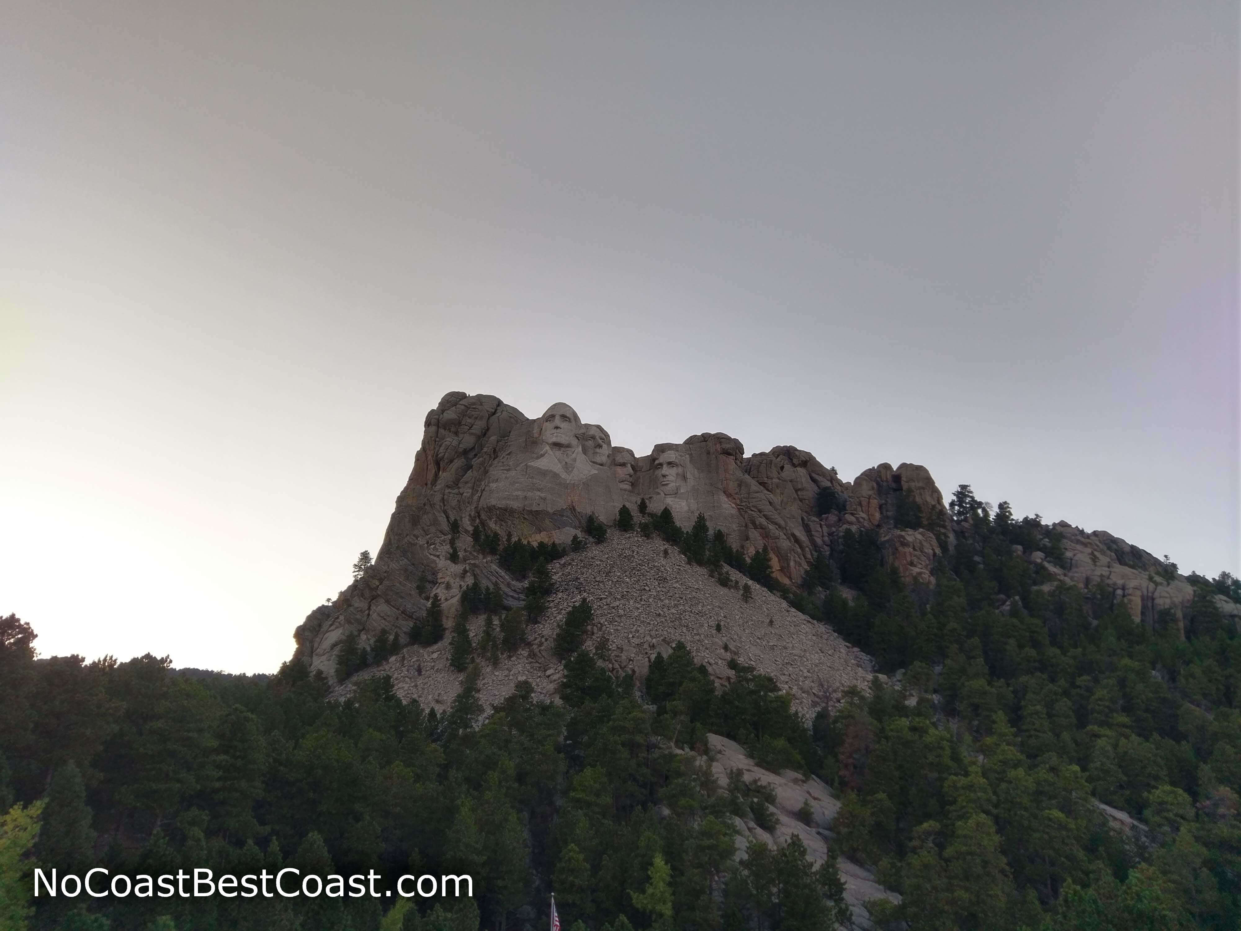
The famous four presidents in all their glory as seen from the Grand View Terrace
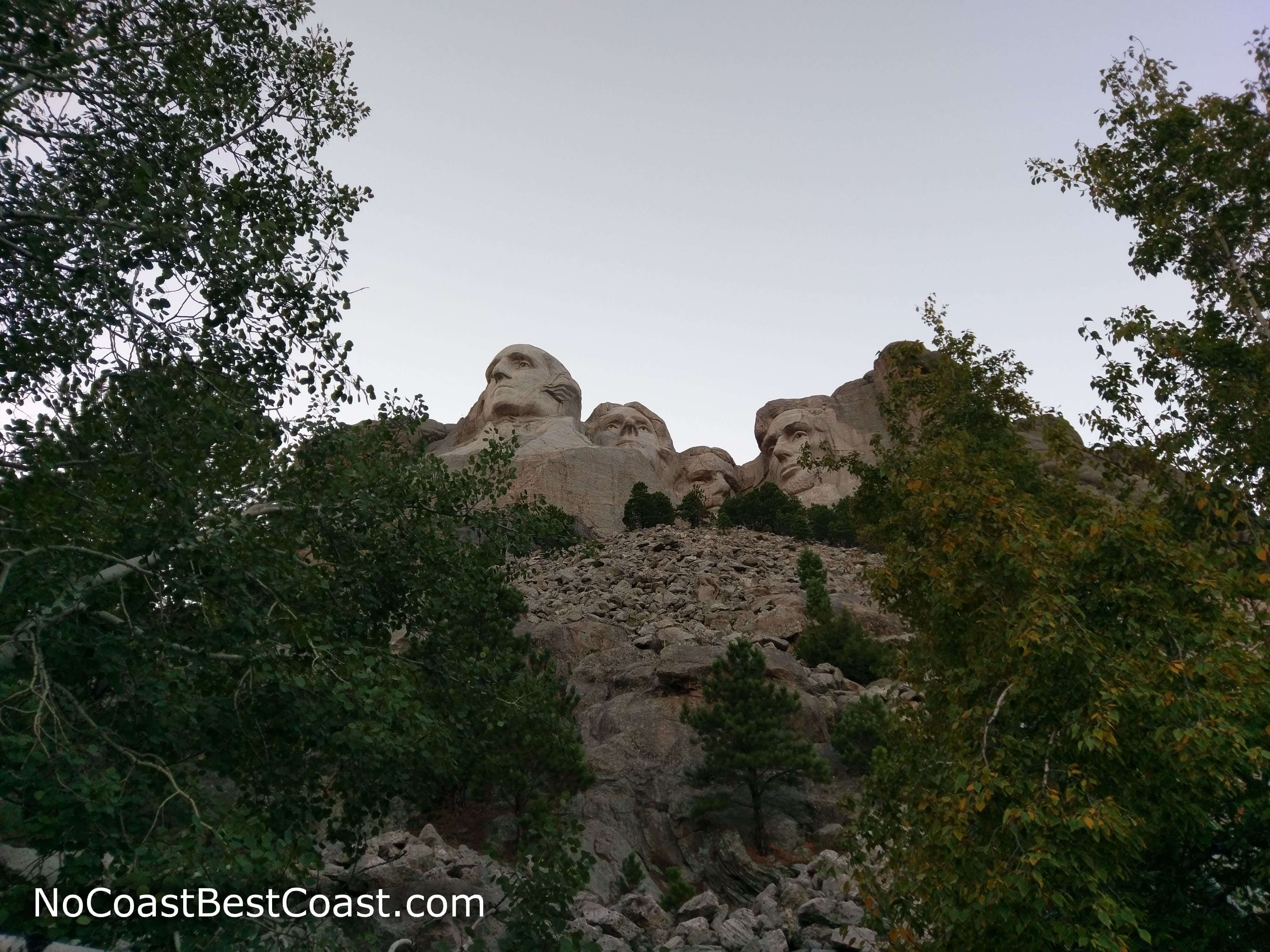
The Presidential Trail takes you close to the base of the monument
Hiked on Thursday, September 20th, 2018 by Ricky Holzer
Important Information
Dogs are prohibited everywhere in the park except for the parking garages and the areas directly adjacent (dogs must be on leash in those areas). The first half of the Presidential Trail is both wheelchair accessible and good for kids, but the latter half (not reviewed here) is very hilly with many stairs. Partway through the Presidential Trail, you'll find access to the Youth Exploration Area. The memorial is open 365 days a year, but all buildings are closed on Christmas Day. Weather may impact your visit, with afternoon thunderstorms common in the summer, view-obstructing fog possible in the fall and spring, and snow and ice possibly closing the Presidential Trail in winter. With over 2 million visitors each year, be prepared for crowds no matter when you go.
Directions
From Rapid City, take U.S. Highway 16 west. Follow signs for Mount Rushmore, and take the left exit for U.S. Highway 16A. Past Keystone, continue straight onto South Dakota Highway 244 (signed for Mount Rushmore). Turn right to enter the park.
Google Maps Directions
Parking, Fees, and Facilities
Parking is $10 per vehicle ($5 for seniors and free for Active Duty Military), valid for one year from the date of purchase. Since the parking ramp is operated by a concessionaire and not the National Park Service, no other annual passes are eligible for use here, including the Interagency Pass, Senior Pass, and Access Pass. More information is available on the park's website. There are restrooms, water fountains, a visitor information center, gift shop, and food court along the main path in the park.
Nearby Hikes
Black Hills National Forest, South Dakota
★★★☆☆(3/5)
Black Hills National Forest, South Dakota
★★★★☆(4/5)
Custer State Park, South Dakota
★★★★★(5/5)
Custer State Park, South Dakota
★★★★☆(4/5)