| Rating | ★★★☆☆(3/5) |
| Overall Difficulty | Easy |
| Navigation Difficulty | Easy |
| Distance | 2.5 miles roundtrip |
| Time | 1 hour |
| Terrain | Mostly flat |
| Best Seasons | All |
| Dog Friendly | Yes |
| Accessible | Yes |
Highlights
- Gorgeous prairie with abundant wildflowers
- Short hike good for all seasons
Hike Summary
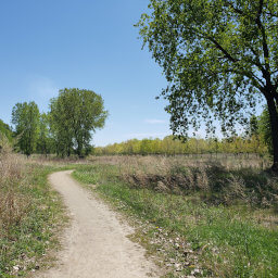
This hike is the kind of place you wouldn't know about unless you live in the area. Even though the trail is close to the freeway and has quite a bit of road noise, the landscape is stunningly beautiful. Wildflowers are abundant, depending on the time of year -- see picture below. This is also a good location for birdwatching; there are several tall wooden platforms constructed for birds of prey to build their nests and many smaller birdhouses posted along the creek. Surprisingly, I even saw a deer near the end of my hike.
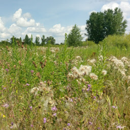
Wildflowers growing along the trail
View full size
From the parking lot, head south on the trail, then turn right when you reach the side of the road. Cross the street at the crosswalk, then continue straight. At the T intersection, you can choose to go either direction since this is a loop. In about a mile, cross the bridge over the creek to complete the loop rather than continuing straight towards the road. Once you complete the loop, turn to head back the way you came and cross the road to the parking lot.
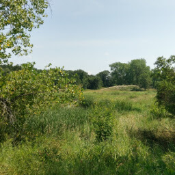
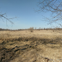
The overgrown prairie grasses hide the view of Rice Creek
View full size
Note: the PDF map you can find on the official page below (first link) is from 2006 and does not reflect current conditions. The official map below (second link) is a web application that has up to date information.
Hiked on Wednesday, August 2nd, 2017 by Ricky Holzer
Directions
This trail is located just off of Interstate 35W in the northern suburbs of the Twin Cities. Take the exit for County Road I, then head east. The entrance to the parking lot will soon be on your left and is well marked with a concrete monument.
Google Maps Directions
Parking, Fees, and Facilities
Parking is free in this small paved lot. There are no facilities.
Nearby Hikes
Tony Schmidt Regional Park, Minnesota
★★★☆☆(3/5)
Theodore Wirth Park, Minnesota
★★★★☆(4/5)
Bruce Vento Nature Sanctuary, Minnesota
★★★☆☆(3/5)
Elm Creek Park Reserve, Minnesota
★★★☆☆(3/5)