| Rating | ★★★★★(5/5) |
| Overall Difficulty | Moderate |
| Navigation Difficulty | Easy |
| Distance | 2.3 miles roundtrip |
| Time | 1.75 hours |
| Terrain | Hilly |
| Best Seasons | All |
| Dog Friendly | Yes |
| Accessible | Yes |
Highlights
- Rushing water in Johnson's Shut-Ins
- Hidden waterfalls on the hillside
Hike Summary
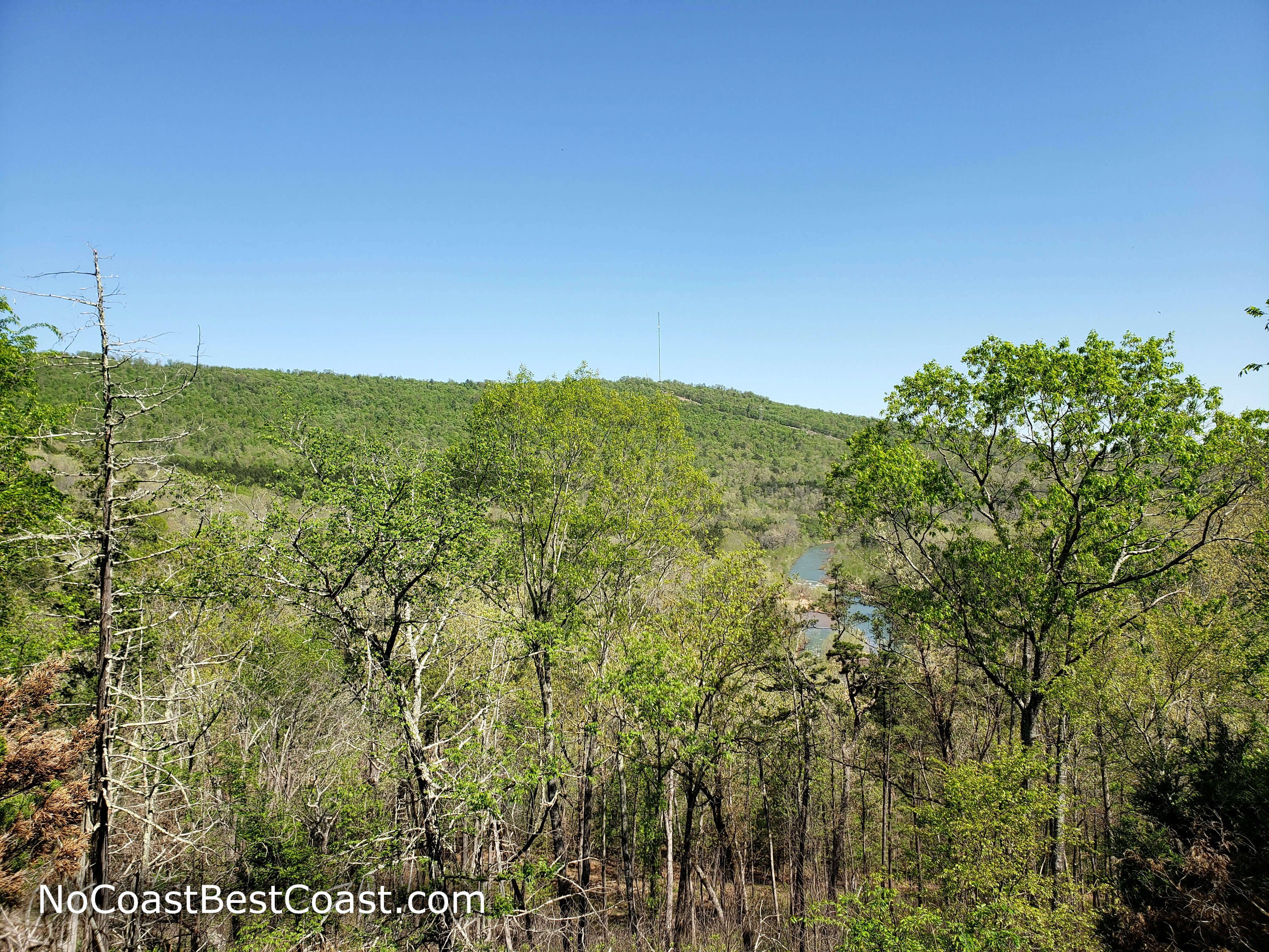
The Ozarks of Southern Missouri offer a welcome scenic change from the relative flatness of the Midwest. In Johnson's Shut-Ins State Park, high, rounded hills and the meandering East Fork Black River with pristine water are a calming escape from the noise of St. Louis, just 2 hours north of here. While most people come here to play in the rushing water of the shut-ins, hiking is an excellent way to experience more of the park and the natural beauty contained within. The Shut-Ins Trail is a relatively short but scenic loop that takes you along the river and high on top of an adjacent hill, treating you to tranquil riverside views and hidden waterfalls.
From the parking lot, follow the paved trail as it cuts through the forest until it reaches the East Fork Black River. The path follows the river, and you'll hear the sound of the clear, sparkling water as it rushes over rocks downriver. On the left, you'll pass a few river access stairways if you want to swim -- when the water is high and unsafe, locked gates and fences block entry. Near the end of the pavement, you'll reach a wooden deck that overlooks the rounded rocks of the shut-ins, as pictured below. Note that I visited when the river was extra high, so normally even more rock is exposed here. The accessible portion of the trail ends here, as evidenced by the stairs required to continue.
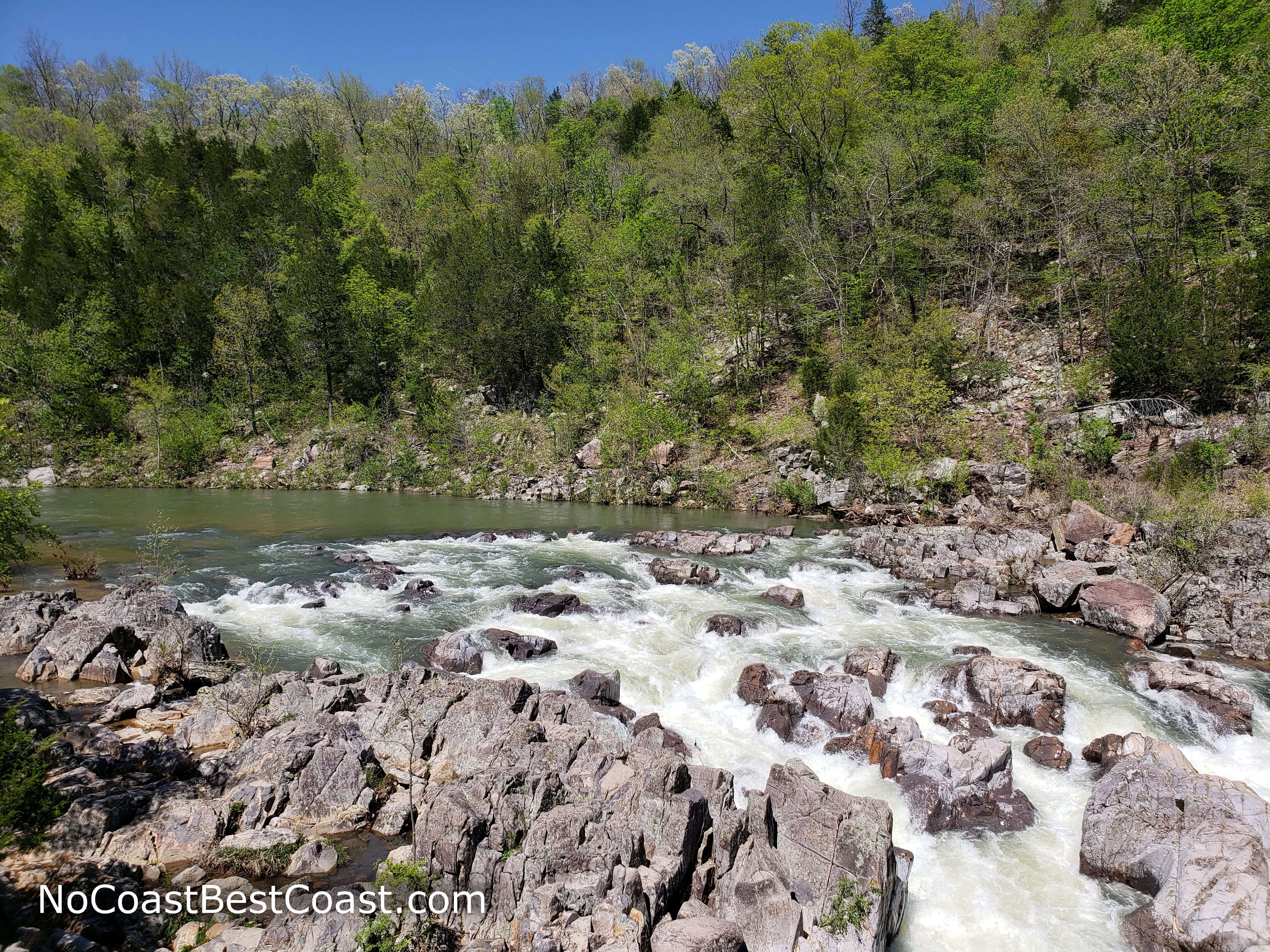
Green-blue water rushing through the rhyolite of Johnson's Shut-Ins
The erosion-resistant cliffs force the river to narrow
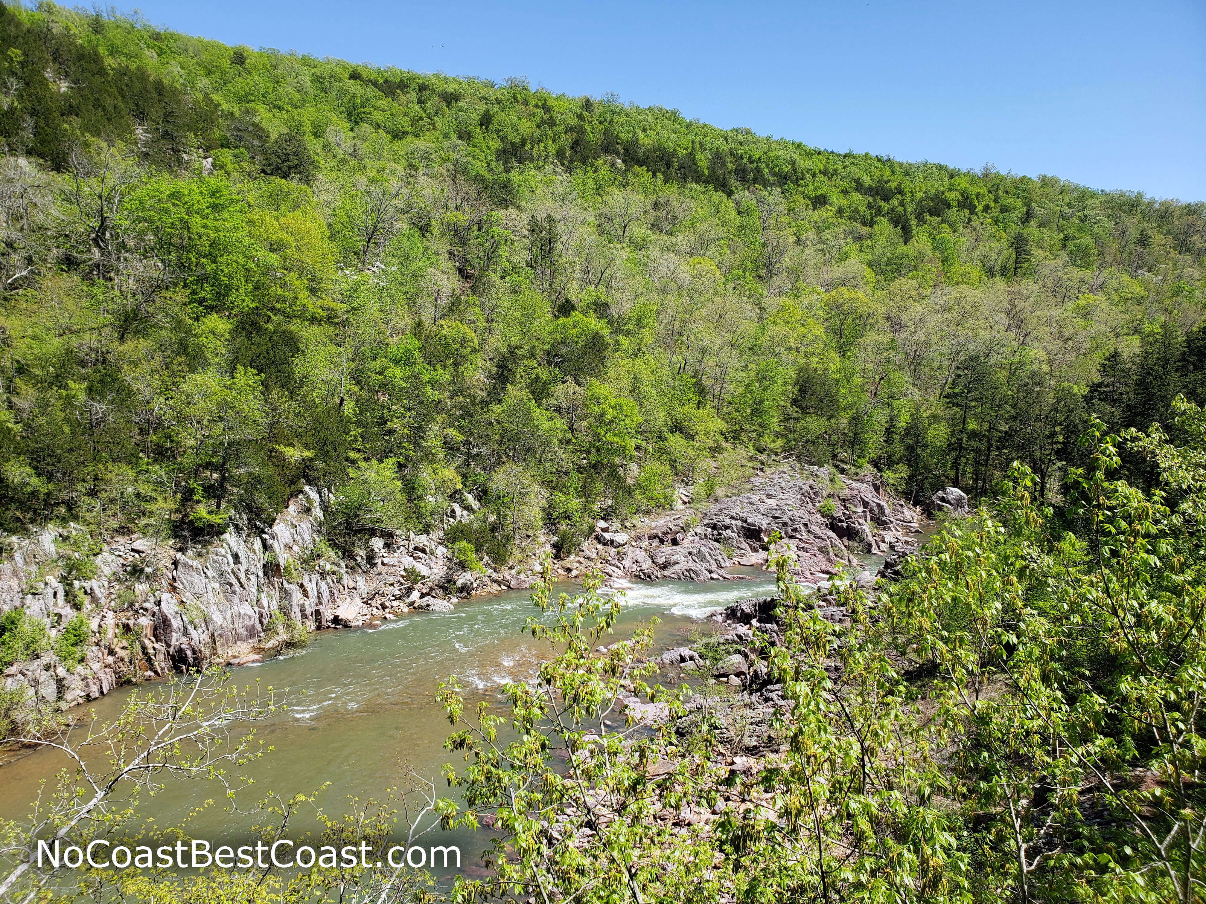
Later on, the trail bends away from the river back into the forest, and you'll reach a junction with the Ozark Trail. I highly recommend turning left here for a short side trip to the picturesque river view shown below -- this was my favorite spot on the entire hike, and it's a great place to eat a snack and drink water. Turn around after this side trip and continue back on the Shut-Ins Trail.
A spectacular springtime view of the East Fork Black River from the Ozark Trail
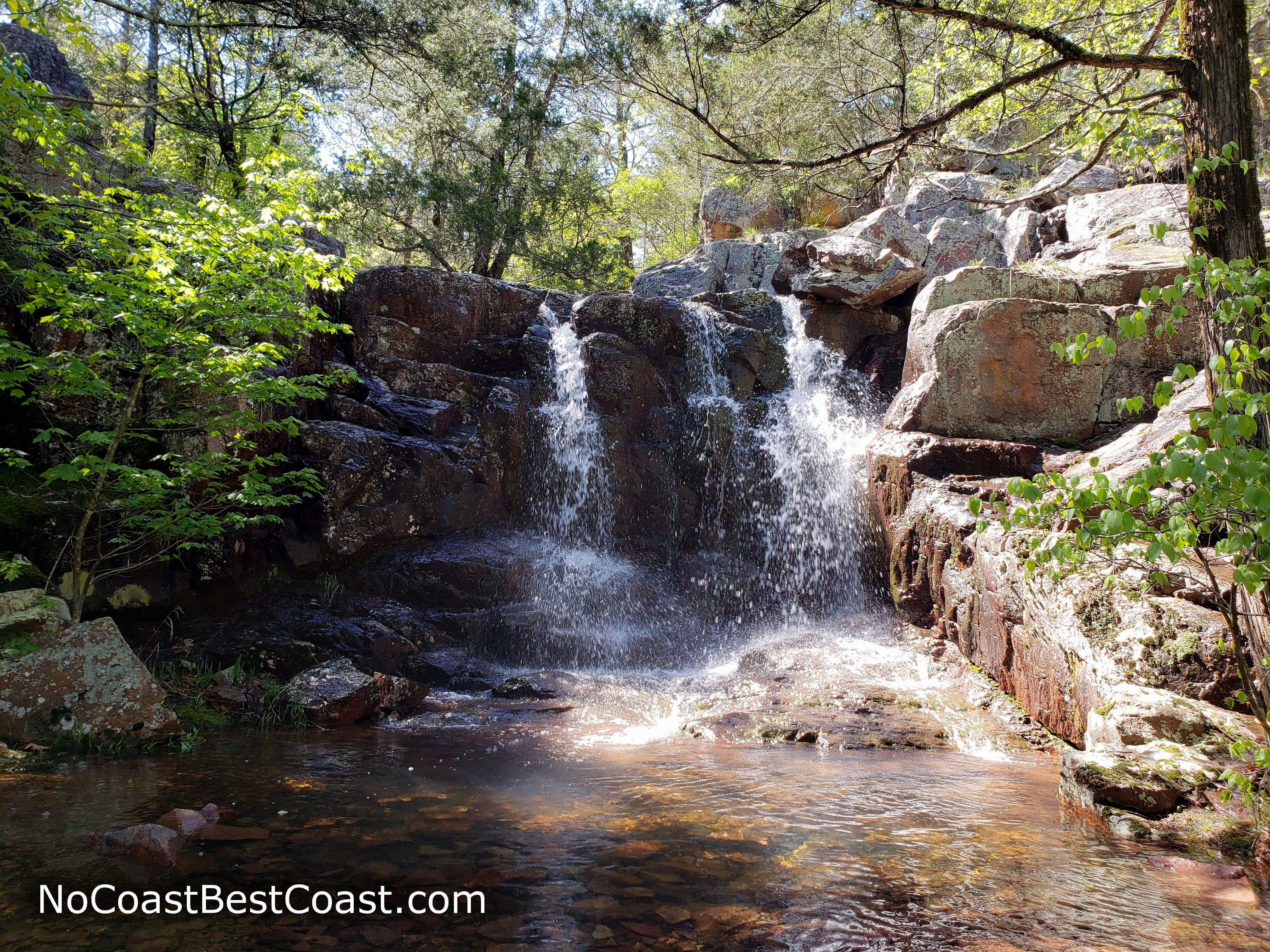
One of the waterfalls hidden on the hillside
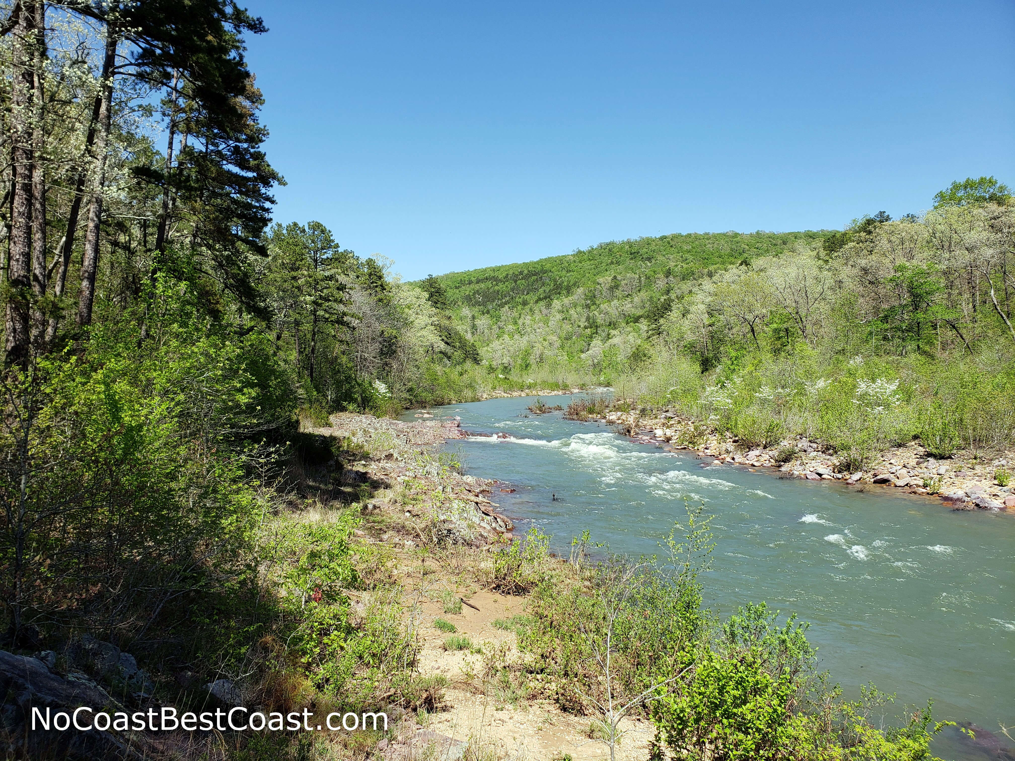
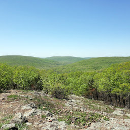
A glimpse of the river from a glade at the top of the hill
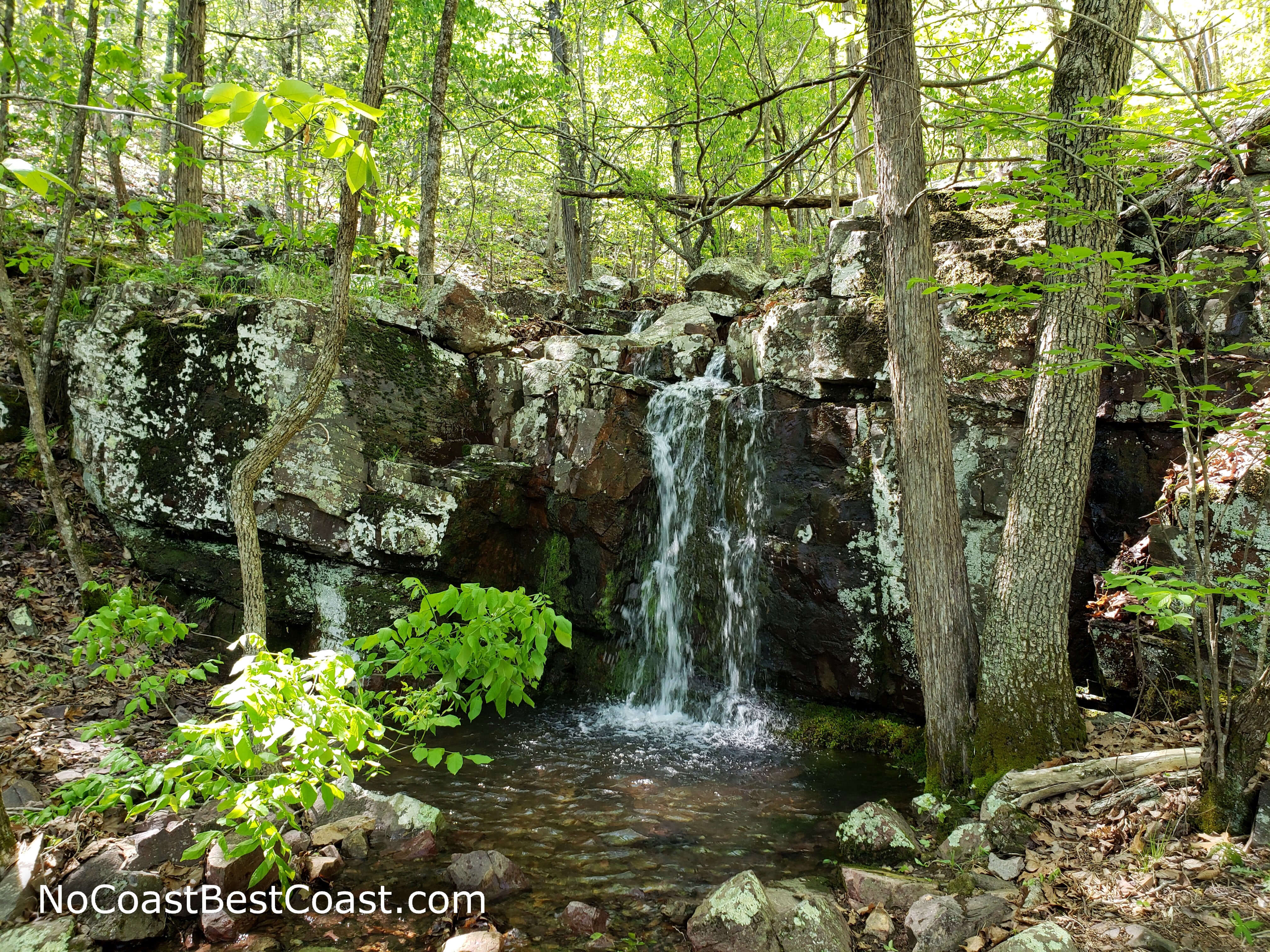
Another hidden waterfall on the high part of the Shut-Ins Trail
Hiked on Friday, April 26th, 2019 by Ricky Holzer
Important Information
Dogs are allowed on leash. The path to the shut-ins starts as paved and accessible, but the entire loop is not accessible as evidenced by the stairs you will inevitably encounter at the end of the pavement. While the loop isn't very long, the amount of uphill and the rockiness make it unsuitable for children; instead, stick to the paved path and enjoy swimming around in the shut-ins.
This trail can be enjoyed all year, but know that in times of high water, fences block direct access to the shut-ins so you'll have to view from afar. Most of the trail is in the shade and you'll be able to enjoy swimming after the hike, making this an excellent place to beat the heat. As one of the most popular state parks in Missouri, expect to see plenty of people especially when the weather is warm enough to swim.
Directions
From St. Louis, take Interstate 55 south. Take the exit for U.S. Highway 67 south toward Bonne Terre/Farmington. In Leadington, take the exit for Missouri Highway 32 and turn right. Turn left on Cedar Street (Highway N) in Bismarck and take a slight right ahead to stay on Highway N. Turn right onto Missouri Highway 21, then turn left shortly after back onto Highway N. In about 13 miles, turn left into the park -- note that flags near the entrance will indicate whether or not the shut-ins are open to swimming -- and continue straight through the day use area until the road ends at a parking lot.
Google Maps Directions
Parking, Fees, and Facilities
Parking is free! There is a store with flush toilets and water by the lot and vault toilets a little down the trail.
Nearby Hikes
Taum Sauk Mountain State Park, Missouri
★★★★☆(4/5)
Elephant Rocks State Park, Missouri
★★★☆☆(3/5)