| Rating | ★★★★★(5/5) |
| Overall Difficulty | Hard |
| Navigation Difficulty | Easy |
| Distance | 7 miles roundtrip |
| Time | 4 hours |
| Terrain | Hilly |
| Best Seasons | All |
| Dog Friendly | Yes |
| Accessible | No |
Highlights
- Summit the highest point in Minnesota
- Astounding views from the overlook
- Beautiful pristine wilderness
Hike Summary
For some, the fact that this is the tallest point in Minnesota is reason enough to hike this trail. For those that need more convincing, I'll let you know that this is a fantastic hike. I waited in my car for an hour and a half for a thunderstorm to pass, and I don't regret wasting any of that time. This is the fourth state highpoint I've reached, and it definitely has the most scenic journey and best views of those four. Not only is this one way to see the Boundary Waters Canoe Area Wilderness without a watercraft or the logistical nightmare of planning an extended trip, this hike features a taste of everything Minnesota wilderness has to offer: crossing a marsh on wooden planks, trekking over mangled old-growth tree roots, and views from the top of a granite peak. Once you finish this hike, you will feel a sense of accomplishment, something rare in the mostly flat Midwest, and you will hunger for more wilderness hikes.
Start your hike by filling out a free wilderness permit at the map kiosk -- you will be ticketed if caught without one. The first 3 miles of the trail are deceptively easy, ascending so gradually you won't really notice. This gives you plenty of time to bask in the quiet of the wilderness and to enjoy the pristine beauty within. Be warned that the trail is especially rocky with many exposed tree roots waiting to snare you. I fell three times on this hike, granted the trail was quite wet after the thunderstorm, but in either case take your time and go slow on the rockiest bits. About a mile after beginning the hike, you will reach the sign pictured below indicating that you are entering the legendary Boundary Waters Canoe Area Wilderness.
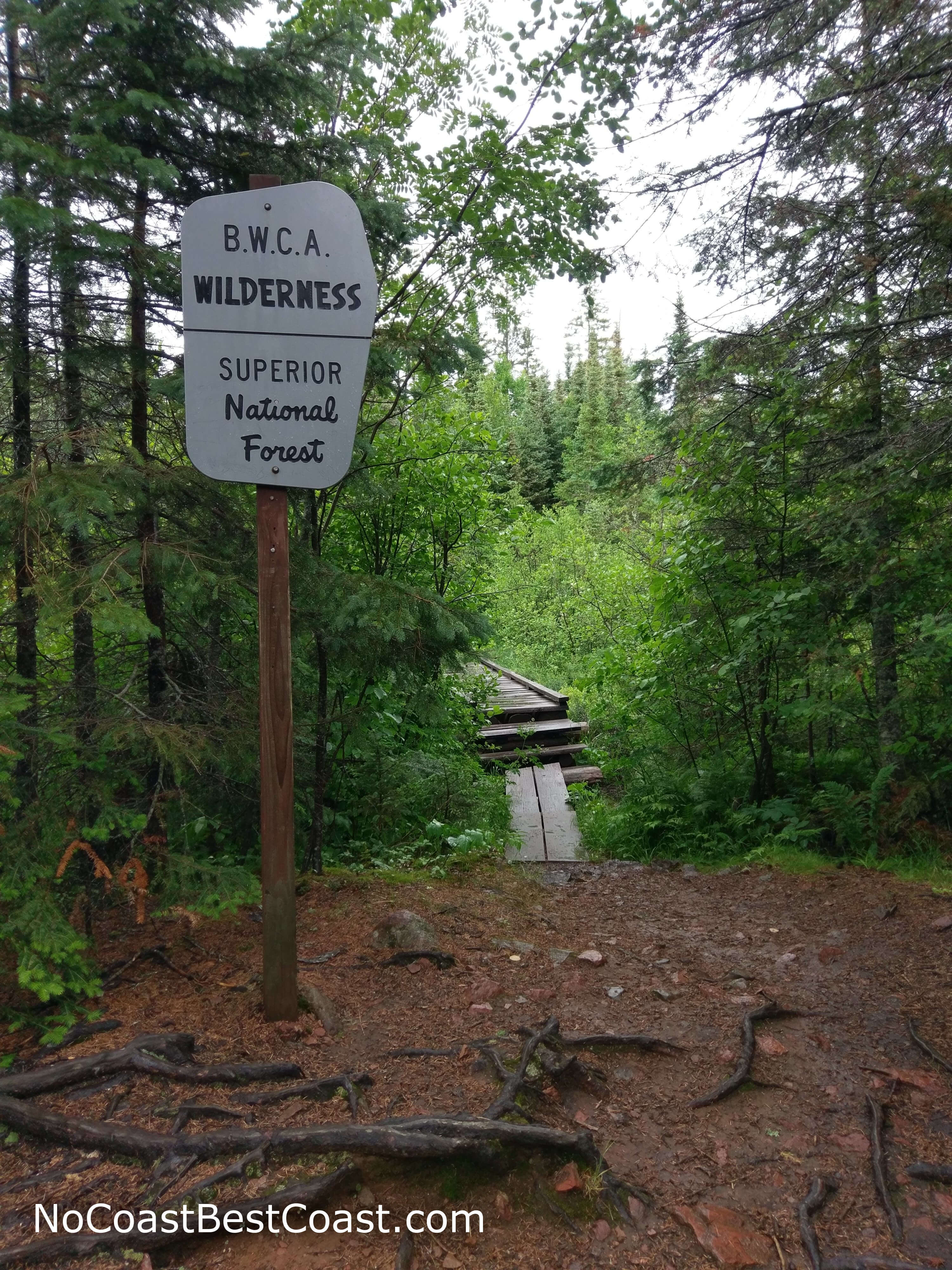
The wilderness beyond the sign awaits you
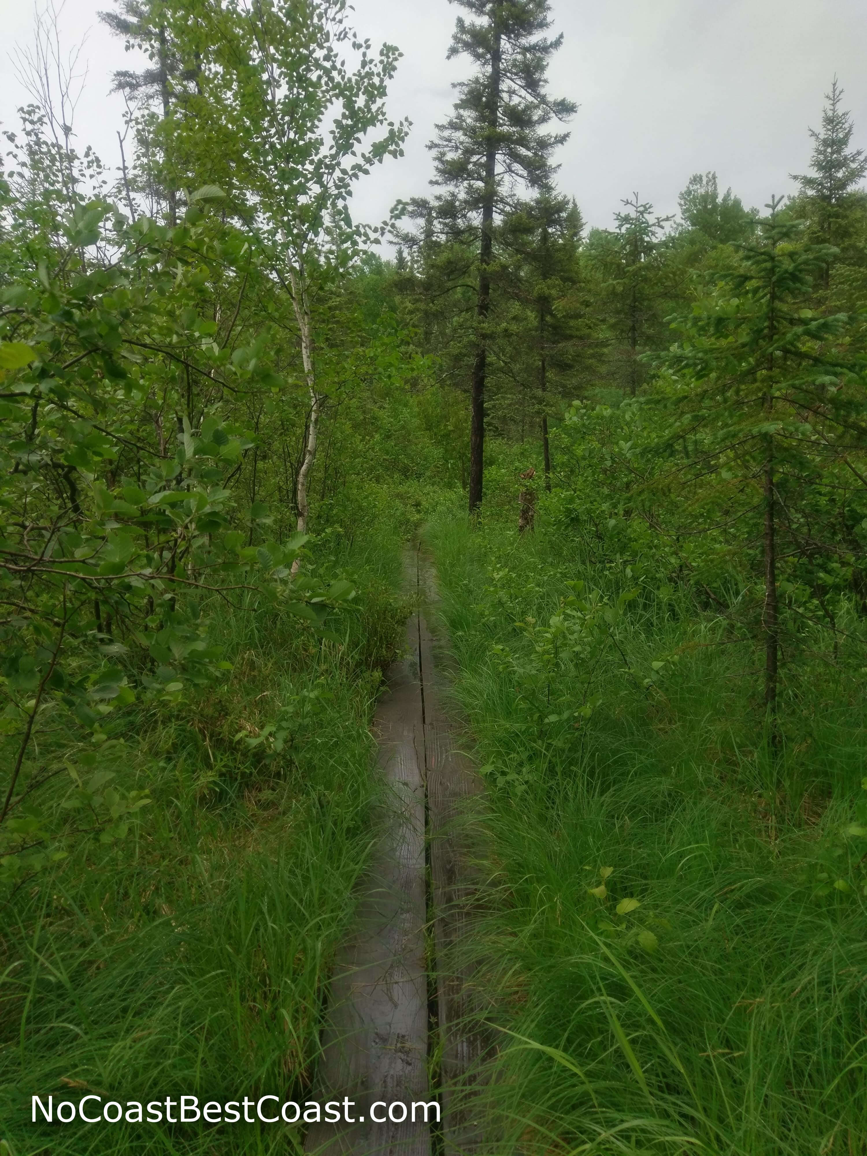
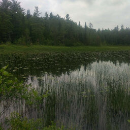
The overgrown marsh is one reason I recommend wearing pants
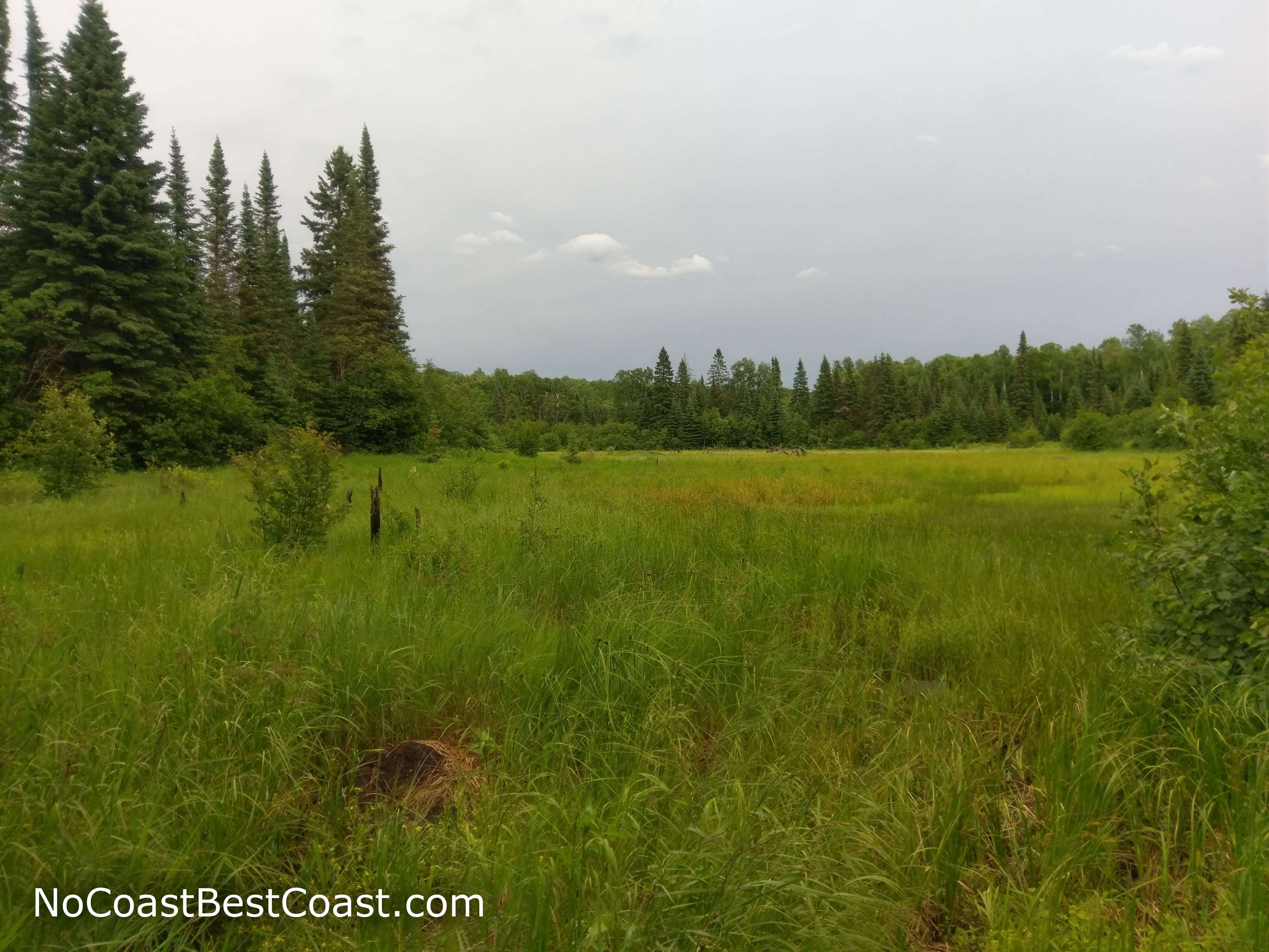
I love when marshes look like a big, grassy meadow
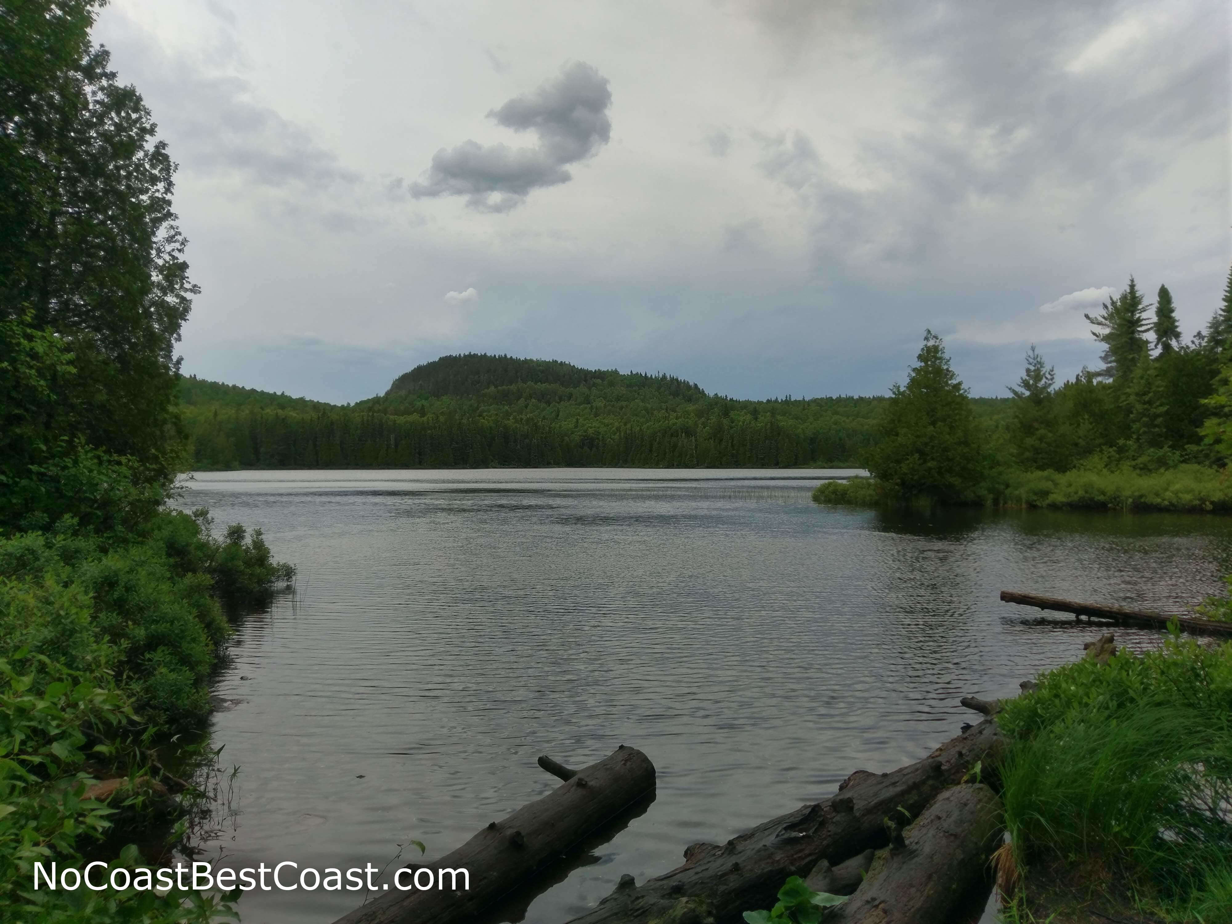
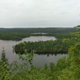
Many mistake the hill in the distance for Eagle Mountain, but it's actually an unnamed peak just east of your destination
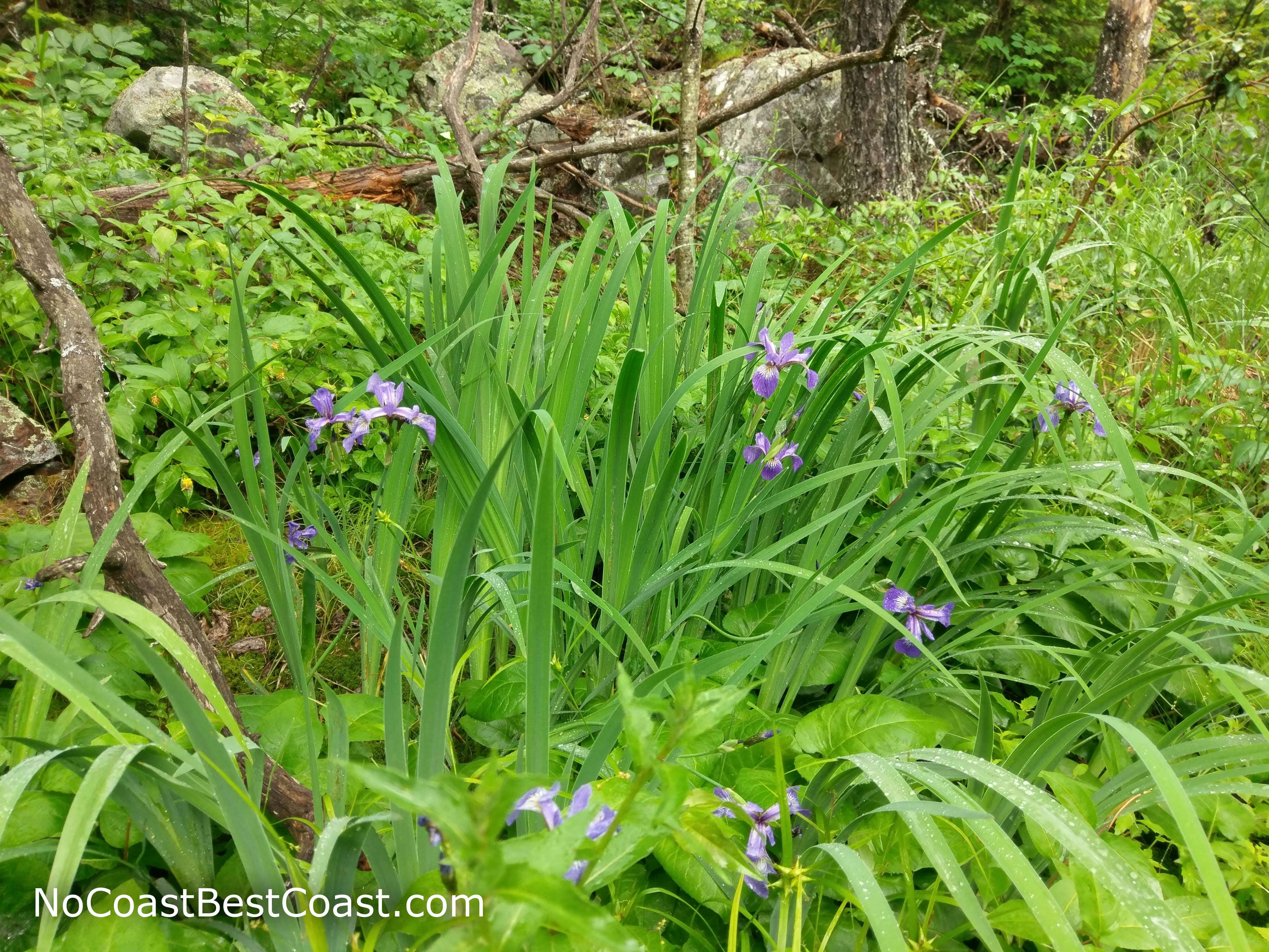
Purple wildflowers near the summit of Eagle Mountain
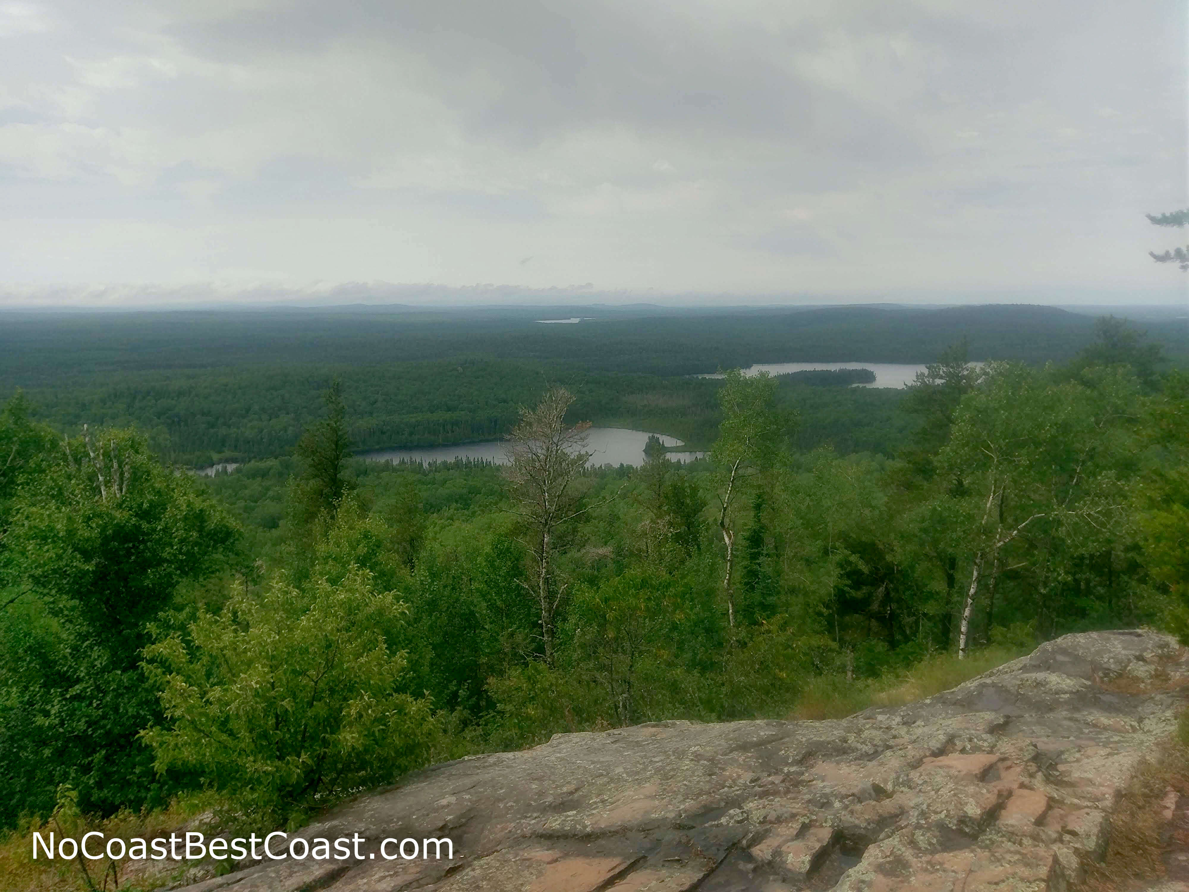
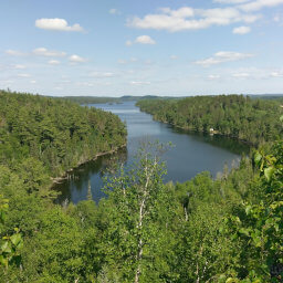
The impressive view from Eagle Mountain makes the uphill struggle worth it
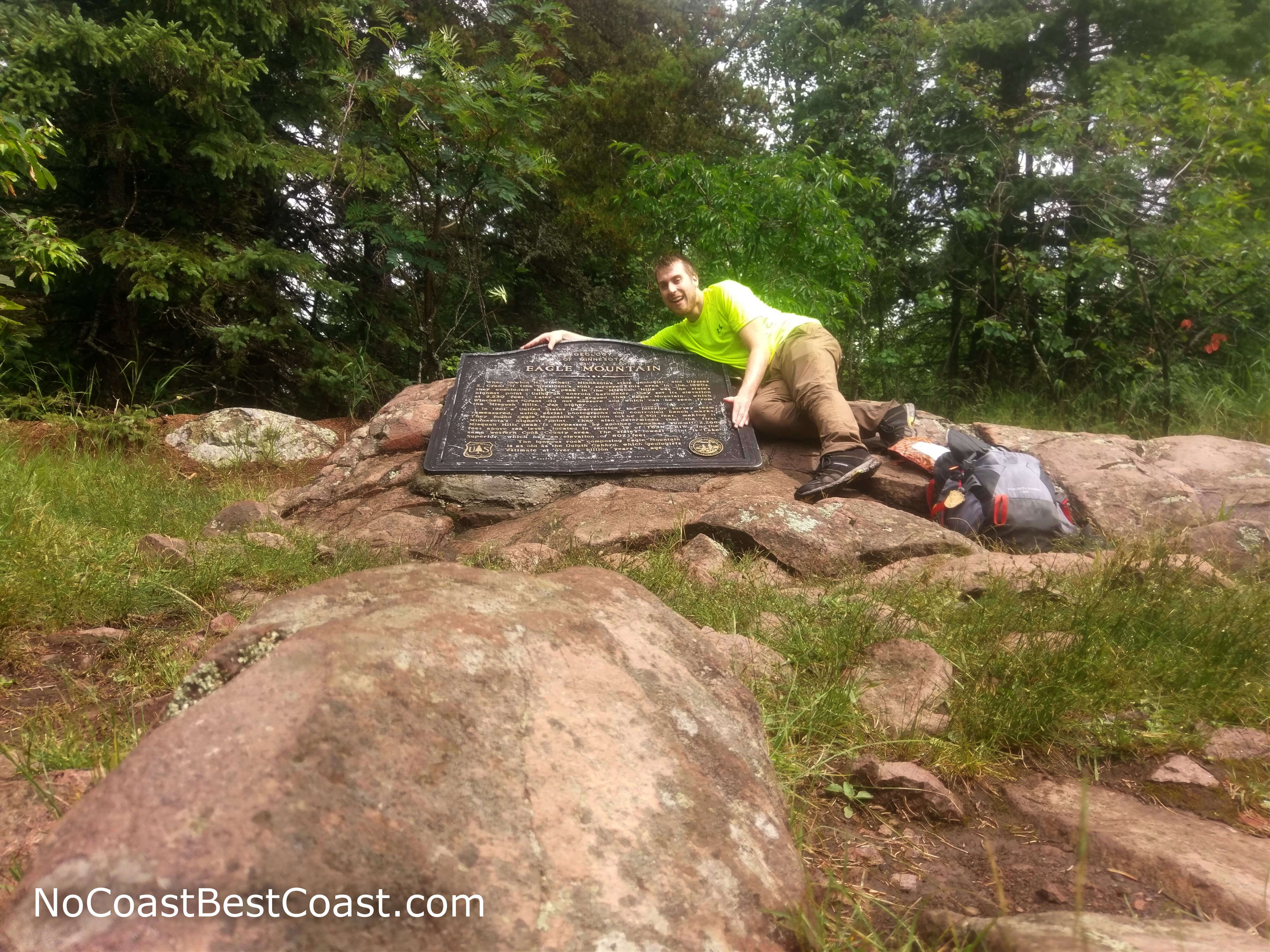
The monument at the summit serves as undeniable proof of your accomplishment
Hiked on Friday, June 29th, 2018 by Ricky Holzer
Important Information
Due to the trail's location in the Boundary Waters Canoe Area Wilderness, a free self-issued permit is required for all day hikers, or if you want to spend the night, you must purchase a permit from a ranger station (the closest ones are in Tofte or Grand Marais). There are also additional rules, all of which are listed in this guide. Your hiking party must not exceed 9 people and cans and glass bottles are prohibited except for non-food items like bug spray or fuel. Dogs are allowed, but they must be under control at all times (there were no specific mentions of using a leash, but use your best judgment). I wouldn't suggest bringing children due to the ruggedness of this wilderness and trail unless they have proven their abilities on other trails of similar length.
You can hike this trail in all four seasons, though snow will make both driving to the trailhead and hiking to the summit more difficult, if not impossible. The extra effort will be rewarded though, since very few attempt this trail in the winter. In the other seasons, bug spray is a must -- mosquitoes thrive in this wilderness. I also highly suggest wearing pants because the trail is often overgrown and the plants brushing your legs may not be friendly. The trail is much less maintained than you may be used to with large rocks and tree roots waiting to trip you and twist your ankles, so wear your best hiking footwear. It's important that you are especially prepared for this hike, bringing extra food, water, clothing, and first aid supplies; unlike hikes in state parks, you will be far away from anyone who can rescue you in an emergency. On a summer weekend, you most likely won't be alone on the trail, but on weekdays in the off season you may very well never see another soul.
Directions
Travel north on Minnesota Highway 61 to Lutsen, then turn left on County Highway 4 (Caribou Trail). Continue straight for quite a while. The road will transition from pavement to gravel -- very doable in a passenger vehicle -- at about a third to halfway through. Eventually, turn right at the T intersection ahead and continue straight until you see the sign for the trailhead pointing to the parking area on the left.
Google Maps Directions
Parking, Fees, and Facilities
Parking is free! There are pit toilets and a map kiosk in the dirt lot.
Nearby Hikes
Superior National Forest, Minnesota
★★★☆☆(3/5)
Superior National Forest, Minnesota
★★★★★(5/5)
Superior National Forest, Minnesota
★★★★★(5/5)

Superior National Forest, Minnesota
★★★★★(5/5)