| Rating | ★★★★★(5/5) |
| Overall Difficulty | Very hard |
| Navigation Difficulty | Easy |
| Distance | 10 miles roundtrip |
| Time | 8 hours |
| Terrain | Strenuous climbing, 3300 feet of elevation gain |
| Best Seasons | Spring, Summer, Fall |
| Dog Friendly | Yes |
| Accessible | No |
Highlights
- Panoramic views from the highest peak in Arizona
- Stunningly beautiful forest and alpine tundra
- Observing the change in vegetation as you ascend
Hike Summary
My 12th state highpoint and also the highest mountain I've ever climbed at 12,633 feet, is a gem in northern Arizona. Towering 6,000 feet above Flagstaff and the surrounding Coconino National Forest, Humphreys Peak is part of the remnants of an extinct volcano that now comprises the San Francisco Peaks. With their monumental size and visibility over a long distance, the San Francisco Peaks are sacred to the Navajo, Hopi, and peoples from 11 other local tribes, some of whom believe the mountains as the home of their ancestors. Although the climb is difficult, it is one of the easier western state highpoints to summit, and the scenic rewards are stupendous.
An early start is recommended because afternoon thunderstorms are frequent, especially in the summer. Bring enough water and food and don't forget to bring an extra layer or two -- it can be as much as 20 degrees cooler on top than it is in Flagstaff, and high winds are common. The trail throughout is exceptionally rocky and covered with mangled tree roots, so wearing good footwear is crucial. Know the signs of altitude sickness, and don't be afraid or ashamed of turning around if you do fall ill.
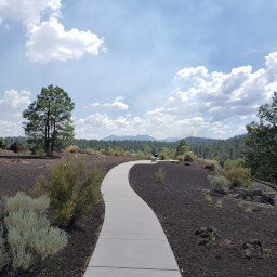
The trail, the "easiest" of all routes to the top, is well-marked and heavily traveled, making navigation simple. The hike begins by crossing a ski slope, which transforms into an absolutely beautiful meadow in the summer, as pictured below. Once in the forest, it's a long series of switchbacks up the mountain until you reach the saddle. With a trailhead elevation of 9,200 feet (almost as high as the tallest mountain near Tucson), the air is already thin, and you'll notice the effects of altitude immediately after you start uphill. Since this trail is on the west side of the mountain, it is entirely in the shadows during the morning, and the trees block most sunlight the rest of the day.
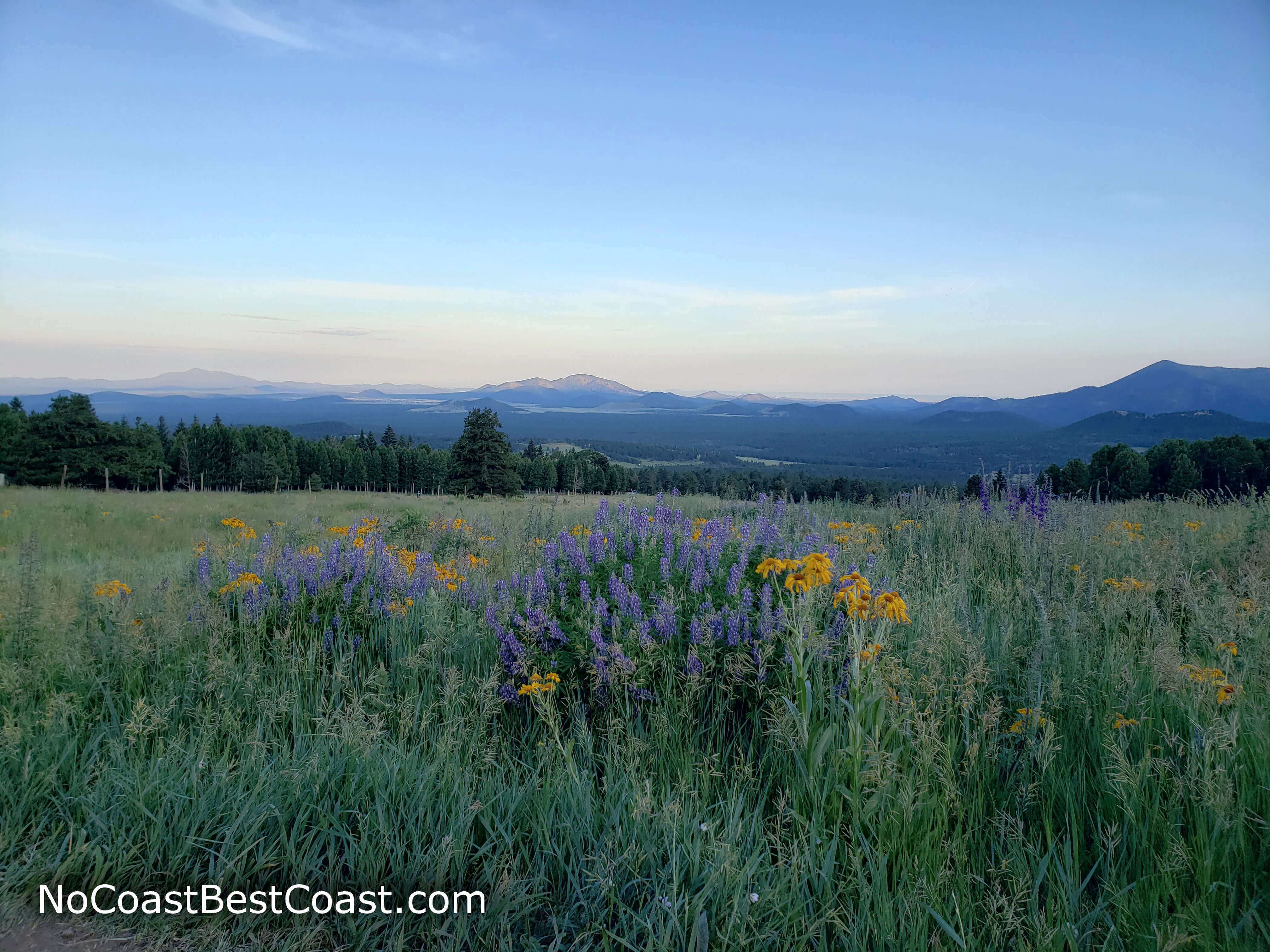
The flowery meadow at the start of the hike
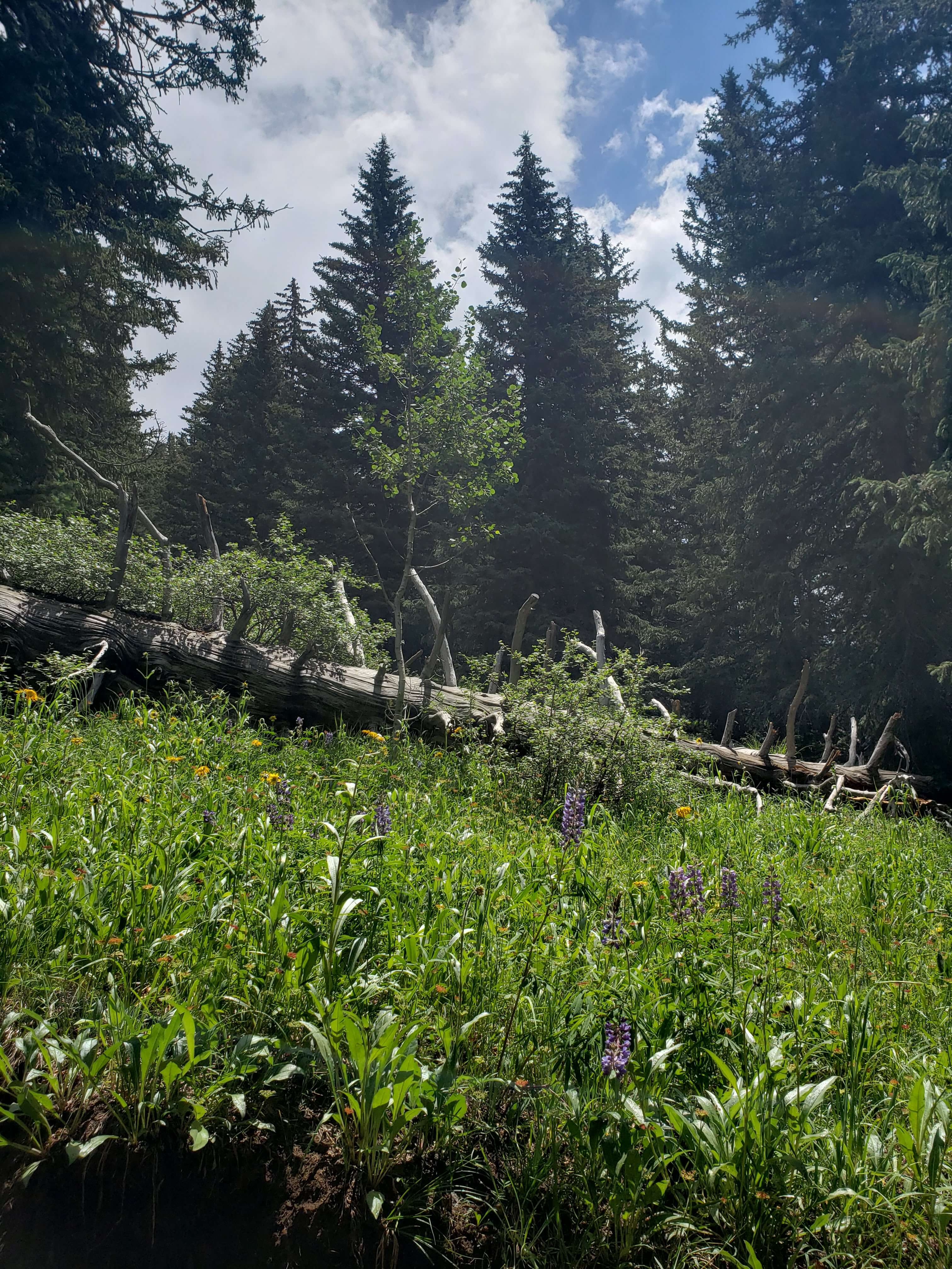
Just one of the small, wildflower-filled meadows along the trail
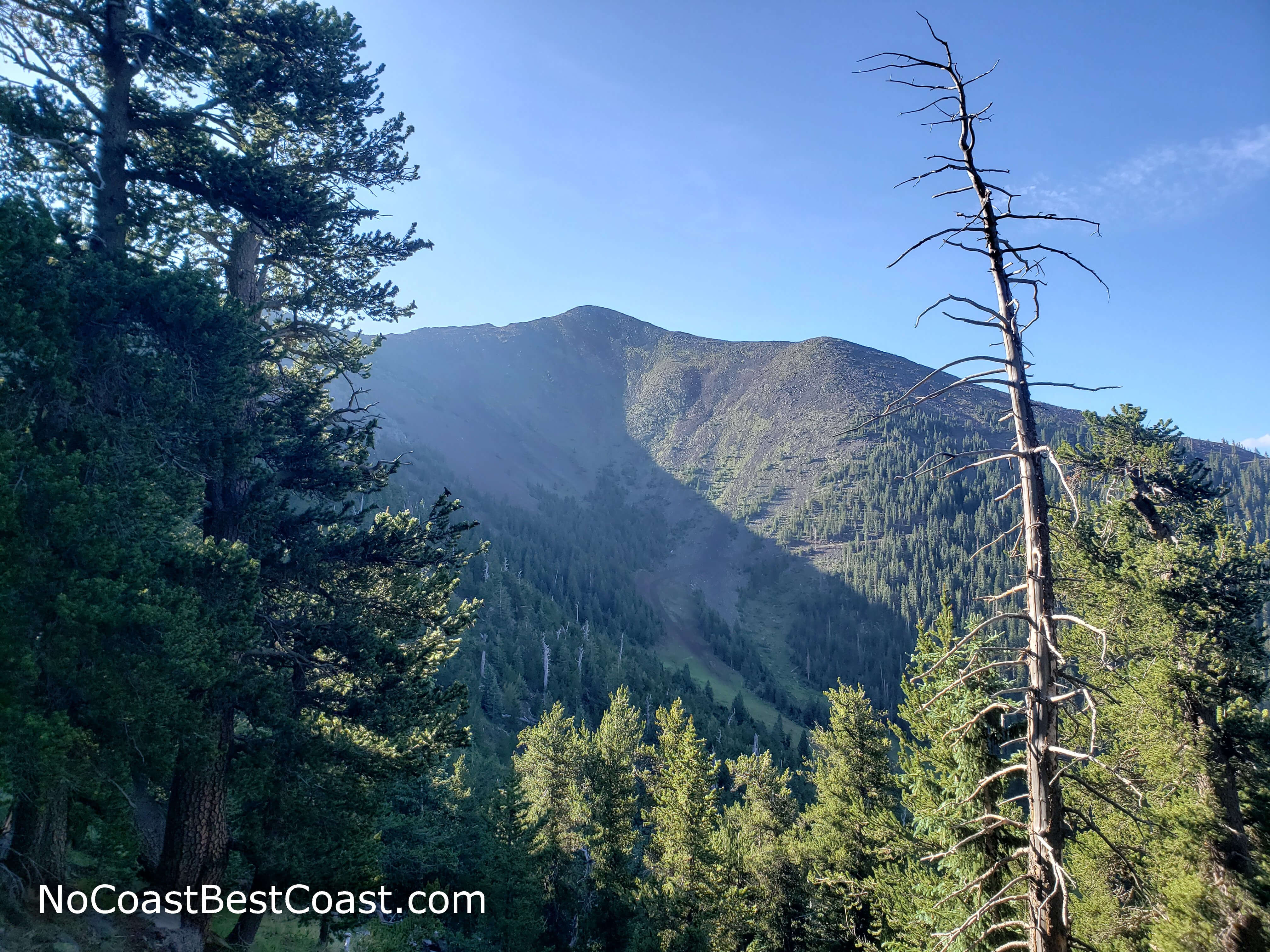
Agassiz Peak as you approach treeline
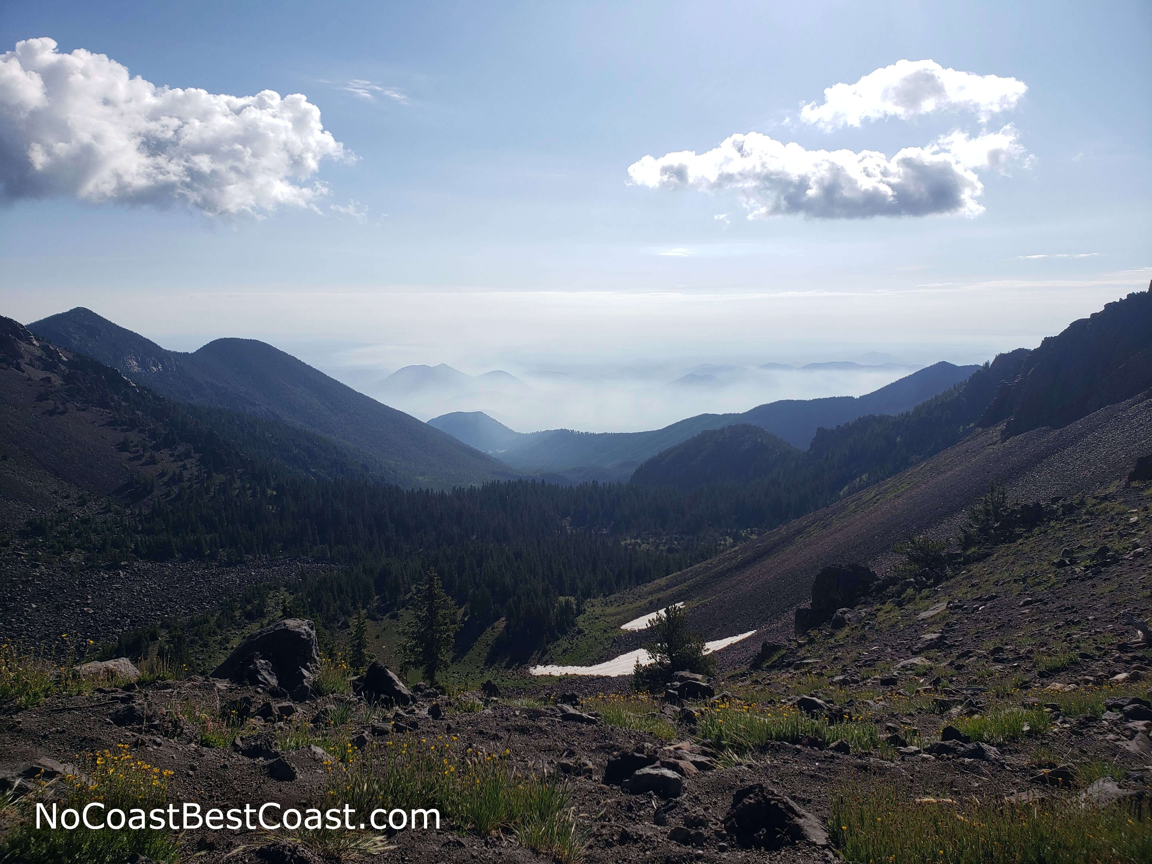
The view from the saddle looking east, snow still visible in July
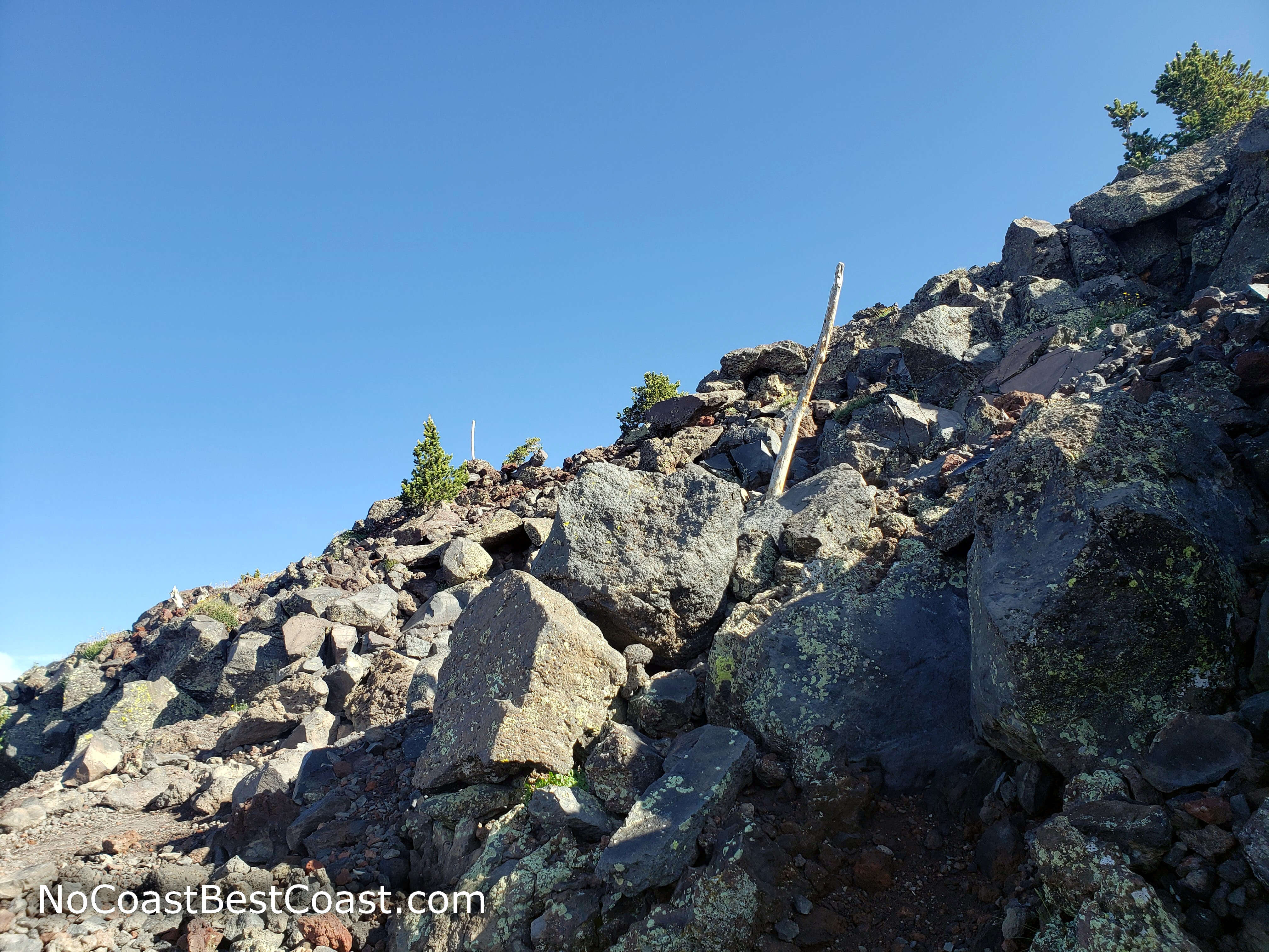
Wooden poles marking the trail through the rocky environment above treeline
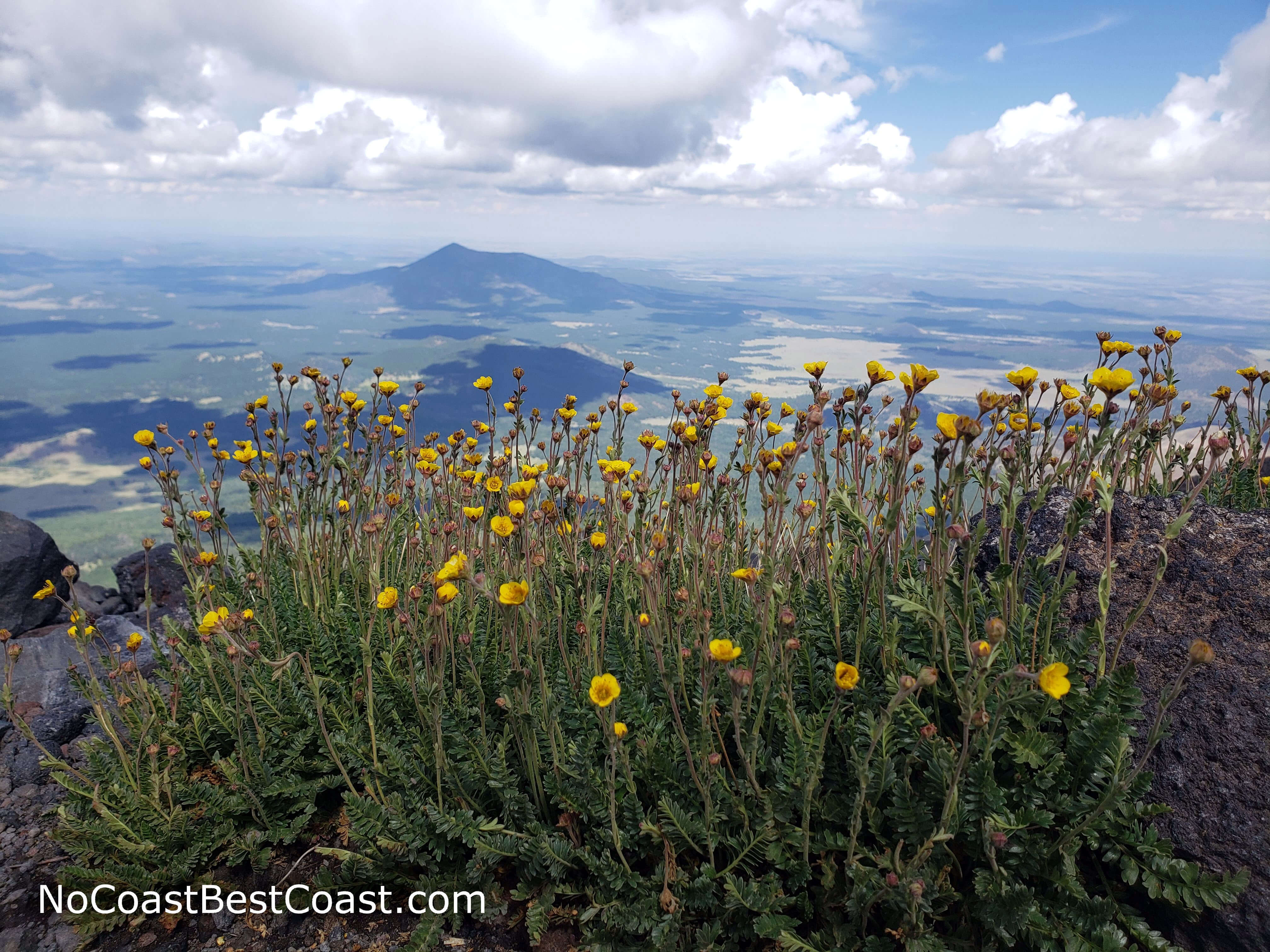
The pretty yellow flowers of the San Francisco groundsel only grow on these mountains
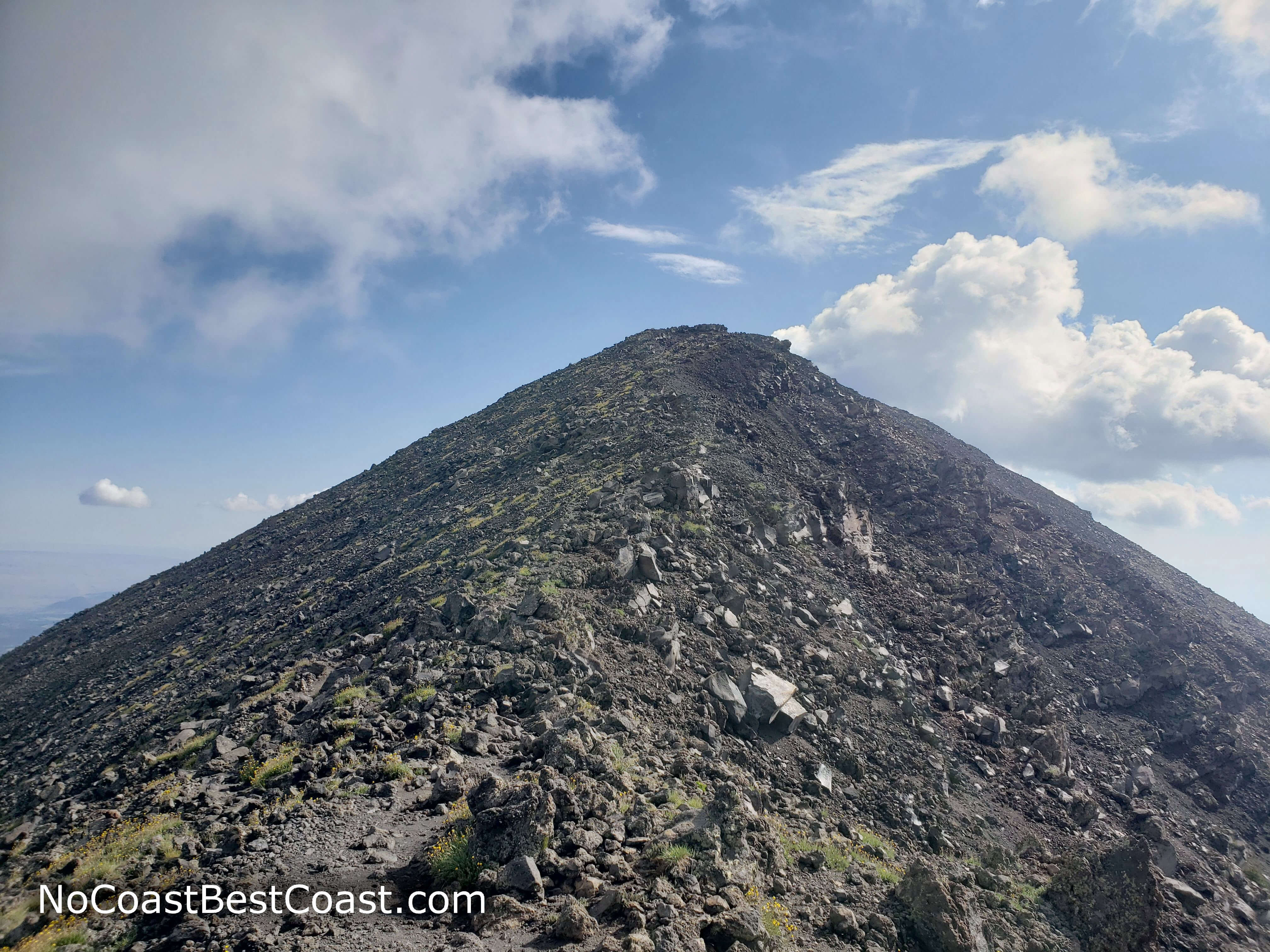
One of several false summits that will crush your spirit
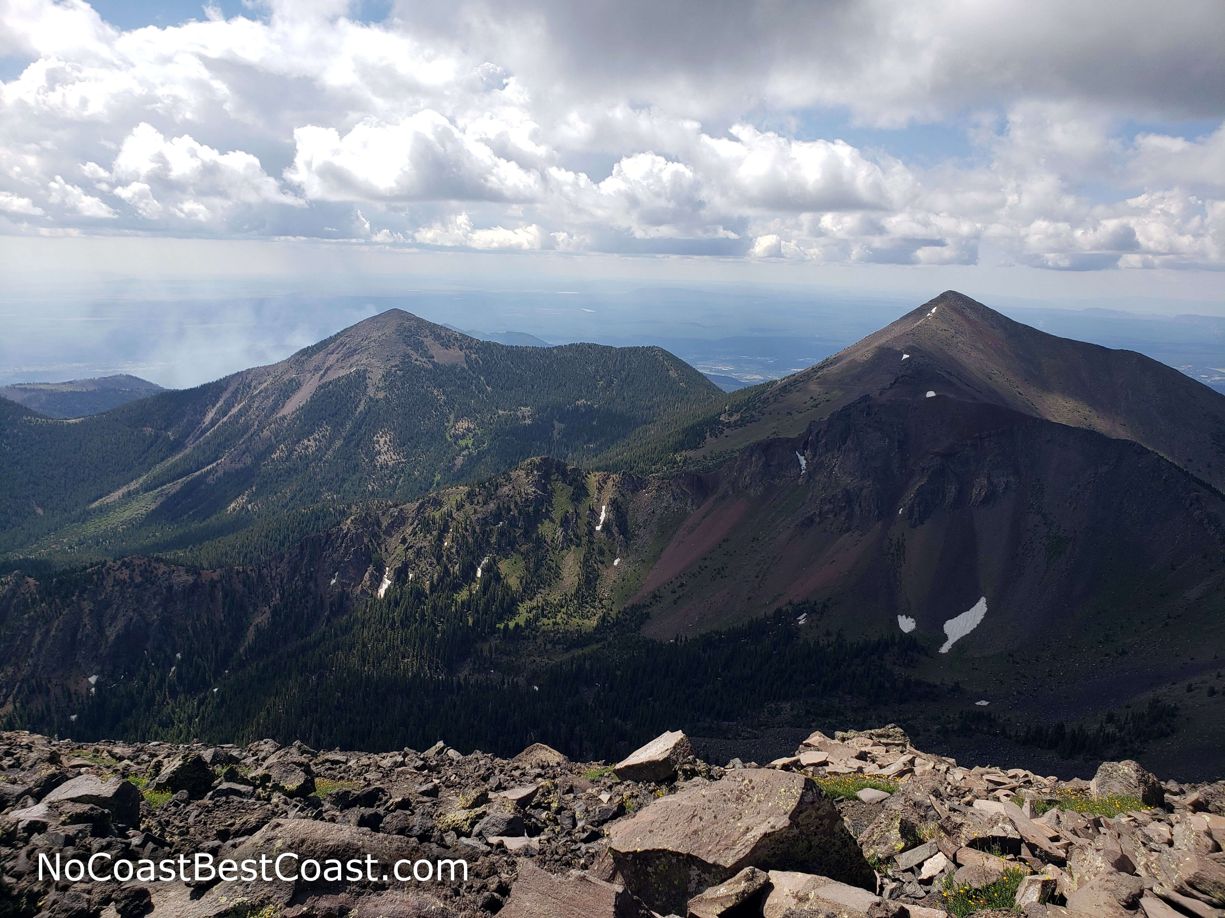
Looking south towards Agassiz and Fremont Peaks from the top of one false summit
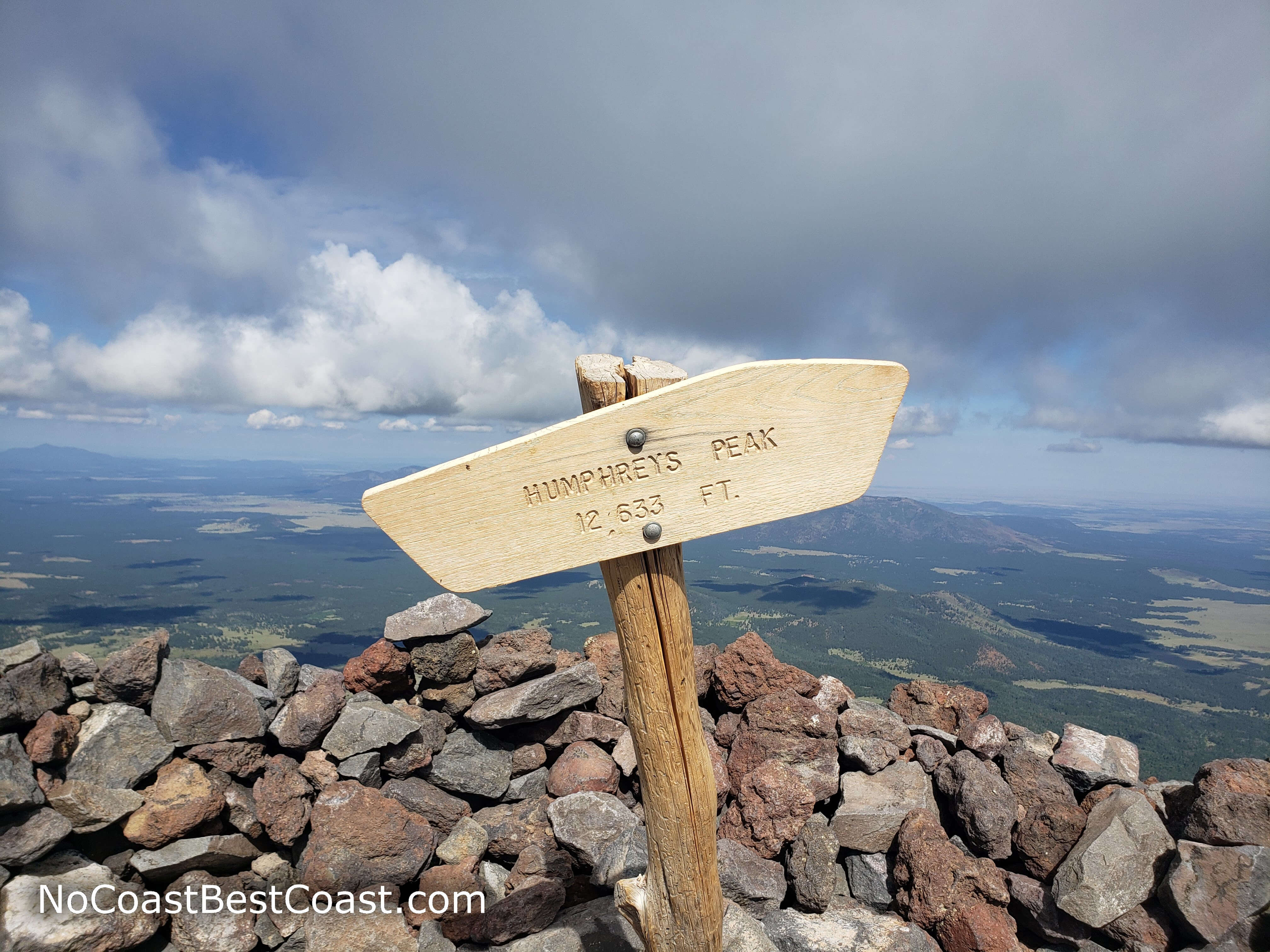
The post marking the summit and the rock wall wind barrier
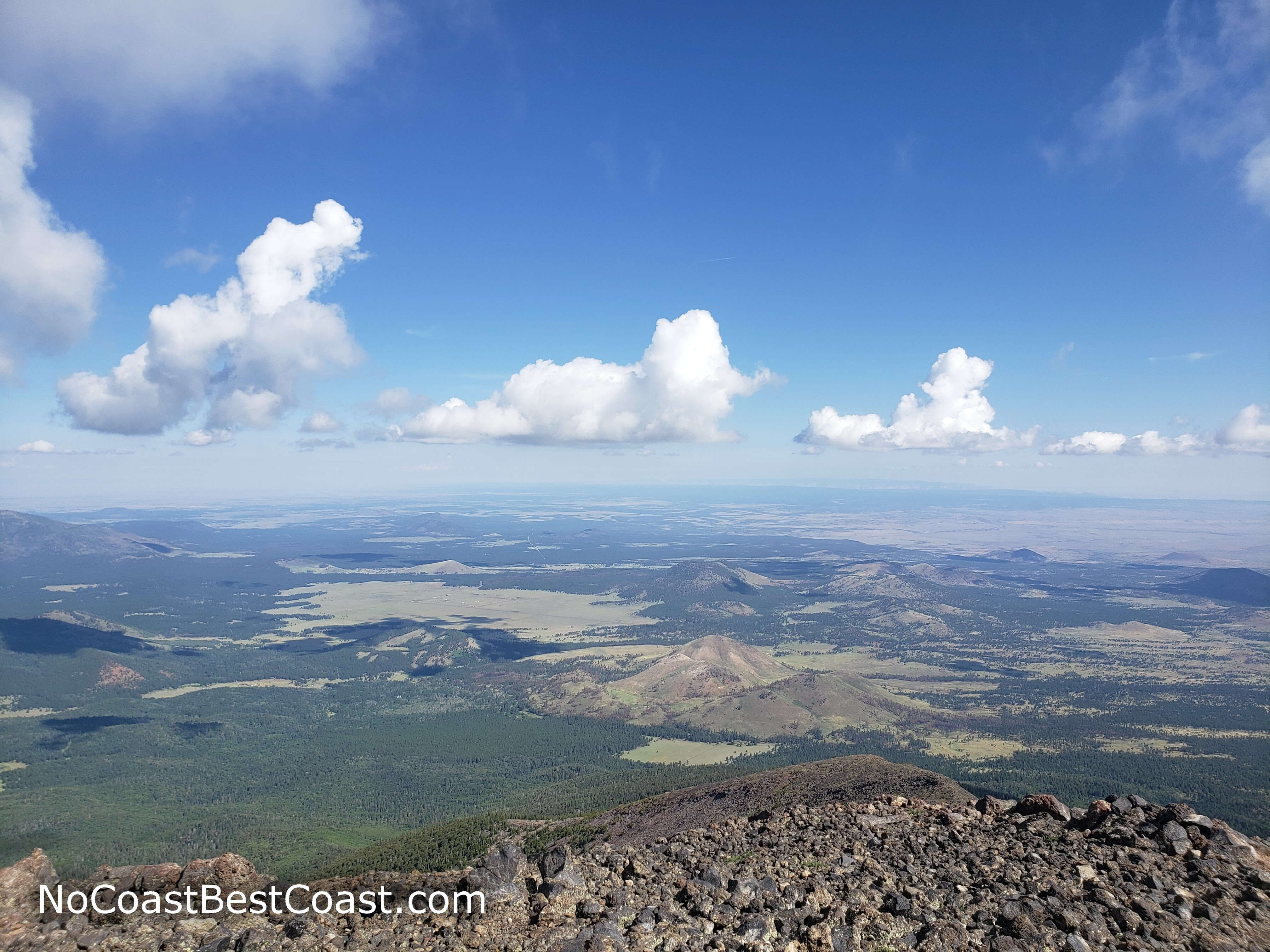
The view north extends to the Grand Canyon on a clear day
This hike is fantastically memorable, and I can already see it making my top list for 2019. Don't miss this hike! Connect with me using the social media links below and share your adventures!
Hiked on Friday, July 26th, 2019 by Ricky Holzer
Important Information
Dogs are allowed on leash -- this is especially important as you ascend above treeline to protect the fragile tundra plants. Don't even think about bringing kids on this hike; instead, take them to nearby Sunset Crater Volcano National Monument to enjoy the shorter trails with excellent views of the San Francisco Peaks.
Hiking to the peak is possible in all seasons; however, late spring and fall are the best times to climb. Summer is also an option (I myself did this), but be aware that afternoon thunderstorms are almost a guarantee -- plan to be off the mountain by noon. Winter hiking requires a free permit; head to the Flagstaff Forest Service headquarters during weekday business hours to obtain a permit. With the exception of winter, this is a highly popular trail and you are bound to see many people especially on weekends. Luckily, the trail is hard enough and long enough that you will still have moments of solitude thanks to everyone's unique climbing speed.
Directions
From Flagstaff, take U.S. Highway 180 north towards the Grand Canyon. Turn right onto Snow Bowl Road, following the signs for the Arizona Snowbowl. Drive up the winding mountain road until you reach the parking areas at the base of the mountain. Turn left into the lot signed for the Humphreys Peak Trail.
Google Maps Directions
Parking, Fees, and Facilities
Parking is free! There are portable toilets in the parking lot.
Nearby Hikes
Sunset Crater Volcano National Monument, Arizona
★★★☆☆(3/5)
Sunset Crater Volcano National Monument, Arizona
★★★★☆(4/5)
Sunset Crater Volcano National Monument, Arizona
★★★☆☆(3/5)
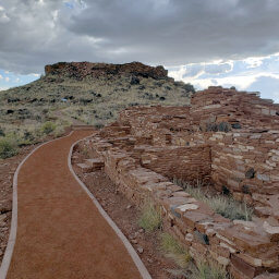
Wupatki National Monument, Arizona
★★★★☆(4/5)