| Rating | ★★★★★(5/5) |
| Overall Difficulty | Easy |
| Navigation Difficulty | Easy |
| Distance | 1.4 miles roundtrip |
| Time | 1 hour |
| Terrain | Hilly |
| Best Seasons | All |
| Dog Friendly | Yes |
| Accessible | No |
Highlights
- Astounding, sweeping views
- Interesting geology
Hike Summary
I'm not entirely certain how I stumbled upon Gibraltar Rock, though it's likely I either saw its small green square on Google Maps while looking for parks around the Wisconsin Dells or on a fellow hiker's Instagram. Either way, I'm glad I stopped here to break up the long drive from Minneapolis to Chicago -- a perfect roadtrip stop since this place is about exactly halfway between the two. This small area of land known as the Gibraltar Rock State Natural Area contains a small portion of the thousand-mile Ice Age National Scenic Trail that climbs to the top of this 200 foot tall rocky butte with amazing views from the rocky outcroppings. Although this trail does see a bit of traffic due to its views and location near the Wisconsin Dells, it's much less crowded here than in the nearby Devil's Lake State Park or Mirror Lake State Park. If you're ever in the area, this is definitely a hike to check out.
There are two options to hike to the top: following the old gated-off paved road or the Ice Age Trail. The road is no-nonsense and skips some of the scenic overlooks, so I recommend taking the trail. Yellow rectangular marks (a symbol prevalent throughout most of Ice Age Trail) spray painted on trees and rocks help guide the way through the forest as the trail crosses over the old road and uphill. The trail is really gradual up until the very end where there are a few stone steps, as pictured below.
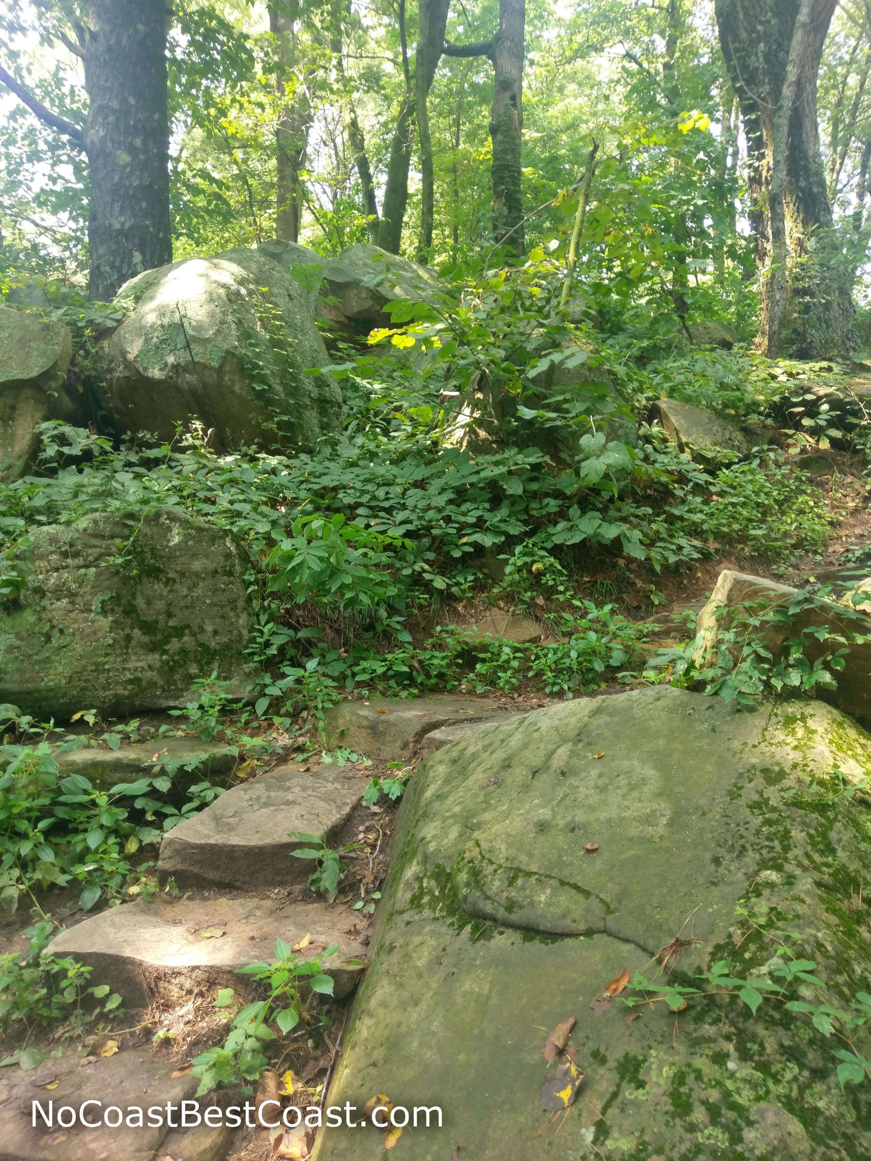
Stone stair steps on the trail up to Gibraltar Rock
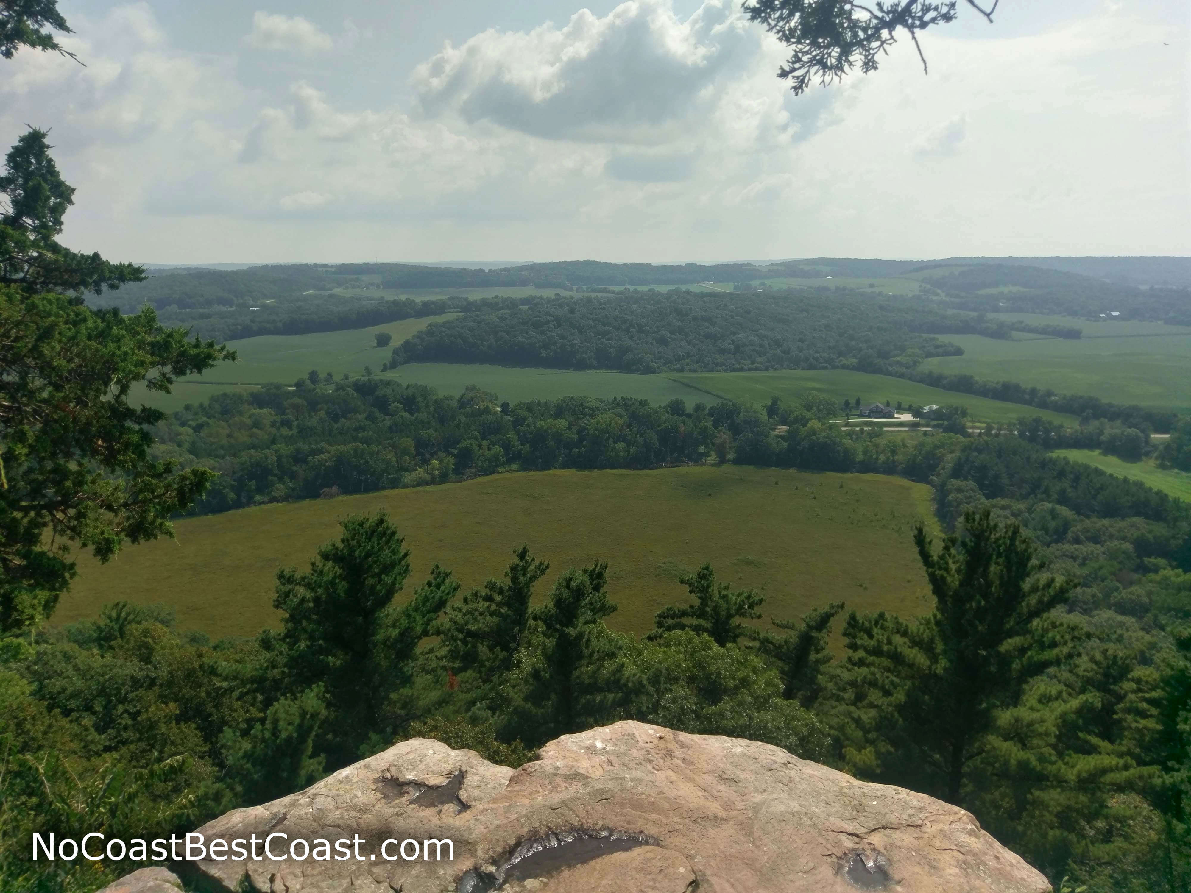
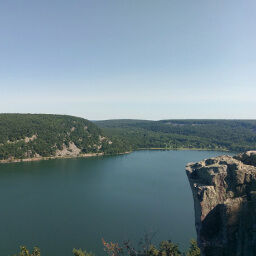
The view from Gibraltar Rock looking west
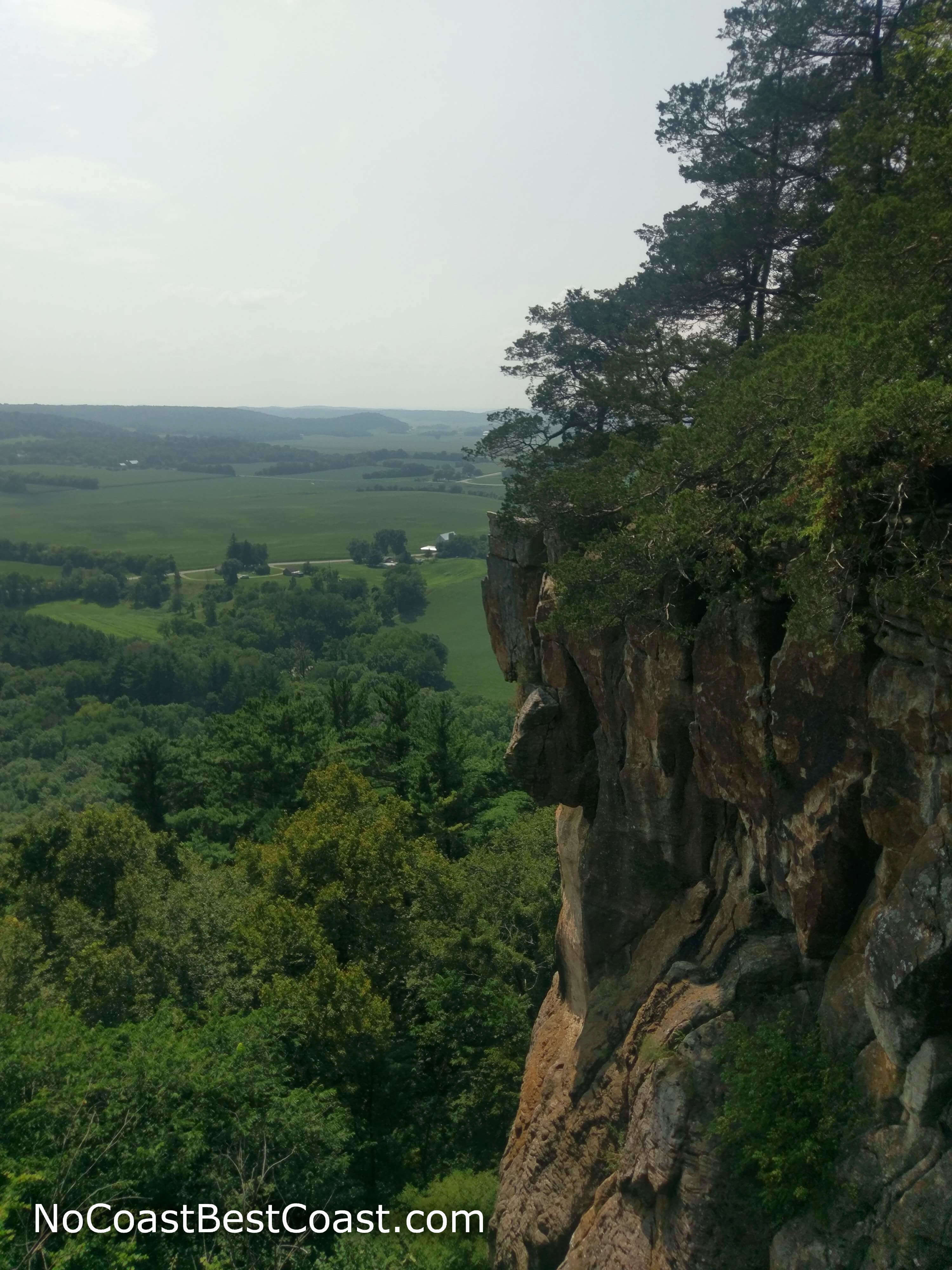
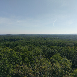
A side profile of Gibraltar Rock shows the scale of the cliff
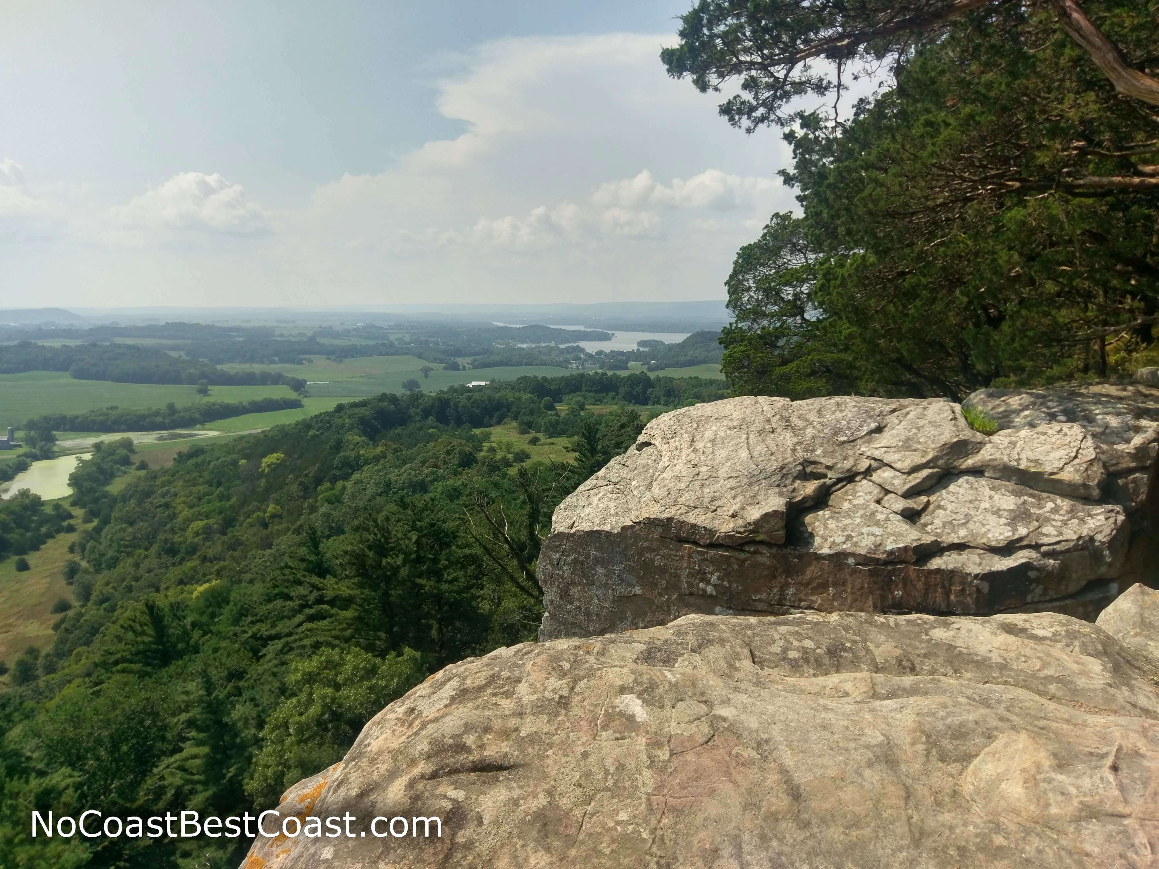
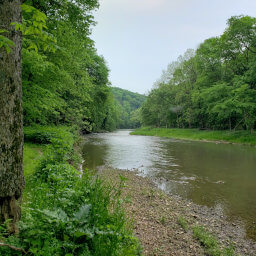
Looking north with Lake Wisconsin in the distance
On the way back you might notice a use-trail on the right (heading to the east). If you follow this unofficial side trail, you'll escape the forest and be able to see the edge of the park's property, especially evident since the neighboring farmer plowed right up to the edge. Here you'll have a nice view of the rolling hills in the distance with a nice meadow in the foreground, as pictured below.
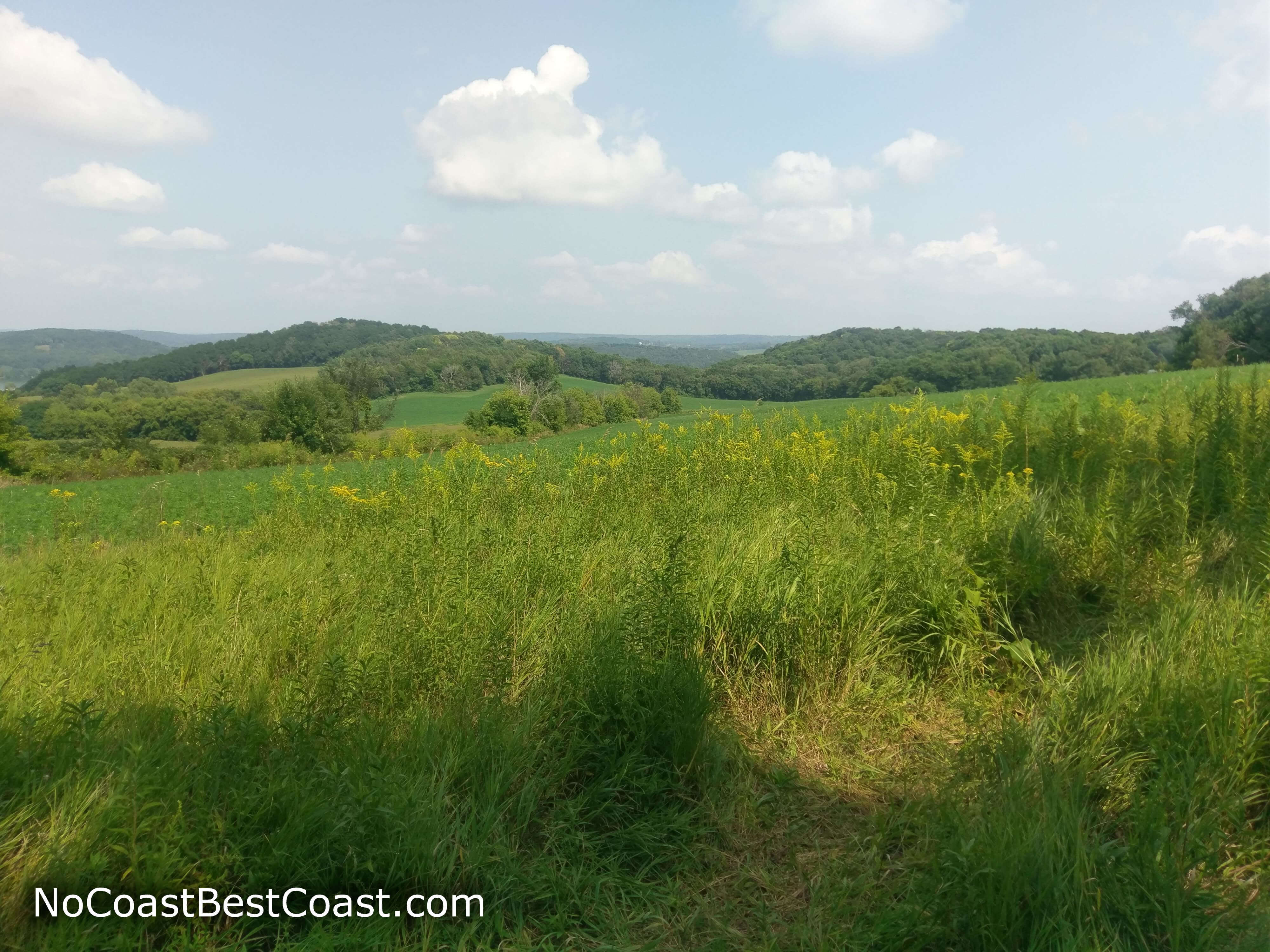
A meadow just on the edge of the park property
Hiked on Friday, August 17th, 2018 by Ricky Holzer
Important Information
Dogs are allowed on leash. With the uphill climbing and many cliff edges, this hike is not ideal for families with small children but is good for older children. This trail is available in all four seasons, and its trailhead location along a county road means and well marked trail with blazes in the trees means you can hike even in the heart of the snowy winter. On a Friday afternoon, I encountered a couple groups of people, and this trail's views and location close to the Wisconsin Dells means you will probably see even more people on a peak summer weekend.
Directions
From Madison, take U.S. Highway 12 West toward Springfield. Turn right on Wisconsin Highway 19, then turn left on Lodi Springfield Road. Turn right onto County Road P. After a couple bends in the road, turn left onto Wisconsin Highway 113 towards Lodi. Continue on Wisconsin Highway 113 through Lodi, then turn left on County Road V. Turn left on Gibraltar Road designated by the brown sign for Gibraltar Rock.
From Wisconsin Dells, take Interstate 90/94 east towards Madison, then exit at County Road CS and turn left. Turn left again on County Road J, then turn right on County Road V. Follow the signs to stay on County Road V as it turns before crossing Wisconsin Highway 113. Turn left on Gibraltar Road designated by the brown sign for Gibraltar Rock.
Google Maps Directions
Parking, Fees, and Facilities
Parking is free! There are no facilities near this lot.
Nearby Hikes
Devil's Lake State Park, Wisconsin
★★★★★(5/5)
Mirror Lake State Park, Wisconsin
★★☆☆☆(2/5)
Kettle Moraine State Forest - Lapham Peak Unit, Wisconsin
★★★★☆(4/5)
Apple River Canyon State Park, Illinois
★★★☆☆(3/5)