| Rating | ★★★★★(5/5) |
| Overall Difficulty | Moderate |
| Navigation Difficulty | Medium |
| Distance | 2.2 miles roundtrip |
| Time | 1 hour |
| Terrain | Hilly |
| Best Seasons | Spring, Summer, Fall |
| Dog Friendly | Yes |
| Accessible | No |
Highlights
- Impressive views of Virginia, MN and the surrounding area
- Rock formations along the trail
Hike Summary
I get excited every time a see a hike in the Midwest with the word "mountain" in it. After living in the Southwest for so long, I originally scoffed at what Midwesterners call mountains, but now I take what I can get! Views and long, leg burning climbs are uncommon in these flatlands. This hike does not disappoint and requires a relatively low effort for the tremendous view at the end (one of the best views I've had in Minnesota). If you're ever near Virginia or are driving to Ely, this is a hike you don't want to miss.
The trails here are good for hiking for at least the 3 warm seasons, and the trails are groomed for skiing in the winter; however, the Forest Service page does not specify if hiking is permitted on the ski trails during the winter months. Usually people don't like when you walk on their groomed trails, so I'd assume no hiking in winter. If you modify the route to only use the Fitness Trail and the service road, you can do this hike worry-free in winter.
The trails here are notoriously labyrinthine, seriously just look at the official map (linked at the bottom of the page) near the parking areas -- it looks like a toddler scribbled with red crayon. They did label each intersection with either a letter or number, so that should help you navigate. In addition, there are colored diamonds to label the type of trail (pictured below): white for the Fitness Trail and blue for hiking/ski trails. Oh, and there's also mountain bike trails scattered throughout, most labeled with a gear logo. It's really easy to get lost here or at least take a wrong turn.
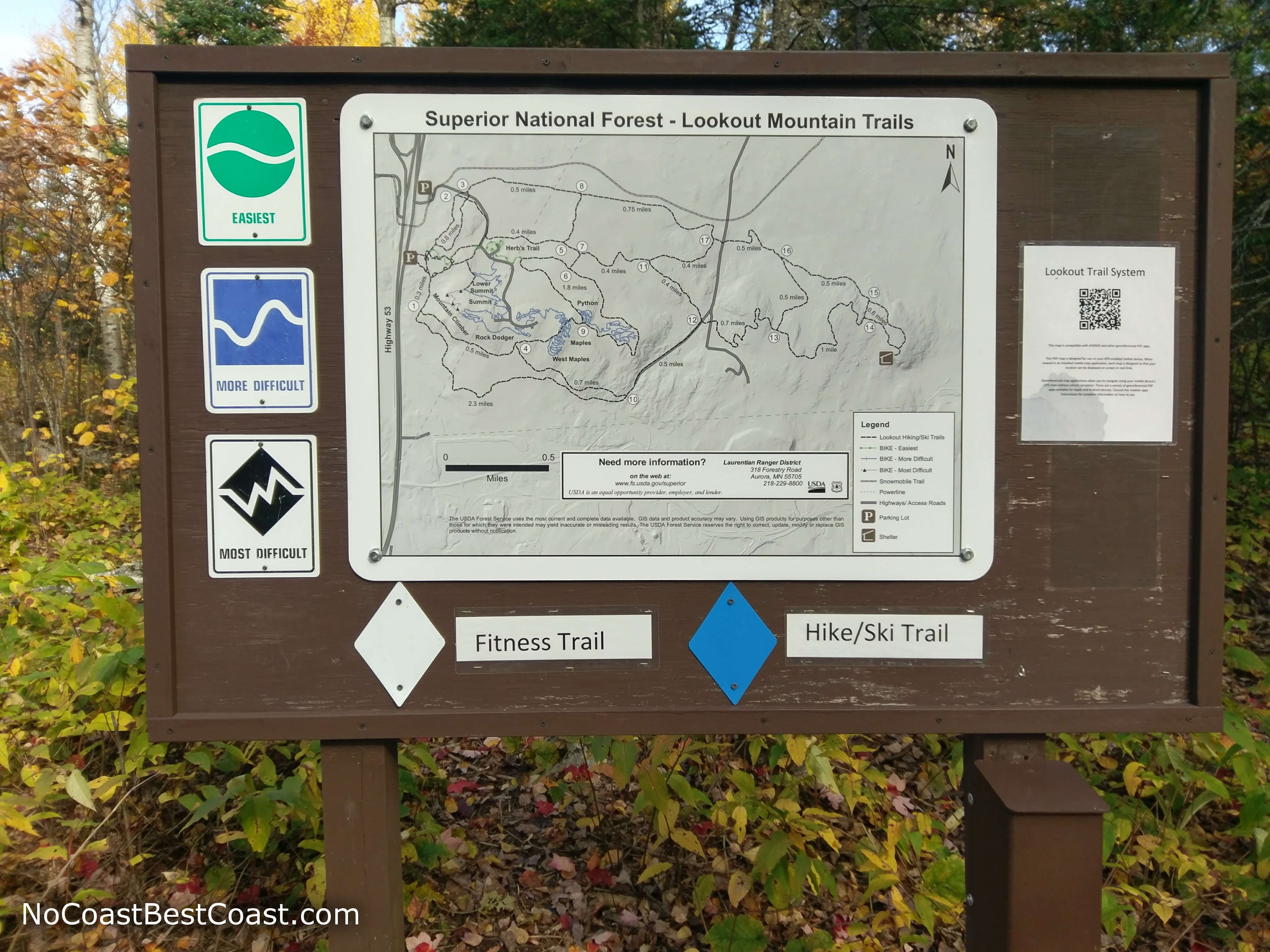
This map at the start of the trail is the best map available
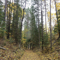
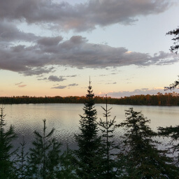
Usually I spoon feed you the directions with turn by turn accuracy, but today I'm just going to tell you to look at the official map and use your best judgement to get to intersection F (quickest route is intersection A to D to F) -- the layout of the trail intersections is confusing and not as simple as "take the first right". On this first part of the trail, you will enter a forest like pictured below, filled with birch and fir trees that look especially lovely in fall. The trail has some slight ups and downs, and you may see some large rock formations typical of the Iron Range.
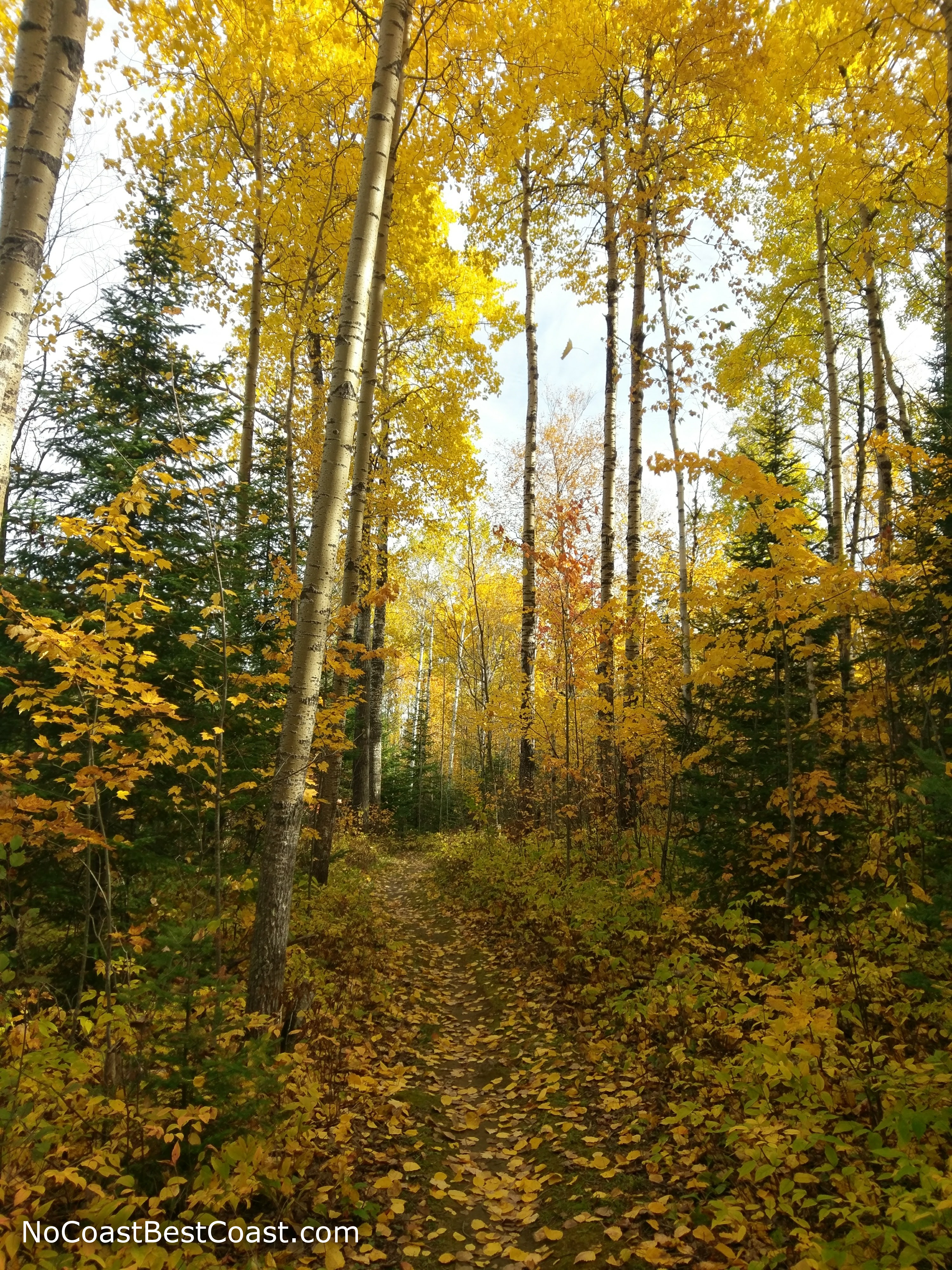
All of the birch trees here make splendid autumn scenery
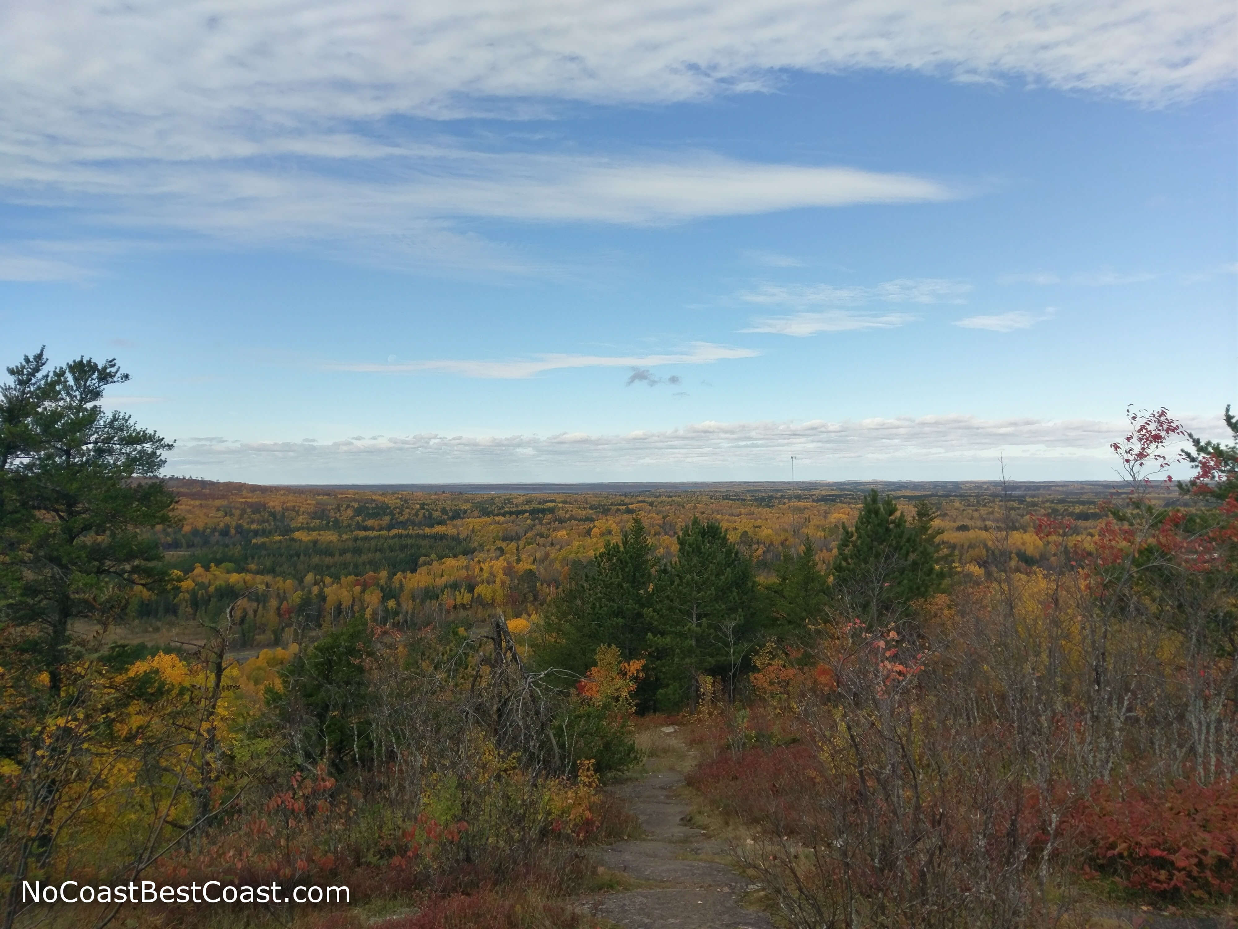
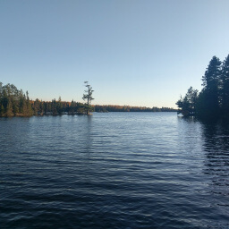
Unlike a typical mountain climb, the end is pretty anticlimactic since the highest point is surrounded by trees and doesn't really feel special. Don't worry though, keep following the road until you are underneath the powerlines. You'll notice that all the trees under the entire length of the powerlines were cut down creating nice little overlooks like in the first picture below. Be sure to check out both sides of the mountain! Looking to the northeast, you can kind of see the Sawtooth Mountains, and to the south you can see Virginia.
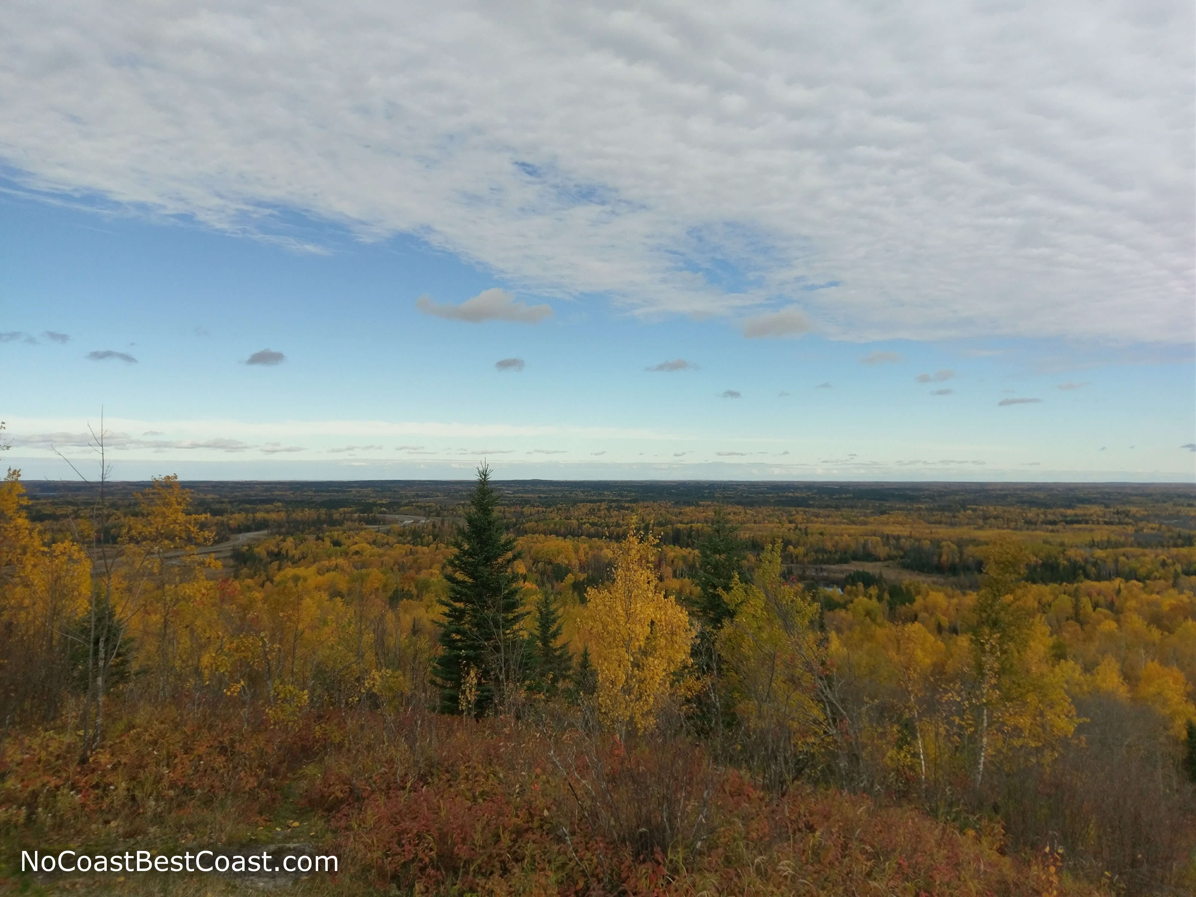
As the highest point around, the views on Lookout Mountain are sweeping
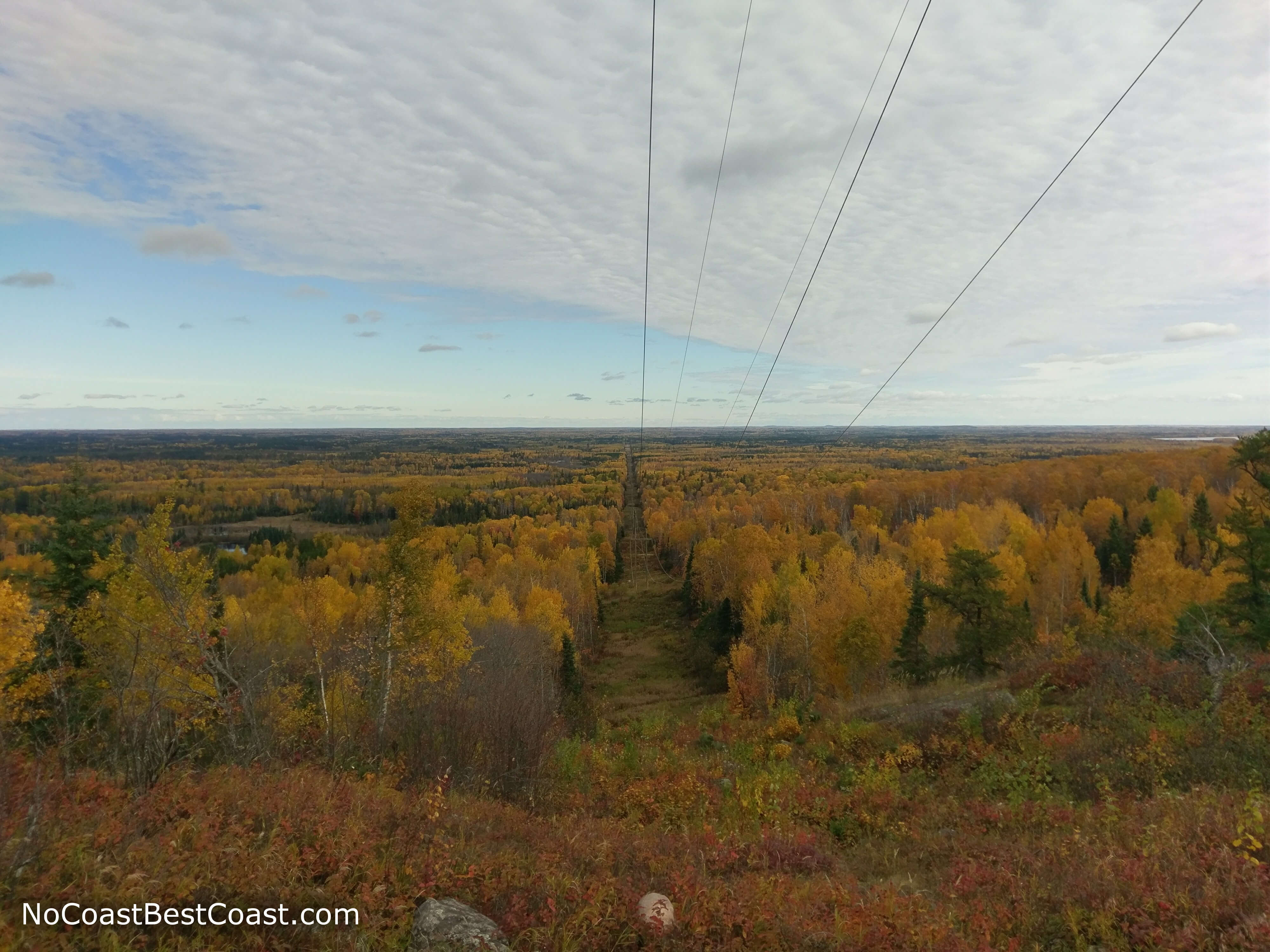
Thanks to the lack of vegetation under these powerlines, you have a wonderful view
Another little overlook on the mountain bike trail
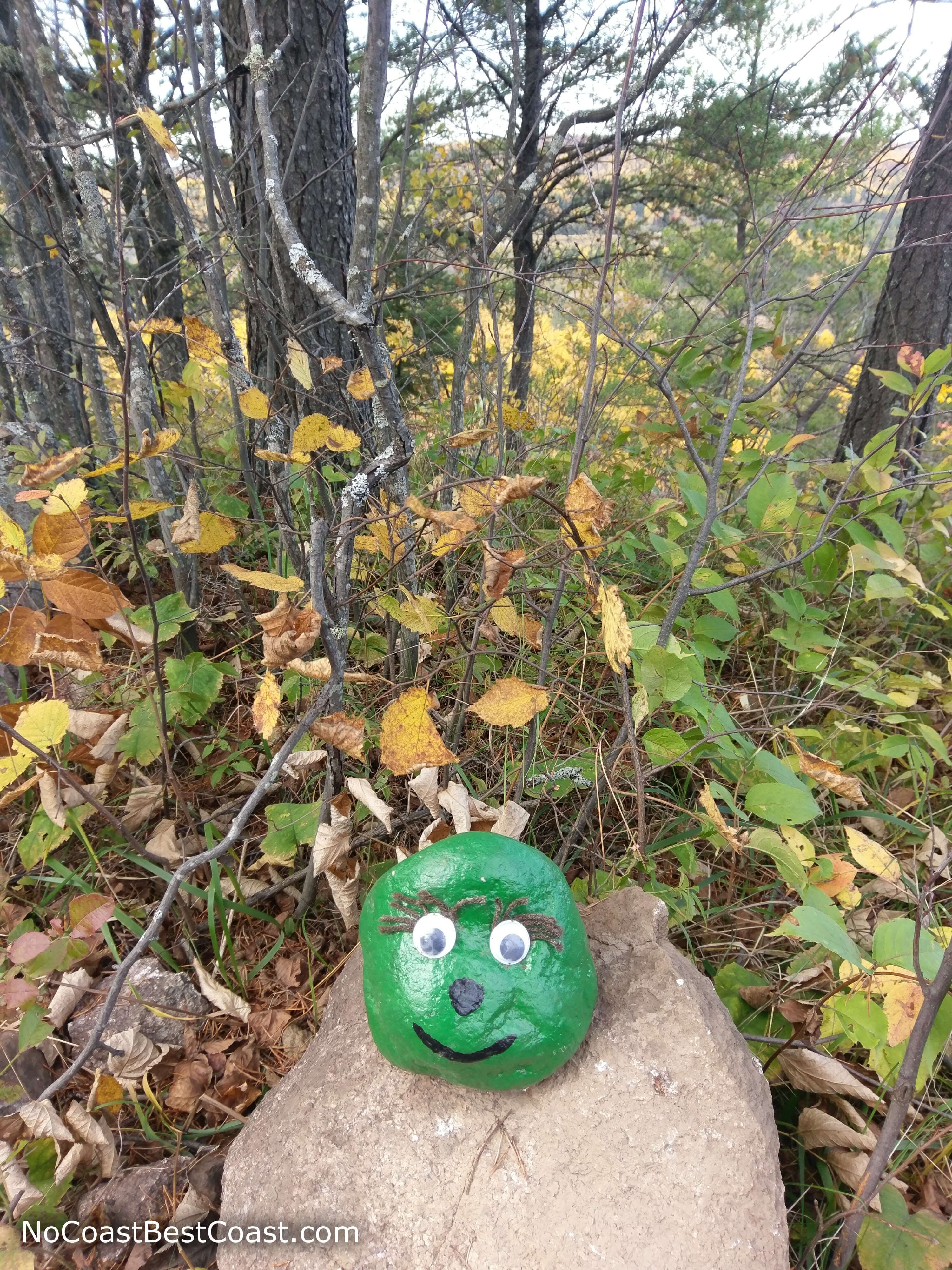
A friendly face painted on a rock greets you on the way down
Hiked on Monday, October 9th, 2017 by Ricky Holzer
Important Information
The Superior National Forest doesn't provide as much information as you might find for a Minnesota State Park. I can't find any rules prohibiting dogs on their website, nor were there any signs on premises, so it's safe to assume dogs are allowed on leash (perhaps even off leash, but it's better to be cautious). While this hike is pretty short, it does require about 300 feet of uphill -- probably too difficult for younger children. Stick to the half mile roundtrip Fitness Trail here if you need a family friendly option. Given the proximity to a large town and easy access via a major highway, I would expect to see plenty of people here on a nice day. I hiked here on a Monday morning and saw a group of photographers and two other lone hikers, but don't expect that few on a weekend.
The trails here are good for hiking for at least the 3 warm seasons, and the trails are groomed for skiing in the winter; however, the Forest Service page does not specify if hiking is permitted on the ski trails during the winter months. Usually people don't like when you walk on their groomed trails, so I'd assume no hiking in winter. If you modify the route to only use the Fitness Trail and the service road, you can do this hike worry-free in winter.
Directions
The trailhead is just north of Virginia, MN off of U.S. Highway 53. Look for a brown sign for the Laurentian Divide Recreation Area and exit the highway. The turnoff is only accessible if you are traveling north on the highway. If you are traveling south, there will be a brown sign indicating a left turn Laurentian Divide Recreation Area followed by a left turn lane; do a U-turn here and look for the entrance to the parking area on the right side.
Google Maps Directions
Parking, Fees, and Facilities
Parking is free! There are pit toilets for use during the warmer months and portable toilets during the colder months as well as a picnic area nearby.
Nearby Hikes
McCarthy Beach State Park, Minnesota
★★★★☆(4/5)
McCarthy Beach State Park, Minnesota
★★★☆☆(3/5)
Bear Head Lake State Park, Minnesota
★★★★☆(4/5)
Scenic State Park, Minnesota
★★★★★(5/5)