| Rating | ★★★★★(5/5) |
| Overall Difficulty | Easy |
| Navigation Difficulty | Easy |
| Distance | 2 miles roundtrip |
| Time | 1 hour |
| Terrain | Hilly |
| Best Seasons | Spring, Fall, Winter |
| Dog Friendly | Yes |
| Accessible | No |
Highlights
- Spectacular badlands rock formations
- Slot canyons to explore
- Historic Civilian Conservation Corps structures
Hike Summary
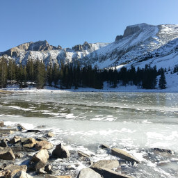
About halfway along the drive from Las Vegas to Great Basin National Park, you'll find this gem of the Nevada State Parks system, Cathedral Gorge State Park -- so named for the unique rock formations evocative of gothic churches. The Miller Point Trail is a short hike through the scenic gorge to the top of the badlands for an amazing top-down view. While you can drive to Miller Point, this is the perfect hike to stretch your legs on a long drive while being introduced to the stunning geology of the park.
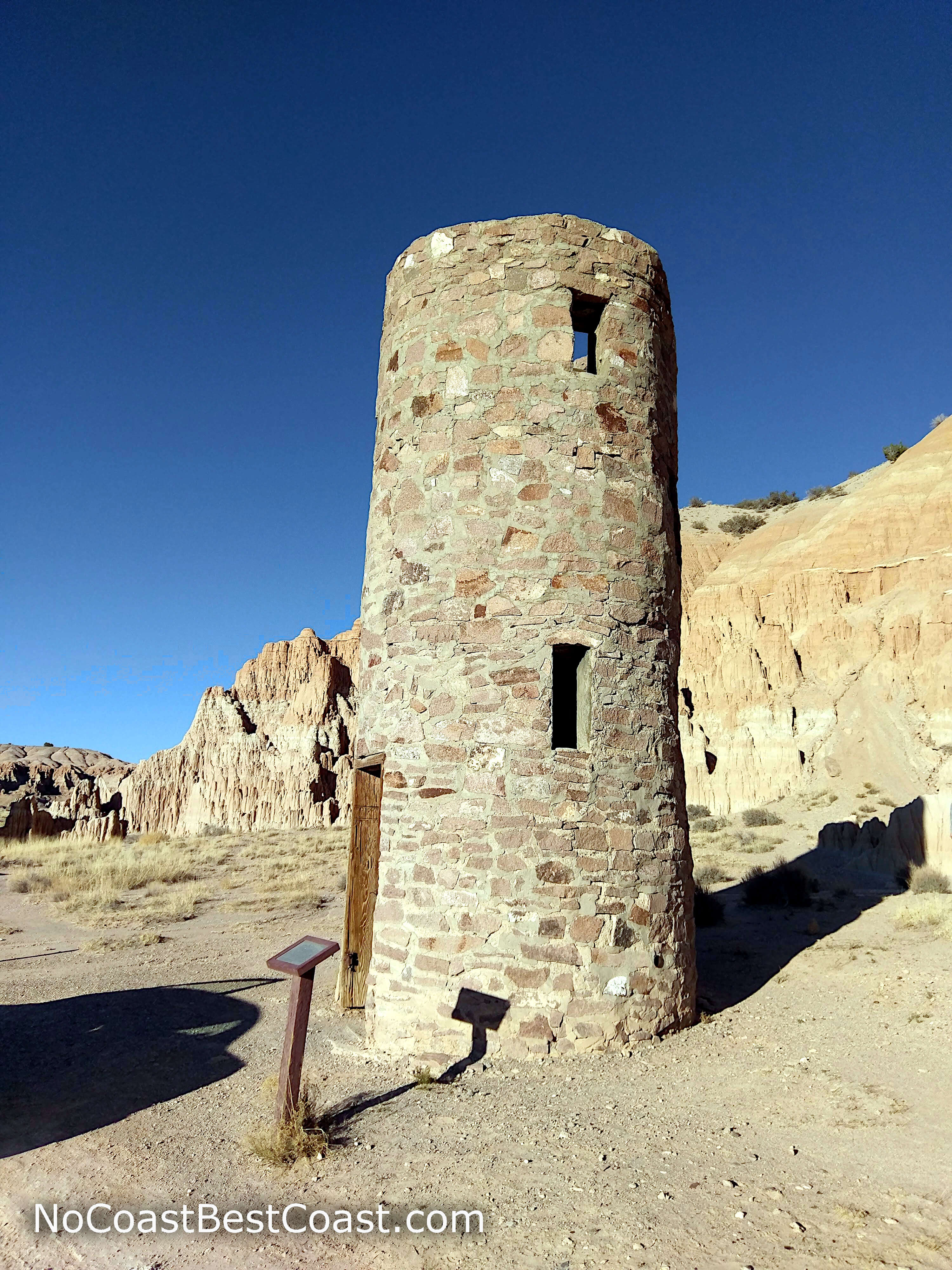
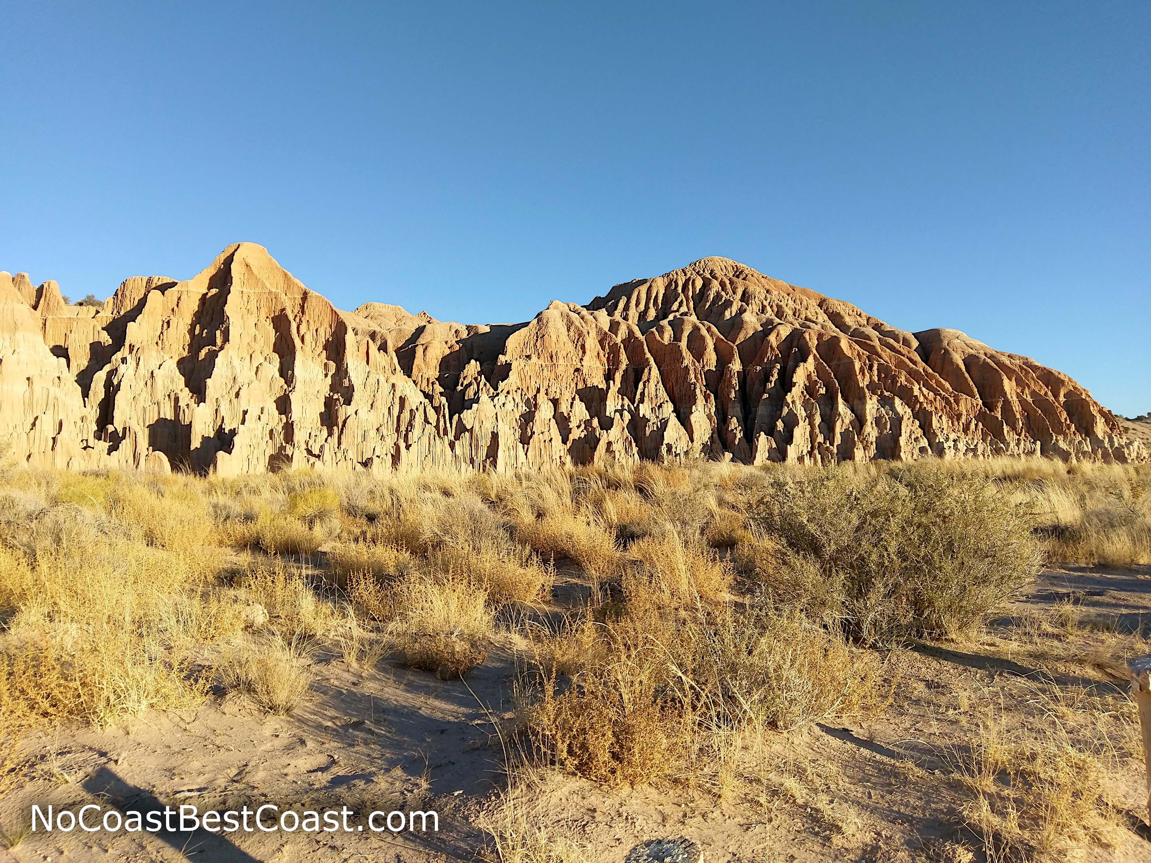
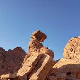
At the start of the trail, you'll see an old stone restroom (in the first picture below) originally constructed by the Civilian Conservation Corps (CCC), a New Deal program that provided jobs during the Great Depression and built much of the nation's park infrastructure. The CCC also built the picnic facilities you passed; the fact that they're still in use despite being over 80 years old is a testament to their sturdy construction. As you continue along the trail, you'll pass some of the grand rock formations the park is known for on your right side, shown in the second picture below.
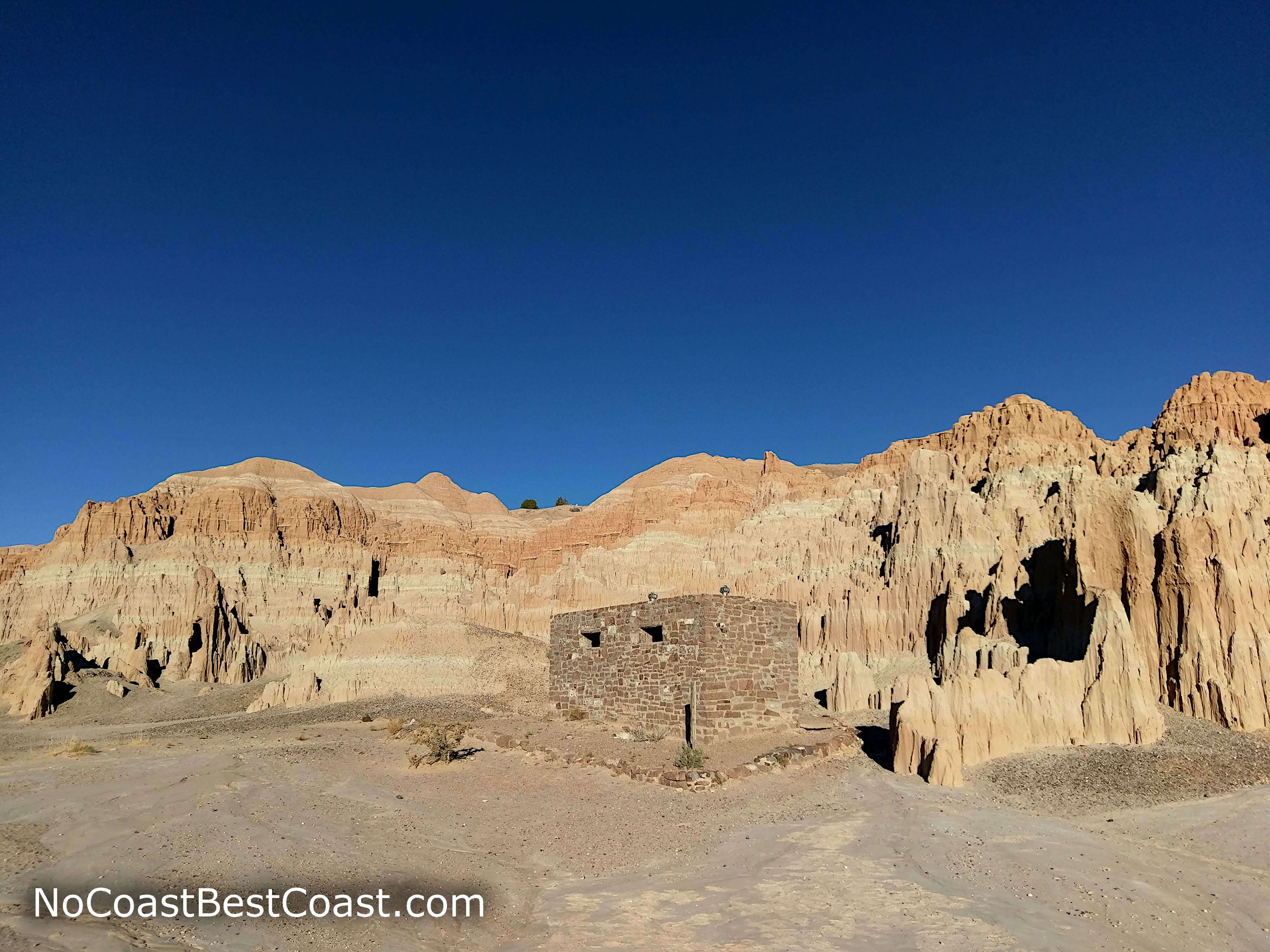
The remnants of a stone restroom constructed by the Depression Era Civilian Conservation Corps
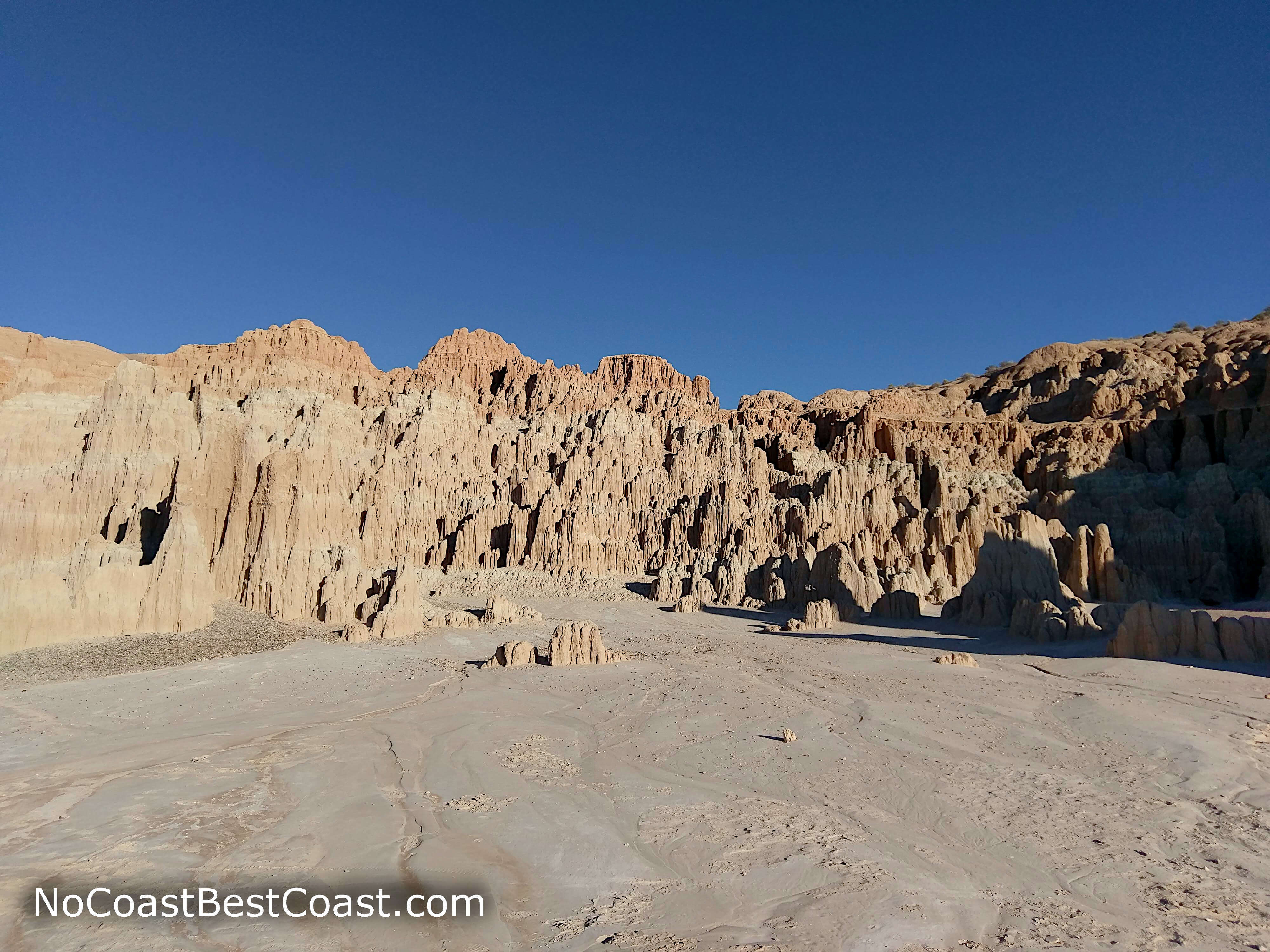
Rock formations to the right of the trailhead
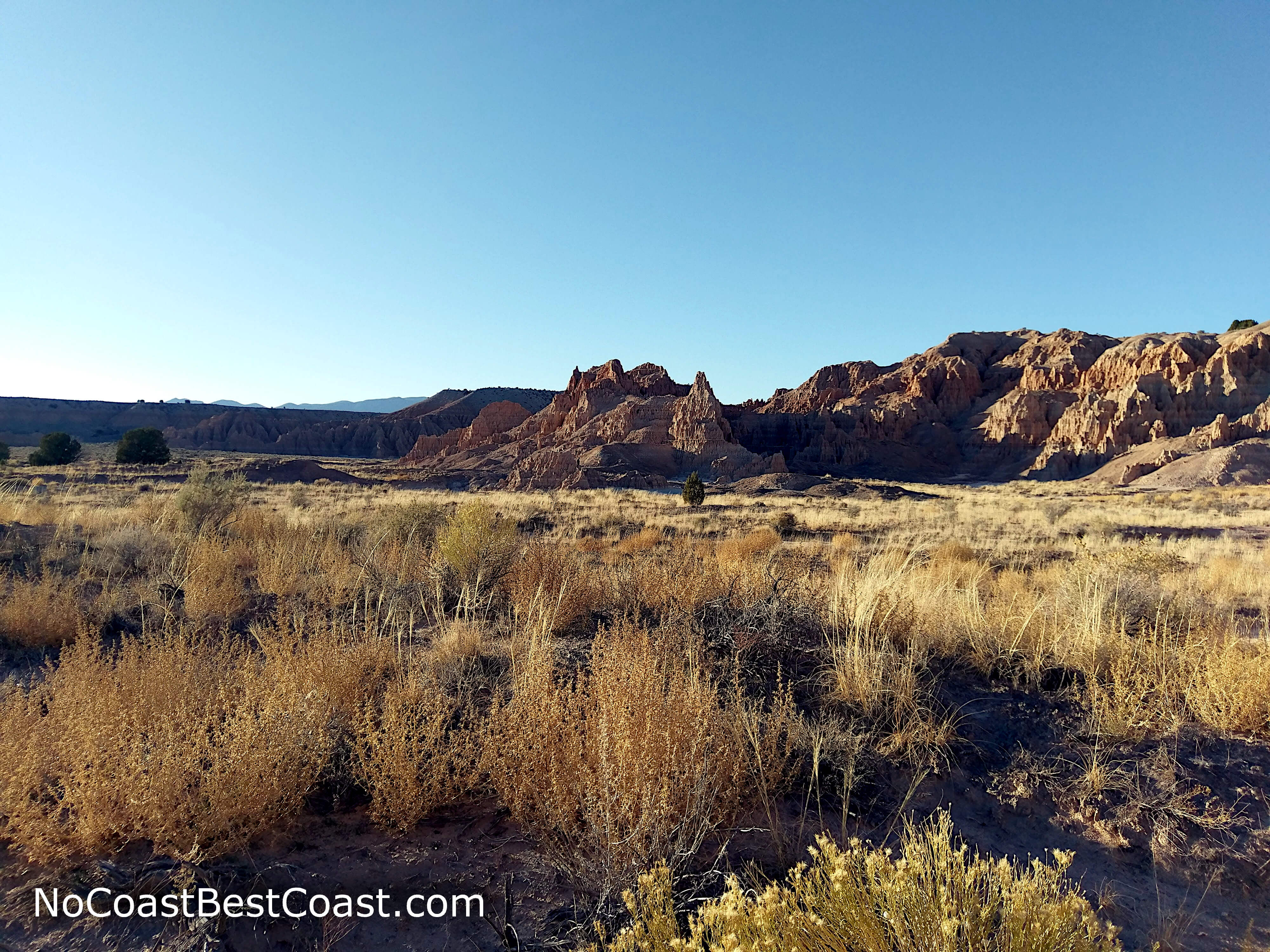
Cathedral-like rocks in the distance
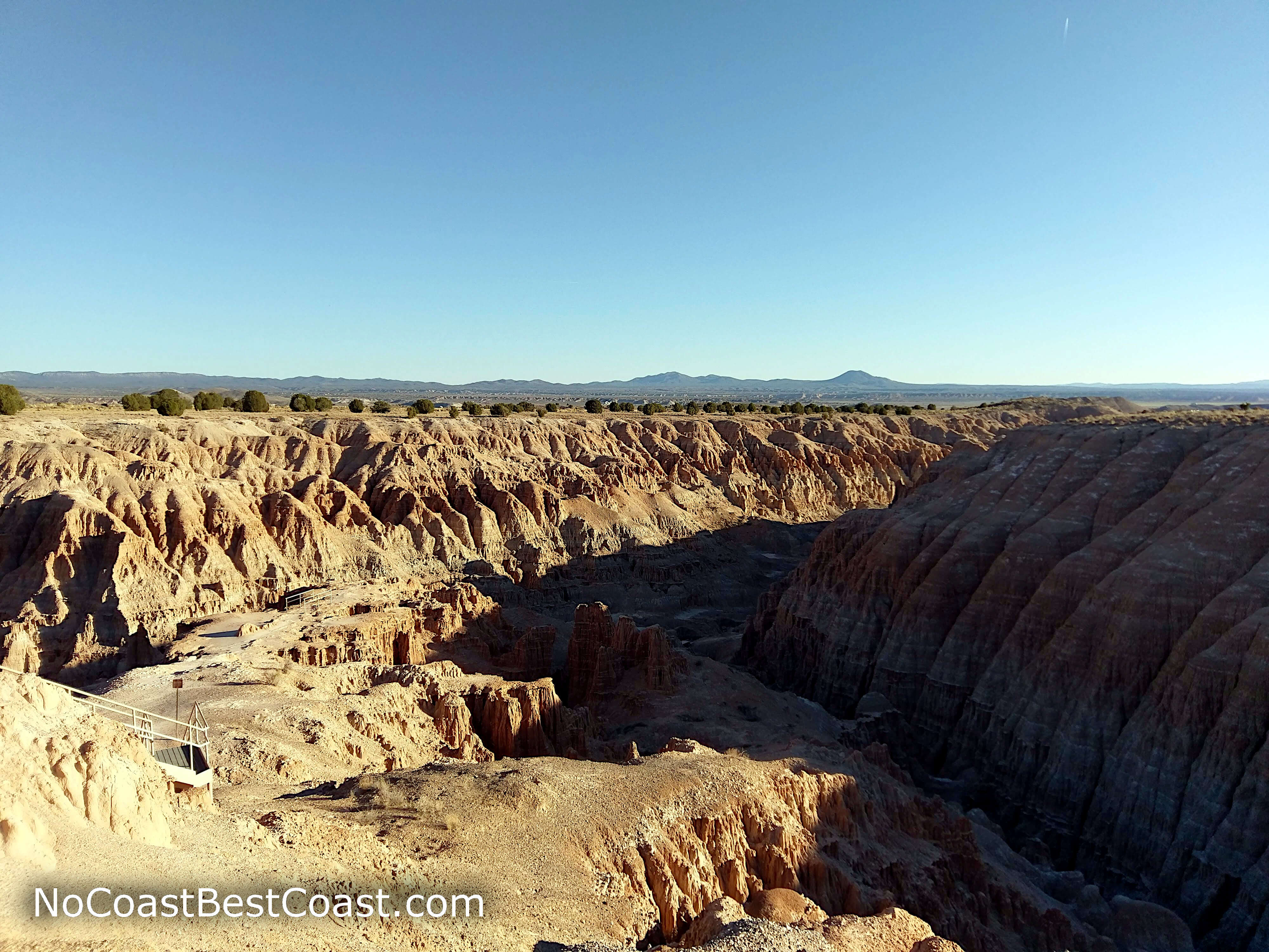
The view of the gorge from Miller Point
A stone water tower built by the Civilian Conservation Corps
The badlands of Canyon Caves from the road
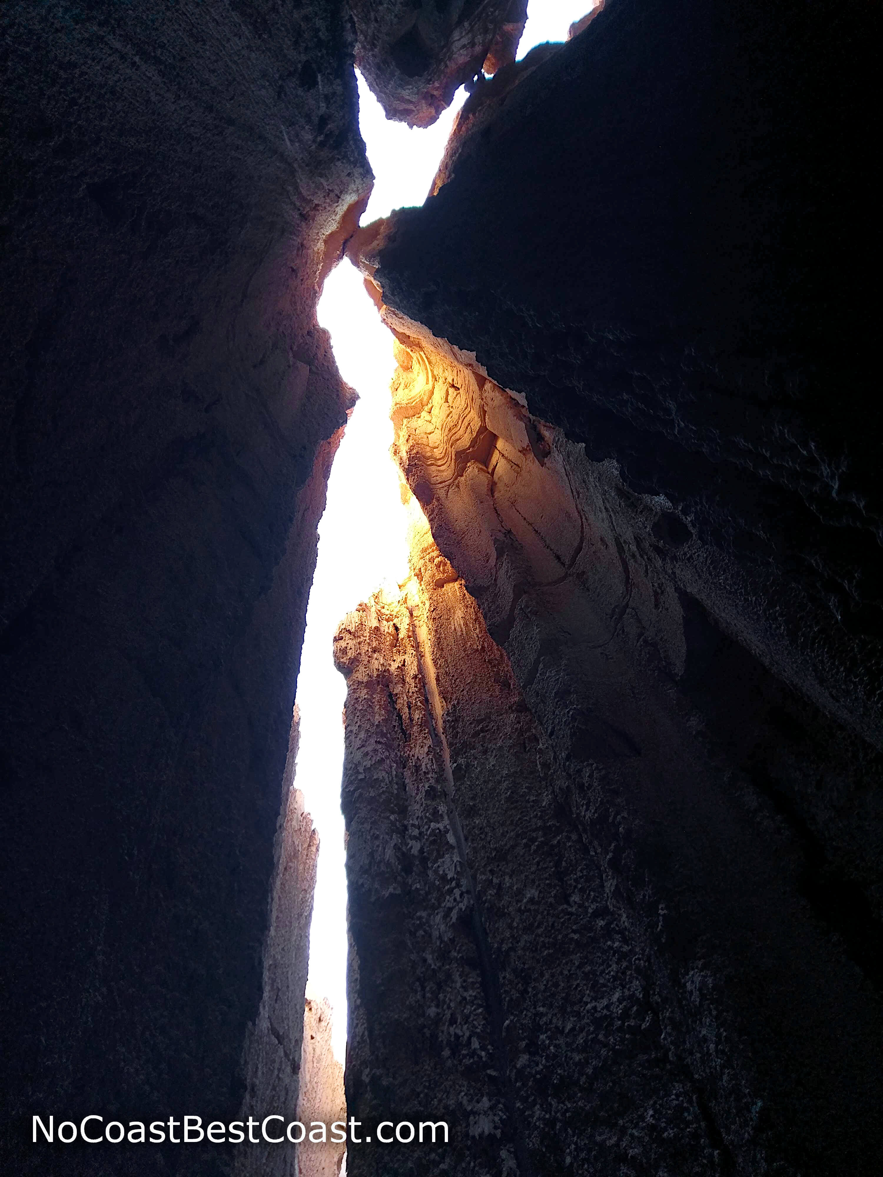
Inside the narrow passages of Canyon Caves
Hiked on Saturday, November 10th, 2018 by Ricky Holzer
Important Information
Dogs are allowed on leash. This is short, fun hike for kids especially because of the narrow slot canyons to explore on the side of the trail. Fall, spring, and winter are the best seasons to visit due to the extreme heat of Great Basin summers. The park's location along a major highway makes it an easy stop for road-trippers, but it's far enough away from any major population center that it won't be crowded.
Directions
From Las Vegas, take Interstate 15 north to U.S. Highway 93 heading north. After about 2 and a half hours, you'll reach the entrance to the park in Panaca. Turn left onto the park's main road and continue straight as it turns to dirt. Park where the road ends.
Google Maps Directions
Parking, Fees, and Facilities
Parking is $5 payable in cash only at the self-service kiosk. Vehicles without the stub displayed will be ticketed. Annual permits are available if you frequently visit Nevada State Parks; visit the Annual Permits webpage for more information. There are pit toilets and picnic tables near this parking area.
Nearby Hikes
Great Basin National Park, Nevada
★★★★★(5/5)
Great Basin National Park, Nevada
★★★☆☆(3/5)
Valley of Fire State Park, Nevada
★★★☆☆(3/5)