| Rating | ★★★☆☆(3/5) |
| Overall Difficulty | Moderate |
| Navigation Difficulty | Easy |
| Distance | 2.5 miles roundtrip |
| Time | 1.5 hours |
| Terrain | Hilly |
| Best Seasons | Spring, Summer, Fall |
| Dog Friendly | No |
| Accessible | No |
Highlights
- Views of Wheeler Peak
- Scenic alpine lake and forest
Hike Summary
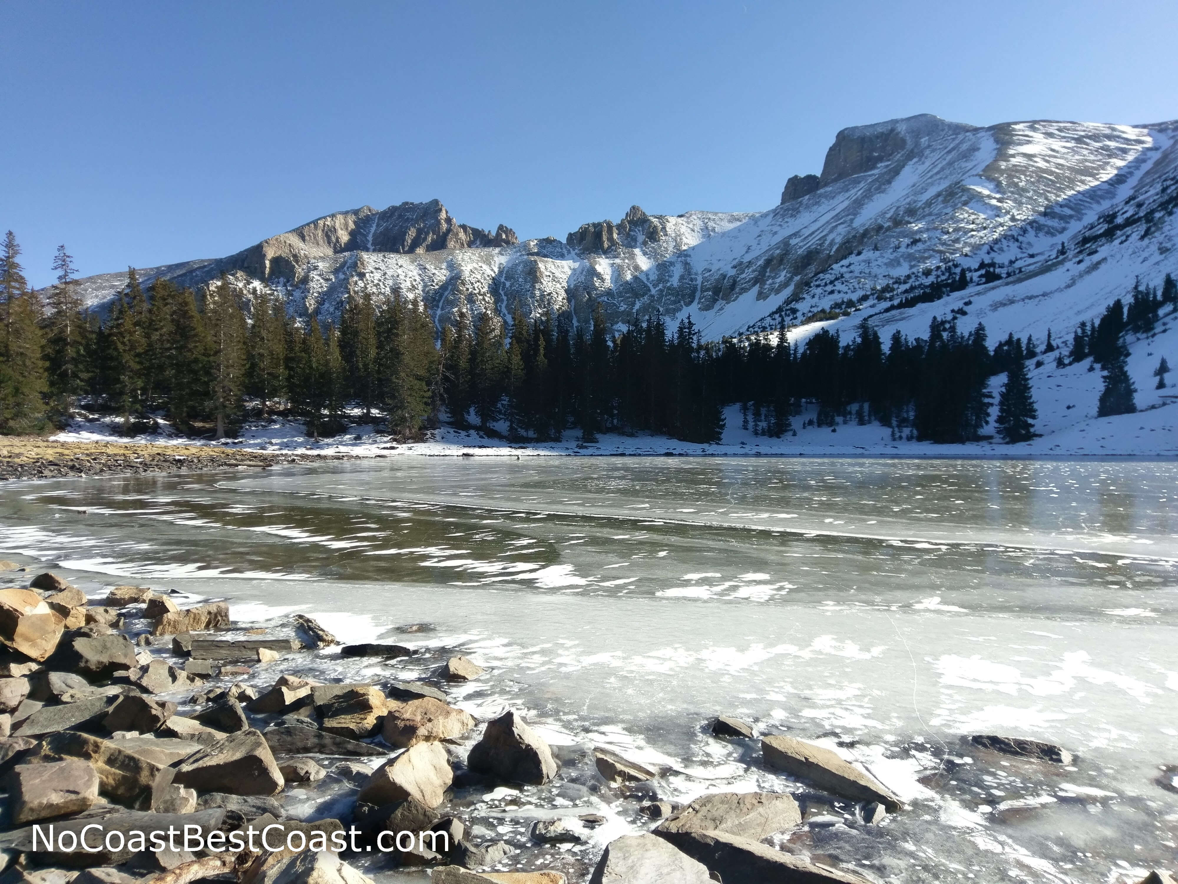
Stella Lake is a beautifully clear alpine lake below Wheeler Peak. The main reasons for hiking this route to Stella Lake are: 1) the road is closed past the Summit Trail parking area, 2) you don't have the stamina to hike the steeper, longer route on the Alpine Lakes Trail, or 3) you're attempting to summit Wheeler Peak and want a scenic break spot. (I myself fell under that last category except I failed to reach the summit -- as you can see in the pictures, Stella Lake was frozen solid at 10,000 feet and I was close to frozen solid one thousand feet higher). If none of those apply to you, I highly suggest doing the more scenic but longer Alpine Lakes Loop starting from the Bristlecone Parking Lot. In any case, this is an easy way to step away from the park's road and see the wilderness of Great Basin National Park firsthand.
Following the trail is easy, you just stay straight for about a mile until you reach the trail junctions with signs pointing you to Stella Lake. Over the course of a little over a mile, you'll only gain about 200 feet of elevation, an extremely gradual grade. However, it's important to note the trailhead starts at around 10,000 feet above sea level. Whether you've spent a night nearby in Baker or Ely or just drove the long distance from Las Vegas or Salt Lake City, you should be decently acclimated for this hike. But if you start feeling dizzy or lightheaded or get a headache, take a break and drink some water; if the symptoms persist, you may have altitude sickness which is easily cured by driving back down the mountain.
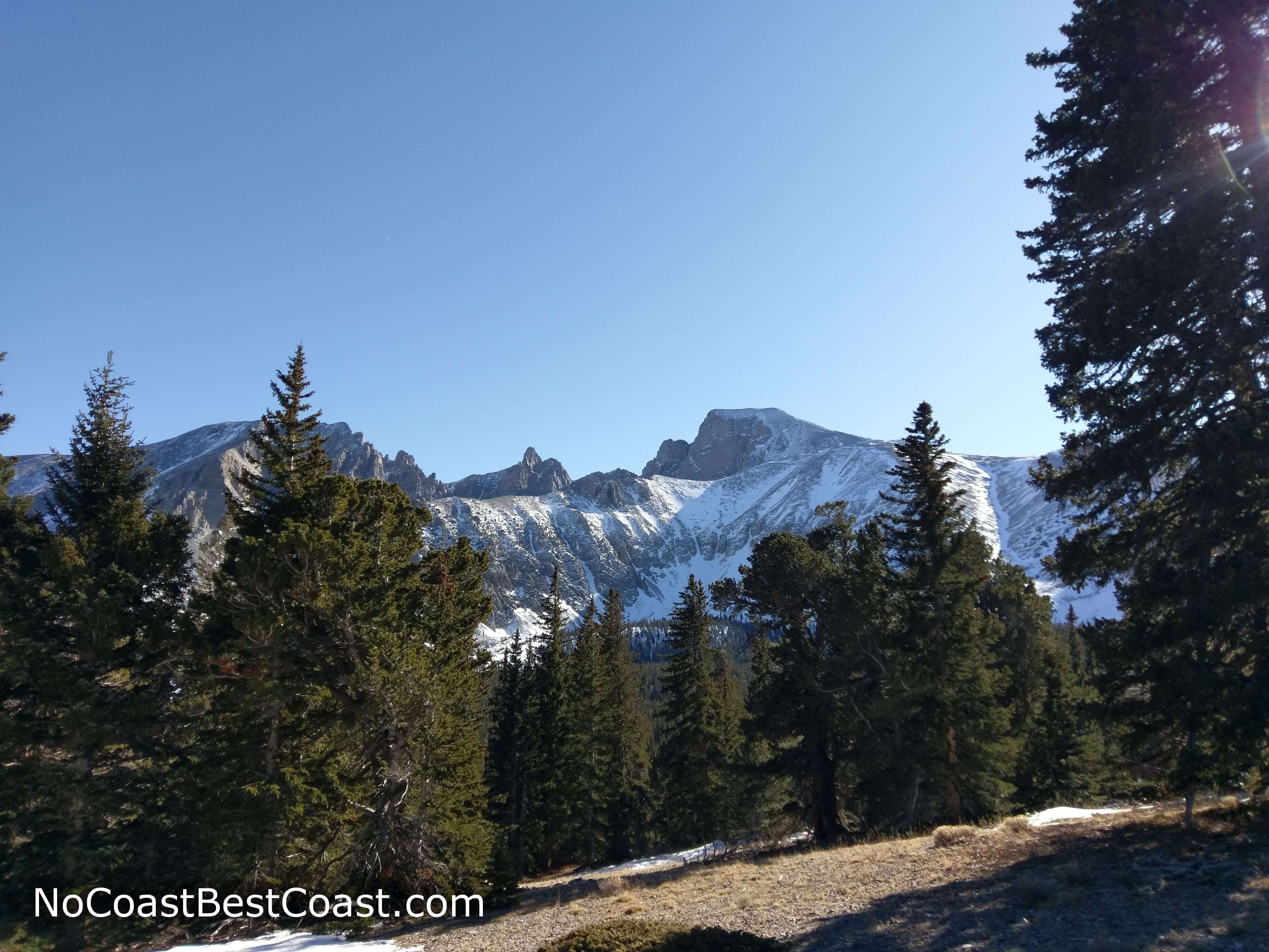
Along the journey to Stella Lake, you'll be walking through pine forest with occasional aspen groves (beautiful in early fall!). The elevation is just high enough that you may see some of the famous Bristlecone pines the park is known for, although I cannot verify this since I forgot the difference between Bristlecone and Limber pines once in the wilderness. The trail is nicely shaded most of the time, and breaks in the trees will grant you fantastic views of Wheeler Peak, as pictured below.
Hiked on Sunday, November 11th, 2018 by Ricky Holzer
Important Information
Dogs are not allowed on trails in Great Basin National Park. This gradually sloping trail with a solid destination is good for kids, though if the 2.5-mile roundtrip distance is too much, try the nature trails around the visitor center. Stick to hiking here in the three warmer seasons, since the road to the trailhead is closed in winter and early spring due to snow and ice. While the park's remoteness deters most of the crowds in other national parks, this is one of the more popular trailheads due to the allure of climbing Wheeler Peak.
Directions
From Baker, take Nevada Highway 488 towards Great Basin National Park. Once in the park, turn right onto Wheeler Peak Scenic Drive -- if you go straight, you'll dead end at the visitor center. Continue up the winding mountain road (and be sure to stop at the several scenic overlooks along the way!). In winter, this road is likely to be closed. Park at the Summit Trail parking area, a pullout on the right side of the road.
Google Maps Directions
Parking, Fees, and Facilities
Unlike most other national parks, there is no vehicle entrance fee at Great Basin National Park. This parking lot has about 20 spaces in it, and you'll be competing for spots with those trying to summit Wheeler Peak. If completely full, you can also drive to the larger Bristlecone Parking Lot further down the road, but you'll have to hike the Alpine Lakes Loop Trail instead to reach Stella Lake. There are no facilities at this lot.
Nearby Hikes

Great Basin National Park, Nevada
★★★★★(5/5)

Cathedral Gorge State Park, Nevada
★★★★★(5/5)

