| Rating | ★★★★★(5/5) |
| Overall Difficulty | Easy |
| Navigation Difficulty | Easy |
| Distance | 2.5 miles roundtrip |
| Time | 1.5 hours |
| Terrain | Mostly flat |
| Best Seasons | Spring, Summer, Fall |
| Dog Friendly | Yes |
| Accessible | No |
Highlights
- Three stunning waterfalls
- Explore Presque Isle
- Relax on the shore of Lake Superior
Hike Summary
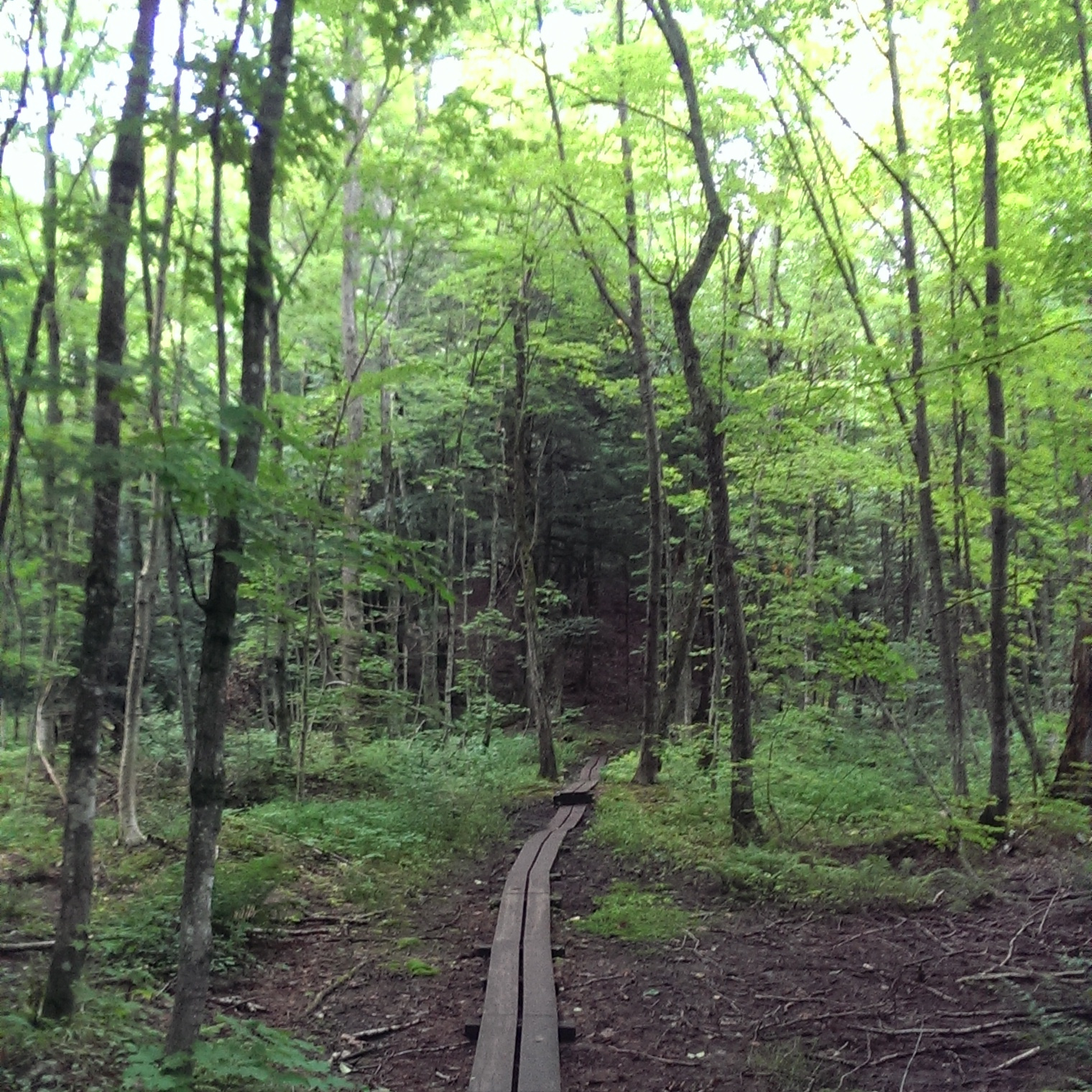
This is a great introductory hike to the Porcupine Mountains Wilderness, with a distance short enough to be suitable for any age. Presque Isle provides a good opportunity for exploring, with many short trails weaving through the woods and small rock formations for climbing over. Dogs are allowed on leash, although they are prohibited on beaches.
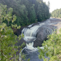
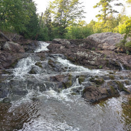
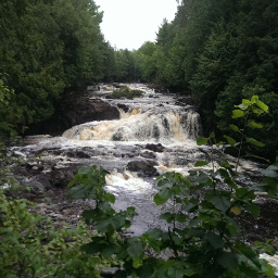
The trailhead starts at the parking lot and heads in one direction. At the first fork, follow the trail to the right so you can see the three waterfalls. Soon you will see wooden steps leading down to the viewing area for Manido Falls. After marveling at the falls, continue following the trail upstream, and eventually you will see Nawadaha Falls on the left. Once you've seen enough of the falls, turn around and retrace your steps. At the junction just past Manido Falls, head to the right. In a bit, you will see Manabezho Falls on the right.
Continue on the trail heading downstream, then cross a short footbridge onto Presque Isle. Feel free to ramble around the island and explore! Wander down to the shore of Lake Superior (pictured below) when you want a break, and you can relax on the rocky beach, eat a snack or lunch, and contemplate the size of the lake. When you're ready to go home, just retrace your steps back to the parking lot. If you are spending another day in the park or are looking for a more challenging hike, check out Summit Peak and Mirror Lake Loop!
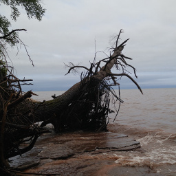
On the shore of Lake Superior.
View full size
Hiked on Saturday, August 13th, 2016 by Ricky Holzer
Directions
The Porcupine Mountains are in a remote part of the Upper Peninsula of Michigan, so be prepared for a long drive. Although this hike is on the west side of the park, enter the park from the east so you can pay the fee at the Park Headquarters. Take Michigan Highway 64 north to Silver City, then turn left on Lincoln St (107th Engineers Memorial Highway). Turn left on Boundary Road and look for a sign for the Park Headquarters. Turn right onto Headquarters Rd, pay your fee, then return to Boundary Rd and turn right. Now enjoy a long drive on a winding road through the wilderness. You will cross a bridge over Presque Isle River, then there will be a stop sign. Turn right and continue down the road until you see the parking lot on the right side.
Google Maps Directions
Parking, Fees, and Facilities
Stop by the Vistor Center and Park Headquarters to pay the vehicle fee. Michigan residents can purchase a Recreation Passport for $11, and it is good for an entire year. Non-residents may purchase a daily pass for $9, or an annual pass for $32. More details here.
Nearby Hikes
Ottawa National Forest, Michigan
★★★★★(5/5)
Porcupine Mountains Wilderness State Park, Michigan
★★★★☆(4/5)
Ottawa National Forest, Michigan
★★★★★(5/5)
Copper Falls State Park, Wisconsin
★★★★★(5/5)