| Rating | ★★★★☆(4/5) |
| Overall Difficulty | Easy |
| Navigation Difficulty | Easy |
| Distance | 2.3 miles roundtrip |
| Time | 1.5 hours |
| Terrain | Hilly |
| Best Seasons | Spring, Fall, Winter |
| Dog Friendly | No |
| Accessible | Yes |
Highlights
- Two naturally occurring springs
- Views of the Guadalupe Mountains and Chihuahuan Desert
Hike Summary
The Smith Spring Trail is no doubt the best easy trail in Guadalupe Mountains National Park. Not only will you see two rare desert water sources, you'll also experience the shift from desert to riparian landscape all while enjoying beautiful views of the Guadalupe Mountains and Chihuahuan Desert. Whether you only have time for one trail or if you're looking for a warm-up to introduce you to the fantastic wilderness in the park, this trail is a winner!
The trail starts as an accessible paved path passing the Frijole Ranch Cultural Museum, pictured below. Inside the original ranch structures you can learn about the human history of the Guadalupe Mountains from initial Native American life to early ranchers to becoming a national park -- the complex was closed when I visited due to dangerous trees and high winds, but hopefully it will be open when you visit. The two springs you'll visit on this hike are the main reason anyone could survive in the harsh desert conditions and why Frijole Ranch was built here in the first place.
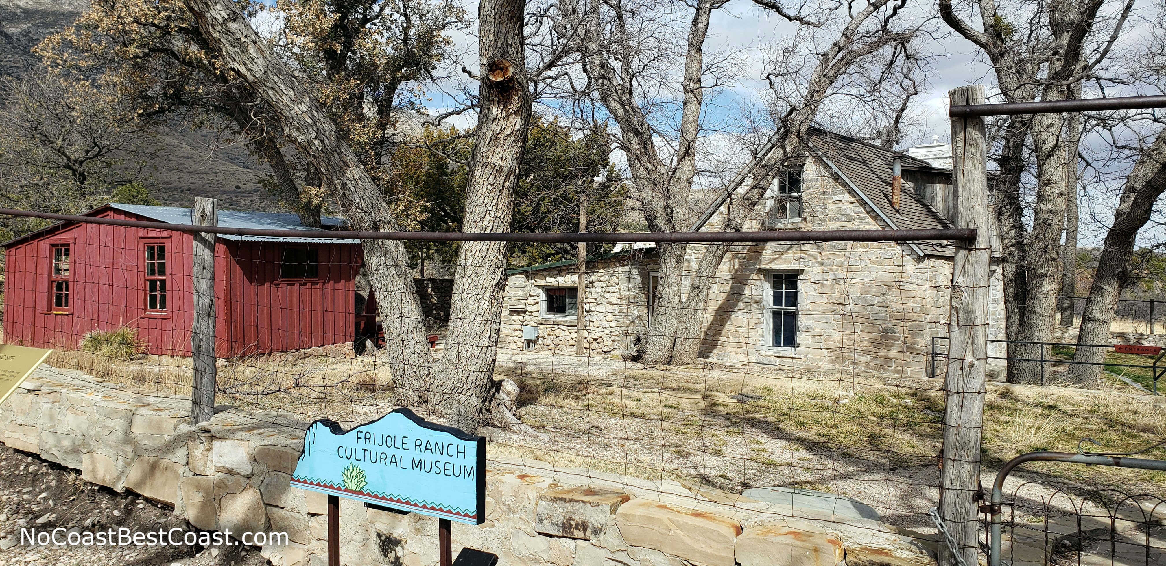
Historic buildings at the Frijole Ranch Cultural Museum
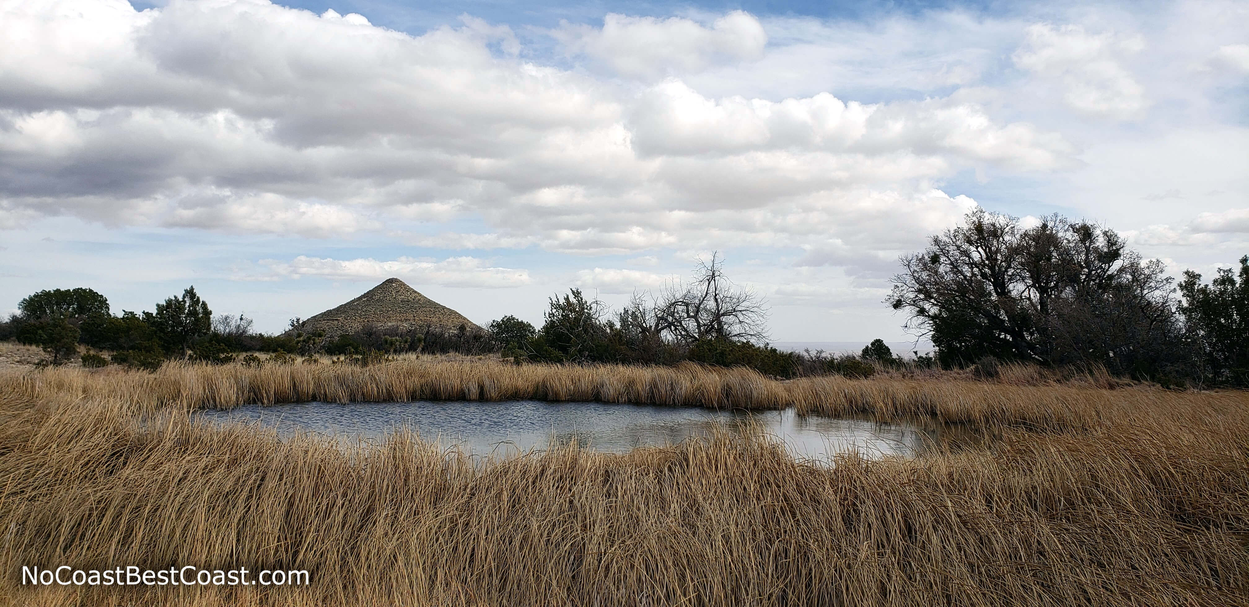
Manzanita Spring with Nipple Hill in the background
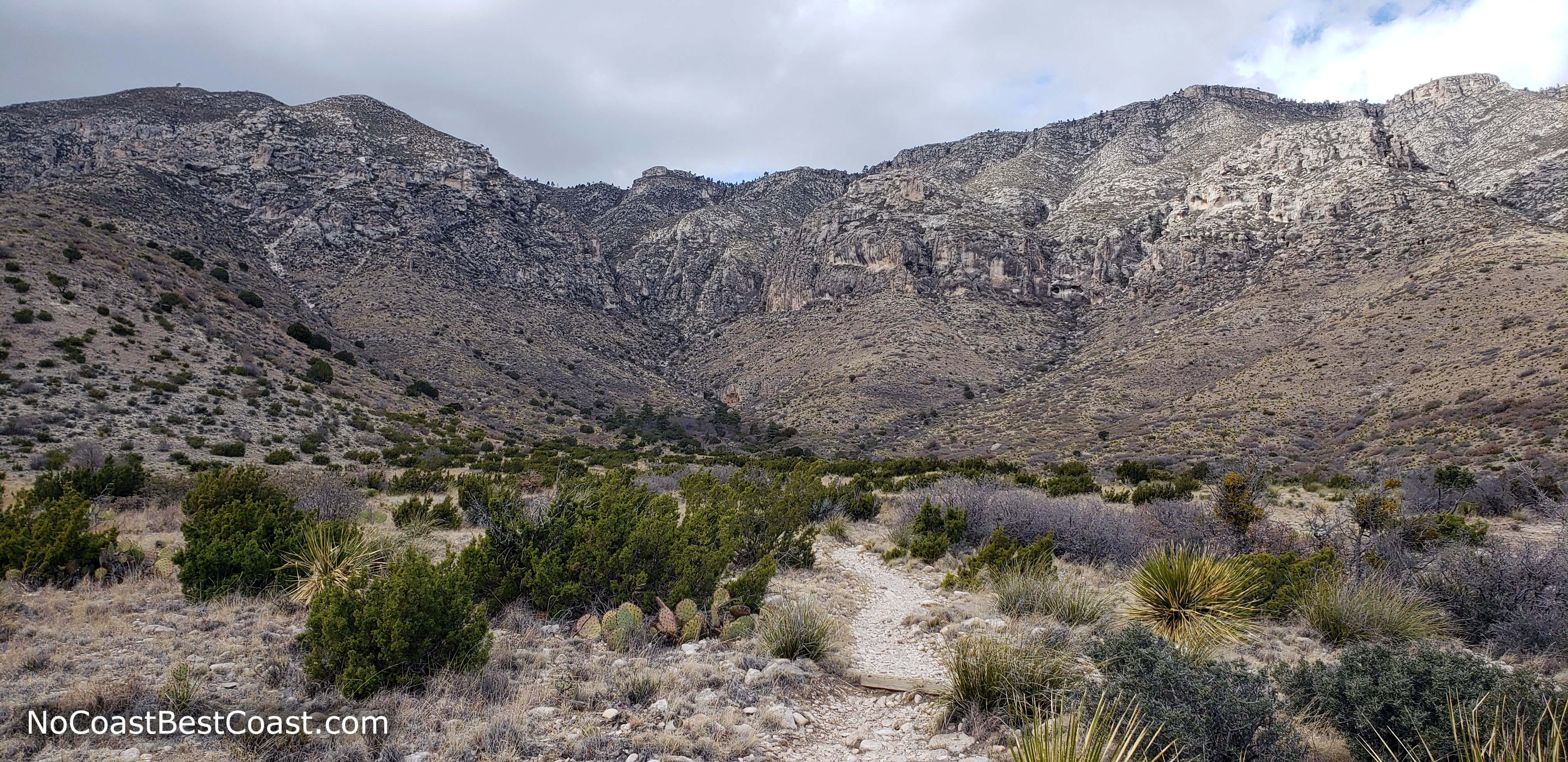
The trail as it heads towards the base of the Guadalupe Mountains
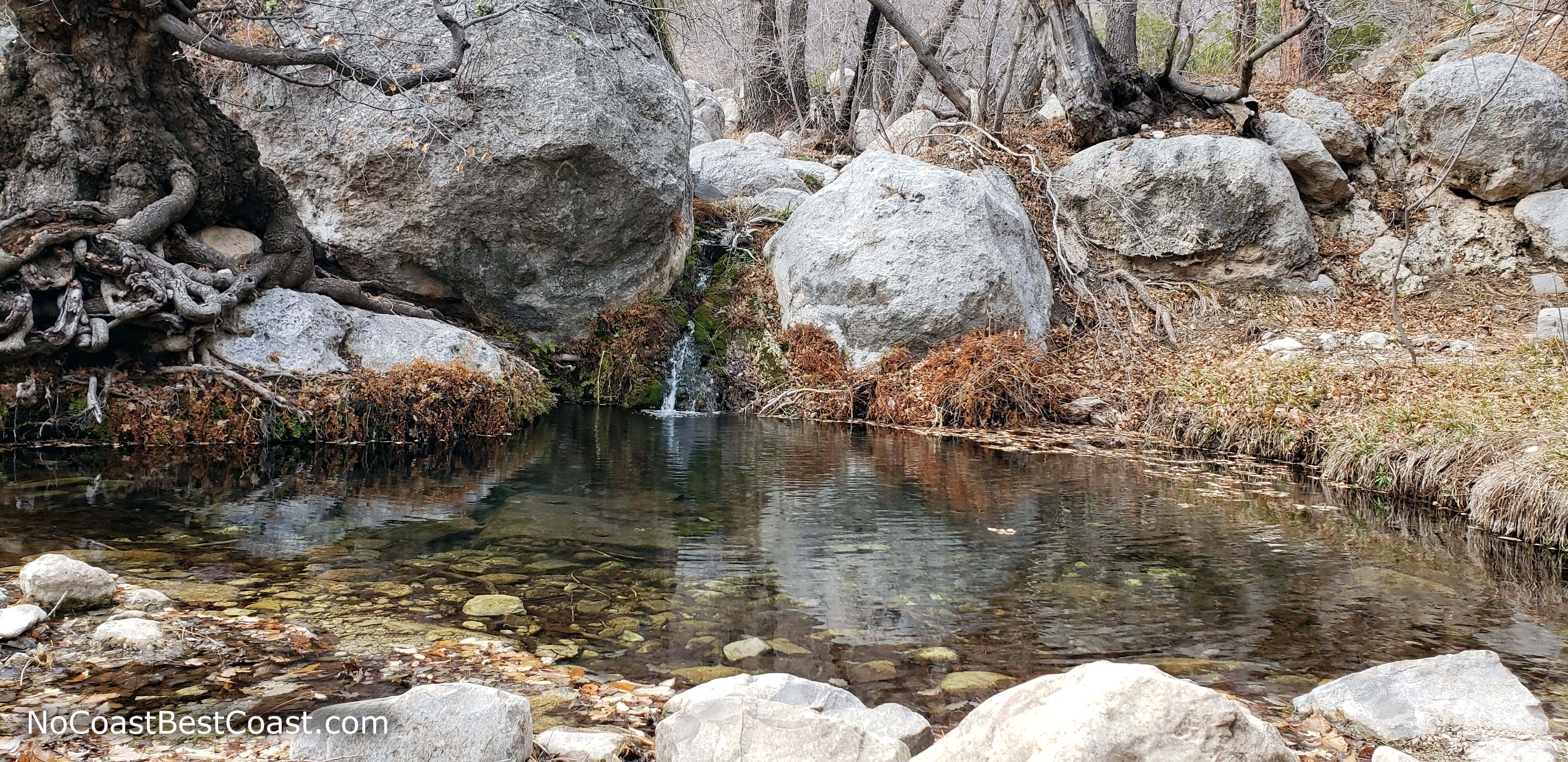
A small waterfall feeding Smith Spring
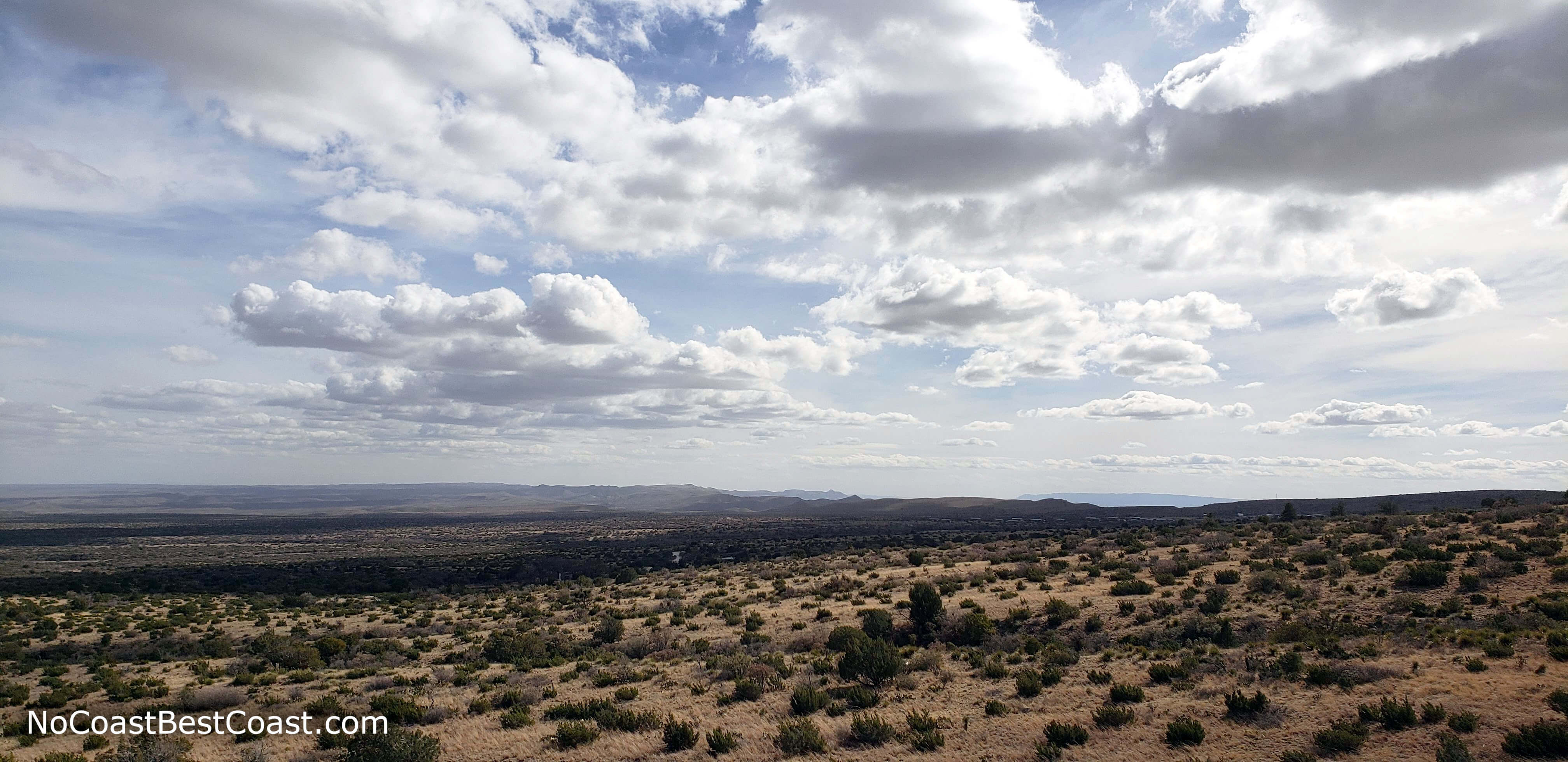
Puffy clouds cast shadows on the vast desert
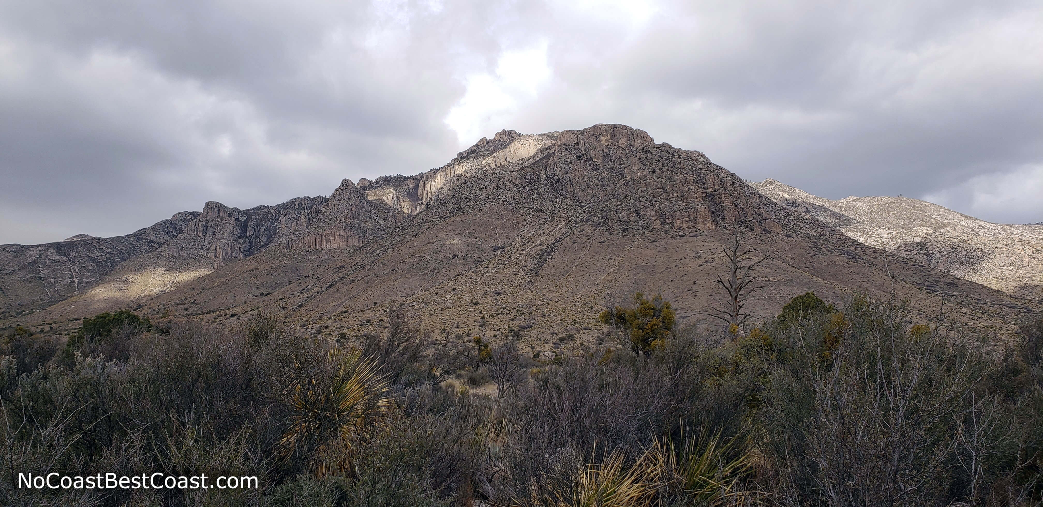
The Guadalupe Mountains tower thousands of feet above you
Hiked on Friday, February 15th, 2019 by Ricky Holzer
Important Information
As with most national parks, dogs are prohibited on all trails. This is one of the best family friendly hikes in the park: the trail is short with interesting scenery and set destinations to keep everyone engaged. The portion of the trail from the parking lot to Manzanita Spring is paved and designated wheelchair accessible. The best seasons for hiking here are fall, winter, and spring since summer temperatures in the desert are hot and shade is minimal on this trail. Regardless of the season, wear sun protection and bring plenty of water -- the springs' water is not drinkable. As one of the best short hikes in the park, this trail is popular, especially on weekends.
Directions
From El Paso, take U.S. Highway 62/180 (Montana Avenue) east. After an hour and a half or so, you'll reach Guadalupe Mountains National Park.turn left on Pine Canyon Drive for the Guadalupe Mountains National Park visitor center. If you need to pay the entrance fee with card, turn left on Pine Canyon Drive to stop by the visitor center; otherwise continue straight, turn left onto Frijole Ranch Road, and park in the lot at the end of the short dirt road.
Google Maps Directions
Parking, Fees, and Facilities
Park entrance fees are $7 per person aged 16 and older and are valid for 7 days. Fees are payable either at the trailhead in cash only using provided envelopes or at the visitor center using card or cash. Annual passes for Guadalupe Mountains National Park are available for $30 and admit the pass holder plus 3 others. All interagency passes are also accepted and admit the pass holder plus 3 people. More information about fees and passes is available on the park's website. Park staff regularly patrol the lot, so don't forget to pay your fee!
There are pit toilets and picnic shelters near the lot.
Nearby Hikes
Guadalupe Mountains National Park, Texas
★★★★★(5/5)
Guadalupe Mountains National Park, Texas
★★★★☆(4/5)
Carlsbad Caverns National Park, New Mexico
★★★★★(5/5)
Carlsbad Caverns National Park, New Mexico
★★★★★(5/5)