| Rating | ★★★★☆(4/5) |
| Overall Difficulty | Moderate |
| Navigation Difficulty | Easy |
| Distance | 5.6 miles roundtrip |
| Time | 3 hours |
| Terrain | Strenuous climbing, 1500 feet of elevation gain |
| Best Seasons | All |
| Dog Friendly | Yes |
| Accessible | No |
Highlights
- Massive three-tiered waterfall
- Views of the Skykomish River Valley
Hike Summary
Seattle is known for its rain, but the weather doesn't have to prevent you from hiking. There is an abundance of waterfall hikes in the Pacific Northwest, and in my opinion, those hikes are better in the rain. Not only does the rain somewhat reduce the amount of people on trail, it also means temperatures are cool, the bugs disappear, and the scenery is perfectly moody -- mist and fog make waterfalls even more magical. But no matter the weather, there is a reason Wallace Falls is one of the most popular hikes in Washington.
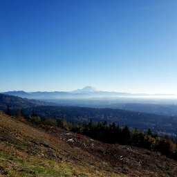
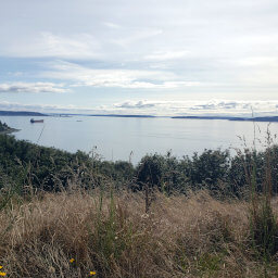
The trail starts like most hikes in this region, cutting through a dense forest with a bit of uphill. Some powerlines yield some views of the surrounding area, as pictured below.
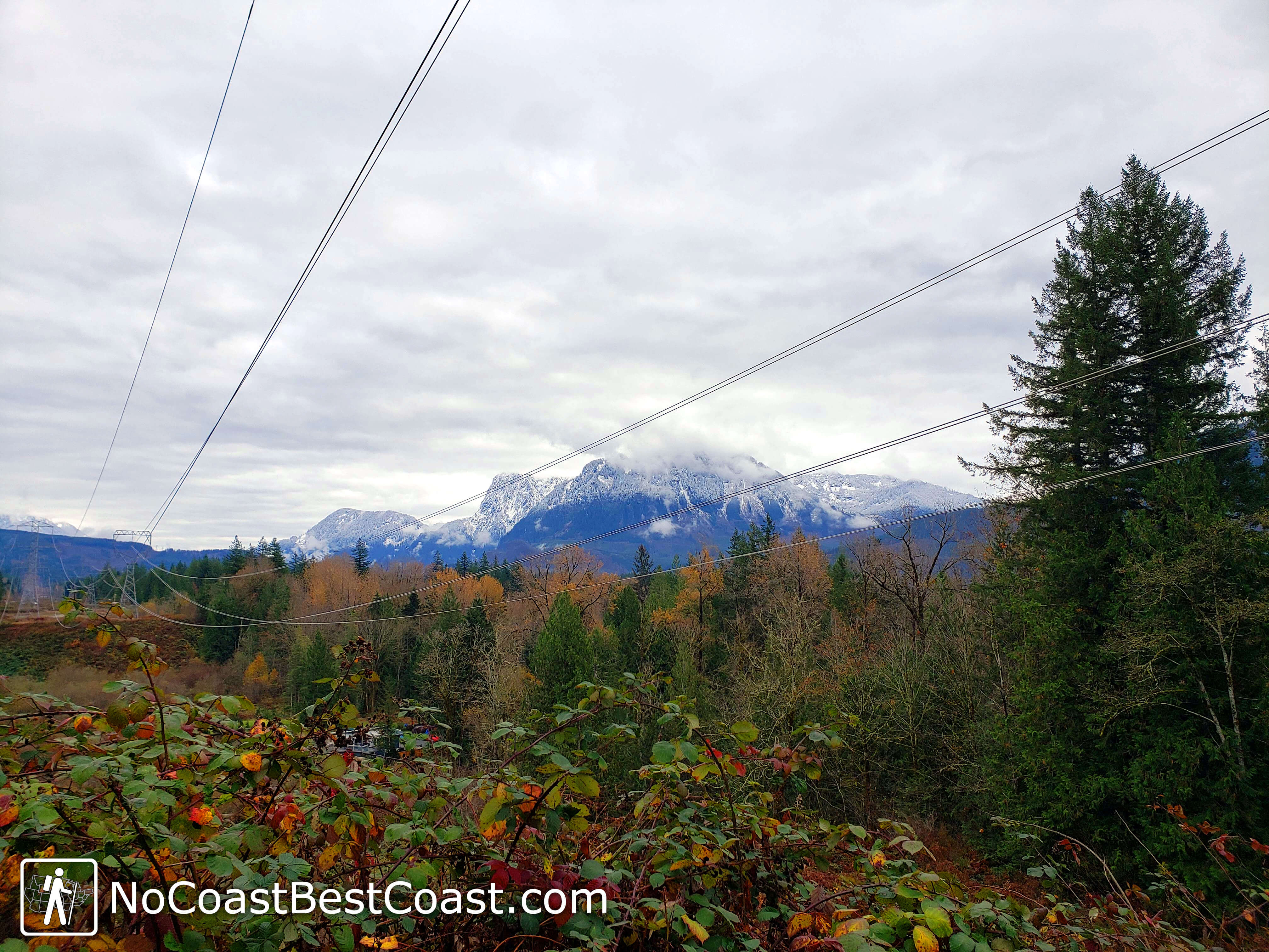
Fall colors and snowy slopes revealed in a break in the trees
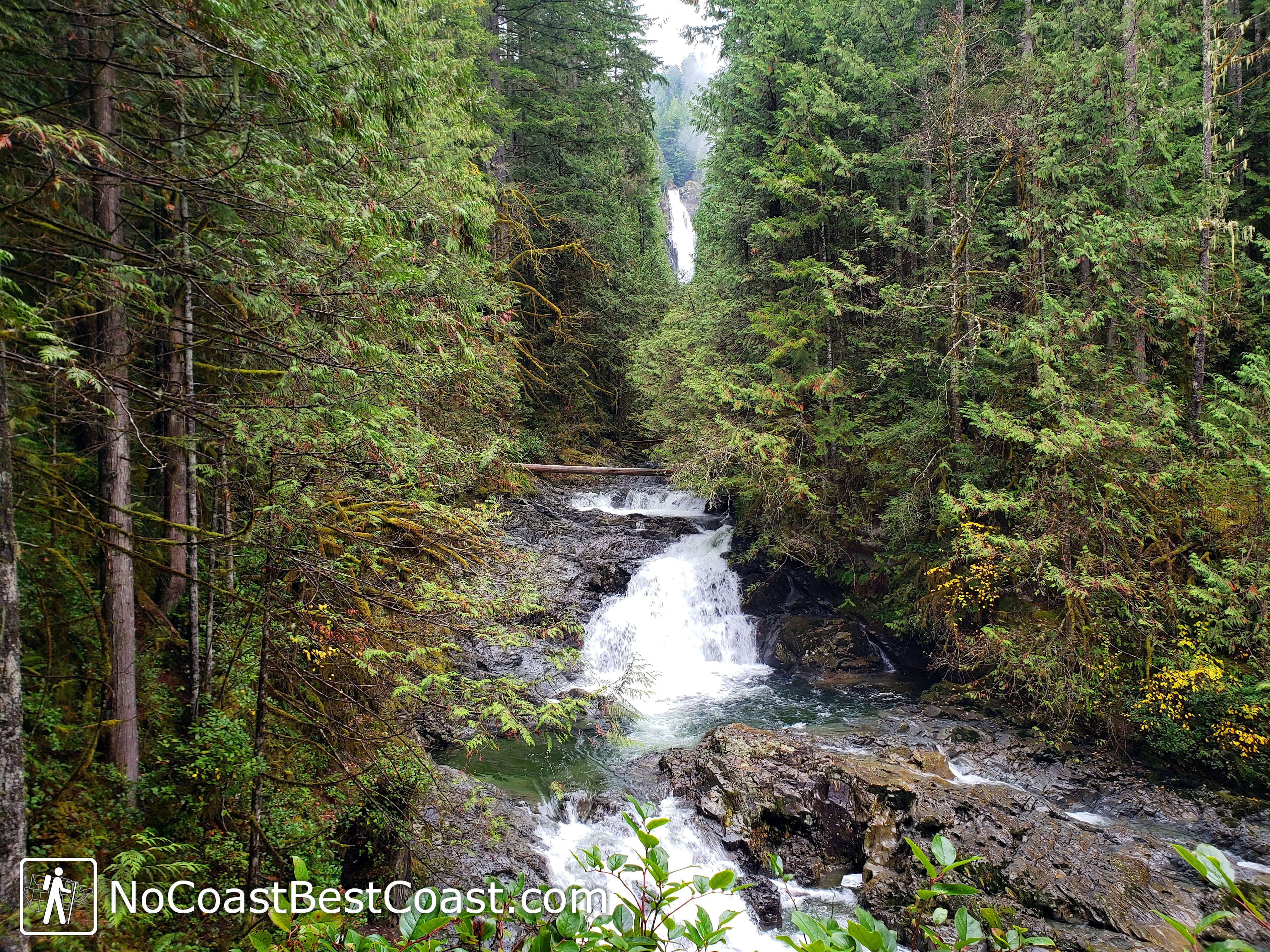
Lower Wallace Falls with a glimpse of Middle Falls in the background
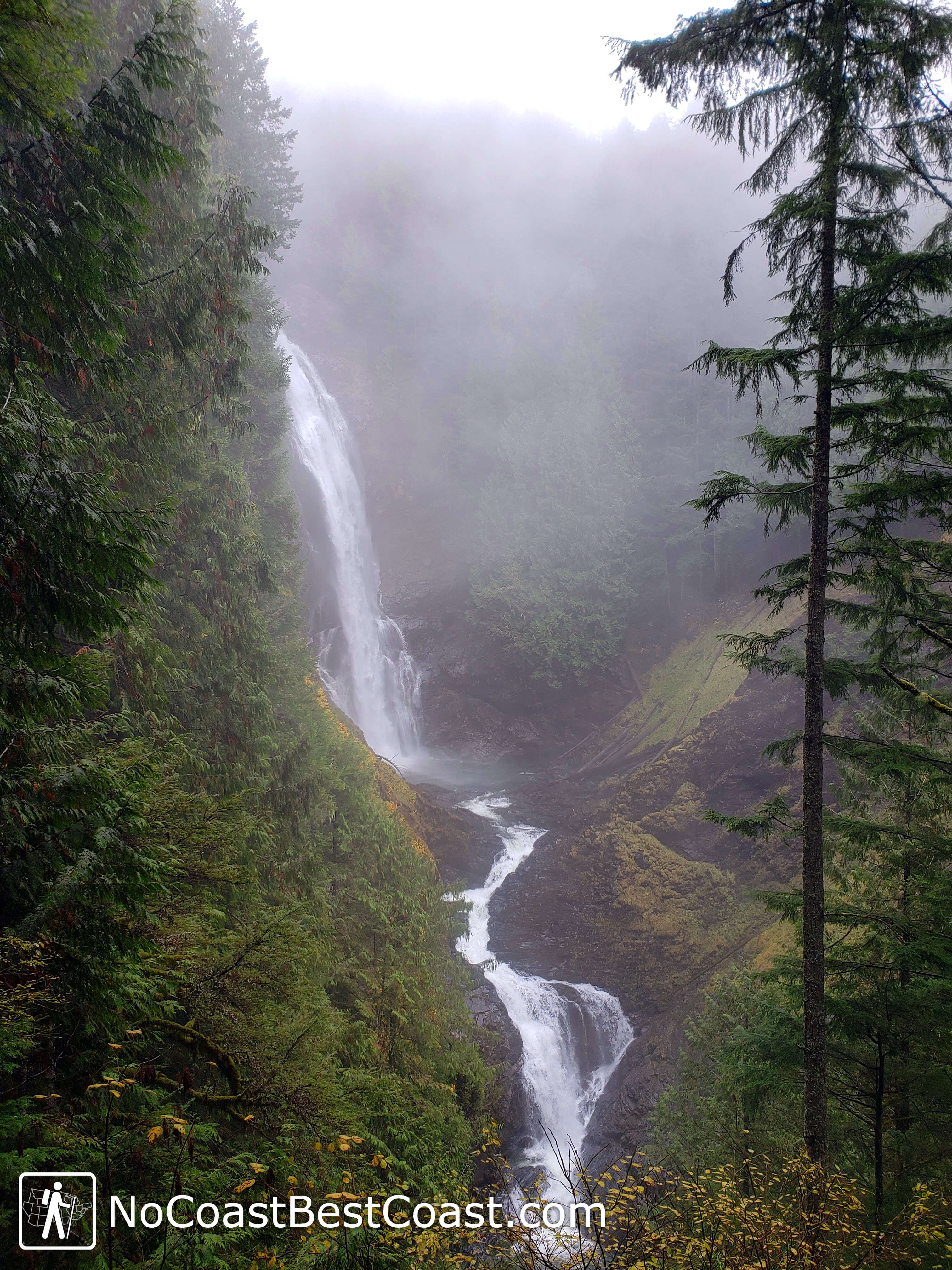
Middle Wallace Falls shrouded in mist and surrounded by moss
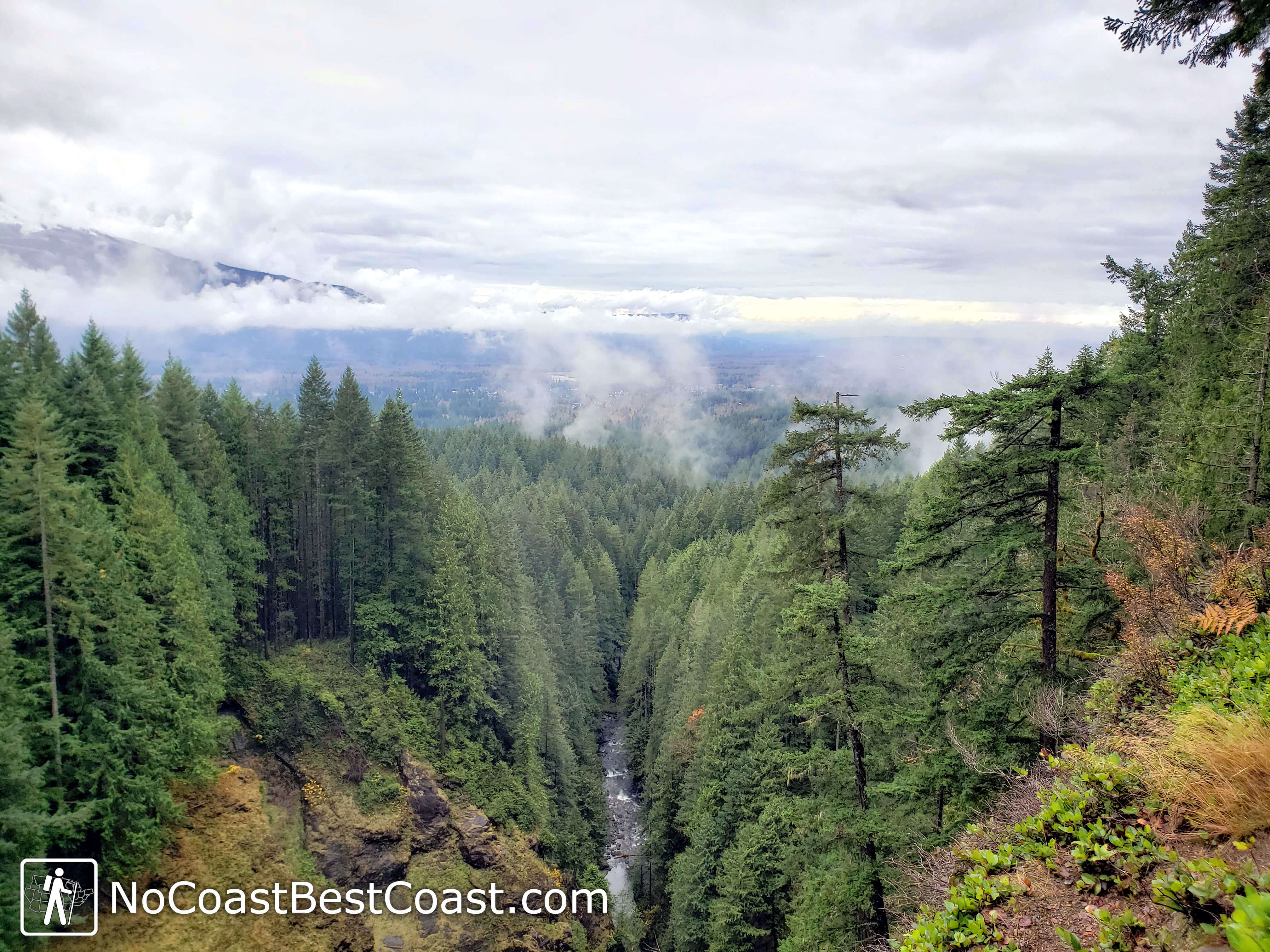
A view of Skykomish River Valley from the overlook near Middle Falls
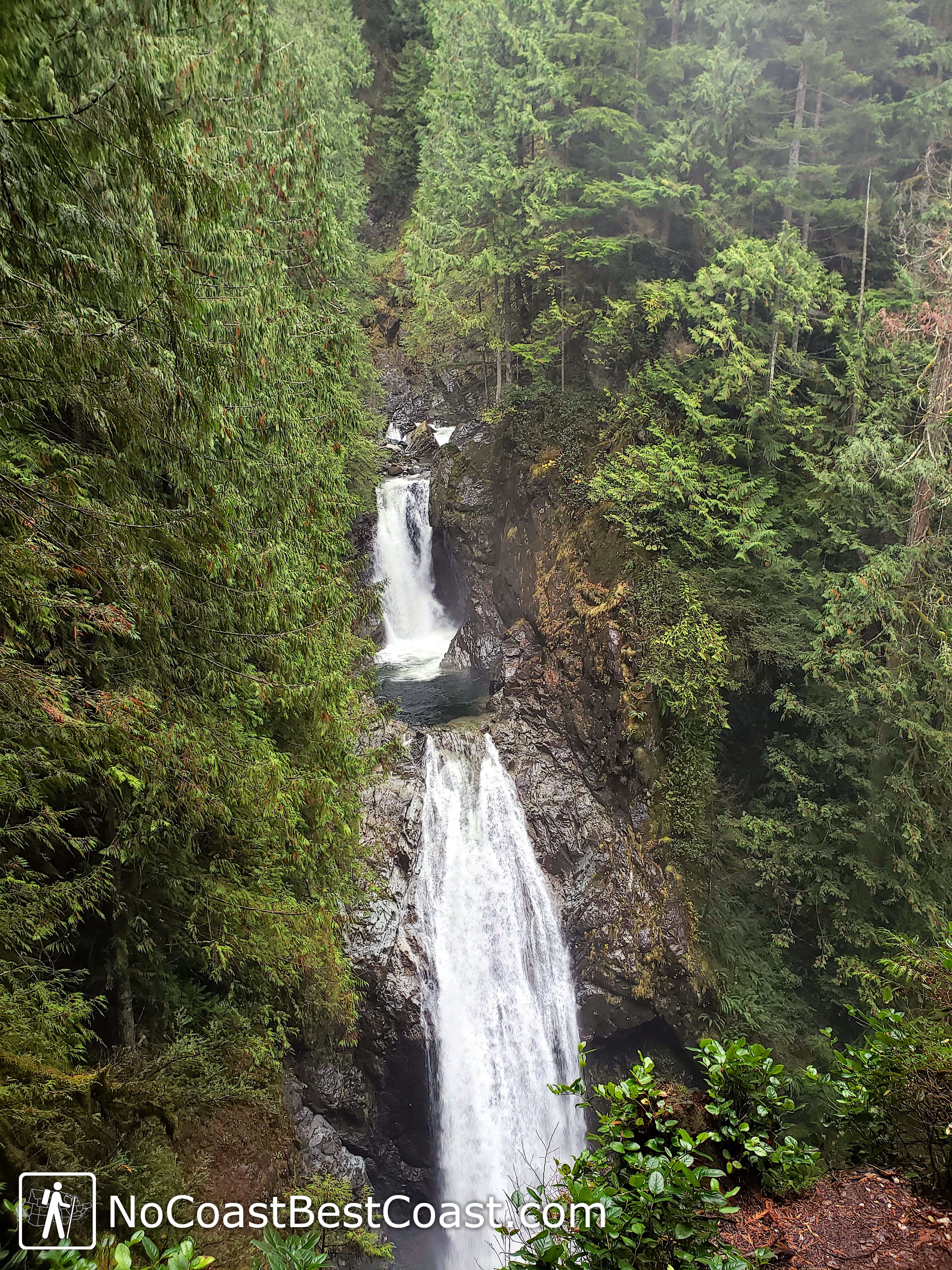
Upper Wallace Falls is your reward after an uphill climb
Hiked on Wednesday, November 11th, 2020 by Ricky Holzer
Important Information
Dogs are allowed on leash. Despite the trail's popularity, the trip to Upper and Middle Wallace Falls involves a sustained uphill climb that isn't family friendly; however, the trip to Lower Falls is much easier if you're willing to turn around there. You can visit Wallace Falls in any season. Expect the park to be busy no matter when you go -- leave early or arrive late to ensure you snag a parking spot.
Directions
From Seattle, take Interstate 90 east to Interstate 405 north. Take the exit for Washington Highway 522 heading east. At the junction with U.S. Highway 2, stay right to continue heading east. In Gold Bar, turn left onto 1st Street, then turn right onto 1st Avenue/May Creek Road. At the Y-intersection, turn left onto Ley Road, then take the next right to enter the park, continuing to the parking lot at the end of the road.
Google Maps Directions
Parking, Fees, and Facilities
Parking is limited, so arrive early for your best chance at grabbing a spot! All vehicles must display a Discover Pass, which is available for purchase at the park or online for $11.50/day or $35/year. A Discover Pass allows you to visit any Washington State Park property, so I highly recommend buying an annual pass if you visit state parks more than 3 times per year. There are restrooms and a ranger station near the lot.
Nearby Hikes
West Tiger Mountain Natural Resources Conservation Area, Washington
★★★★☆(4/5)
Discovery Park, Washington
★★★☆☆(3/5)