| Rating | ★★★★☆(4/5) |
| Overall Difficulty | Moderate |
| Navigation Difficulty | Easy |
| Distance | 3.8 miles roundtrip |
| Time | 2.5 hours |
| Terrain | Strenuous climbing, 1760 feet of elevation gain |
| Best Seasons | All |
| Dog Friendly | Yes |
| Accessible | No |
Highlights
- Incredible views of Mount Ranier
- Watching paragliders
- Views of downtown Bellevue
Hike Summary
This is my first post of many Washington hikes now that I live in Seattle. My posts about Washington State will be a bit shorter and focused on sharing pictures since the Washington Trails Association has such good, up-to-date information. A link to their page about this hike is at the bottom of this post.
Poo Poo Point, named for the noise of locomotives chugging up the mountain to transport timber (and not named for the latrine conveniently located at the top), is a Seattle-area classic. However, its proximity to the city and unbeatable Mt. Ranier views draw immense crowds of people -- if you want solitude in nature, avoid this hike. Though you wouldn't expect it given how many people hike here, the hike is pretty difficult and the 1700+ feet of elevation gain is no joke! The end views are really the only reason to hike here, since the scenery on the way up and down is buried in forest.
Much like most hikes in the area, the trail starts by ascending through a dense forest, as pictured below.
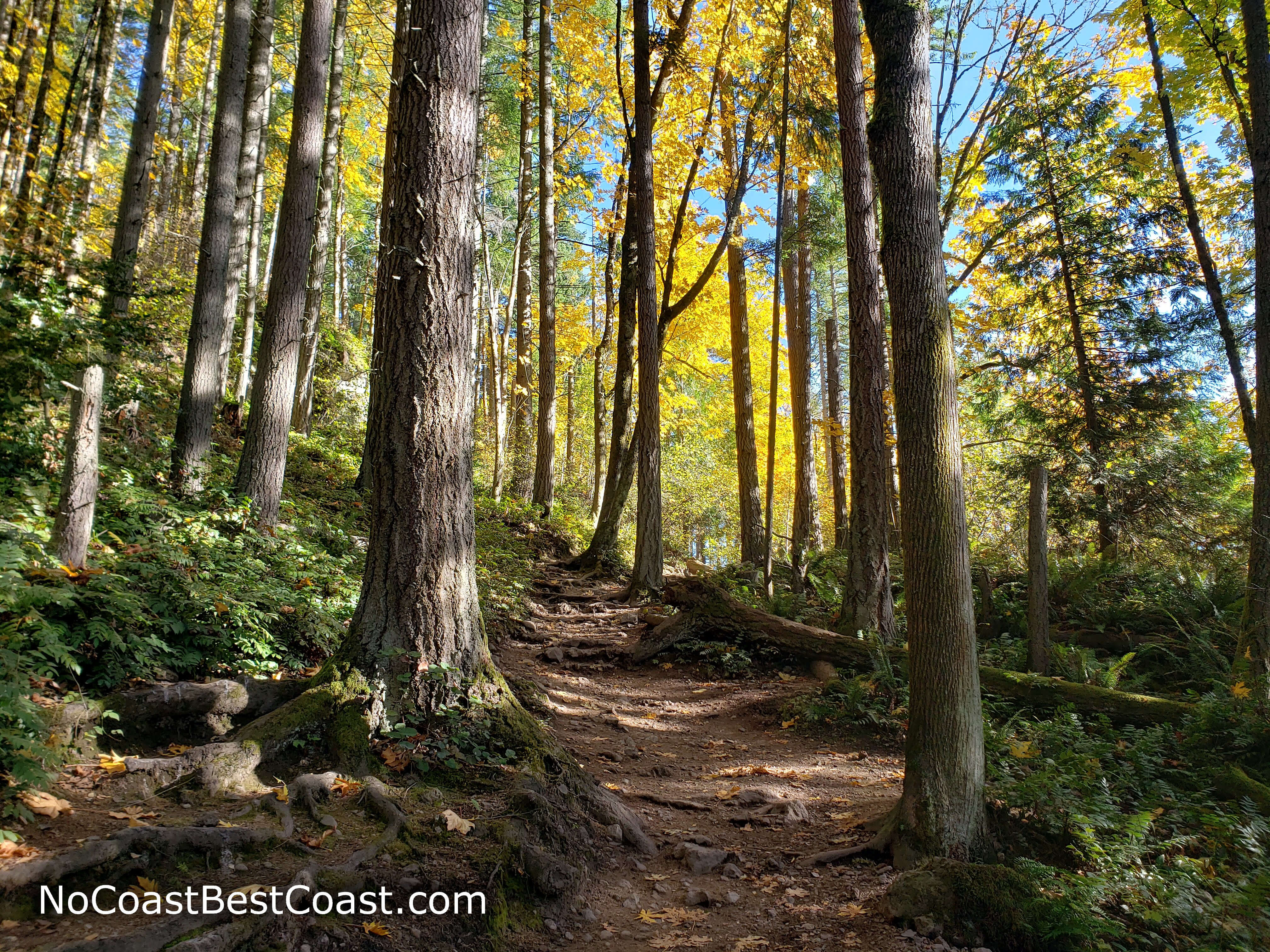
Fall foliage along the uphill trail
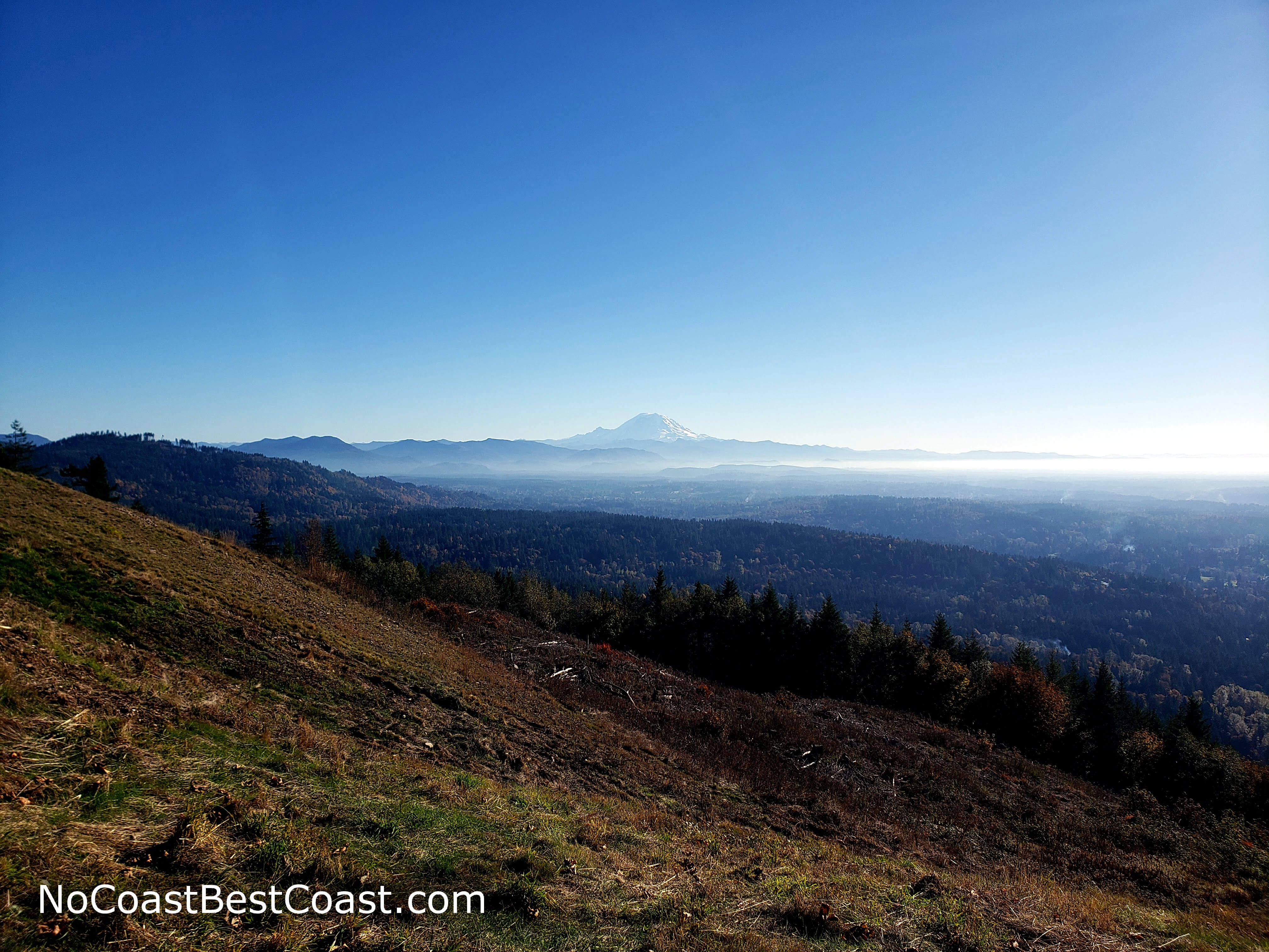
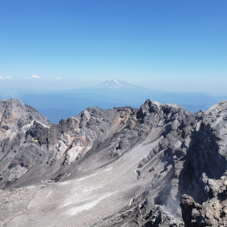
The amazing, unobstructed view of Mount Ranier from Poo Poo Point

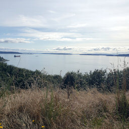
Lake Sammamish and downtown Bellevue in the distance from Poo Poo Point
View the Poo Poo Point - Chirico Trail entry on the Washington Trails Association website
Connect with me using the social media links below and share your adventures!
Hiked on Sunday, November 1st, 2020 by Ricky Holzer
Important Information
Dogs are allowed on leash. Despite the difficult amount of elevation gain, many families attempt this hike. You can hike here in any season, though the views are best if you wait for a clear day. Given its close proximity to Seattle, this trail is insanely popular, so arrive very early in the morning to avoid crowds.
Directions
From Seattle, take Interstate 90 east to Issaquah. Take the exit for Front Street, then turn right. Drive straight through the old part of town, turning left after about 3 miles into the gravel parking lot.
Google Maps Directions
Parking, Fees, and Facilities
Parking is free but limited, and there are portable restrooms available in the lot. If the lot is full (very likely on a weekend), there is a privately-owned lot about a block north on the opposite side of the street; parking there is $5 per vehicle paid by cash envelope or Venmo.
Nearby Hikes
Discovery Park, Washington
★★★☆☆(3/5)
Wallace Falls State Park, Washington
★★★★☆(4/5)
Gifford-Pinchot National Forest, Washington
★★★★★(5/5)