| Rating | ★★★★★(5/5) |
| Overall Difficulty | Very hard |
| Navigation Difficulty | Medium |
| Distance | 10 miles roundtrip |
| Time | 6 hours |
| Terrain | Strenuous climbing, 4500 feet of elevation gain |
| Best Seasons | Summer |
| Dog Friendly | No |
| Accessible | No |
Highlights
- Views of three volcanic peaks from the summit: Rainier, Adams, and Hood
- Looking down at the wasteland in the crater left by the last eruption in 1980
- Glissading down glaciers for an easy descent
Hike Summary
***Permits are required to summit Mount St. Helens! Visit Recreation.gov to reserve your spot!***
Nestled in the rugged landscapes of the Pacific Northwest, Mount St. Helens stands as a beacon of both natural beauty and historical significance. With its iconic volcanic peak and captivating trails, summiting this majestic mountain is a dream for many avid hikers. It's not every day you can climb a volcano that has exploded as recently as 1980! The hike is not without difficulties, however.
Let me reiterate the bit about permits being required. This is not the kind of hike you can wake up in the morning and decide to do, especially on a weekend. The Forest Service limits permits from April 1st to October 31st to prevent dangerous overcrowding on the steep trail and to help preserve the environment. From Recreation.gov: "Permits are released in one month increments on the first day of the preceding month. For example, April permits are released on March 1. All releases occur at 7:00 AM Pacific Time". People travel from all over the country (and perhaps the world) to try and summit this famous volcano, so you better wake up early on the first of the month to try and snag a permit for your desired date.
If you're not the planning type, you can still luck out if you check the permit calendar for openings -- people cancel or change plans. I was lucky enough to snag a last minute permit to climb on a weekday, even though my boss wasn't as thrilled as I was about this success. Don't count on rangers not enforcing. You may be ticketed up to $500 for failing to present a permit above 4800 feet.
Depending on your level of fitness, finding a permit may in fact feel more difficult than the actual hike. The journey begins at the trailhead, where anticipation hangs in the air like mist among the towering 2nd growth trees, as pictured below. As we set off on the well-marked Ptarmigan trail, the surrounding wilderness envelops us, offering glimpses of wildlife and the soothing sounds of cascading streams. With each step, the excitement builds, fueling your determination to reach the summit.
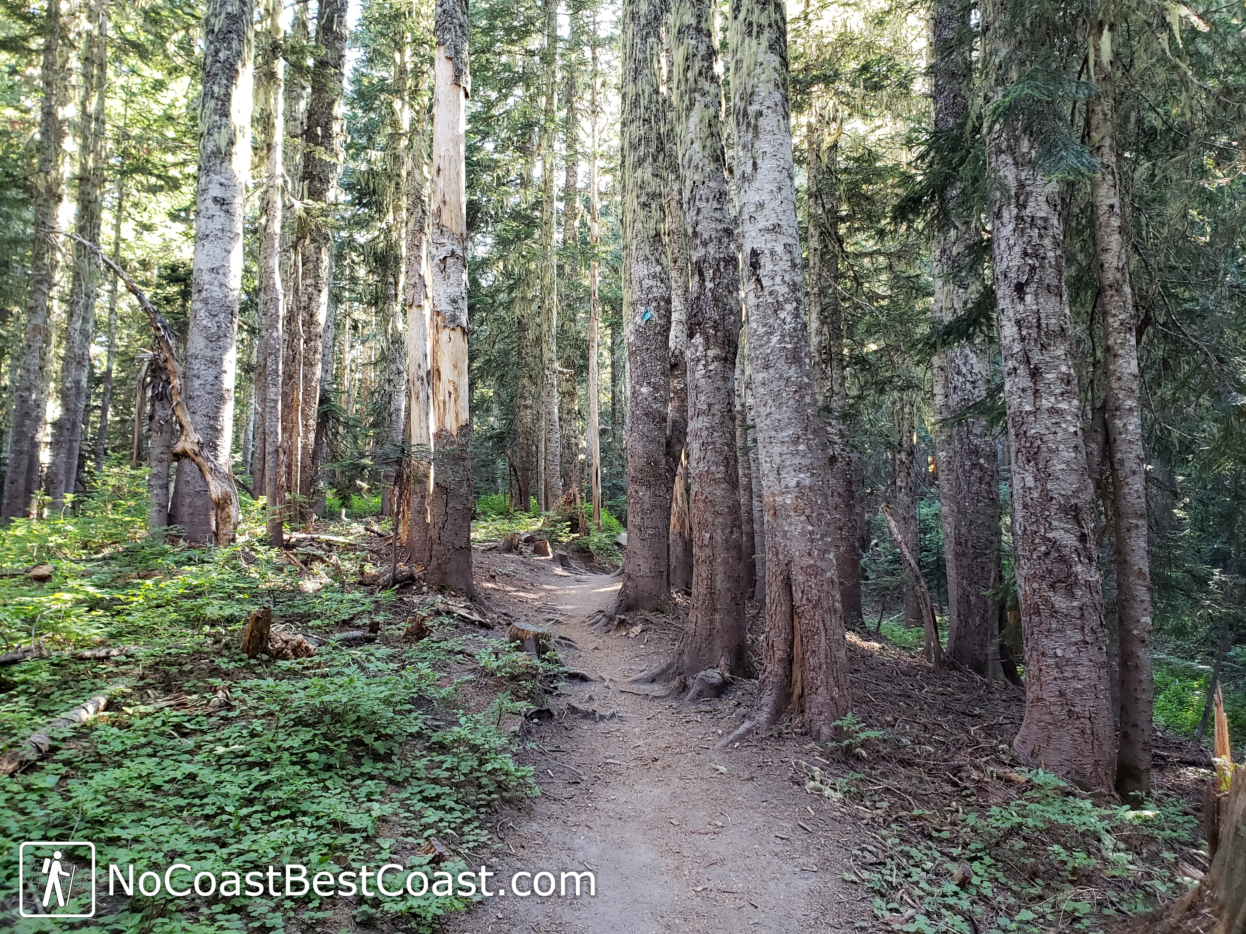
The start of the Ptarmigan Trail as it winds through a classic PNW forest
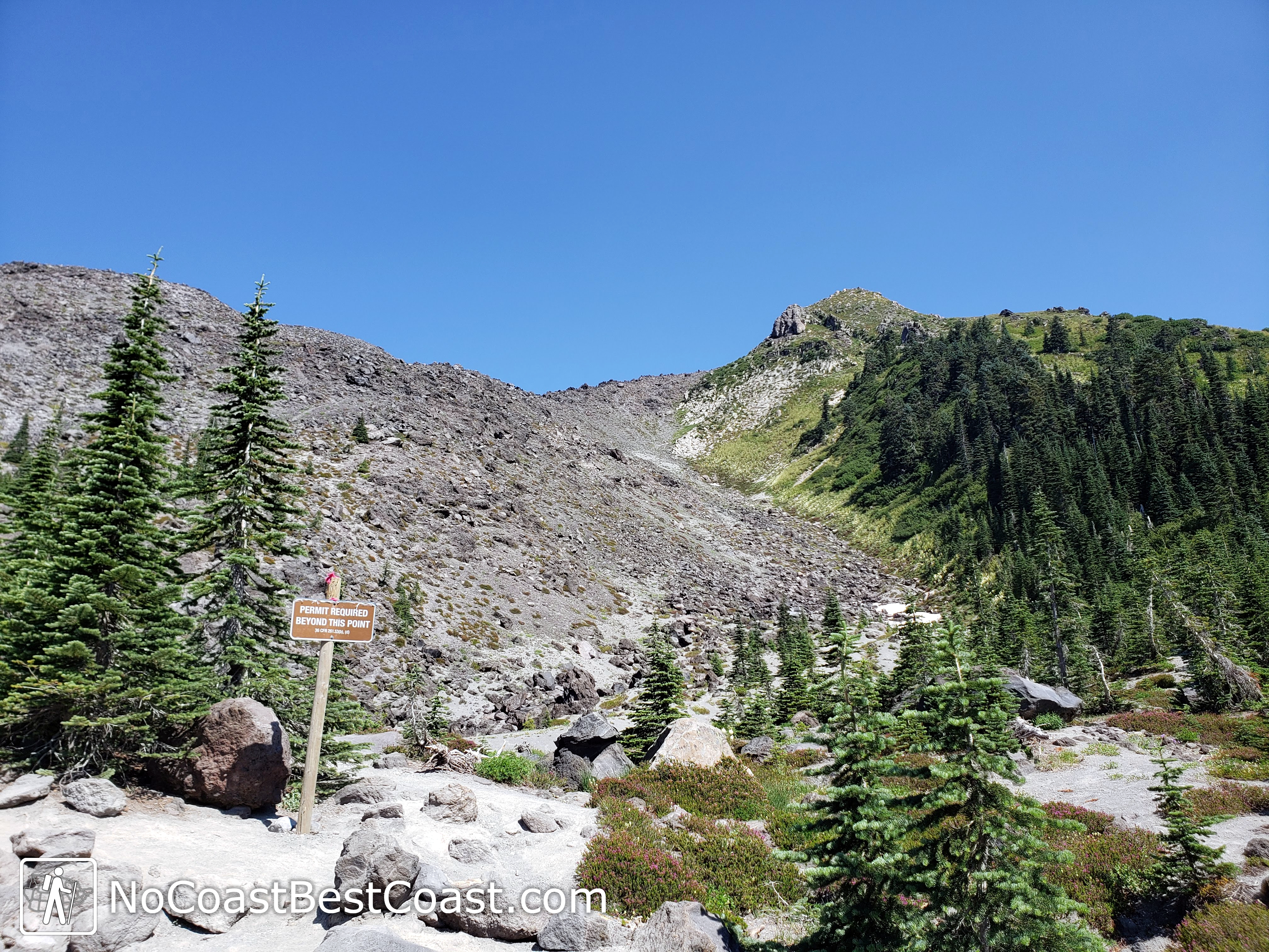
Once you leave the forest and reach the sign requiring permits, as pictured below, the hike suddenly becomes more difficult.
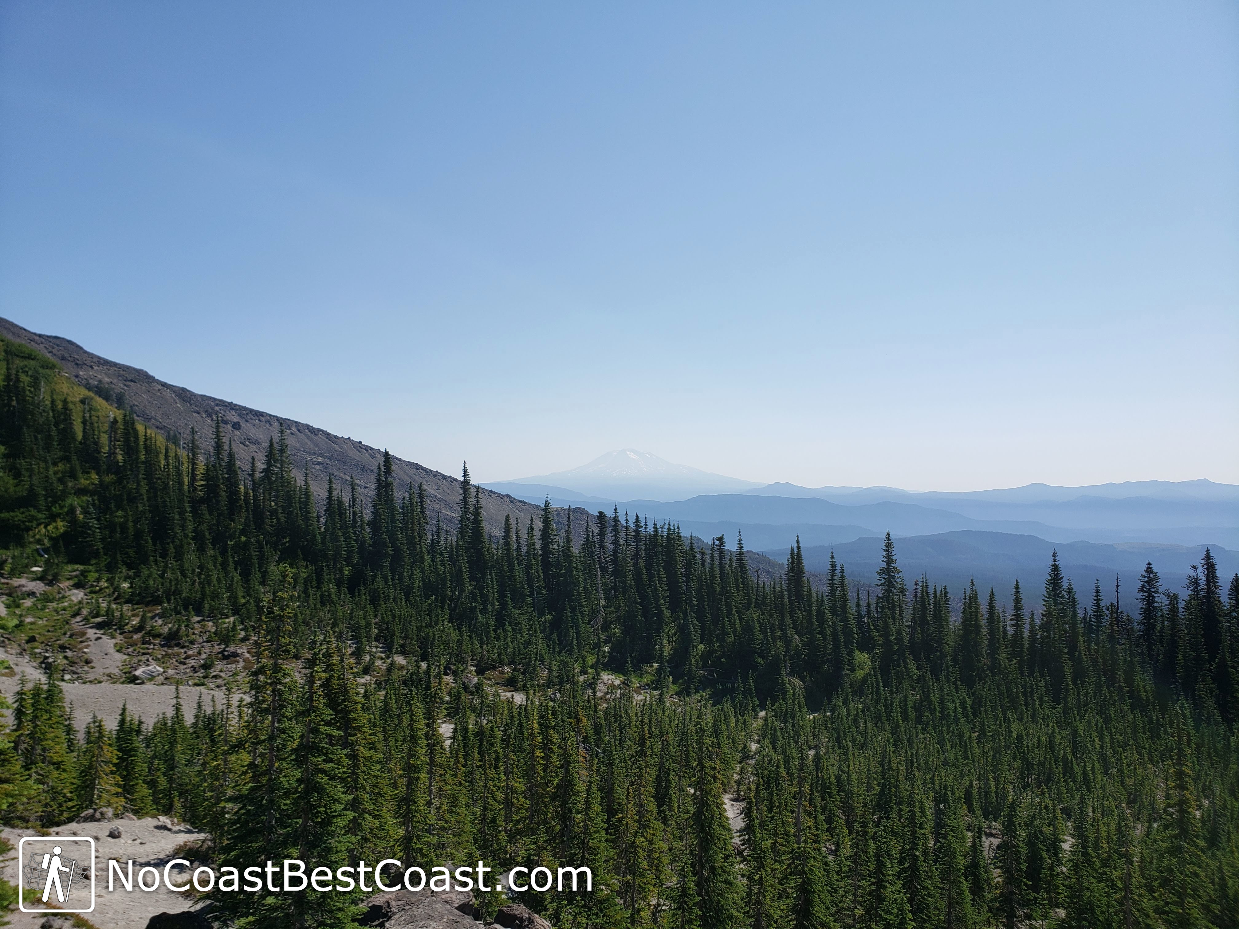
Mt. Adams is visible to the east once you ascend above treeline

Looking down on the rugged field of pumice you'll have use your hands to ascend
At last, you reach the summit – but actually not. The trail seems to end at the crater rim, but this is not in fact the true summit. You must continue to the left on a faint trail traversing the rim to reach the true summit. Sure, it's extra effort, but most people stop at the rim, meaning you will have the true summit all to yourself.
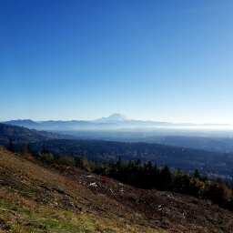
As you stand atop Mount St. Helens, surrounded by panoramic views of the Cascade Range and the volcanic summits of Mt. Rainier and Mt. Adams (both pictured below) prominently rising above the rest, a profound sense of awe will wash over you. Now imagine that this mountain used to be 1300 feet taller before it erupted in 1980. Suddenly, the crater in front of you seems all the more impressive.
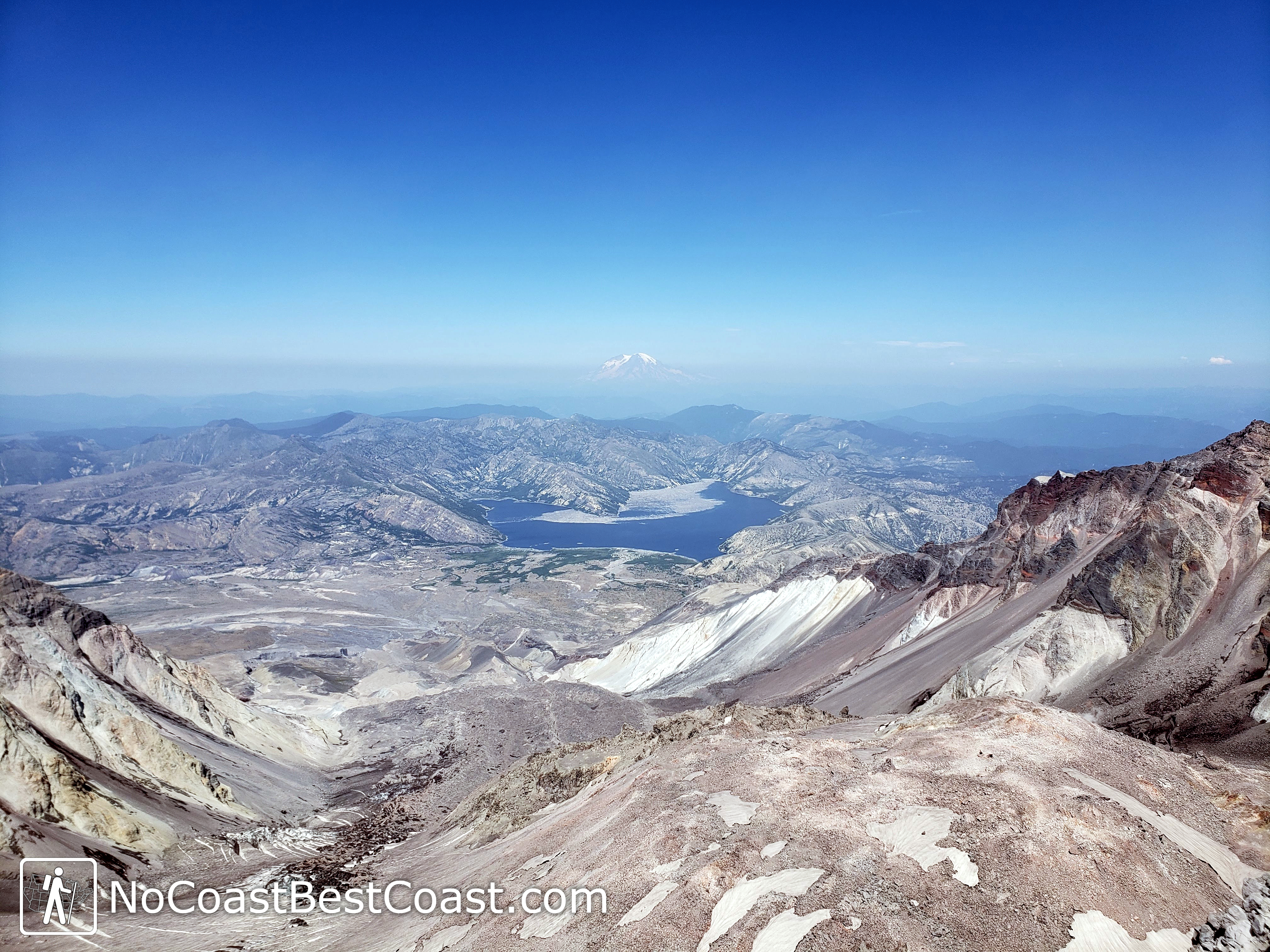
The impressive crater of Mt. St. Helens with Mt. Rainier in the distance
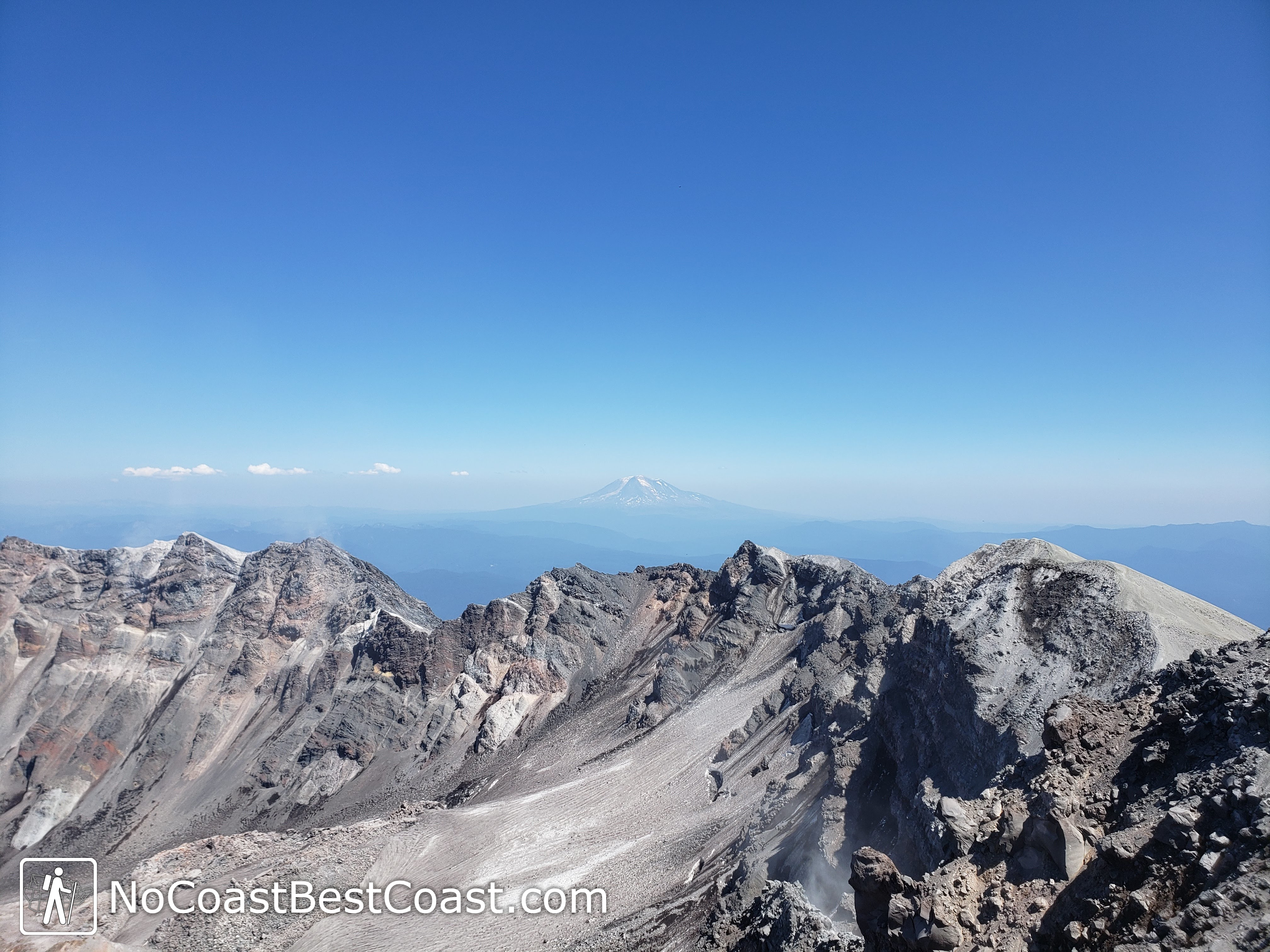
Mt. Adams rising above the crater rim of Mt. St. Helens

Remnants of past glissades in the snow
The rest of the descent is straightfoward, though it will feel like a long slog repeating the same trail in reverse now that you're tired from summitting.
Climbing Mount St. Helens is more than just a hike; it's an experience that stirs the soul and ignites the spirit of adventure. From the tranquil beauty of the trailhead to the exhilaration of reaching the summit, every moment is infused with wonder and possibility. As you bid farewell to this iconic peak, you carry memories that will last a lifetime and a renewed appreciation for the majesty of the natural world. Until next time, Mount St. Helens, until next time.
See more information with trip reports and up to date conditions at the Washington Trails Association Page for Mount St. Helens.
Connect with me using the social media links below and share your adventures!
Hiked on Thursday, July 29th, 2021 by Ricky Holzer
Important Information
Dogs are strongly discouraged for safety reasons. Climbing season is April-October, though the earlier in the season you go, the more snow you will have on top. Be sure to check conditions before going and prepare accordingly! Winter ascents are possible and done frequently by skiers, but the road to the trailhead may be closed, requiring a long trek through the forest before even reaching the trailhead.
Directions
From Seattle, take Interstate 5 south towards Portland. After 110 miles, take the exit for Washington Highway 503/Lewis River Road and turn left. You'll continue on this road almost all the way to the trailhead. Turn left onto Forest Road 87. Turn left onto Forest Road 81, then right onto Road 830. Signage is decent along the way, but you'll want to use GPS just in case.
Google Maps Directions
Parking, Fees, and Facilities
Parking at the trailhead requires a Northwest Forest Pass ($30 per year or $5 per day) or an America the Beautiful Pass ($80 per year), purchased ahead of time. However, parking is included with the $20 permit you are required to purchase during peak season April-October.