Highpointing the Midwest
Last Updated by Ricky Holzer on Monday, March 22nd, 2021
Unlike much of the rest of the country which has mountain ranges like the Rockies and Appalachians, reaching the highest elevations in each of the Midwestern states is doable for almost anyone. Of the highpoints in these 12 states, only 3 truly require any sort of strenuous uphill climbing. Highpointing the Midwest really drives home the point that it's about the journey and not the destination, and this endeavor will encourage you to travel to some beautifully scenic places in addition to some strange, remote regions that you never would have gone to otherwise. In particular, it's enjoyable to see how much pride a landowner or surrounding community takes in their little flat spot that's slightly higher than all the flat spots in their state.
I have visited all 12 Midwest highpoints (I dream of highpointing the entire U.S. and have done 40 so far!), and I have found that in contrast to the tall mountains in the western states, much of the difficulty in the Midwest is due to access restrictions and remoteness rather than the physical ability required to summit. One note: looking around on the internet, you'll probably find claims that it's hard to find some of these highpoints. I've successfully navigated using Google Maps on my phone. If you visit each of my pages for each state highpoint I've completed (all linked in the below list), you can find a link to Google Maps to help you navigate.
Using my criteria for ranking of distance from a major city, difficulty of the hike (if any), and access restrictions with hike difficulty as the most important criterion, here is my ranked list of the Midwest highpoints from easiest to hardest to achieve. At the bottom you can find a map of all 50 state highpoints (and U.S. territories too).
Midwestern Highpoints from Easiest to Hardest
Hoosier Hill, Indiana - 1257 ft
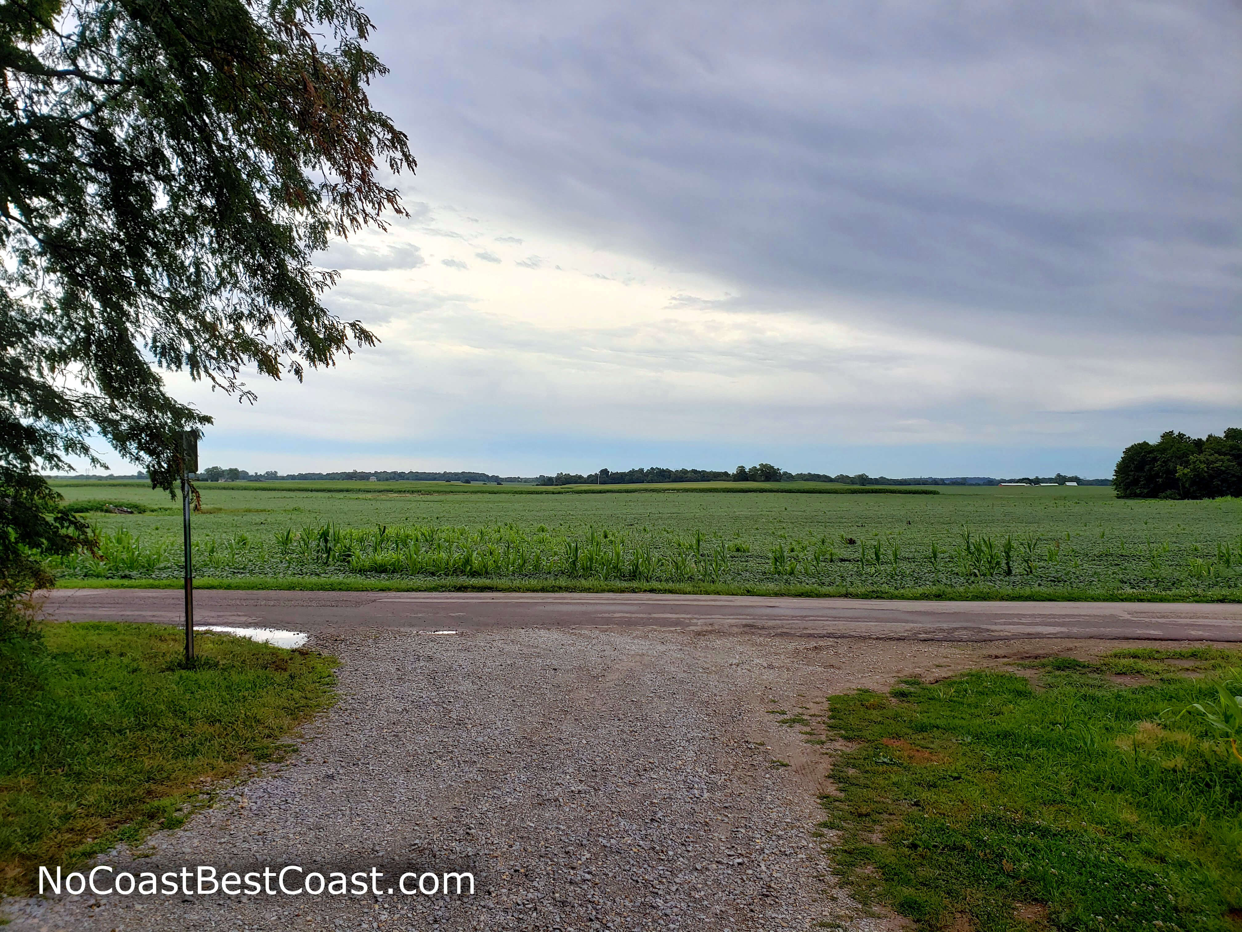
Moody Midwest skies above Indiana farm country
Read my post about Hoosier Hill.
Only a 90-minute drive from Ohio's Campbell Hill and about halfway between Columbus and Indianapolis, Hoosier Hill is hidden in the woods between farm fields, a seemingly forgotten place. Reaching the "summit" mostly involves driving with a short few steps into the woods from the parking area. There's not much to see here other than an elevation marker, summit register, and picnic table. This is the easiest Midwest highpoint and possibly one of the easiest state highpoints of all to attain. It's also one of the least remarkable places on the U.S. highpointing journey
Campbell Hill, Ohio - 1550 ft
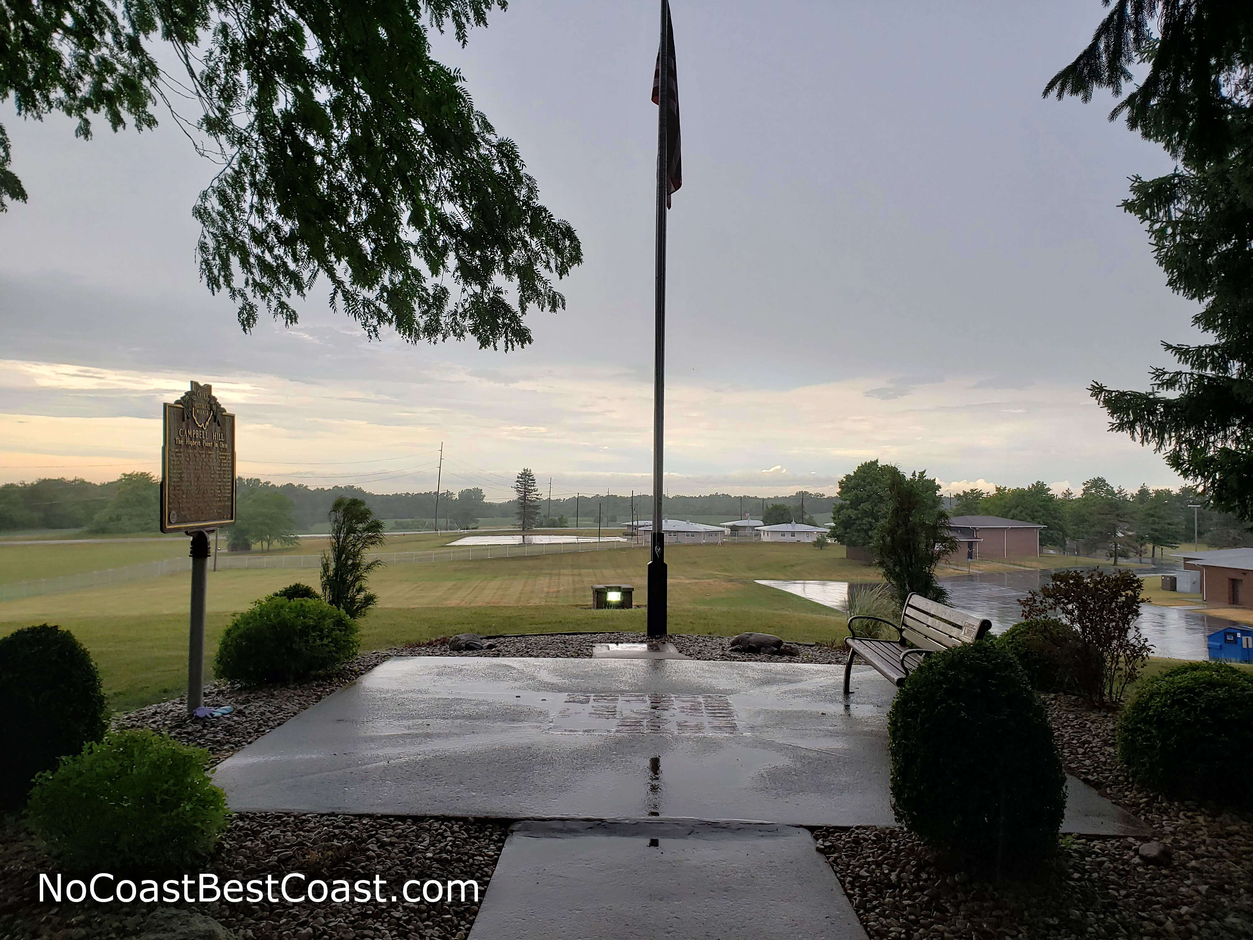
The picturesque monument atop Campbell Hill after a rain storm
Read my post about Campbell Hill.
This highpoint is a celebrated fixture of the town of Bellefontaine, where several local businesses and buildings bear the name "Hi Point". Only an hour drive from Columbus, it's the closest Midwest highpoint to a major population center. Combining this fact with the ease of parking and walking up a small hill to reach the "summit", this is one of the easiest of all Midwest highpoints to attain. However, Campbell Hill is located on school property and is only open Monday through Saturday during the day, though you can make special arrangements to visit on a Sunday. Thus, Campbell Hill is slightly harder to summit than Hoosier Hill. The summit is unremarkable since the hill is so wide the rise is unnoticeable, and the view looks like any schoolyard in the Midwest.Taum Sauk Mountain, Missouri - 1772 ft
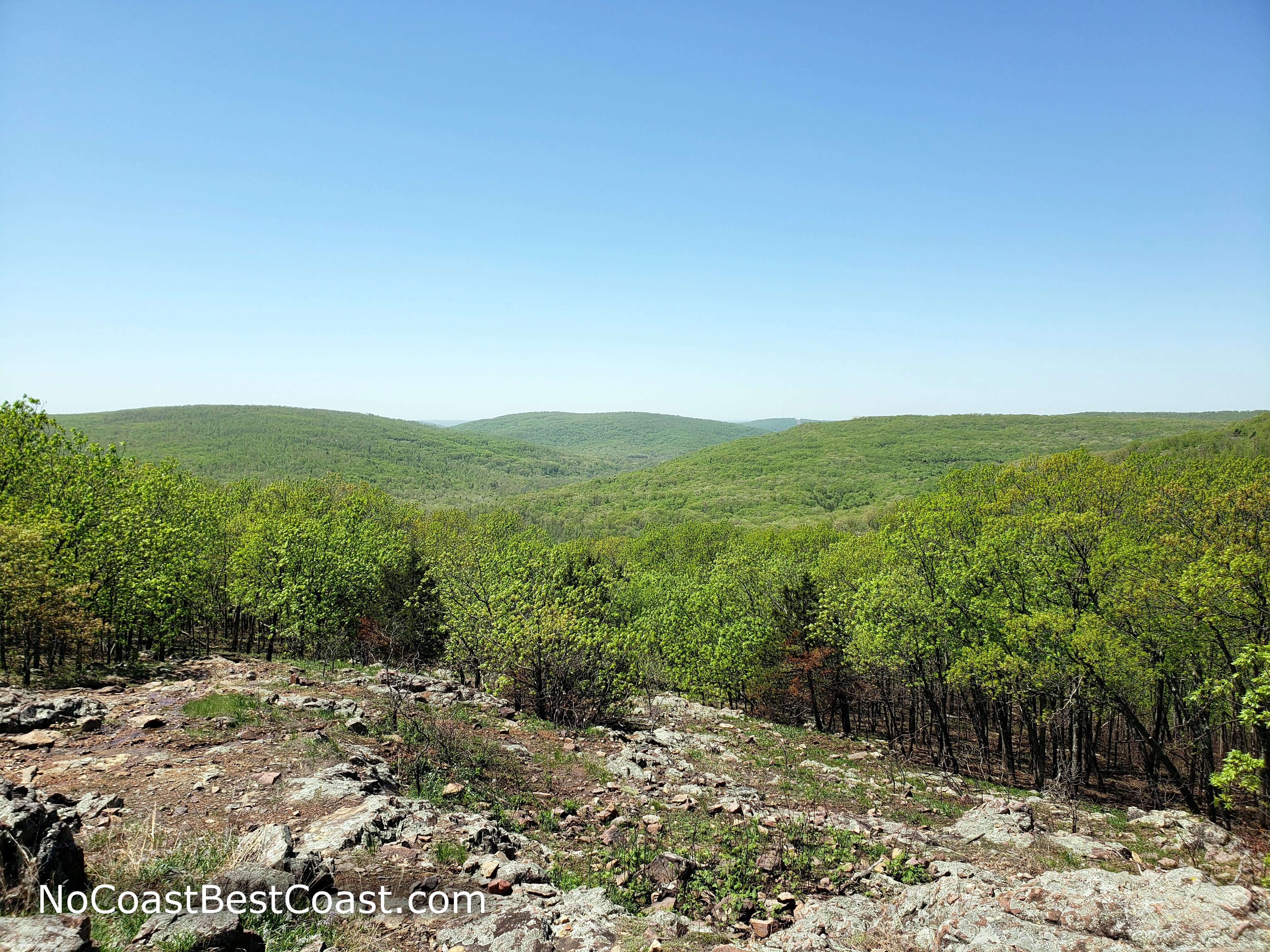
The rolling green Ozarks from a glade on the Mina Sauk Trail
Read my post about Taum Sauk Mountain.
The cousin of the Arkansas state highpoint and my 10th state highpoint, this mountain in the Ozarks of Southern Missouri has an entire state park dedicated to it (also like Arkansas's state highpoint). The park is less than a two hours drive from St. Louis, and the hike to the top is less than half a mile roundtrip along a paved and designated accessible trail. While trees block the view at the summit, you'll pass an overlook on the drive to the parking area that provides a view of the St. Francois Mountains to the north. From the summit, you'll have the option to continue on a scenic 3 mile roundtrip hike to Mina Sauk Falls -- Missouri's highest waterfall -- featuring scenes like pictured above, making this a worthwhile trip indeed.
Hawkeye Point, Iowa - 1670 ft
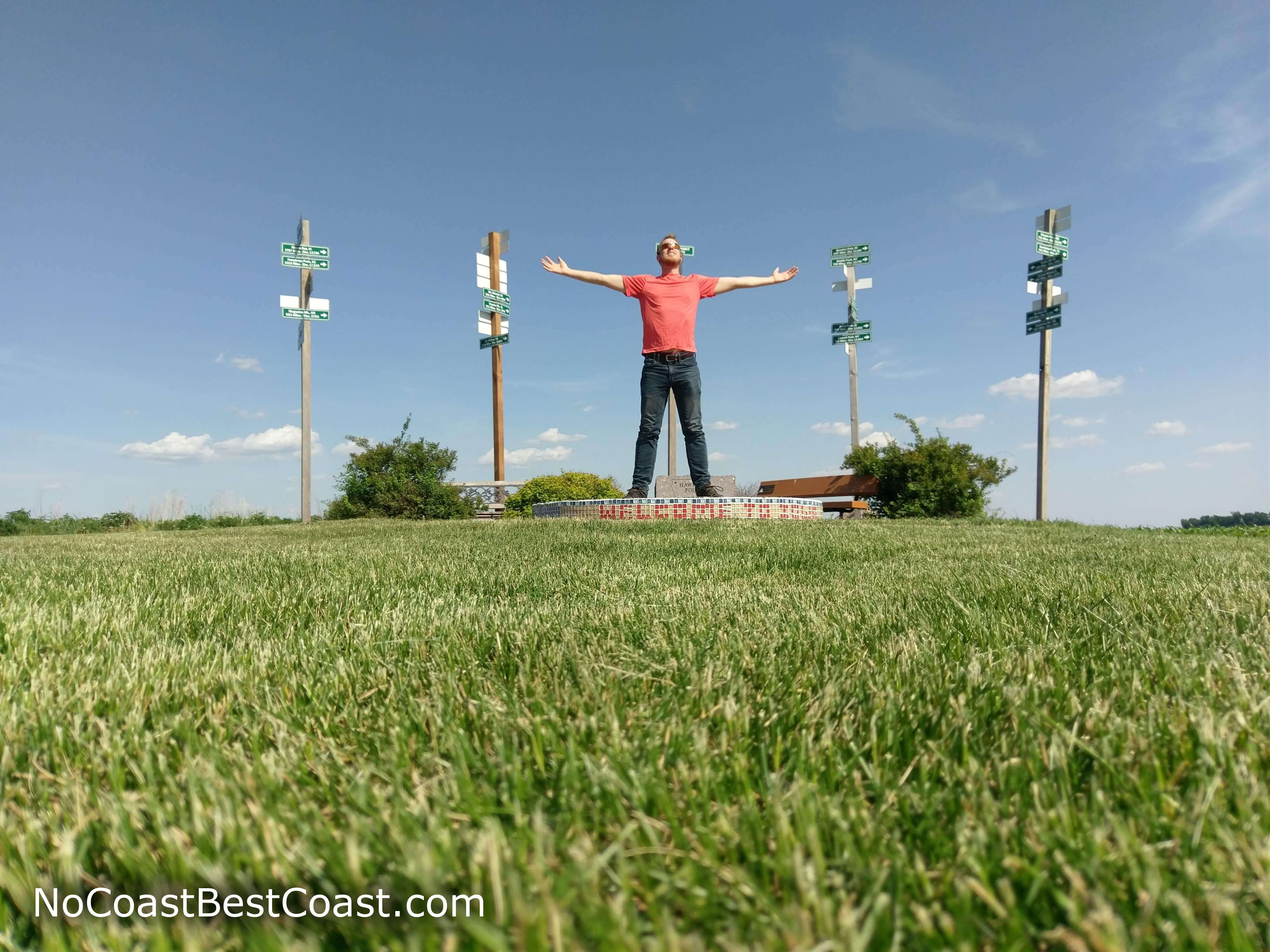
Me at the summit monument of Hawkeye Point
Read my post about Hawkeye Point.
The first Midwest highpoint I've visited is also one of the easiest to reach and a highly developed celebration of an otherwise unimportant place. Located right off the four-lane Highway 60 just 15 minutes south of Interstate 90 and a bit over an hour from both Sioux Falls, SD and Sioux City, IA, you can drive to the "top" of this slightly elevated flat space in the middle of farm country. Not only are there several great photo opportunities, such as the flag poles with directional signs pointing to all the other state highpoints in the U.S. and a version of American Gothic where you and a friend can stick your faces, there is a small walk-through museum in an old barn and historic farm equipment. The county constructed a rather nice campground across the dirt road from the highpoint, complete with flush toilets and showers, a picnic area, and firepits. At 3 hours from Minneapolis, this is quite a distance from a major city and why I've ranked it harder than Ohio, Indiana, and Missouri.
Mount Sunflower, Kansas - 4039 ft
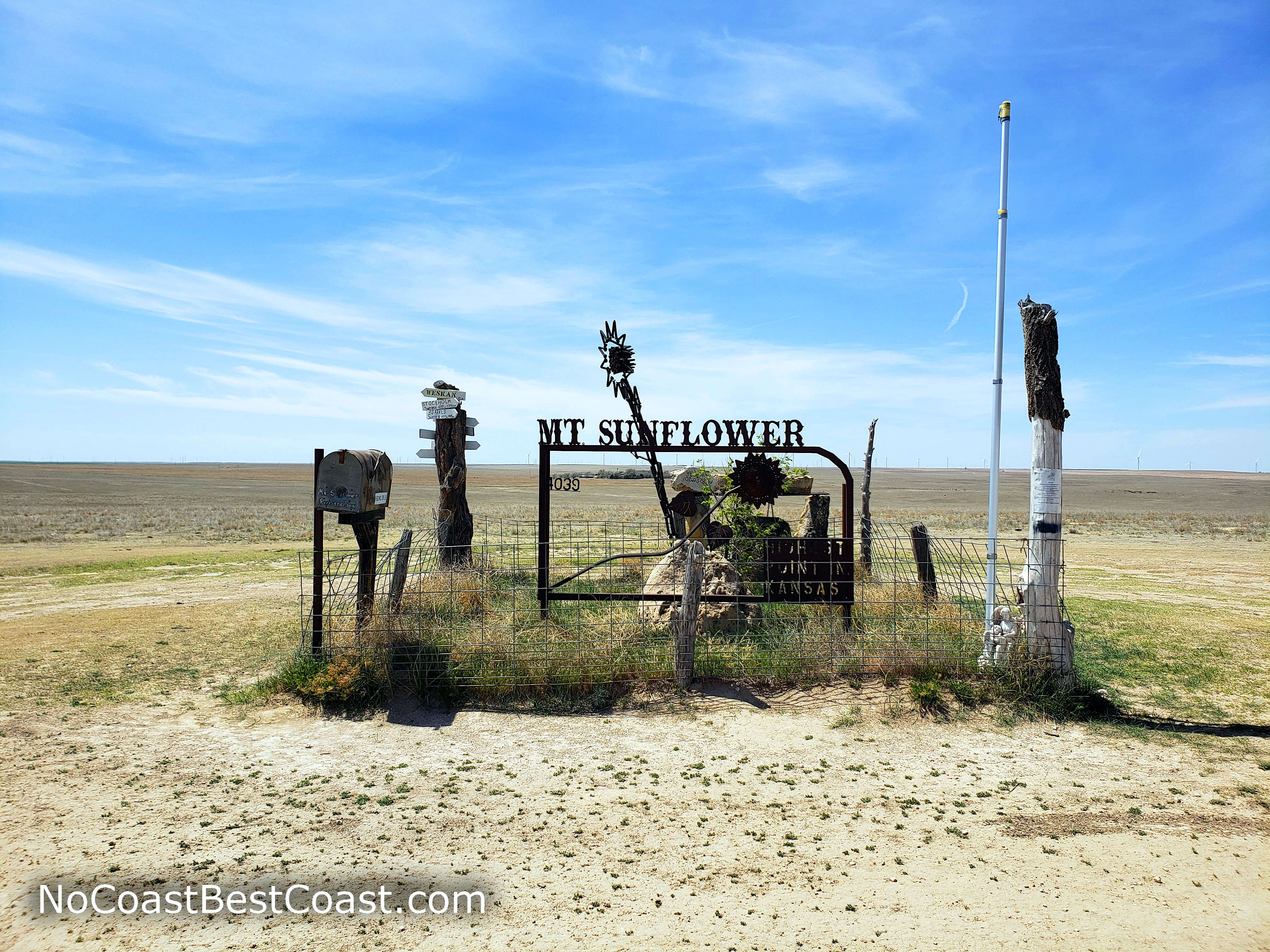
The summit monument on Mount Sunflower, Kansas
Read my post about Mount Sunflower.
My 15th state highpoint, Mount Sunflower is another drive-up "summit". Reaching the Kansas state highpoint requires driving over 15 miles on gravel roads, but luckily you can take Interstate 70 most of the way there. At the summit, you can take pictures next to the homemade iron sunflower and sign adorning the vast prairie. With nothing around for miles, this spot is stunningly quiet and peaceful with endless views and fascinating clouds hovering above the dry grasslands.
Panorama Point, Nebraska - 5429 ft
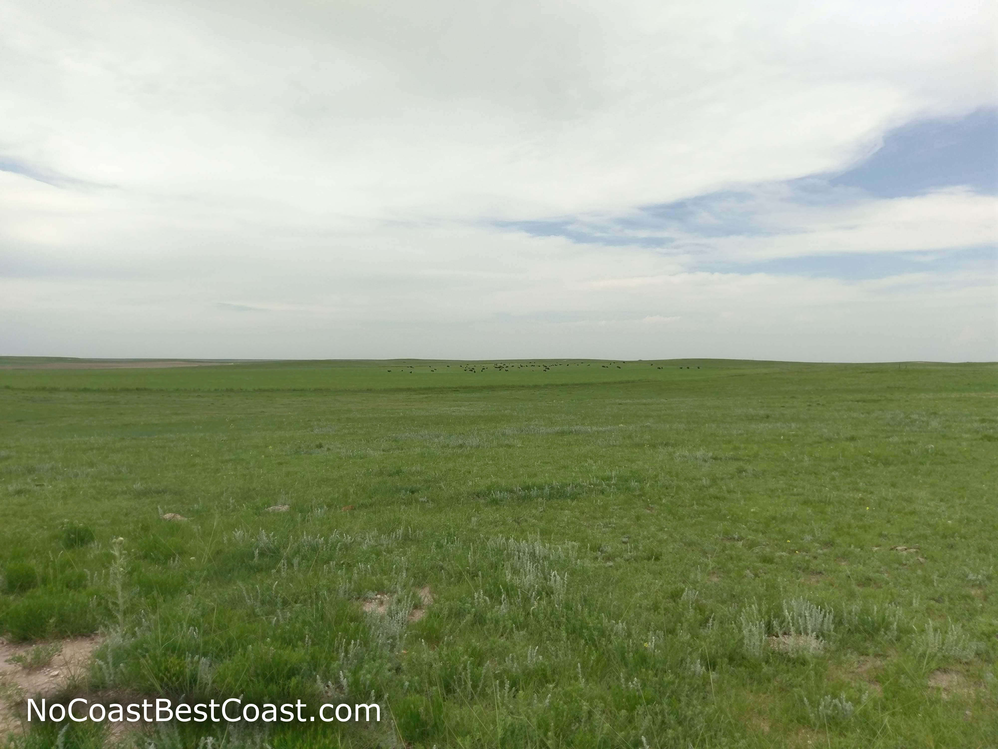
Way off in the distance you can see the black dots of bison roaming the plains
Read my post about Panorama Point.
You might not realize it as you drive across Nebraska on Interstate 80, but you are slowly going uphill the entire way, starting from Omaha at 1,090 ft above sea level and climbing to over a mile above sea level once you cross the Wyoming border. In fact, this flat highpoint is at an elevation higher than many mountains I've climbed in California and Arizona, mountains that required serious effort to ascend. Although you can drive all the way to the "summit", I ranked this one higher because it is more remote (but not too far from Interstate 80) and requires driving on some unmarked gravel and dirt roads -- roads that may be impassible after a heavy rain or snow. Panorama Point is also on private property, and the owners may lock the gate to the access road without notice, which is why I've ranked this higher than the slightly more remote Mount Sunflower. Despite the relative flatness of the area, the grassy green surroundings here are stupendous, and if you're lucky you'll see the bison herd that resides on this property.
Timms Hill, Wisconsin - 1951 ft
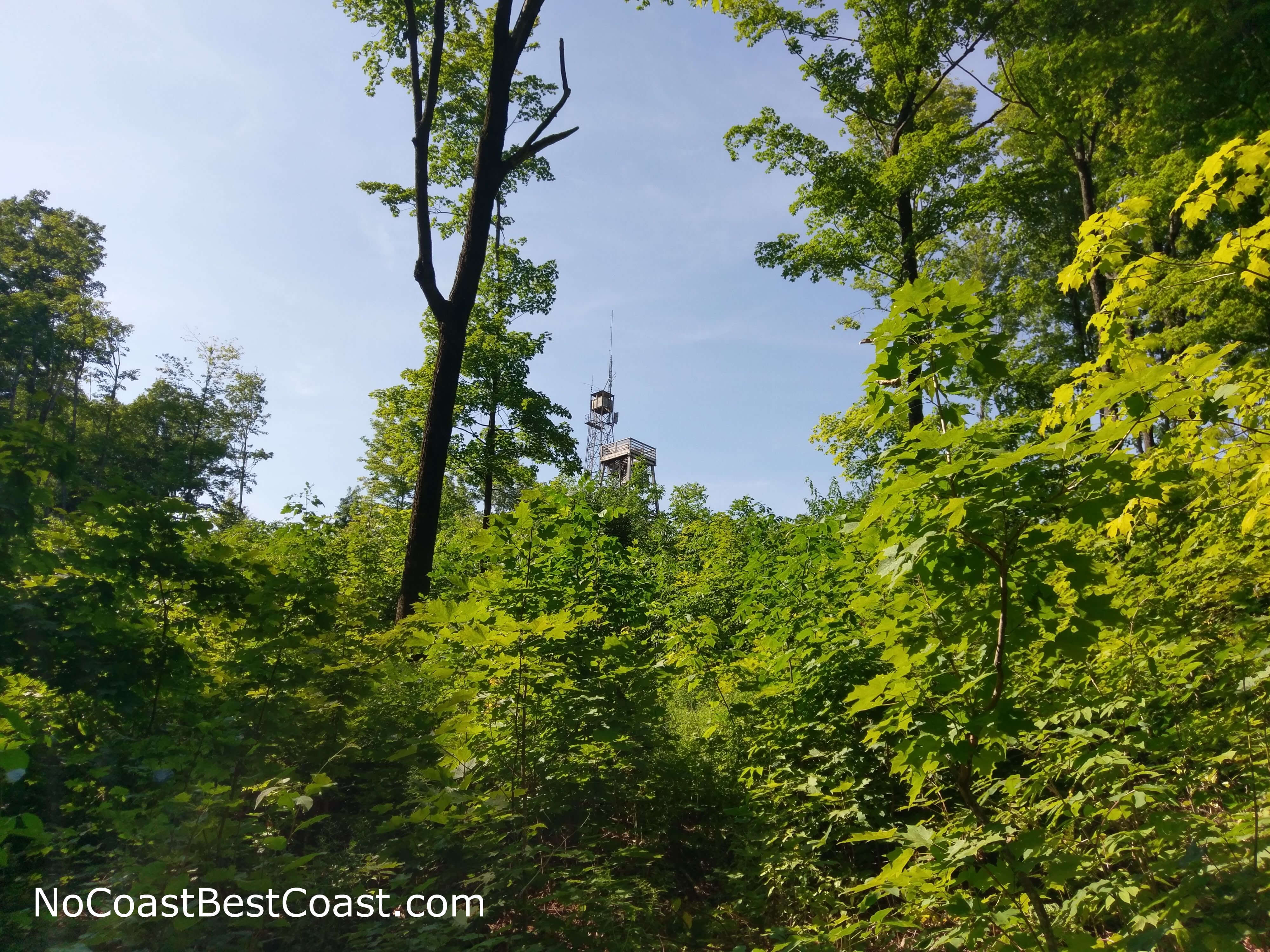
The observation tower as seen from the base of Timm's Hill
Read my post about Timms Hill.
This is another example of how the Midwestern states really celebrate their highpoints even if they aren't anything impressive. Timms Hill is uniquely protected by a small county park deep in rural Northern Wisconsin and has its own resort called High Point Village. The distance from any major city puts this highpoint at a higher difficulty than others on this list, requiring at least a 3 hour drive from either Madison or Minneapolis. From the parking lot, the summit is a short walk up the hill and then many flights of stairs to the top of the observation tower. Despite it being a lower elevation than most of the highpoints on this list, it has one of the better views thanks to the observation tower providing fantastic panoramic views of the rolling hills and forests found in this part of the state. The rest of the park has trails and two absolutely immaculate lakes, one of which is where I took one of my favorite photos of 2018.
Charles Mound, Illinois - 1235 ft
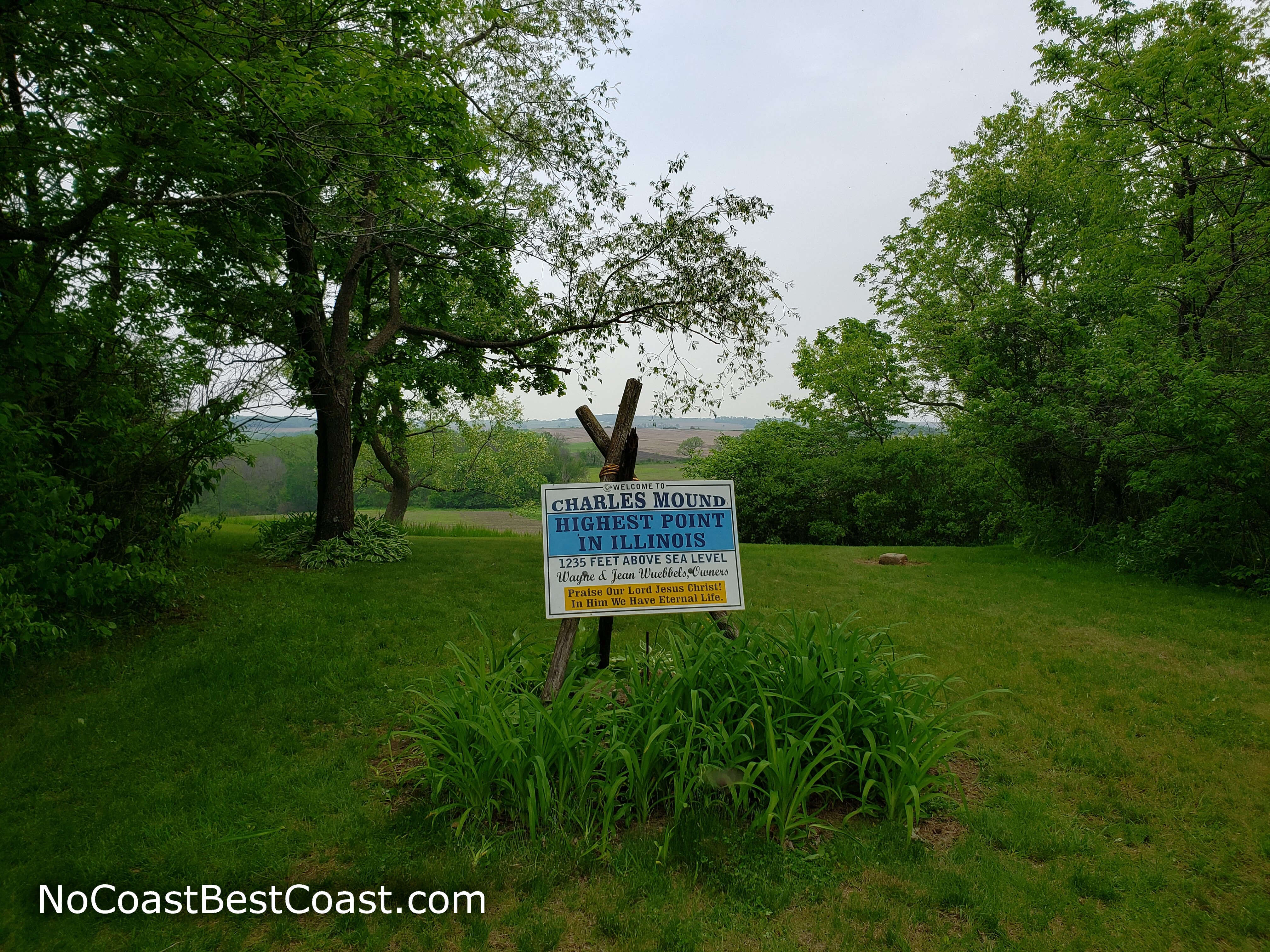
The sign at the top of Charles Mound marking the elevation
Read my post about Charles Mound.
This is yet another Midwest highpoint that is mostly flat, but the main reason it's ranked harder than the others is that access is restricted to only a few select days each year since it's located on private property. Located almost 3 hours from Chicago near the Illinois-Wisconsin border, planning a trip here is a real commitment. However, this part of Illinois is more interesting scenically when compared to the rest of the state's flatness (the state is so flat that the top of Willis Tower is still almost 800 feet higher in elevation than this highest point!). The top of Charles Mound has somewhat of a view, although it's mainly just farm fields. However, you'll find Mississippi Palisades State Park nearby, with amazing bluffs overlooking the Mississippi River that are definitely worth a visit when you're in this part of the state.
Mount Arvon, Michigan - 1957 ft
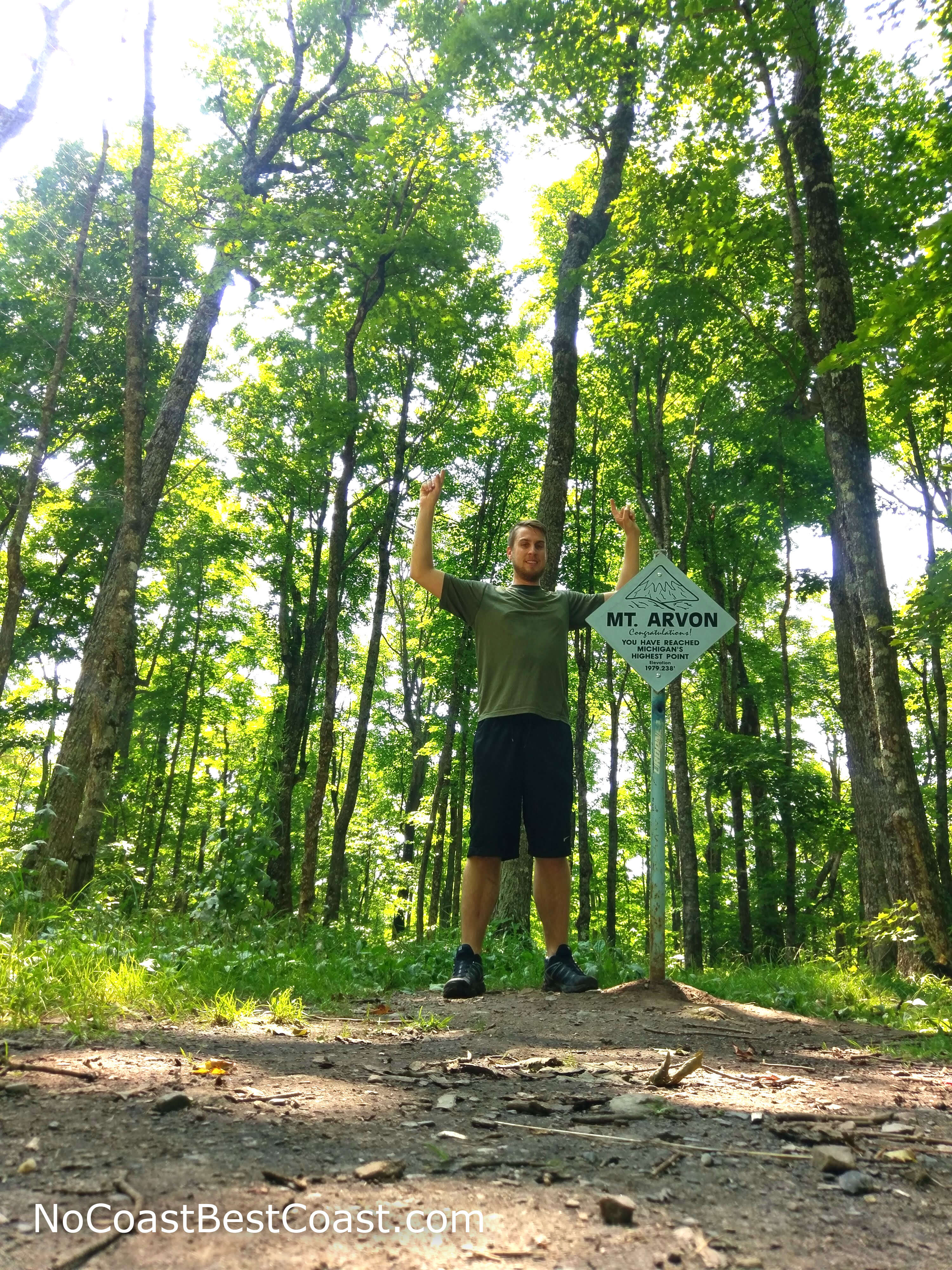
Me standing on top of Mount Arvon
Read my post about Mount Arvon.
In the middle of land owned by a timber company in the Upper Peninsula, you'll find this modest hill that overlooks Lake Superior. Milwaukee and Minneapolis are the closest major cities, but they are still at least a 6 hour drive away! The last stretch of the drives takes you through a labyrinth of dirt forest roads, and you have the choice of driving to the top or parking sooner and hiking a peacefully scenic 3 miles roundtrip through a pristine forest with waterfalls and gentle creeks. The true summit is surrounded by trees, but you'll find a picturesque overlook a short walk away where the timber company strategically cut trees to give views to Lake Superior. This remote forest was so quiet, I didn't hear a single sound as I napped on a bench -- not even birds or bees or the wind in the trees.
White Butte, North Dakota - 3507 ft
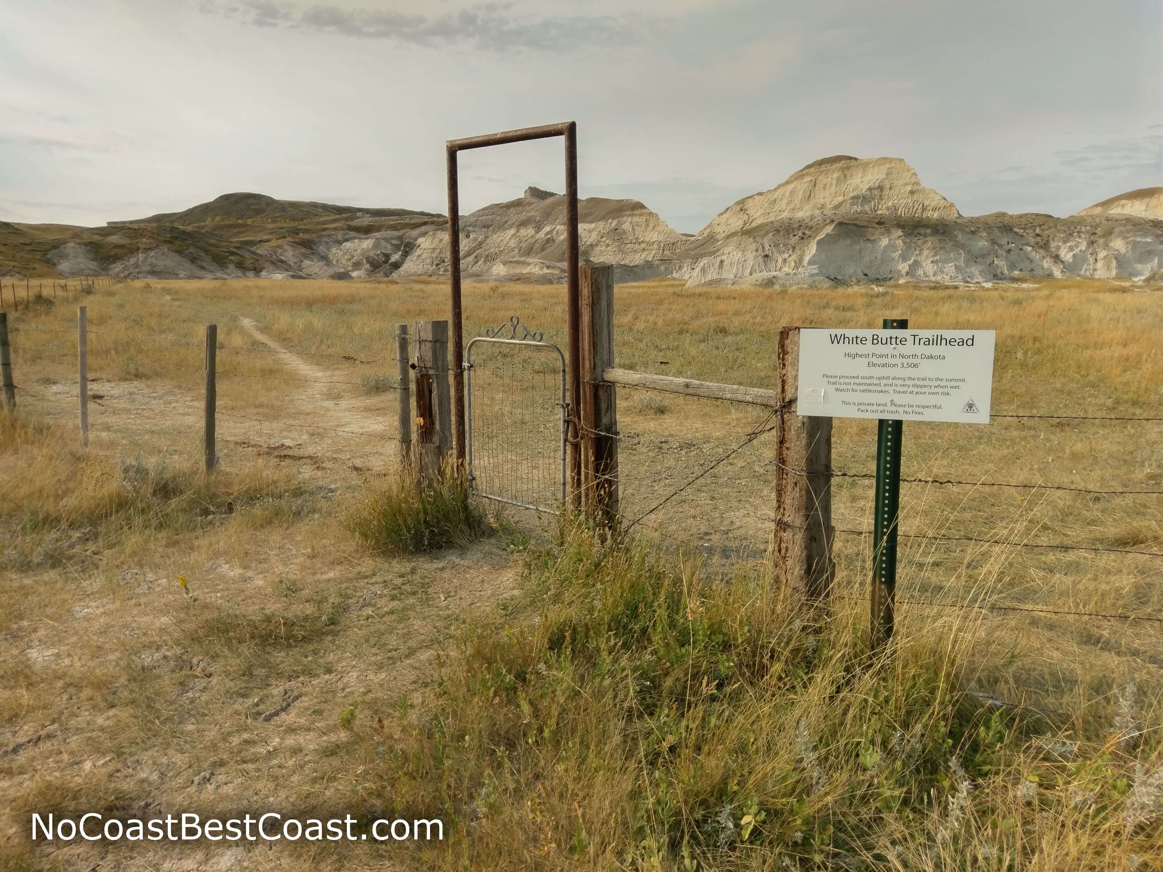
The entrance gate to the trail to White Butte with its namesake white limestone cliffs
Read my post about White Butte.
North Dakota really makes you work for its highpoint. Not only will you follow nebulous directions on unmarked roads a day's drive from any major city, you have to pay between $5 for the privilege of access (it's technically a donation, but necessary to appease the private landowners to keep this highpoint open to the public). The hike is 4 miles roundtrip, starting by walking next to active cow pasture before the ascent to the top using a slippery trail while prairie winds whip your face. All of that effort is worthwhile though, and the views are rather pretty and extend forever over the surrounding flatness. Even better, you can make an extended trip out of this adventure by going to the incredibly scenic Theodore Roosevelt National Park which is less than an hour away.
Eagle Mountain, Minnesota - 2301 ft
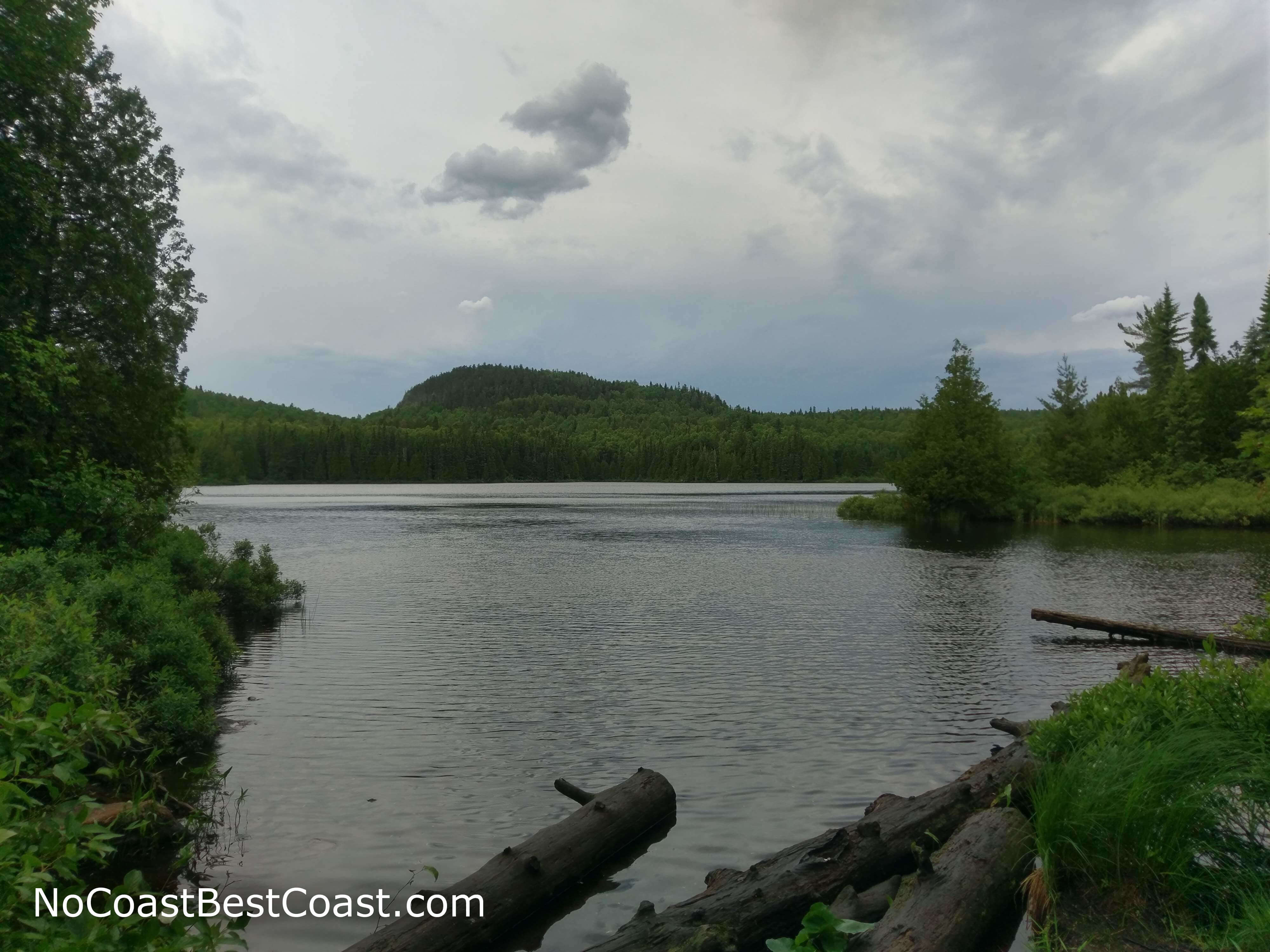
An unnamed peak adjacent to Eagle Mountain
Read my post about Eagle Mountain.
This is one of the few highpoints on this list requiring a decent amount of physical effort to reach, with a 7 mile roundtrip hike and a few hundred feet of elevation gain. Its location in the beautiful Boundary Waters Canoe Area Wilderness means your journey to the top will be memorable, passing a small lake and trekking through dense boreal forest. Almost all the uphill climbing occurs in last mile of the hike, and you'll actually be huffing and puffing your way to the top! While the actual summit is completely surrounded by trees, there is a rocky overlook with views to the south where nearly all of the surrounding land in view is part of the Superior National Forest -- unspoiled nature.
Black Elk Peak, South Dakota - 7242 ft
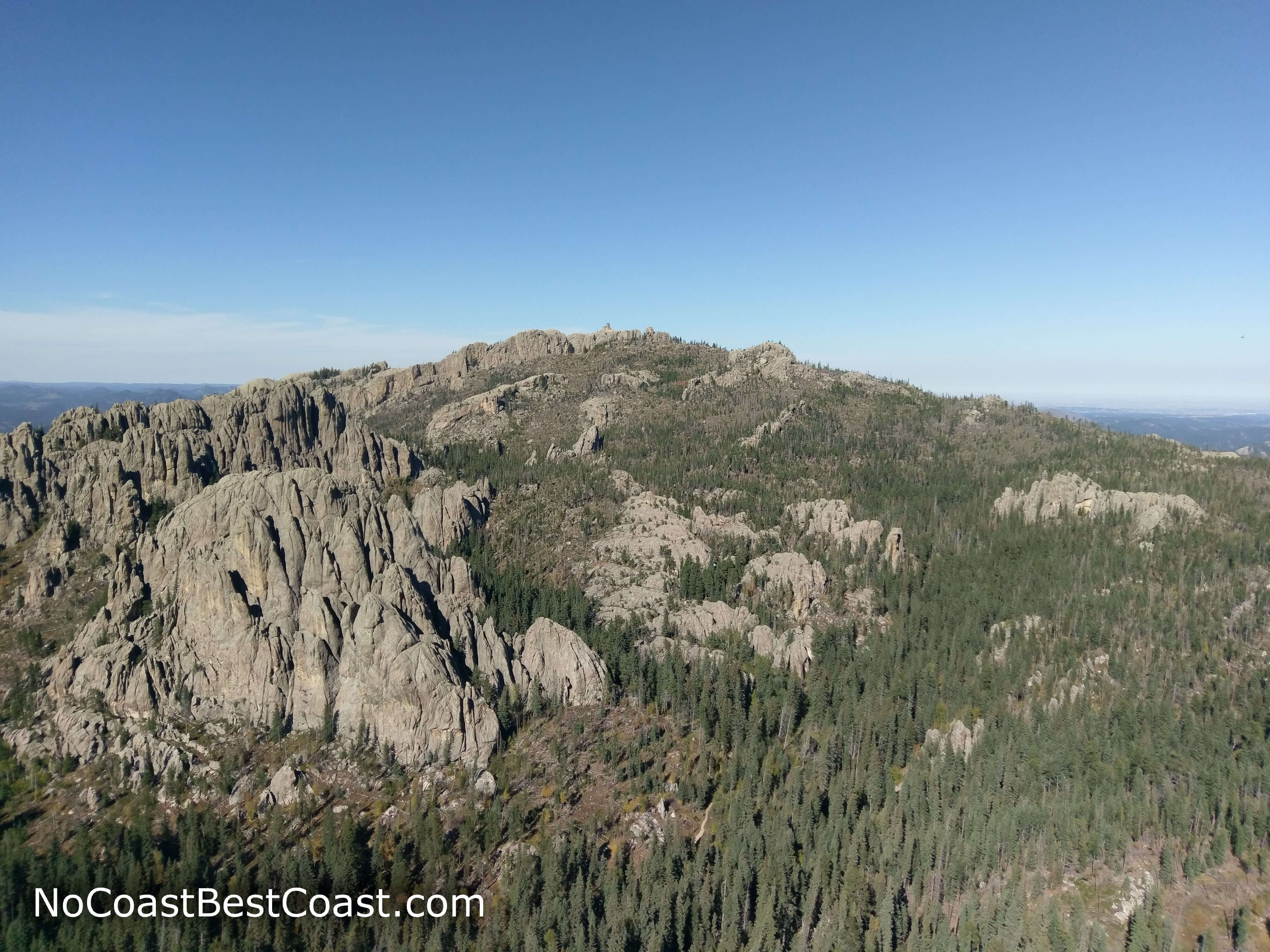
Black Elk Peak as seen from the top of Little Devils Tower
Read my post about Black Elk Peak.
Not only is this the tallest point in the Midwest, it's also the highest peak east of the Rockies, standing over 550 feet taller than the next highest point (Mount Mitchell in the Appalachians of North Carolina). By far the hardest hike of the Midwest highpoints, aspiring climbers must ascend 1,000 feet and travel over 7 miles roundtrip to summit on a popular hiking trail. Though the hike is strenuous, you'll be surrounded by constant beauty and there are numerous spots to catch your breath while enjoying rugged granite rock formations and the pine forest wilderness. It's fitting that the highest point in the Midwest also has the best view, and you can climb to the top of an old stone fire tower for views extending into Montana, Wyoming, North Dakota, and Nebraska as well as Badlands National Park to the east.
Bonus Highpoints
While technically not in the Midwest, I have no qualms about including the highpoints of non-coastal, non-mountainous Arkansas and Oklahoma as honorable mentions.Mount Magazine, Arkansas - 2753 ft
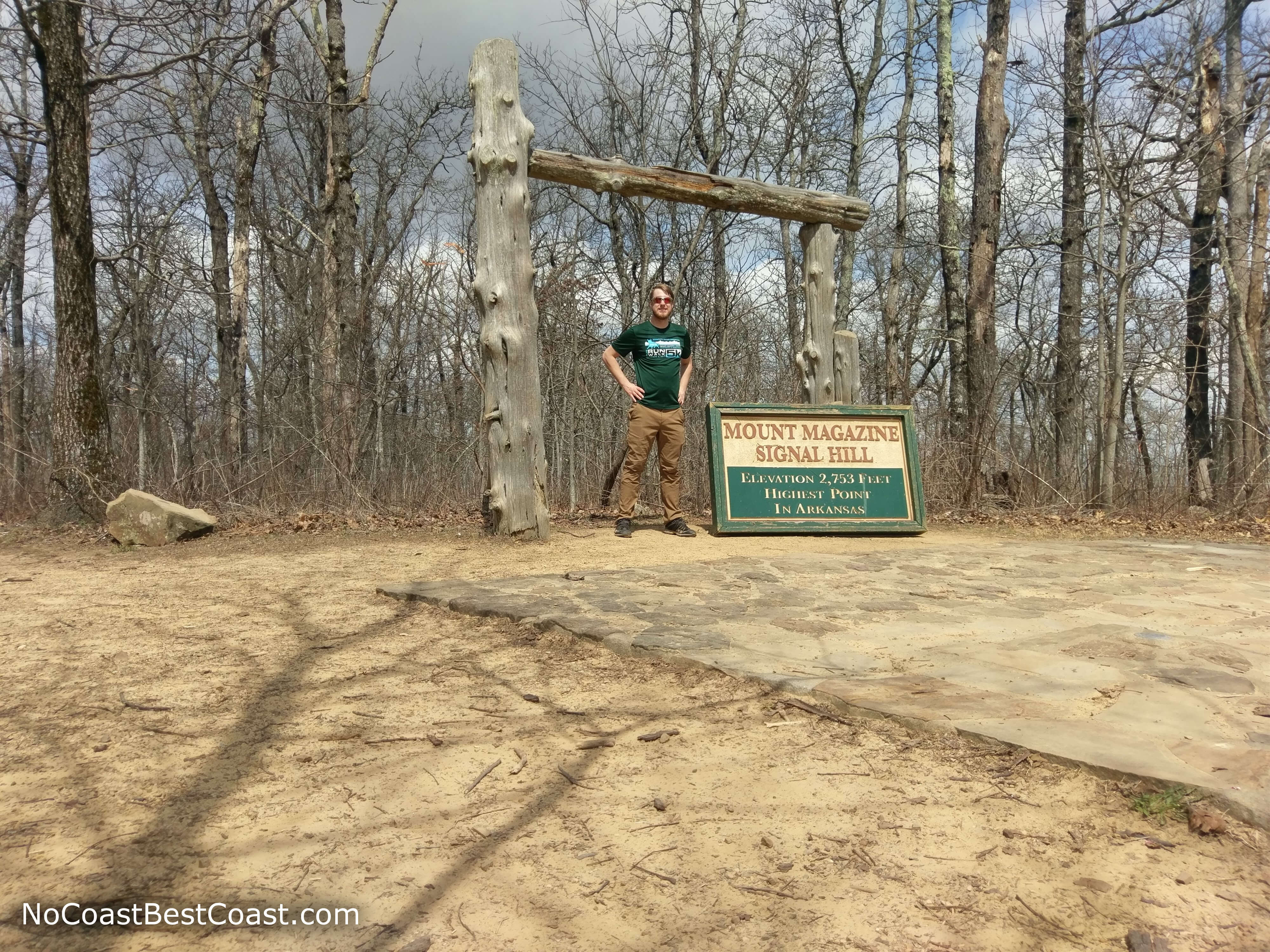
Me standing at the highest point in all of Arkansas
Read my post about Mount Magazine.
Another Ozarks highpoint, a state park protects this "island in the sky", a high plateau with deep valleys on all sides. The hike to the summit is relatively easy, with a gradually sloping trail just under 1.5 miles roundtrip. While the views from the top are mediocre and blocked by trees, the rest of the park offers outstanding vistas thanks to the 1,500 foot prominence of Mount Magazine over the surrounding landscape.
Black Mesa, Oklahoma - 4975 ft
It's strange to think this very Western looking landform belongs in Oklahoma (you'll even see cactus during your journey). The nearest major cities are Albuquerque and Denver both around 5 hours away, and you'll be able to see the actual highest point of this mesa which lies in Colorado. The trail is quite long, requiring more than 8 miles roundtrip of hiking and a couple hundred feet of elevation gain to reach the summit. The trek has views throughout thanks to the treeless landscape.
You can also read about all the highpoints in the Midwest and beyond at SummitPost.com. Happy highpointing! Let me know what you think in the comments section below and be sure to use #nocoastbestcoast on Twitter and Instagram!