| Rating | ★★★★☆(4/5) |
| Overall Difficulty | Hard |
| Navigation Difficulty | Easy |
| Distance | 3.5 miles roundtrip |
| Time | 2.5 hours |
| Terrain | Strenuous climbing, 1400 feet of elevation gain |
| Best Seasons | Spring, Summer, Fall |
| Dog Friendly | Yes |
| Accessible | No |
Highlights
- Impressive natural stone arch
- Views of Boulder and the Denver skyline on a clear day
- Scenic pine forest and meadows next to the Flatirons
Hike Summary
Boulder is often acclaimed for its hiking opportunities, and the trip to Royal Arch is exemplary of the beauty you'll find in the Boulder Open Space. Don't be fooled by the short 3.5 mile distance though, this trek is surprisingly difficult and has over 1400 feet of elevation gain. Your effort will be rewarded with a natural arch at the end and some great views throughout.
The trail starts with an uphill climb on the Chautauqua Trail. During this initial push, you'll always have an excuse to take a breather to savor the best view of Boulder's famous reddish, toothy rock formations known as the Flatirons, as pictured below.
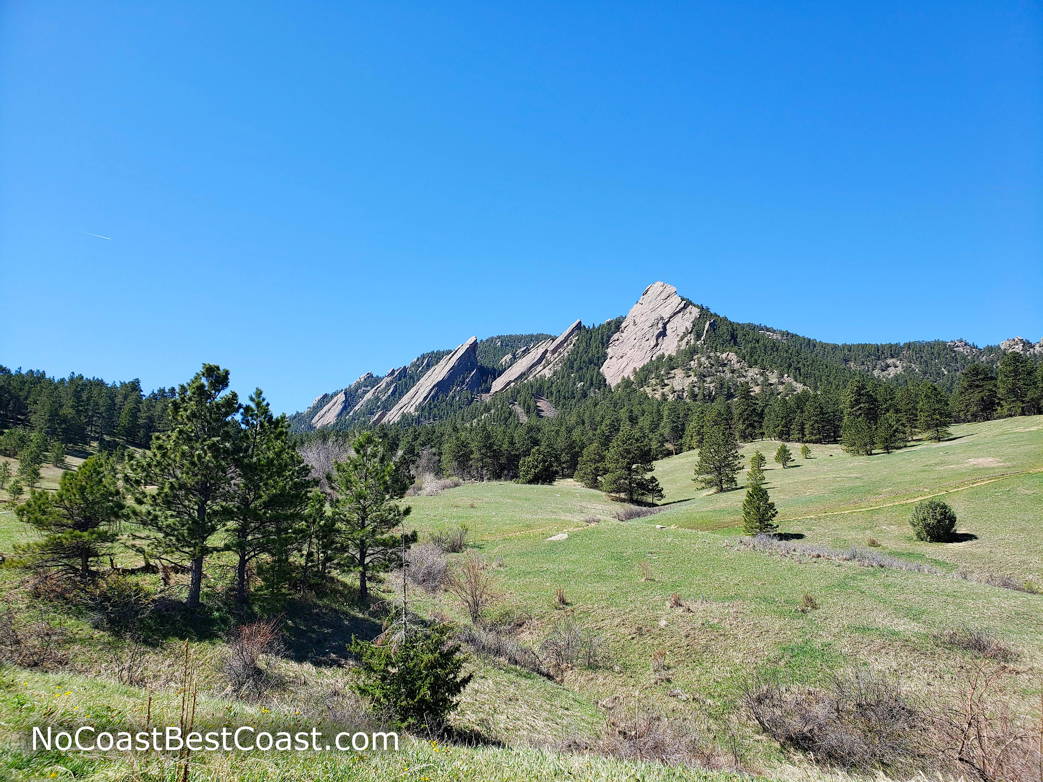
Boulder's famous Flatirons from the Chautauqua Trail
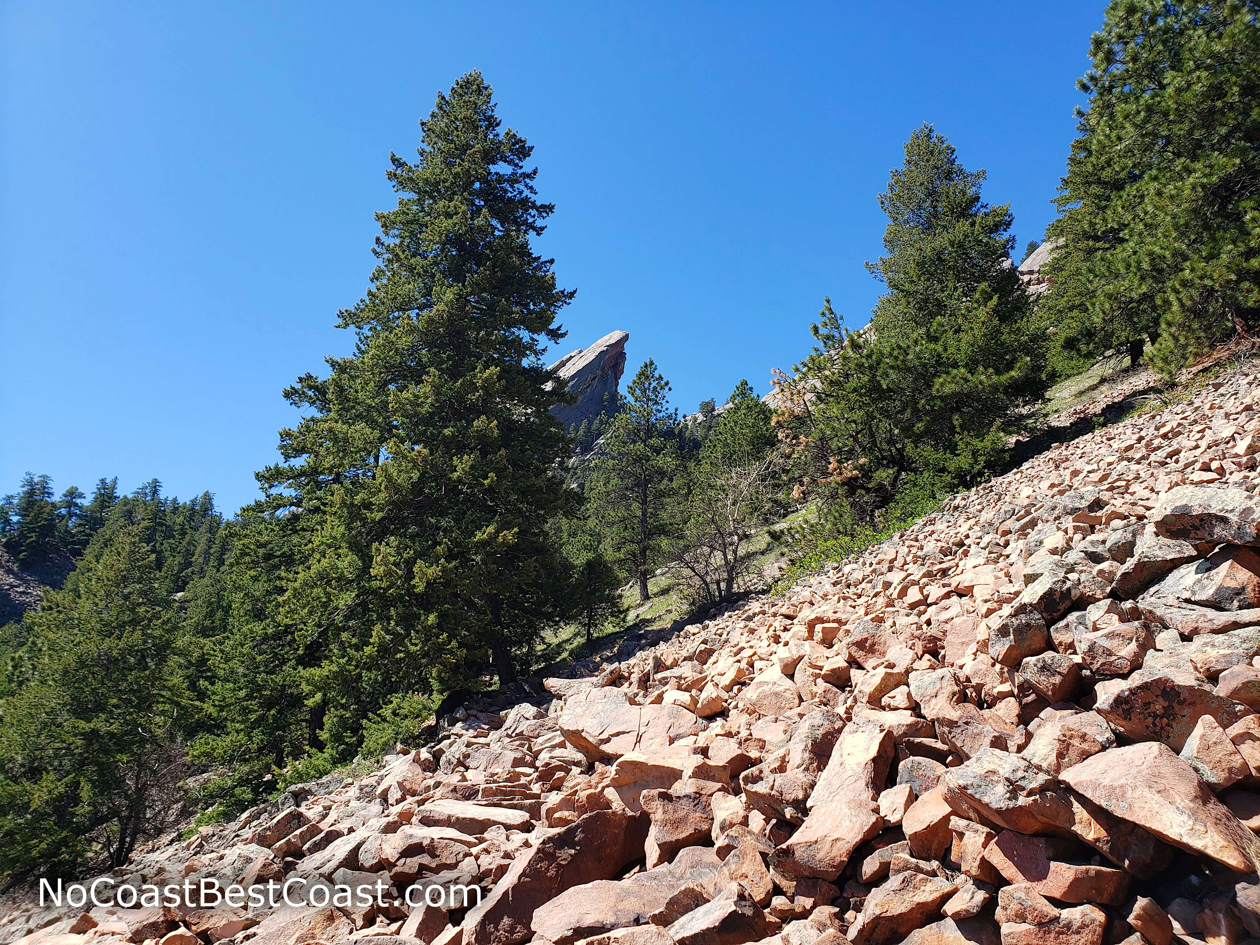
A field of rocks on the side of the mountain
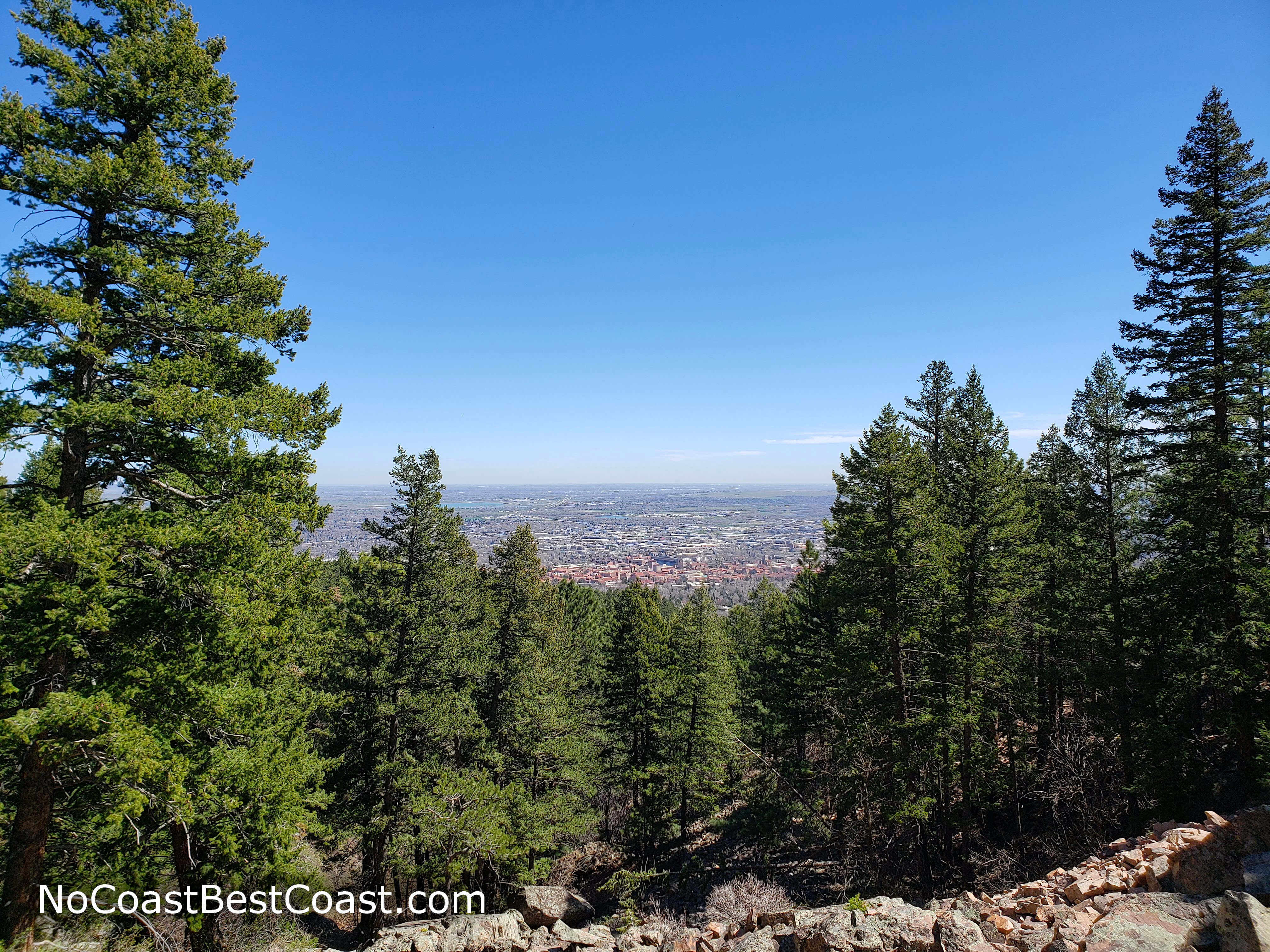
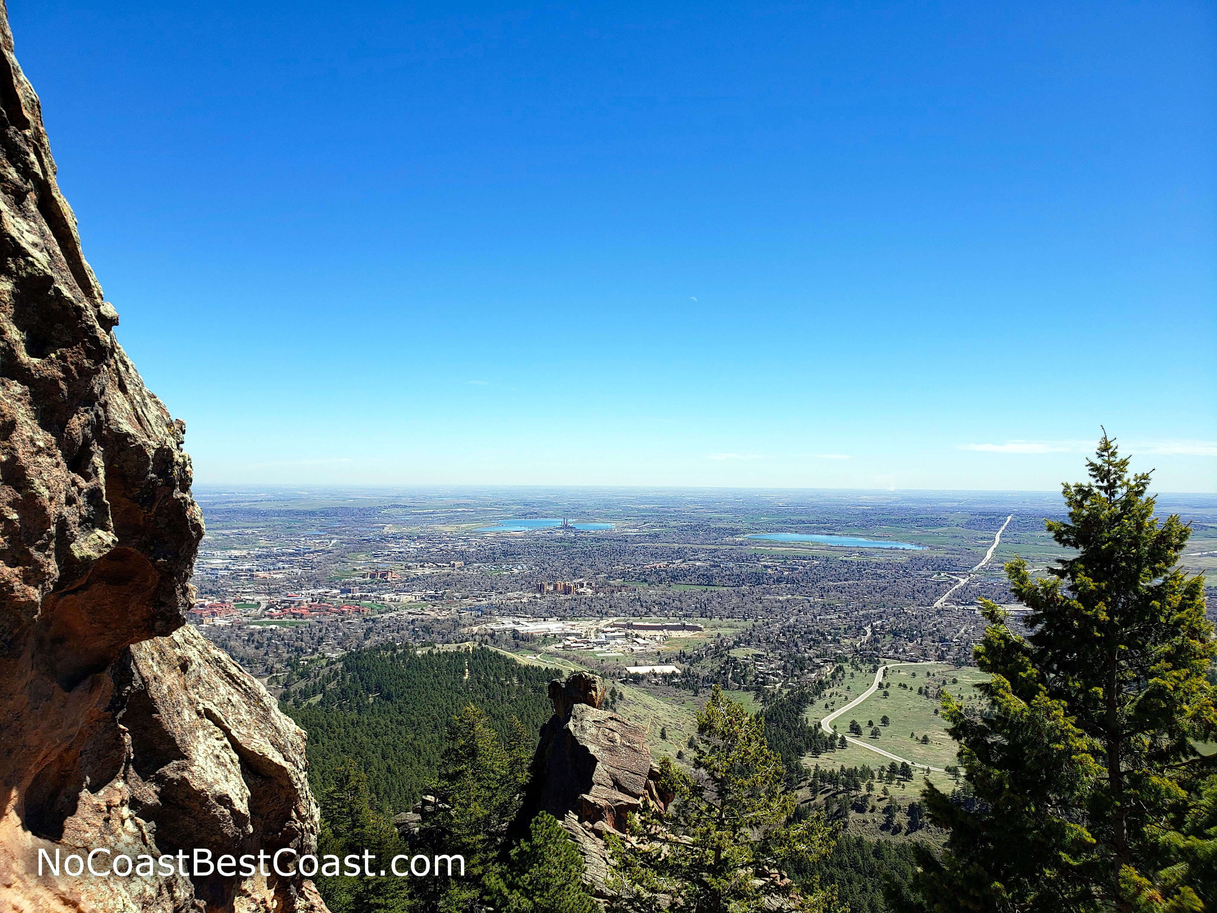
The view to the east from the rock field
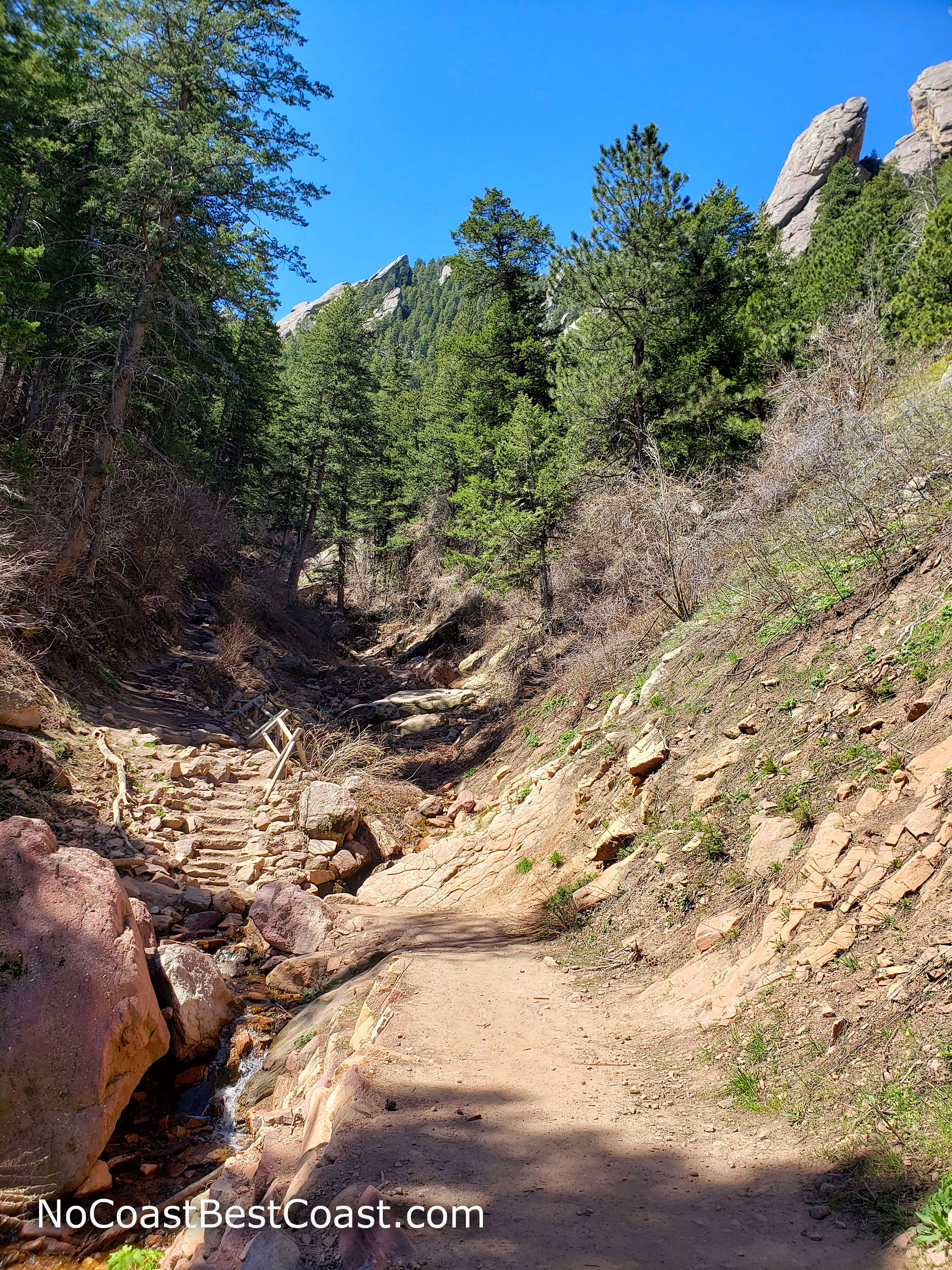
A pleasant creek before starting a difficult climb
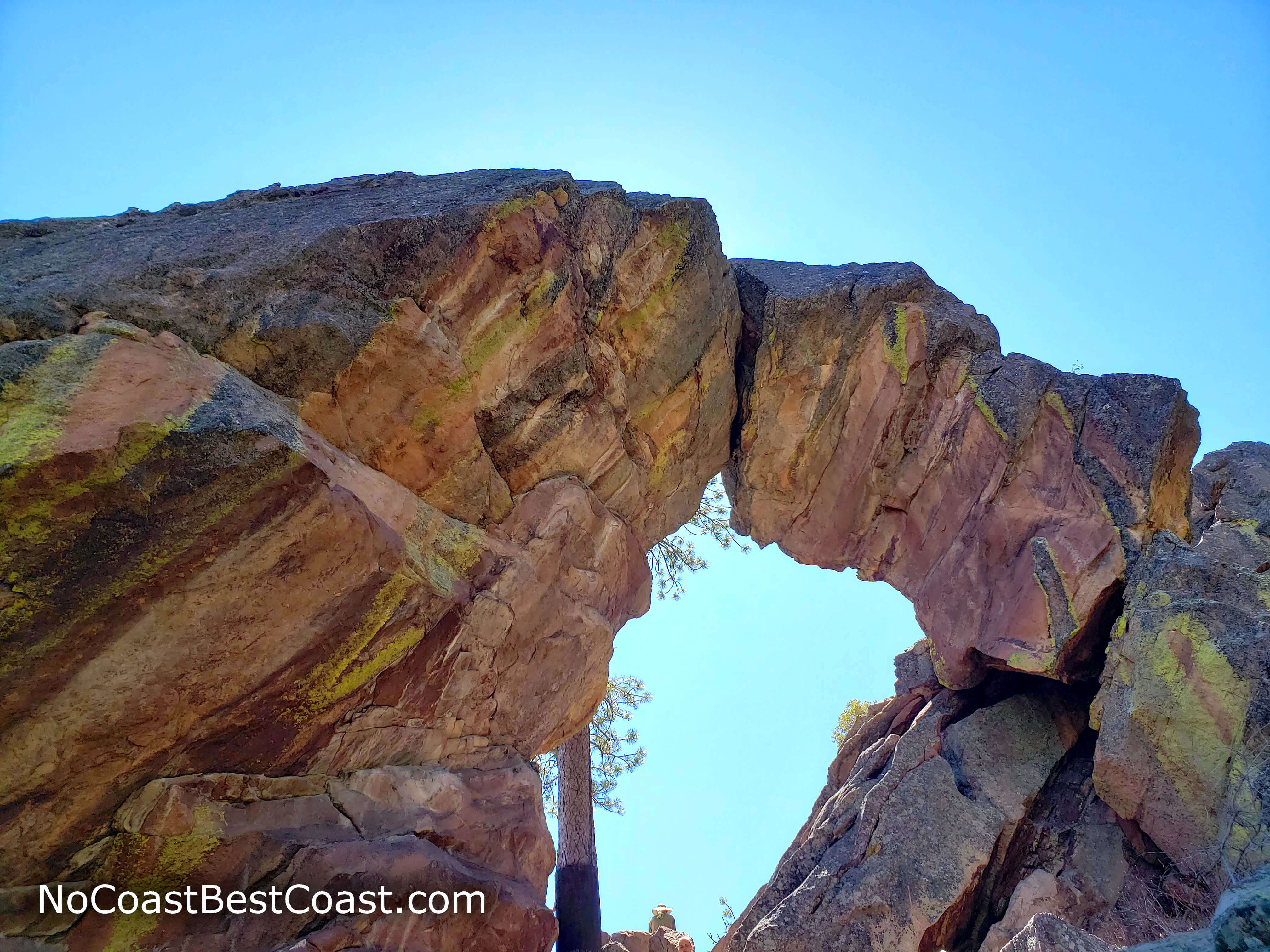
Royal Arch is your reward for your effort
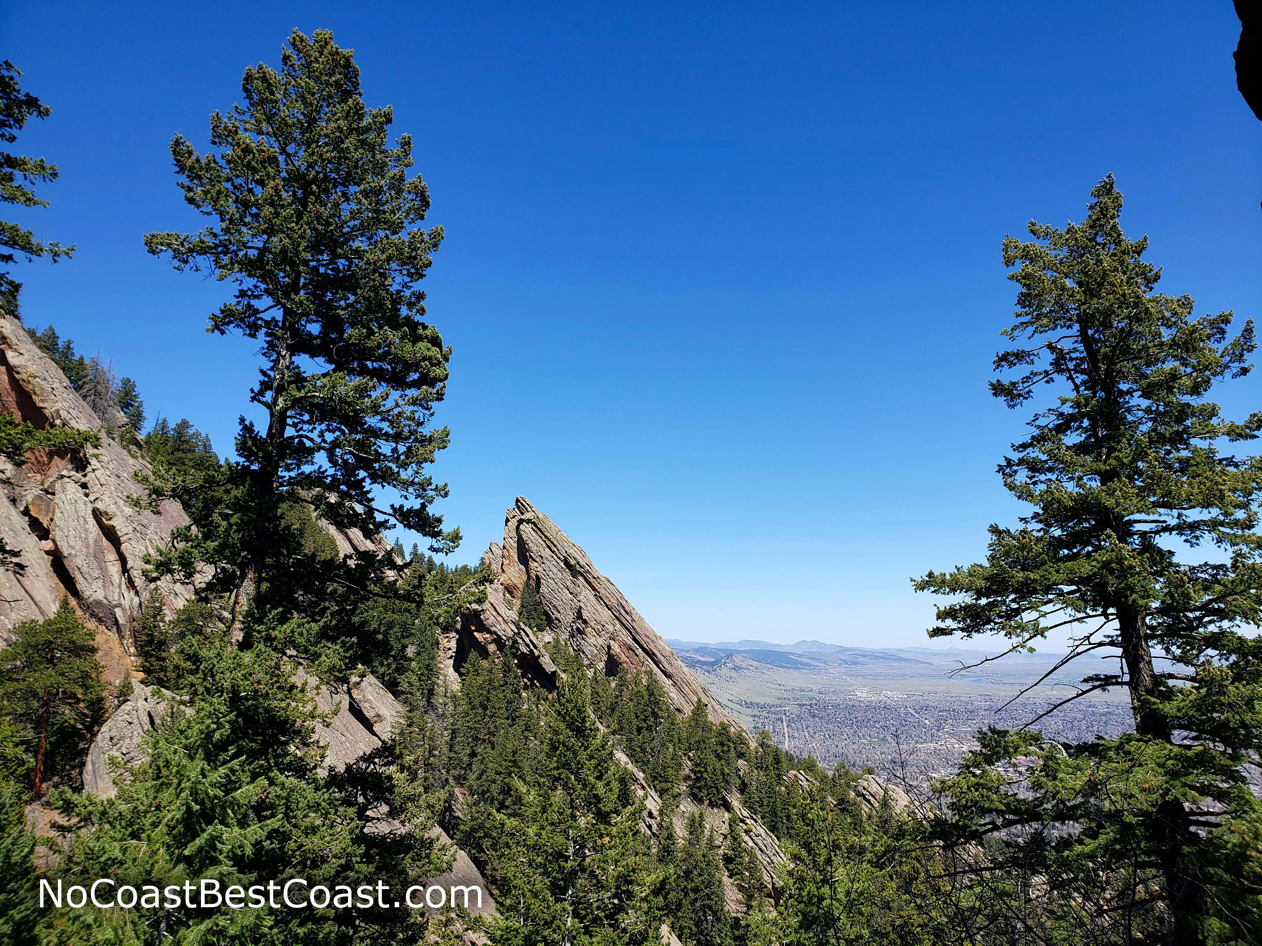
A side view of the Flatirons from Royal Arch
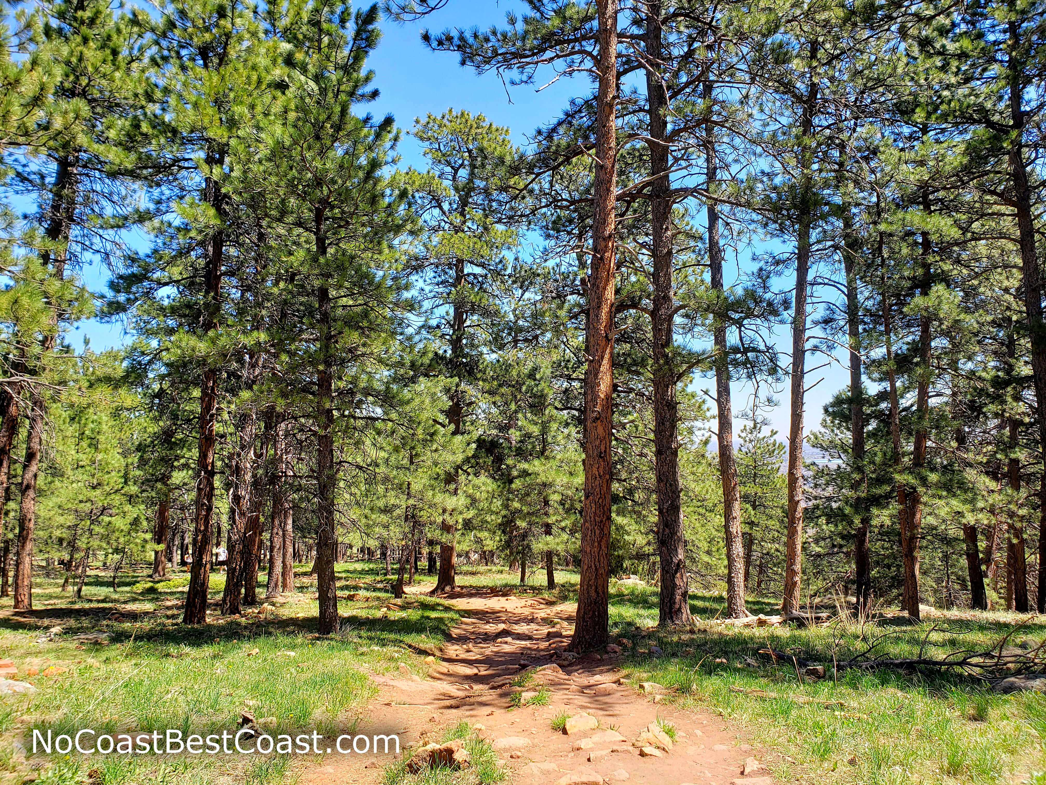
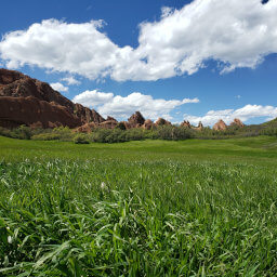
Ponderosa pine forest on Bluebell Mesa
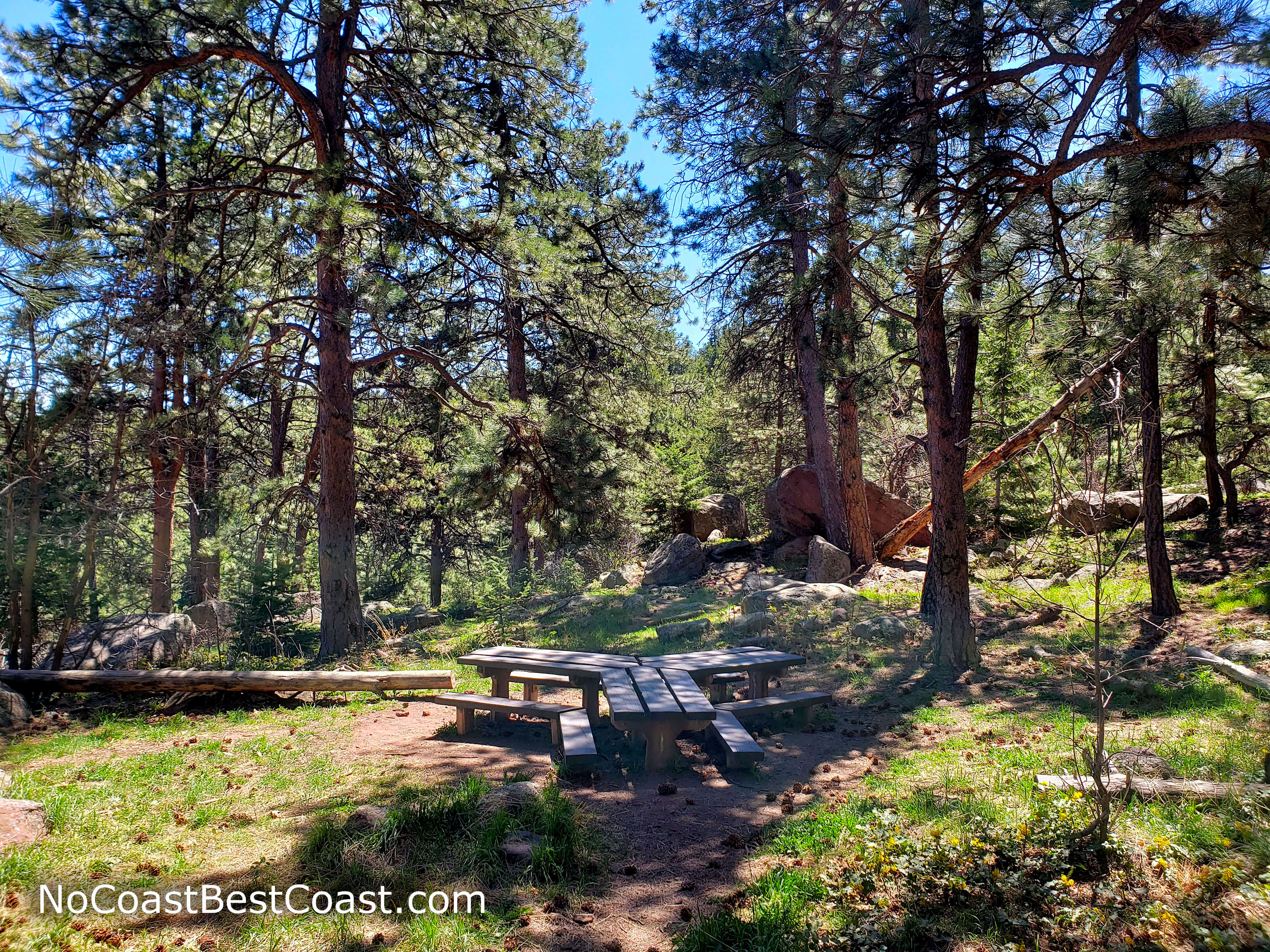
One of a couple of picnic tables along the Bluebell Mesa Trail
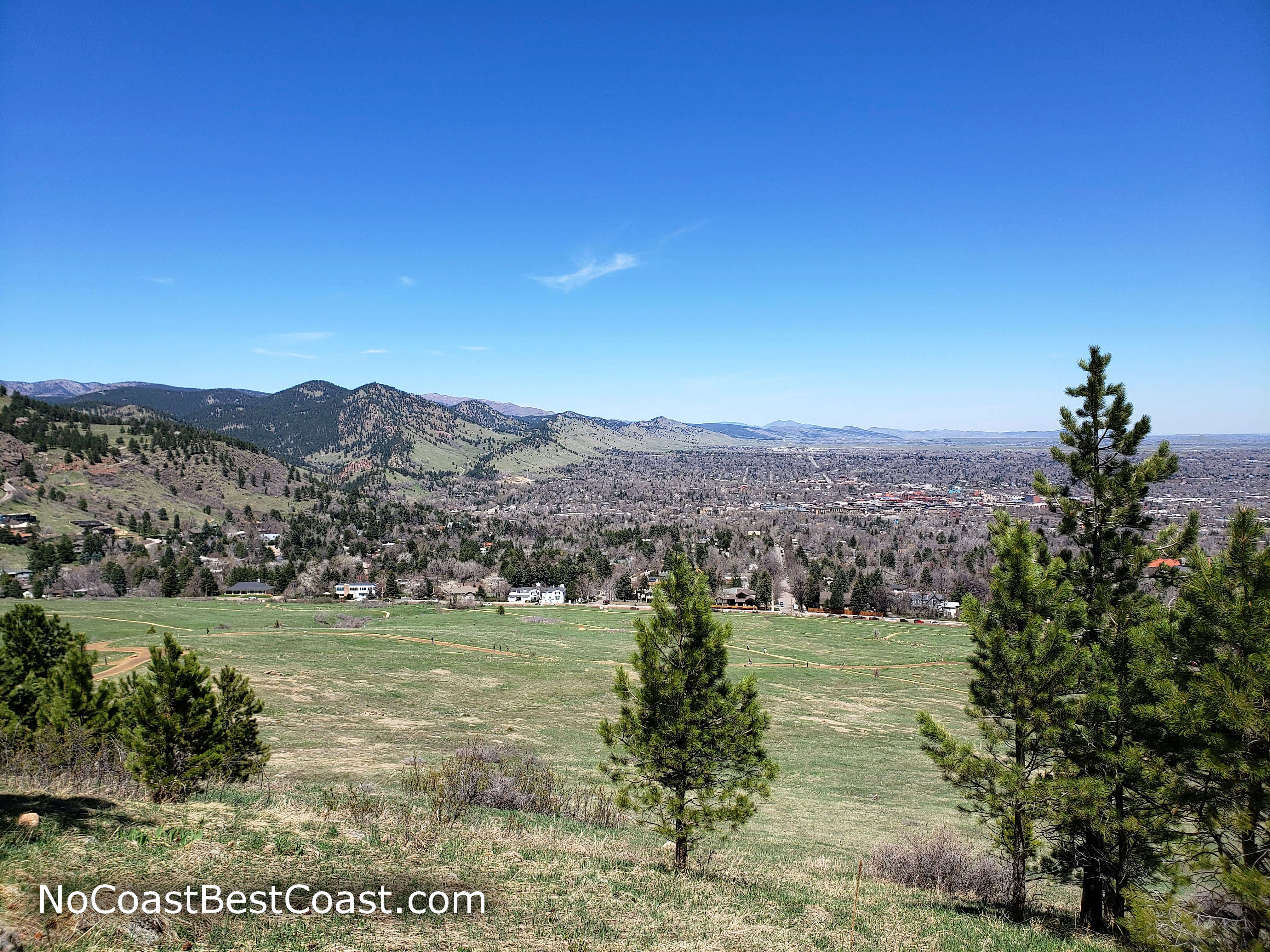
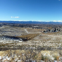
Boulder as seen from the Bluebell Mesa Trail
Hiked on Wednesday, April 29th, 2020 by Ricky Holzer
Important Information
Dogs must be on leash near the trailhead, but further along the trail, dogs are allowed off leash if they have a Voice and Sight Tag. The route to Royal Arch is difficult and not suitable for most children; there are a ton of other kid-friendly options starting from Chautauqua Trailhead or the nearby Enchanted Mesa Trailhead. Spring, summer, and fall are the best time to visit, since winter snow and ice may make the steep Royal Arch Trail dangerous. This is an extremely popular trailhead, so expect to see many people no matter when you come -- even on weekdays.
Directions
From Denver, take U.S. Highway 36 west to Boulder. Once in Boulder, take the exit for Baseline Road, then turn left. Continue straight, then turn left into the parking area for Chautauqua Park.
Google Maps Directions
Parking, Fees, and Facilities
Parking is free on weekdays, but you have to pay per hour on weekends and holidays. This is a popular trailhead, so you may have difficulty finding a space. You may have to park on nearby streets.
There are flush toilets near the trailhead.
Nearby Hikes
William F. Hayden Park, Colorado
★★★★☆(4/5)
Deer Creek Canyon Park, Colorado
★★★★☆(4/5)
Bluffs Regional Park, Colorado
★★★☆☆(3/5)
Roxborough State Park, Colorado
★★★★★(5/5)