| Rating | ★★★★☆(4/5) |
| Overall Difficulty | Easy |
| Navigation Difficulty | Easy |
| Distance | 0.35 miles roundtrip |
| Time | 30 minutes |
| Terrain | A few hills |
| Best Seasons | All |
| Dog Friendly | Yes |
| Accessible | No |
Highlights
- Wild blueberries and raspberries
- Signs identifying native plants
- Excellent views of nearby lakes
Hike Summary
This is a quick, easy hike and a great way to start your day, especially if you spent the night camping at nearby Trail's End (a most excellent campground that I highly recommend). With multiple nice views of lakes and signs labeling the plants along the trail, you will become well acquainted with the lovely nature located on the Gunflint. There's also a nature center and museum to visit -- surprisingly I was up so early on a Saturday that neither were open yet, so I can't attest to their quality. All of the above reasons make this the perfect place for the whole family.
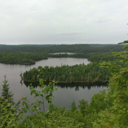
The trail is called Rubaboo Road, named for the porridge eaten by the Voyageurs. It starts near the covered picnic area (which was still under construction when I visited, but should be brand new when you visit!) and is labeled in purple on the official map linked at the bottom of the page. The path hugs Saganaga Lake at first, with nice views like pictured below.
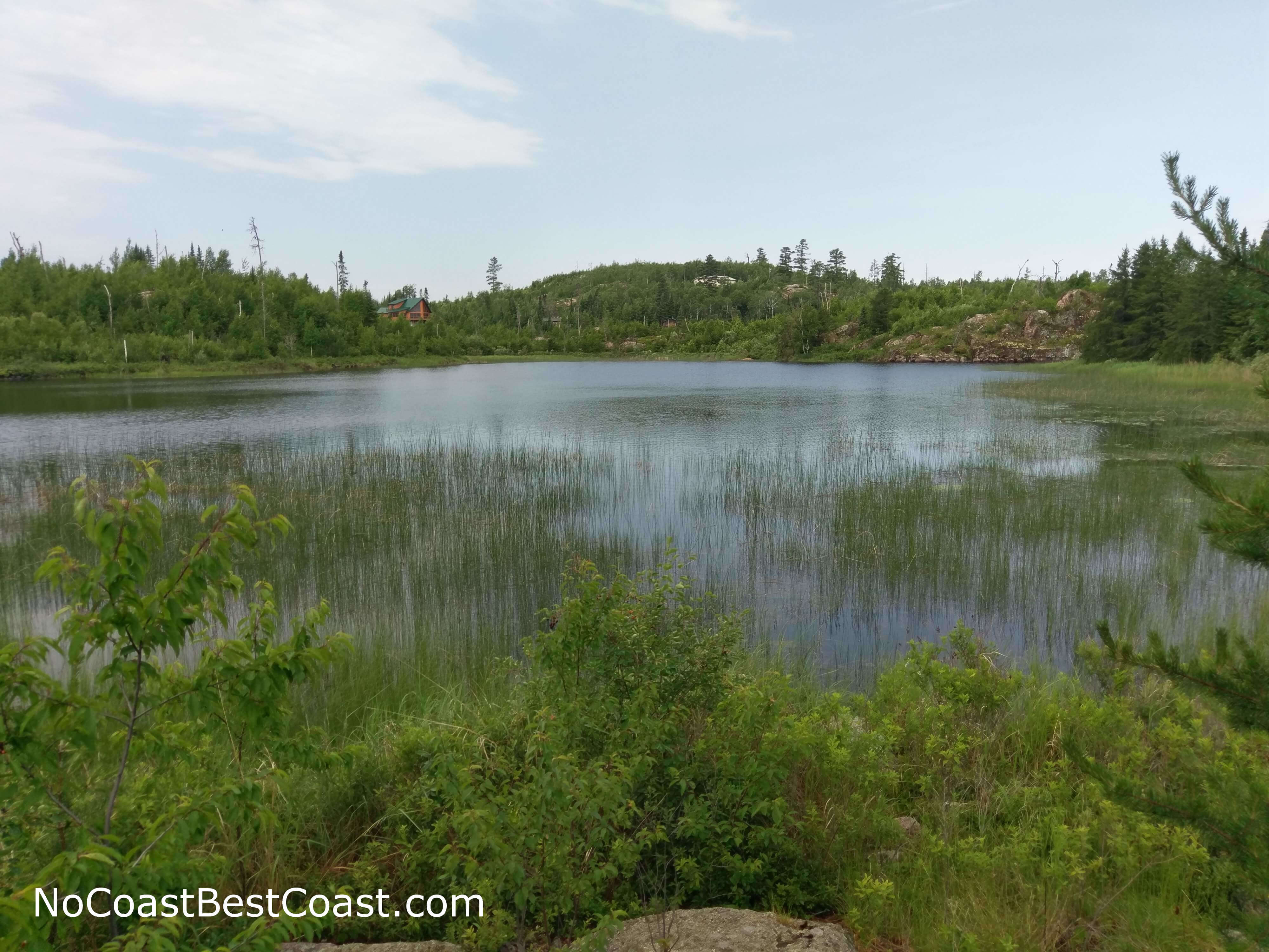
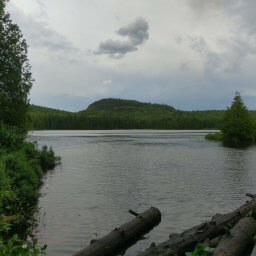
This view of Saganaga Lake greets you almost immediately after starting on the trail
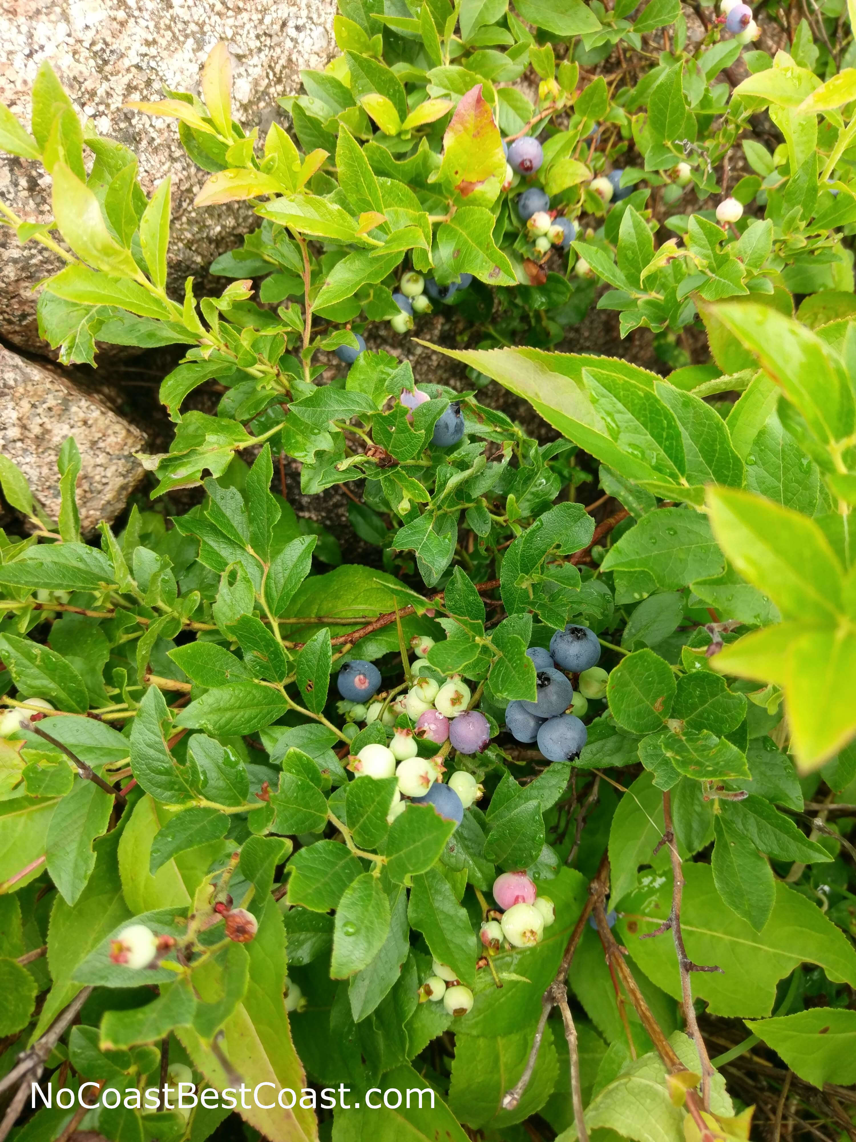
I ate way too many of these wild blueberries while on the trail
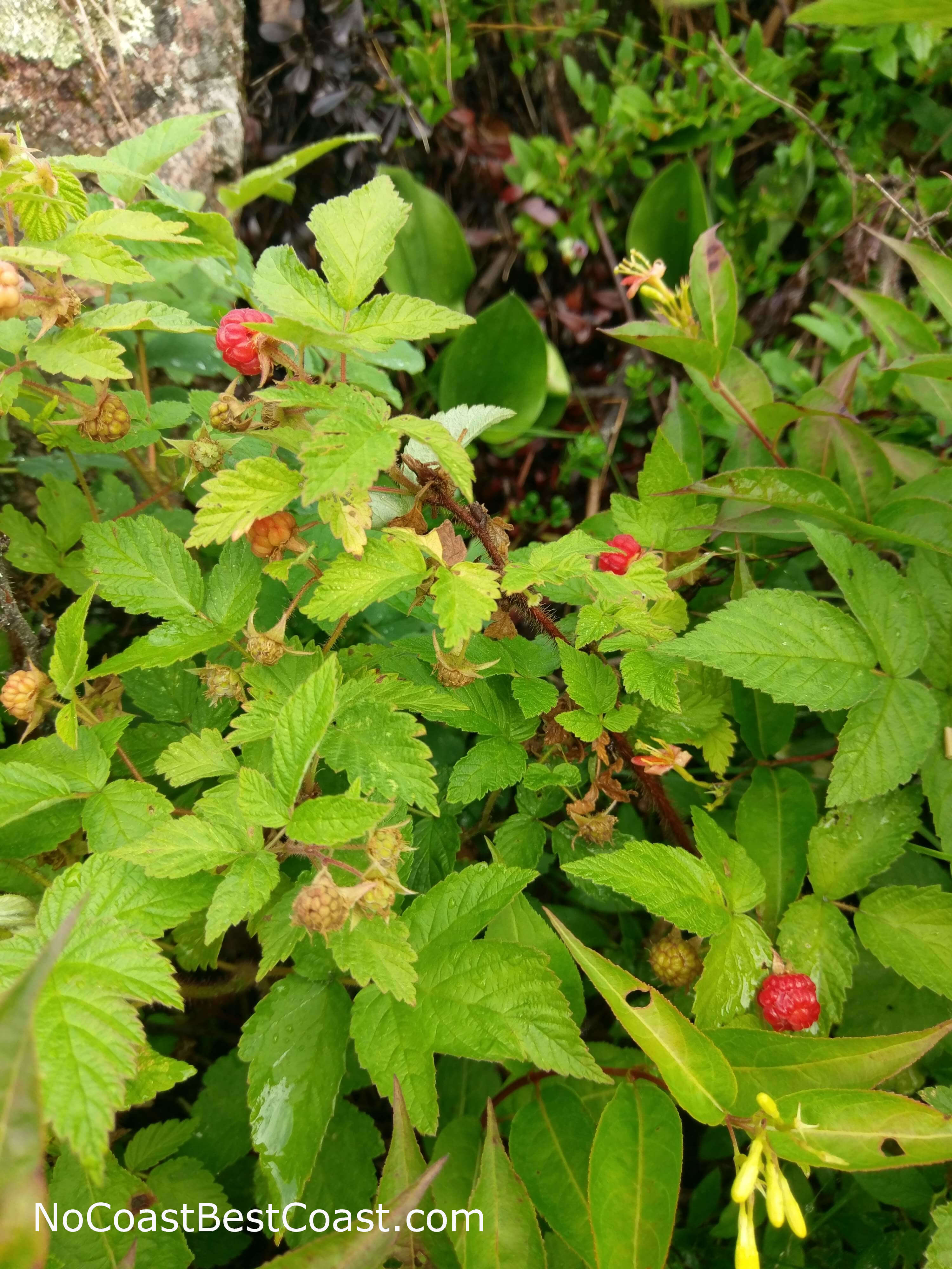
Wild raspberries grow here too!
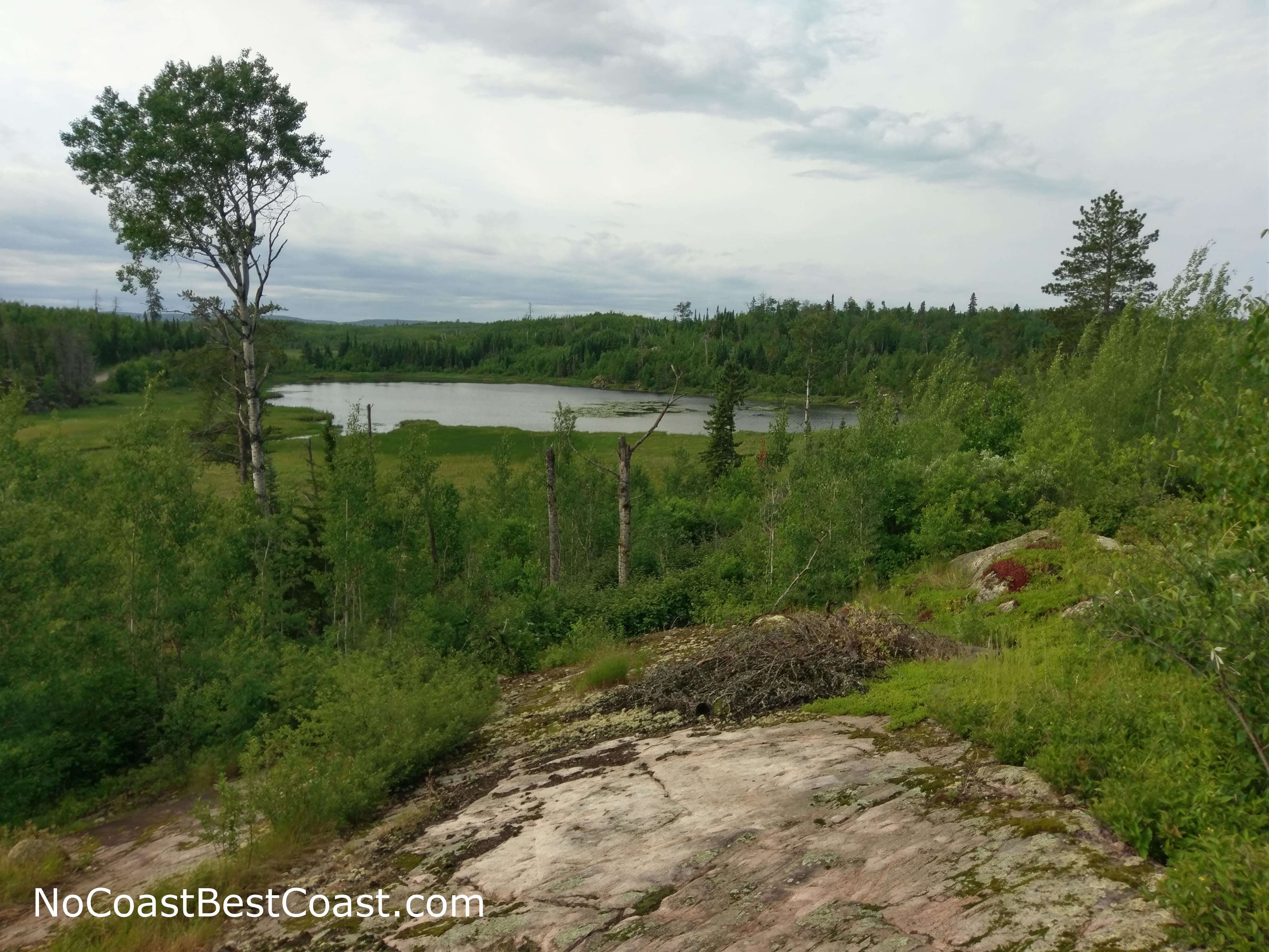
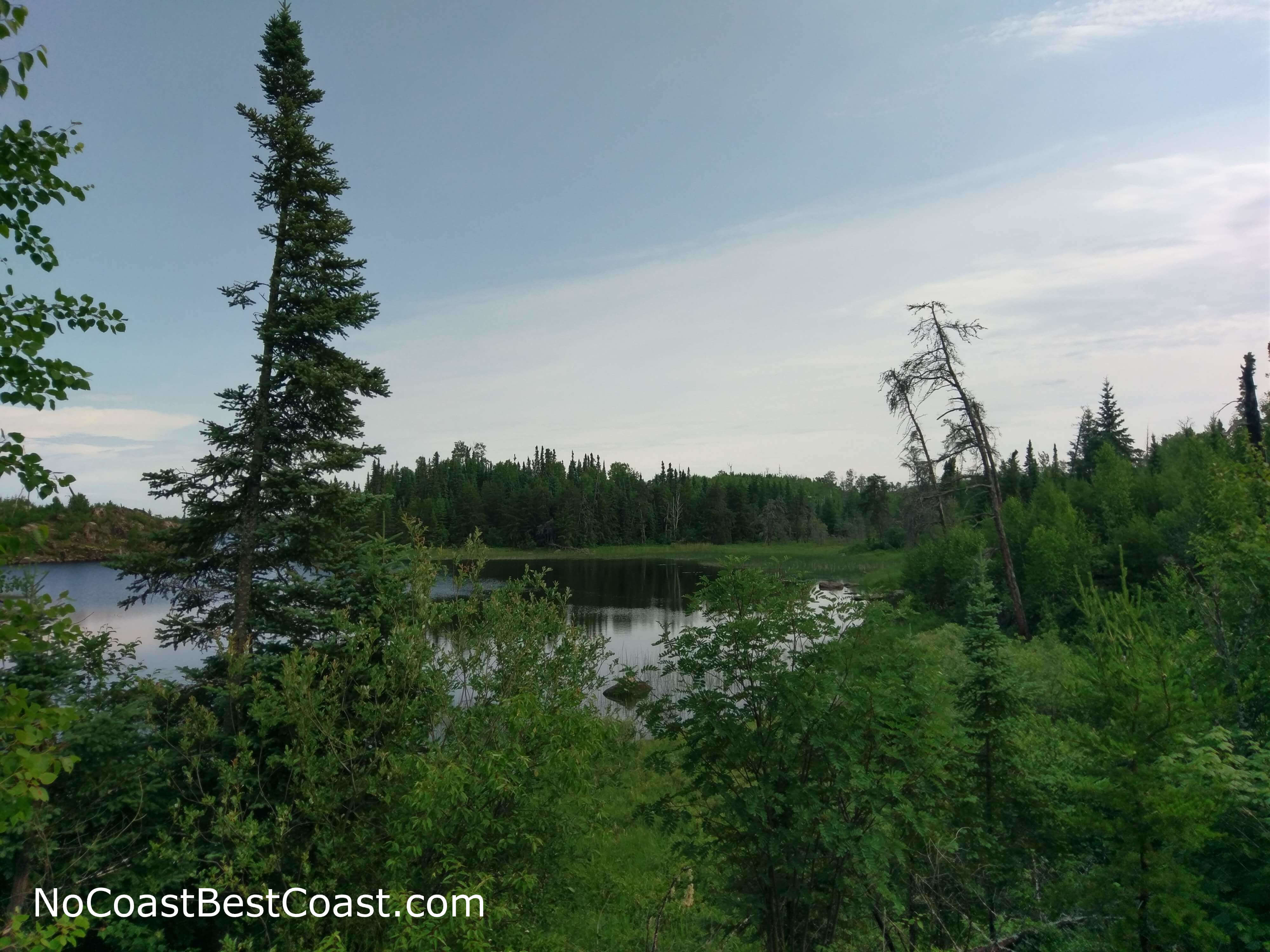
The view from Moose Pond Point, overlooking (obviously) Moose Pond
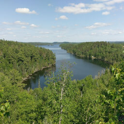
The view of Saganaga Lake from Algoman Overlook
Hiked on Saturday, June 30th, 2018 by Ricky Holzer
Important Information
Dogs are allowed on leash. This is an excellent place for children to hike thanks to the easy trails, wild blueberries to pick in July and August, and museum and nature center to visit before or after your hike. This particular hike is not accessible, but the boardwalk that connects to this trail is ADA accessible (the website states there is another accessible trail, but it isn't identified on the official map linked at the bottom of the page). While the museum and nature center are only open from Memorial Day to the third Sunday of October, you can access the hiking trails year round and outside of building hours. I hiked before the museum opened on a Saturday morning and had the trail completely to myself, but I would guess there are slightly more people around once the museum is open.
Directions
From Grand Marais, drive up the Gunflint Trail (Cook County Highway 12) for about 55 miles, just about to Trail's End. Turn right on Moose Pond Drive (Cook County Highway 81) and look for the entrance gate for the Chik-Wauk Museum on the right.
Google Maps Directions
Parking, Fees, and Facilities
Parking is free! There is a museum and nature center nearby with flush toilets and vending machines; note that you will have to pay a small admission fee to view the exhibits, but you can hike for free.
Nearby Hikes
Superior National Forest, Minnesota
★★★★★(5/5)
Superior National Forest, Minnesota
★★★★★(5/5)
Superior National Forest, Minnesota
★★★★★(5/5)
Superior National Forest, Minnesota
★★★★★(5/5)