| Rating | ★★★★★(5/5) |
| Overall Difficulty | Very hard |
| Navigation Difficulty | Medium |
| Distance | 14 miles roundtrip |
| Time | 9 hours |
| Terrain | Strenuous climbing, 4500 feet of elevation gain |
| Best Seasons | Spring, Fall, Winter |
| Dog Friendly | Yes |
| Accessible | No |
Highlights
- Summitting an iconic Ventura County landmark
- Remote trail for peaceful solitude
Hike Summary
If you've ever driven through Ventura County, you've seen Topatopa Bluff, a landmark towering nearly 6400 feet above Western Ventura County known for its rocky banded cliffs. In fact, it's one of the few mountains (if not the only place) in California where you can see snow while standing on the beach! Ever since I moved to Ventura, I dreamt of climbing to the top of this mountain I'd see every day. Now that I've done it, I can say it is no easy feat, requiring a 14 mile trek and 4500 feet of elevation gain. However, the effort is worth the reward of views extending all the way across Ventura County to the Pacific Ocean to the Channel Islands.
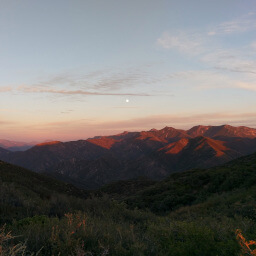
The hike begins by steadily climbing the dirt forest road Sisar Canyon Road. The road follows Santa Paula Creek, and the trail is beautifully shaded by trees. After about 3 miles, the road sharply bends left for the second time. Straight in front of you on this sharp curve you will find a trail with a sign indicating the Nordhoff Ridge Road is 2.5 miles away. Take this trail (you can continue on the road and you'll eventually end at the Nordhoff Ridge Road, but it's significantly longer). Topatopa Bluff will be in view on the right side of the trail, as pictured below.
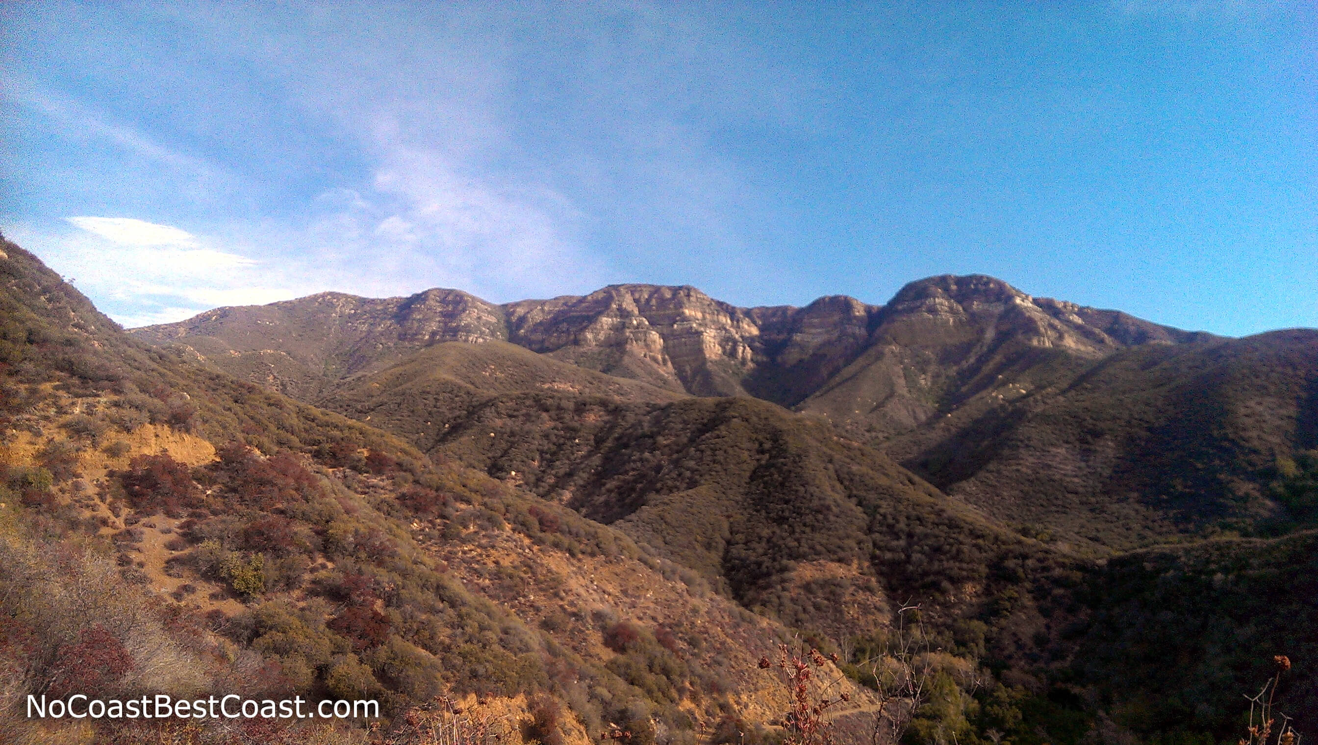
The iconic ridge of Topatopa Bluff looming overhead
Once you reach the Nordhoff Ridge Road, turn right. You'll only be on this mostly flat stretch of road for about a half mile before looking for the use-trail along the ridge on the right side of the road. Try your best to follow the overgrown switchbacks until you reach the summit.
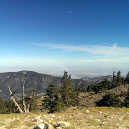
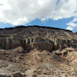
At the top, you'll have amazing views. To the north (first picture below), you can see the mountains deeper into the Los Padres National Forest, with Mount Pinos, the highest mountain in Ventura County visible in the far distance. To the west, you can see a portion of that striped cliff that you've been looking at for so long (second picture below). The best view is to the south and west, where you can see across Ojai and Ventura as far as the Channel Islands on a clear day. One final note: take your time on the descent -- 4500 feet is very taxing on your body!
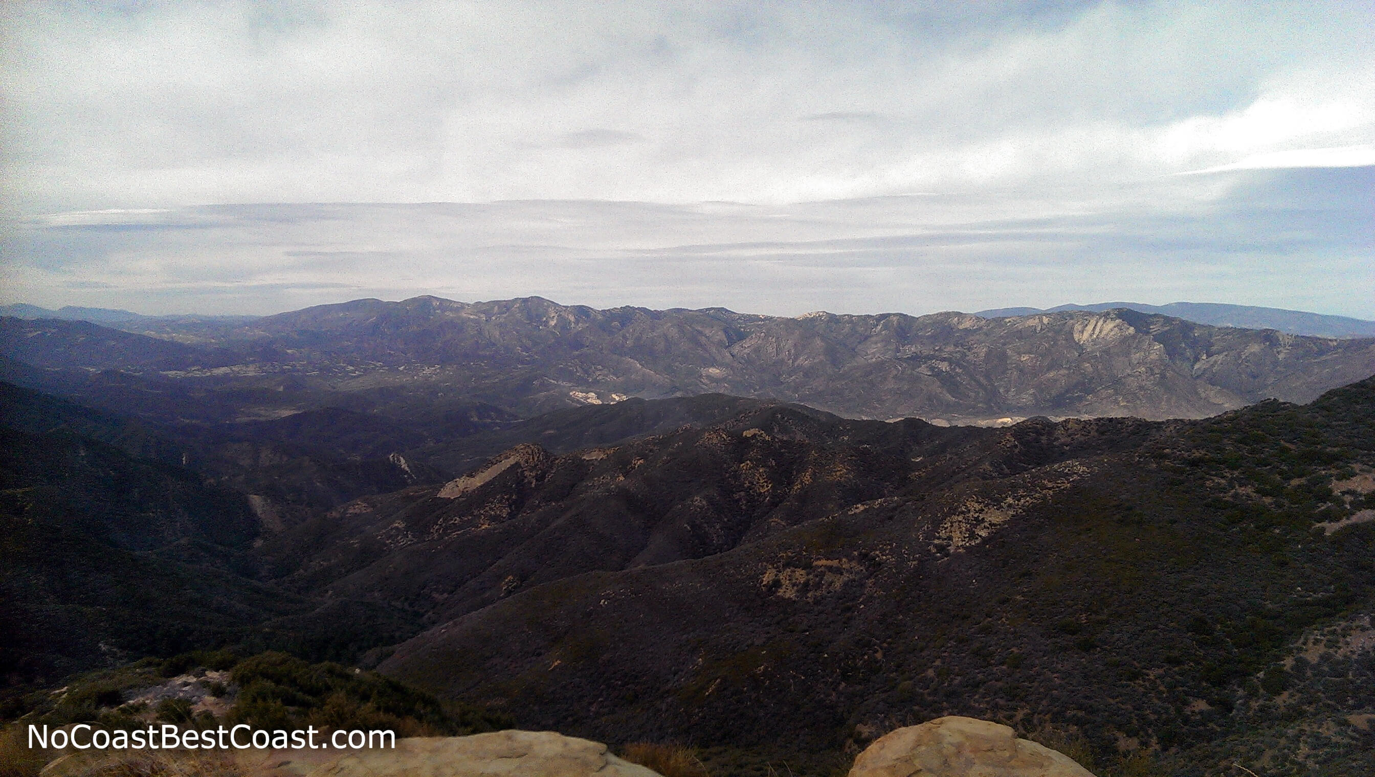
The view north deeper into the Los Padres National Forest
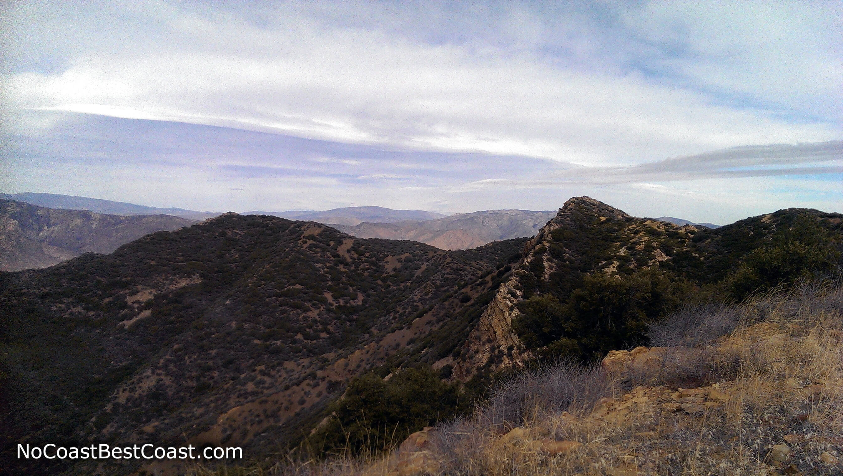
Looking west with part of the rocky cliff visible in the center
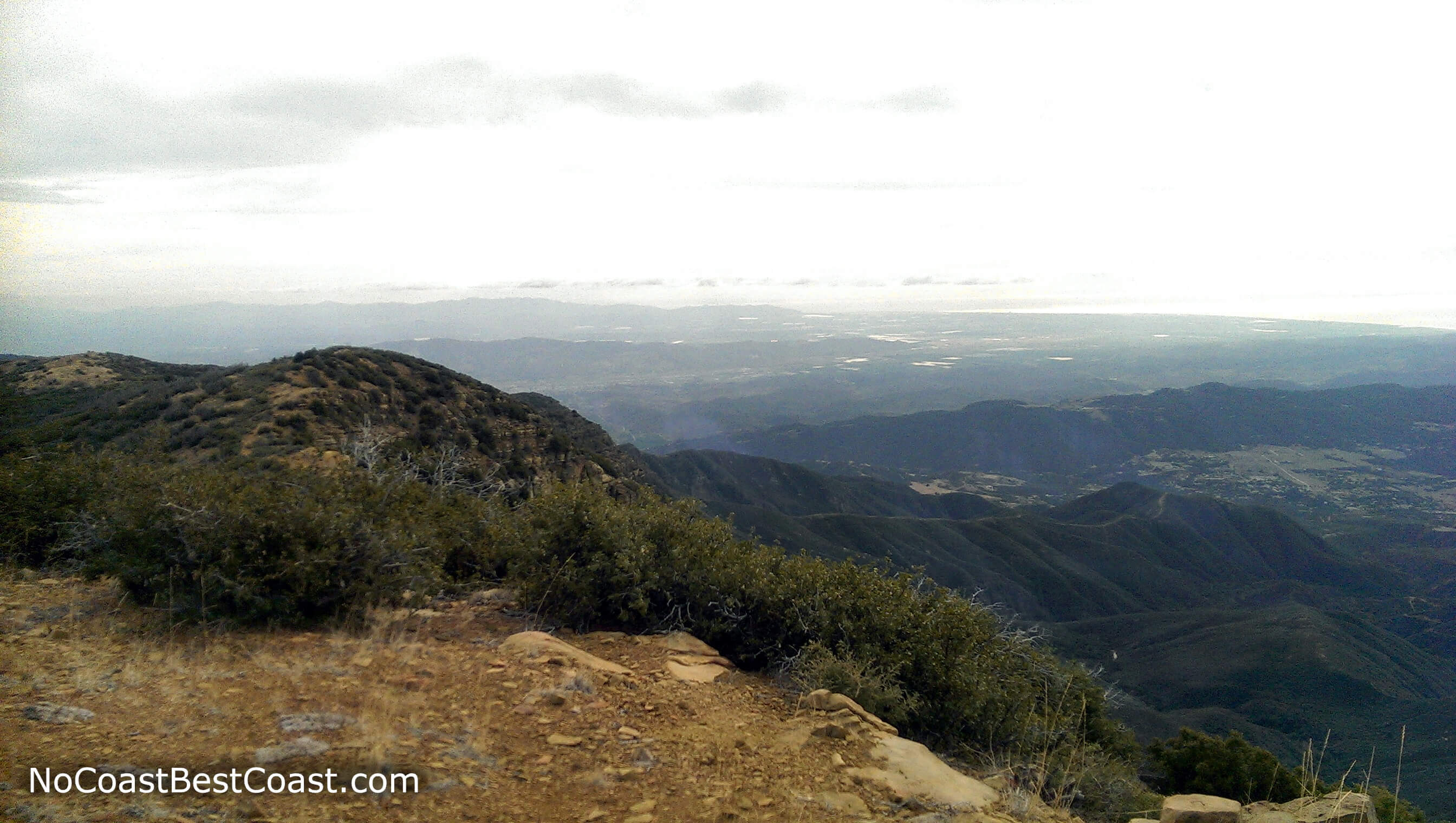
The Ojai Valley thousands of feet below with Ventura, Oxnard, and the Pacific Coast in the distance
Hiked on Sunday, January 3rd, 2016 by Ricky Holzer
Important Information
Rules about dogs are generally pretty relaxed in national forests once you leave the popular trails and recreation areas. Dogs are definitely allowed on leash, and you could easily get away with going off leash. This hike certainly is not family-friendly; look deeper in the Los Padres National Forest north of Ojai near campgrounds and day use areas for more family-friendly options. Spring, fall, and winter are the best seasons to hike since summer in this mostly shadeless environment can be terribly hot unless you start before sunrise. While snow may fall at this elevation, it usually doesn't remain for long. Sun protection is a must, and you should bring plenty of water in any season. This trail is far from LA and the population centers of Ventura County, so you won't see many people on this hike (if any at all).
Directions
From Los Angeles, take Interstate 5 to California Highway 126 to Santa Paula. Take the exit for California Highway 150 (10th Street) and continue north for about 9 miles. Turn right on Sisar Road just before the Summit School -- this narrow road is easy to miss, so pay attention and look for the green sign! Stay right at the fork in the road where the road turns to dirt. Park on the side of the road near the two water tanks.
Google Maps Directions
Parking, Fees, and Facilities
Parking is free! There are no facilities or amenities nearby, so bring everything you need for this long trek.
Nearby Hikes
Los Padres National Forest, California
★★★★★(5/5)
Los Padres National Forest, California
★★★★☆(4/5)
Angeles National Forest, California
★★★★☆(4/5)
Red Rock Canyon State Park, California
★★★★☆(4/5)