| Rating | ★★★★☆(4/5) |
| Overall Difficulty | Easy |
| Navigation Difficulty | Easy |
| Distance | 0.5 miles roundtrip |
| Time | 30 minutes |
| Terrain | Mostly flat |
| Best Seasons | Spring, Fall, Winter |
| Dog Friendly | Yes |
| Accessible | Yes |
Highlights
- Seeing the well-preserved cliff dwelling
- Learning about native culture and local plants
Hike Summary
My mother told me we visited Montezuma Castle when I was a kid, but I was too young to remember it. As an adult, this place was fascinating: an outdoor museum exhibit that explained how the Sinagua people survived their entire lives in a desert while I could barely last 30 minutes outside in the heat to learn about them. Only a few minutes from Interstate 17, this is somewhere you shouldn't miss if you ever drive between Phoenix and Flagstaff.
Follow the sidewalk out the back end of the visitor center to start your walk. The path was strategically designed for the desert climate with ample shade from mature trees lining the trails and keeping the many benches cool, as pictured below.
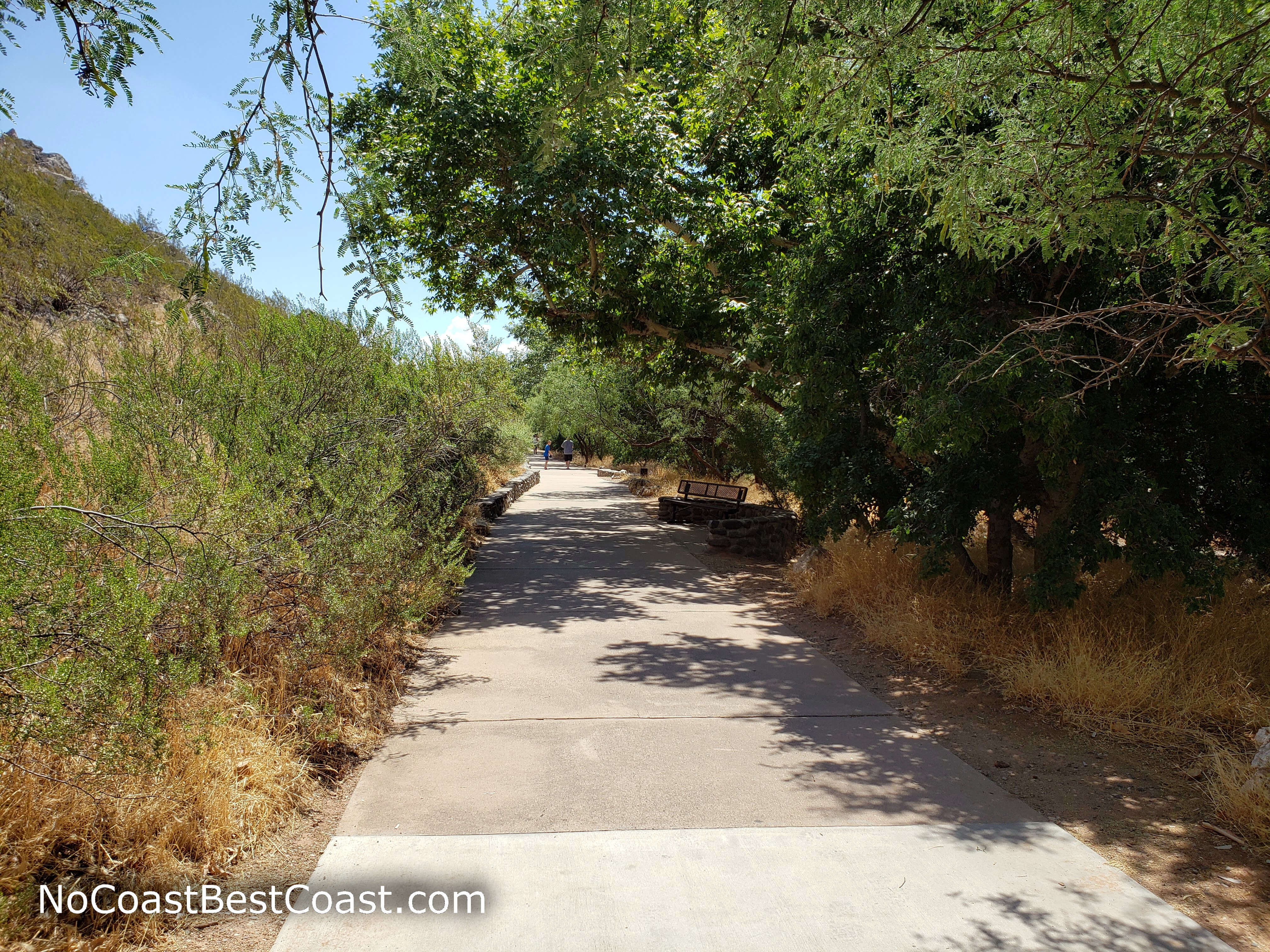
Benches and shady trees line the pavement
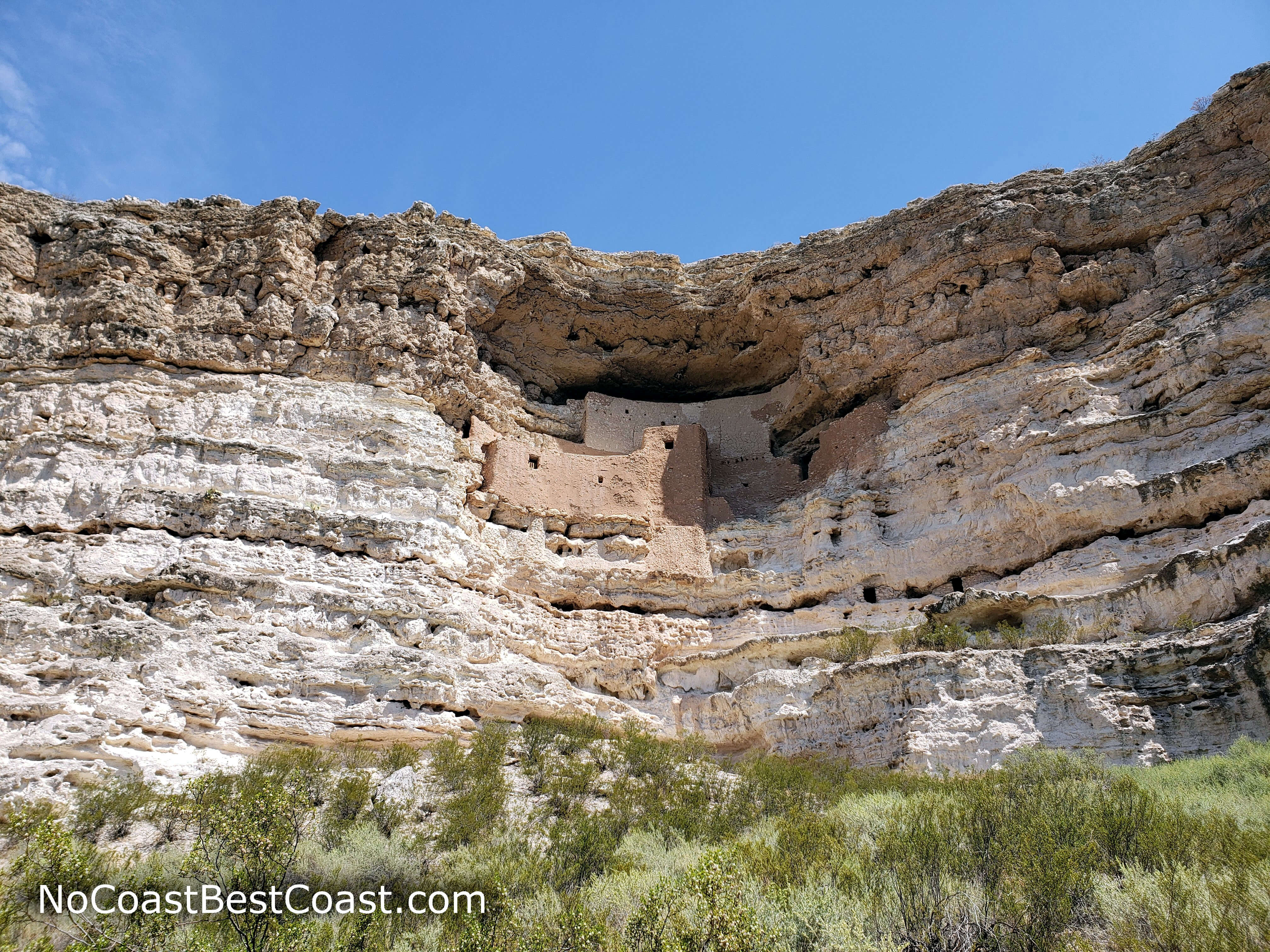
Montezuma Castle built directly into the cliff above
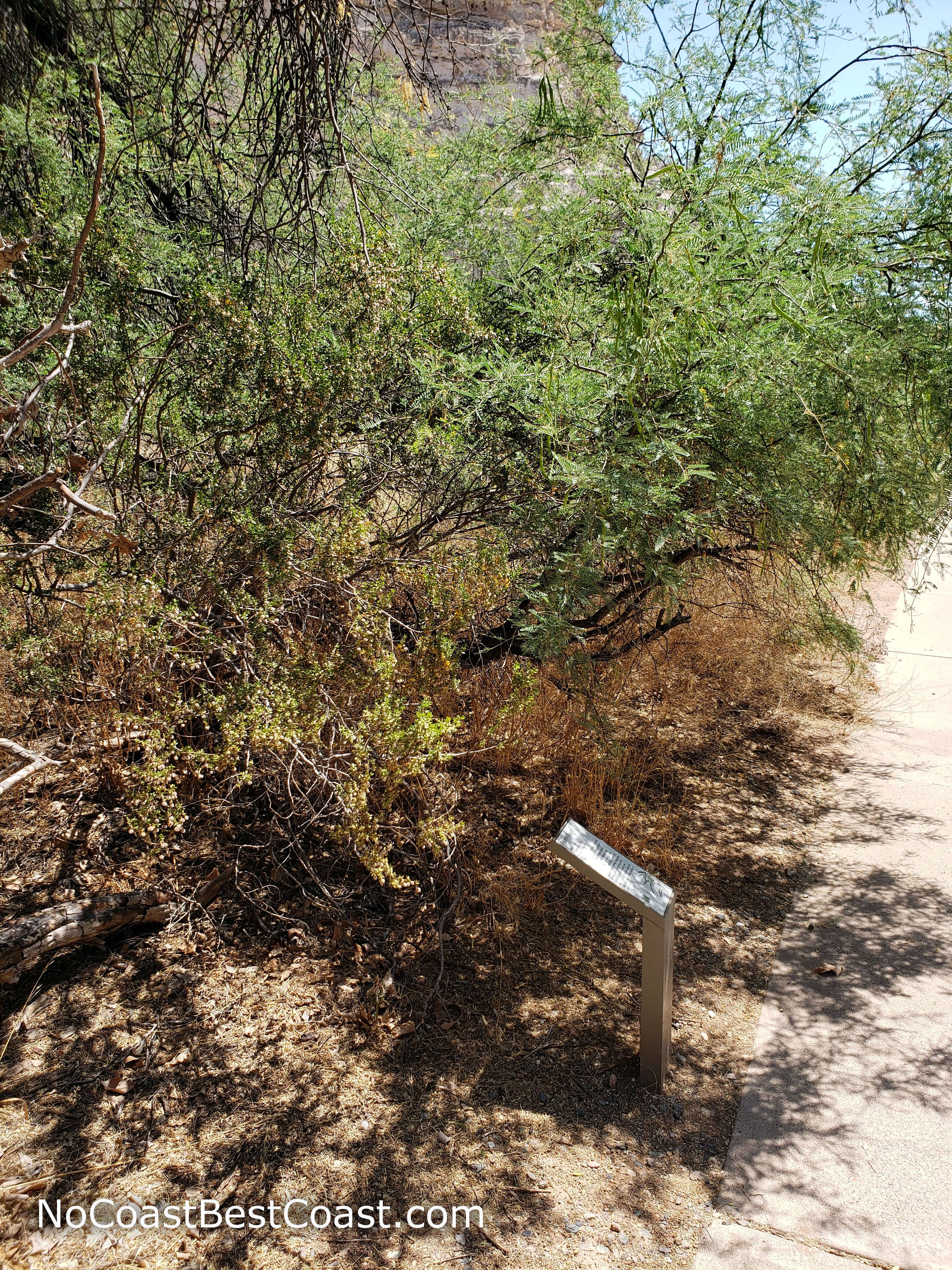
Signs like this share information about local plants and how native peoples used them
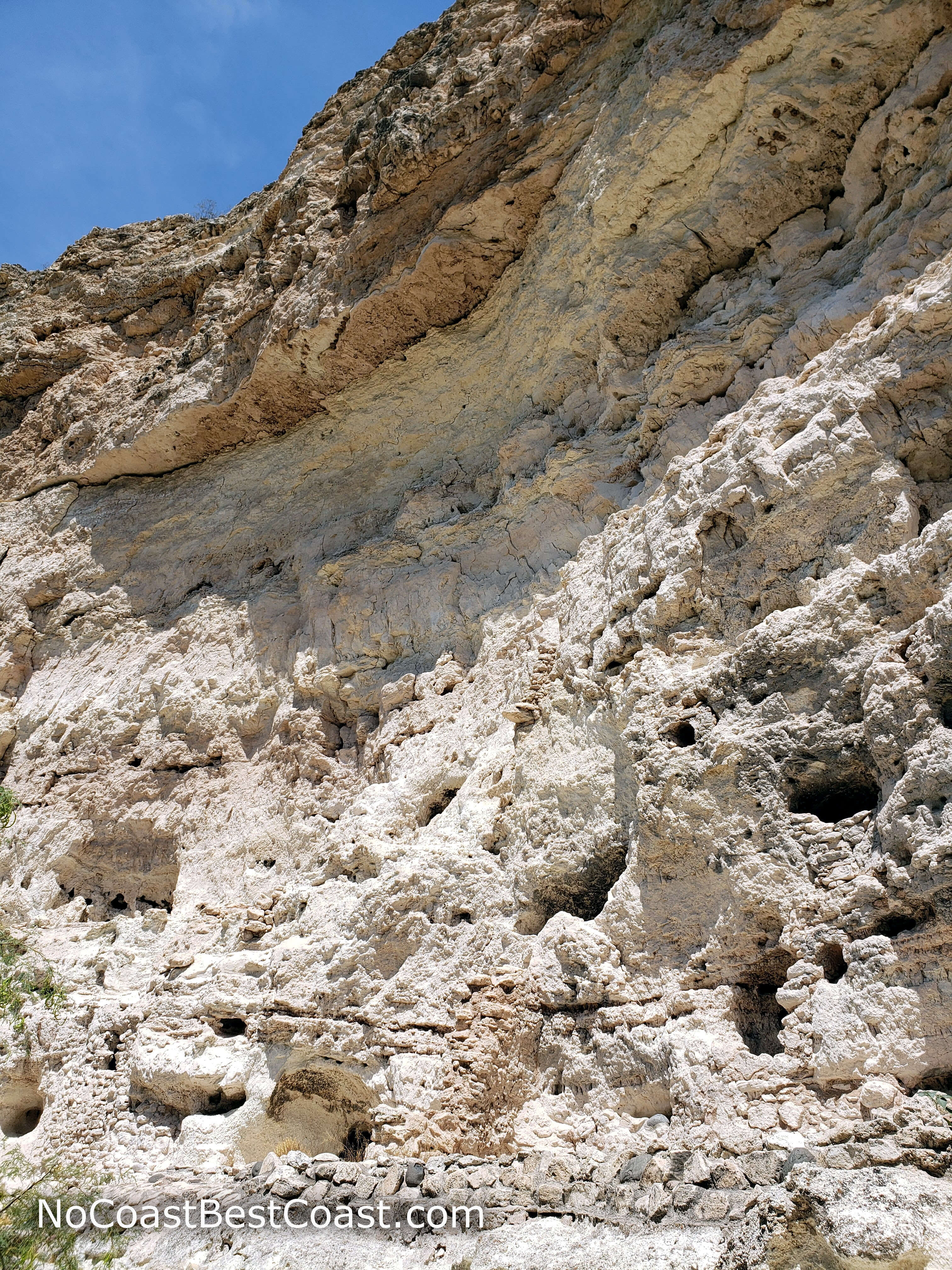
Remnants of stone and mortar walls at the base of the cliff
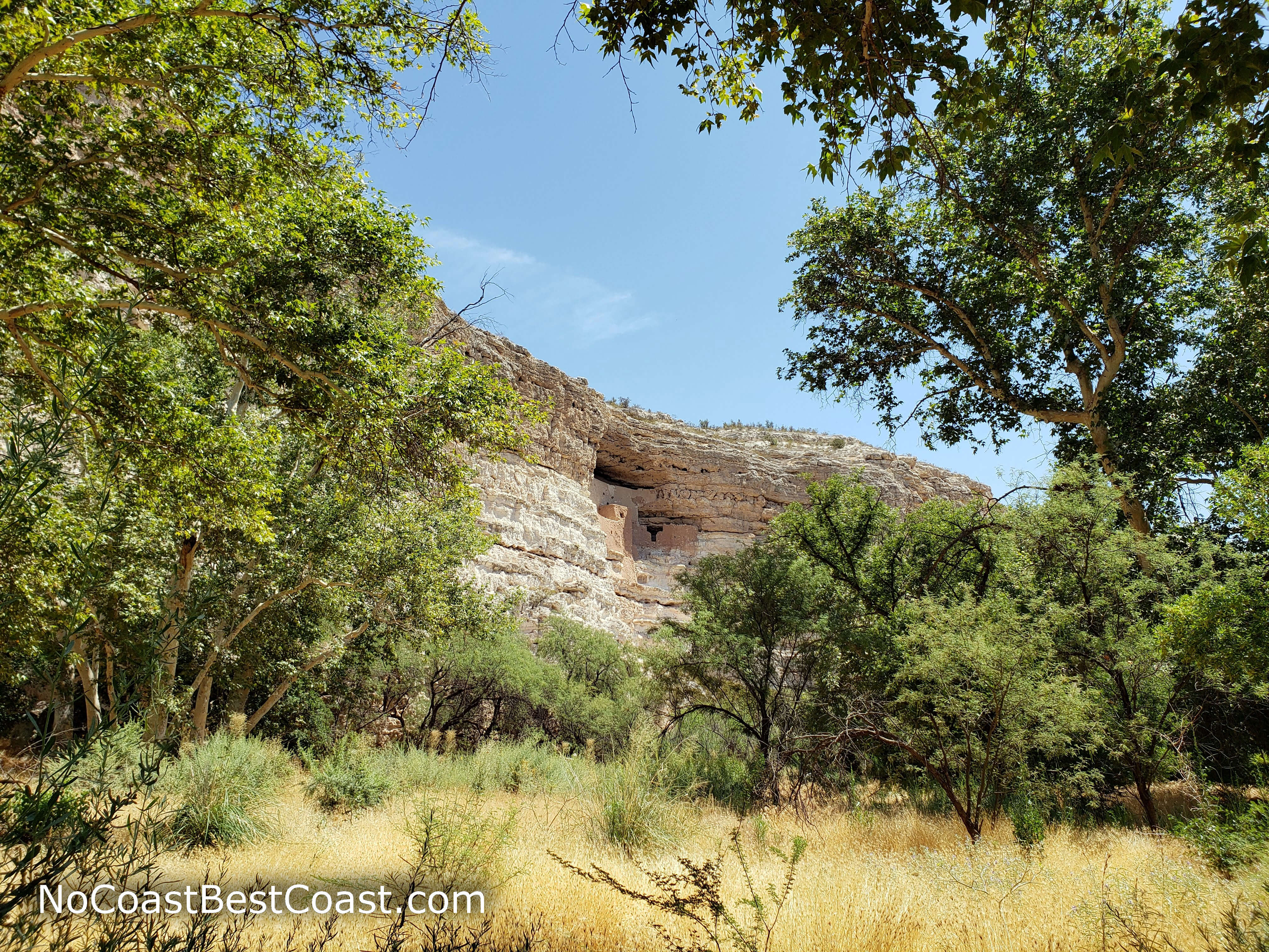
Montezuma Castle in the distance above the trees
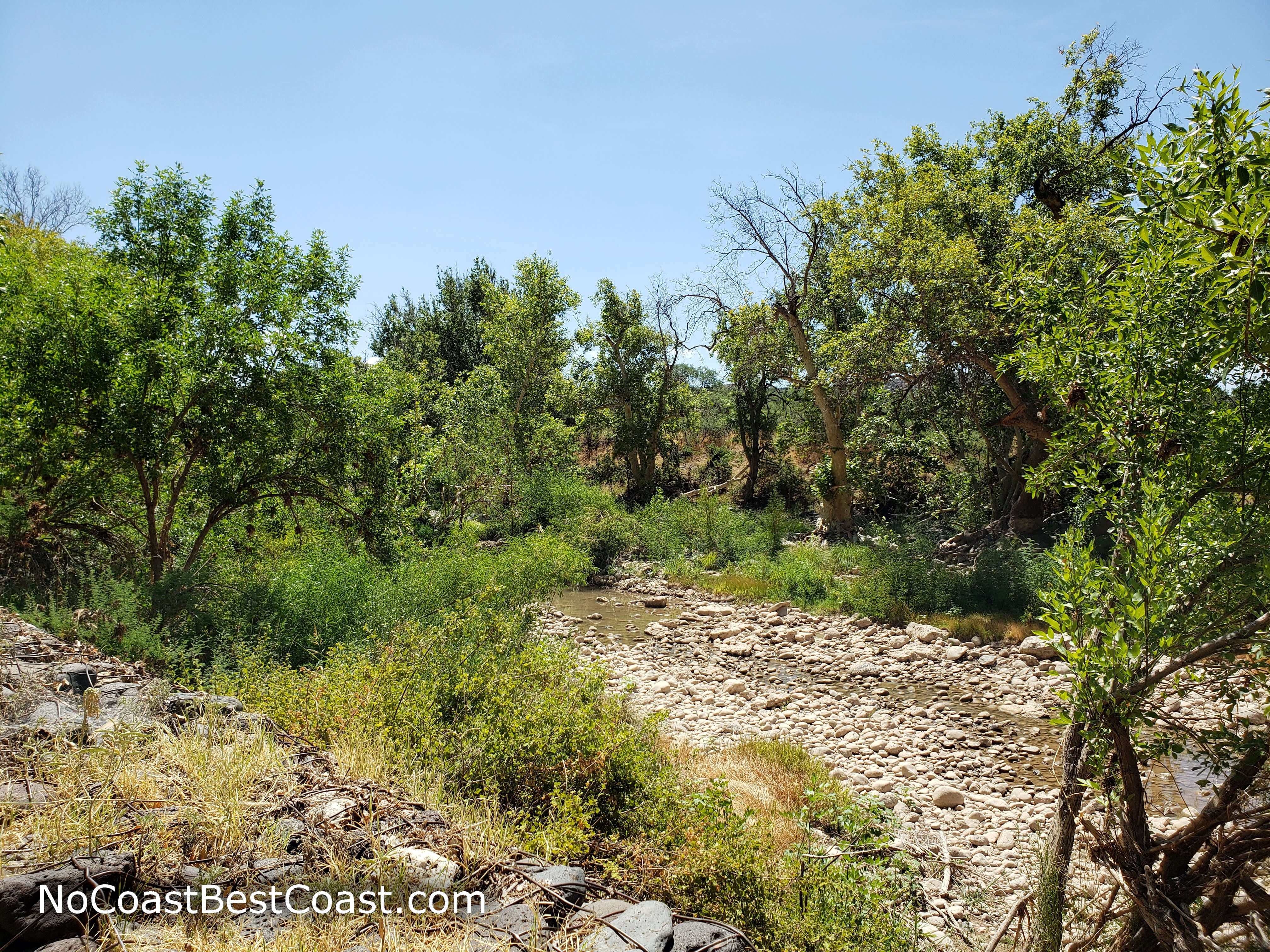
A view of Beaver Creek
Hiked on Thursday, July 25th, 2019 by Ricky Holzer
Important Information
Unlike many national park sites, dogs are allowed on leash on the trail, but not inside the visitor center. This trail was designed with families in mind! The paved trail is wheelchair accessible (which also makes it great for strollers) and shaded with easy-to-read signage along the way. While the park is open all year, summer afternoons should be avoided due to the oppressive heat. No matter when you go, bring water and wear sunscreen! This is a prime stop along Interstate 17, so expect to see people when you visit -- on peak weekends you may have trouble finding a parking space.
Directions
From Phoenix, take Interstate 17 north towards Flagstaff. In Camp Verde, take the exit for Middle Verde Road, then turn right. Continue straight through the traffic circles, then turn left onto Montezuma Castle Road. The road ends at the parking lot in front of the visitor center.
Google Maps Directions
Parking, Fees, and Facilities
Rather than charging per vehicle like most national park sites, you must pay per person: $10 for adults (age 16 and older) and free for children under 16. The entrance fee is good for 7 days and also provides entry to nearby Tuzigoot National Monument. The visitor center has restrooms, water, exhibits, and a gift shop.
Nearby Hikes
Montezuma Castle National Monument, Arizona
★★★★☆(4/5)
Coconino National Forest, Arizona
★★★★★(5/5)
Sunset Crater Volcano National Monument, Arizona
★★★☆☆(3/5)
Sunset Crater Volcano National Monument, Arizona
★★★★☆(4/5)