| Rating | ★★★★☆(4/5) |
| Overall Difficulty | Moderate |
| Navigation Difficulty | Easy |
| Distance | 0.75 miles roundtrip |
| Time | 1 hour |
| Terrain | Hilly |
| Best Seasons | Spring, Fall, Winter |
| Dog Friendly | Yes |
| Accessible | No |
Highlights
- Seeing rare water in a desert environment
- Remains of cliff dwellings
- Learning about the Sinagua people and how they used canals for agriculture
Hike Summary
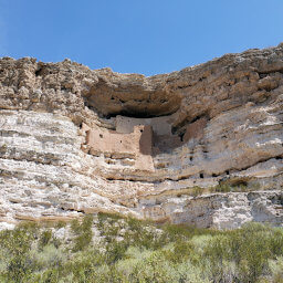
While nearby Montezuma Castle is pretty cool, I found Montezuma Well to be more interesting and unique. This limestone sinkhole is filled with water from an underground spring and remains full even during droughts! The Sinagua people used the outflow of the well for irrigation, allowing them to farm in an otherwise inhospitable landscape. You'll learn more about these people from signs along the trail, all while enjoying beautiful desert scenery.
From the parking lot, follow the paved trail on the right side of the building. A series of stone steps lead uphill, with signs for you to read as you catch your breath. The steps end at a viewpoint on the rim of Montezuma Well, pictured below. The water is highly carbonated with elevated levels of arsenic -- not suitable for drinking -- so as you'll learn from signs here, the Sinagua used it for agriculture instead. While the carbonation prevented fish from populating the well, five endemic species are found here, including a species of leech, snail, water scorpion, algae, and a shrimp-like amphipod.
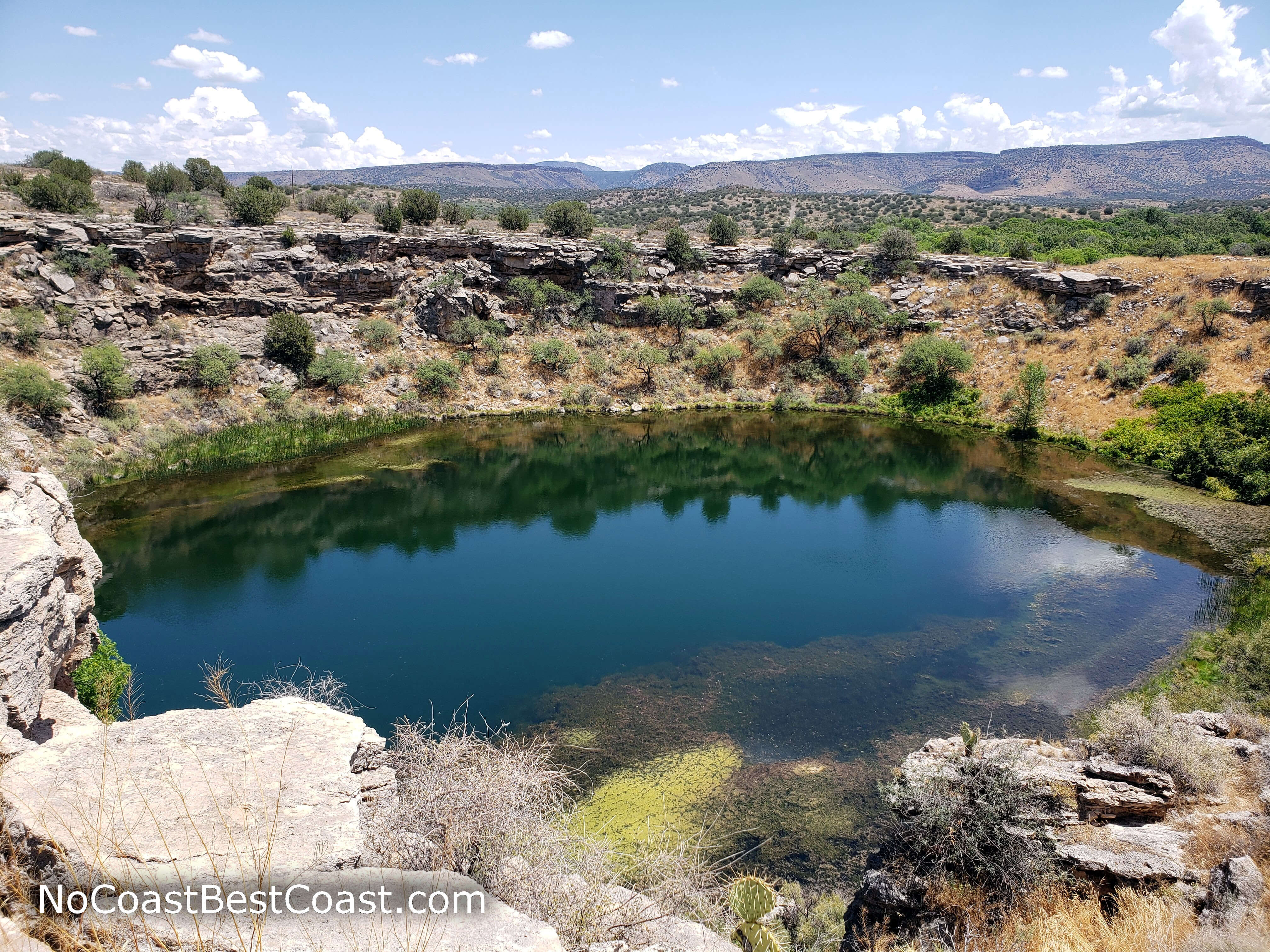
The blue of Montezuma Well contrasting with the brown desert
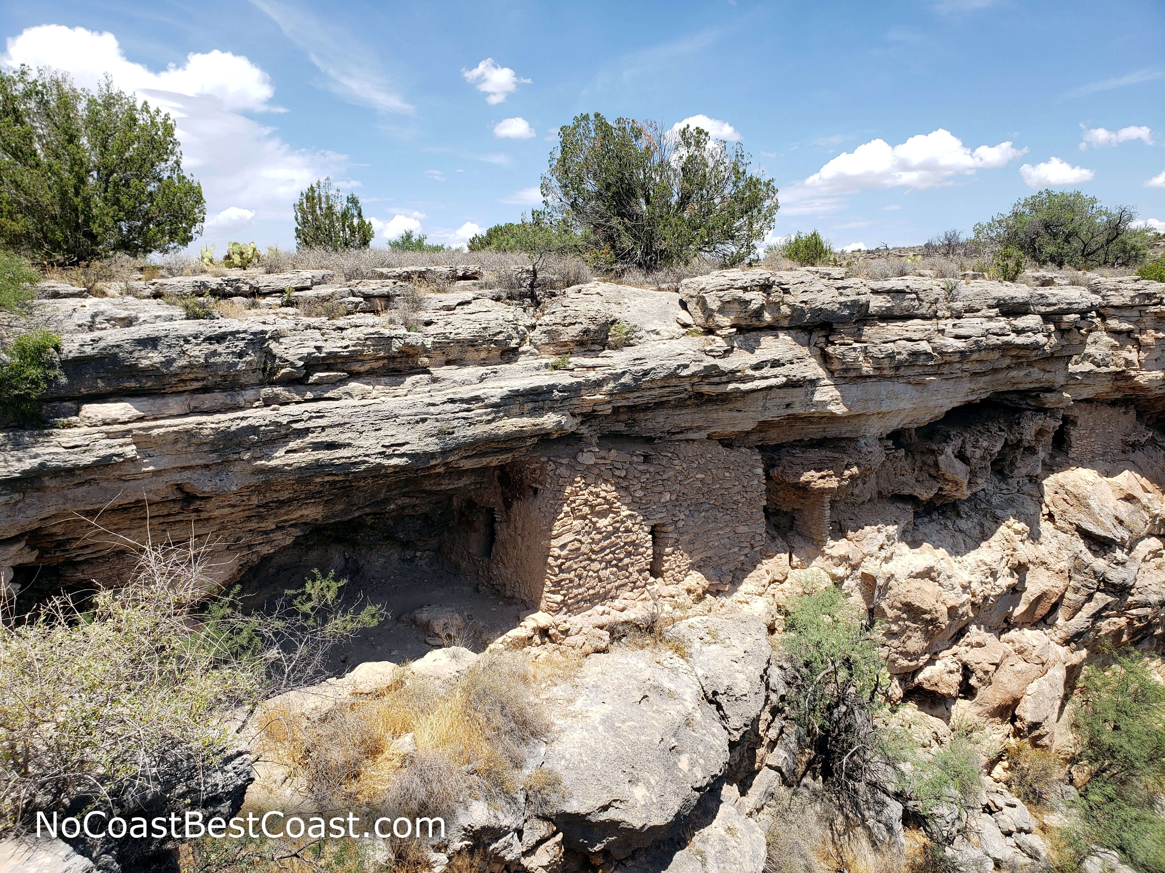
Cliff dwellings along the rim of Montezuma Well
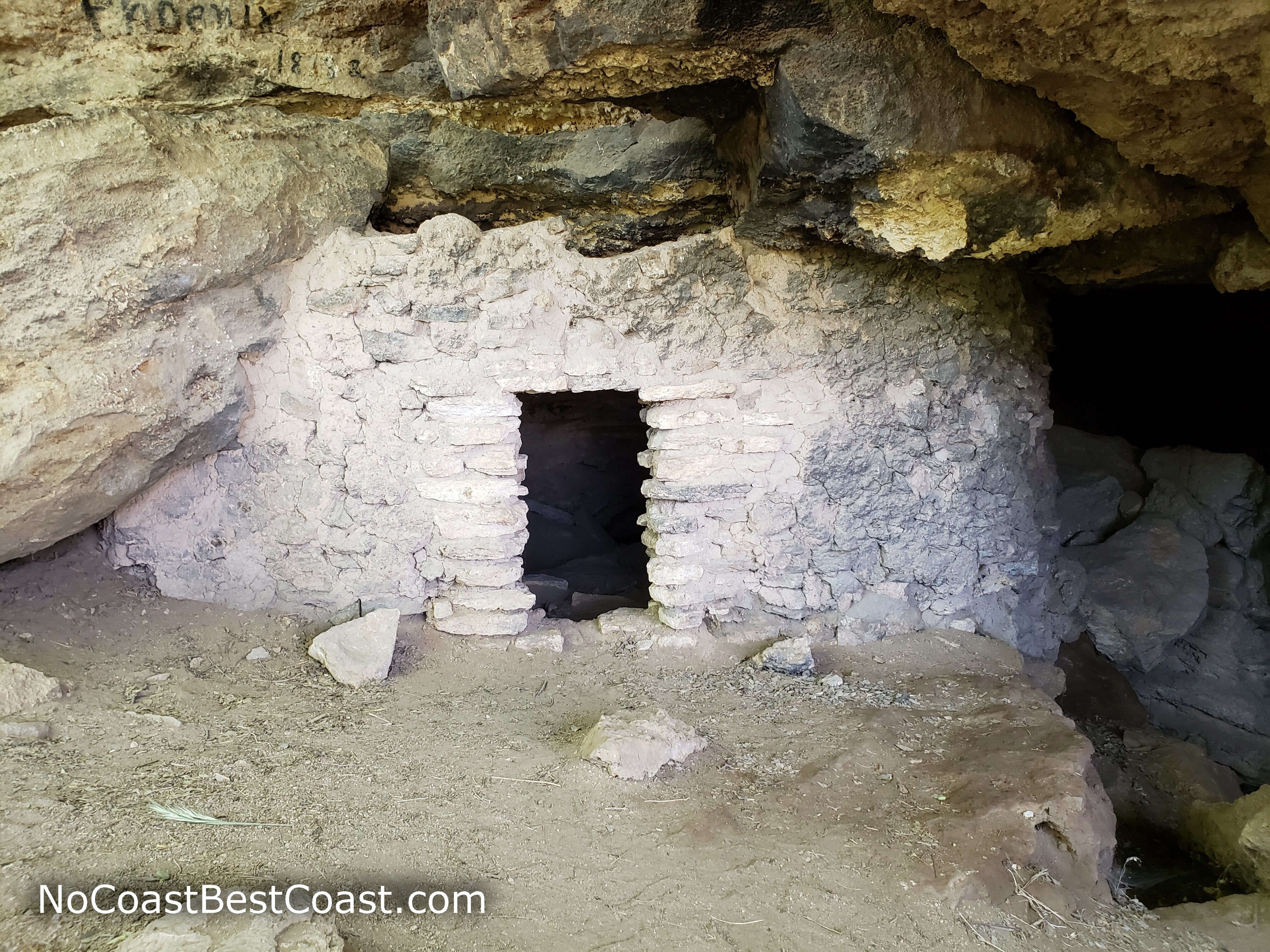
A cliff dwelling near the bottom of Montezuma Well
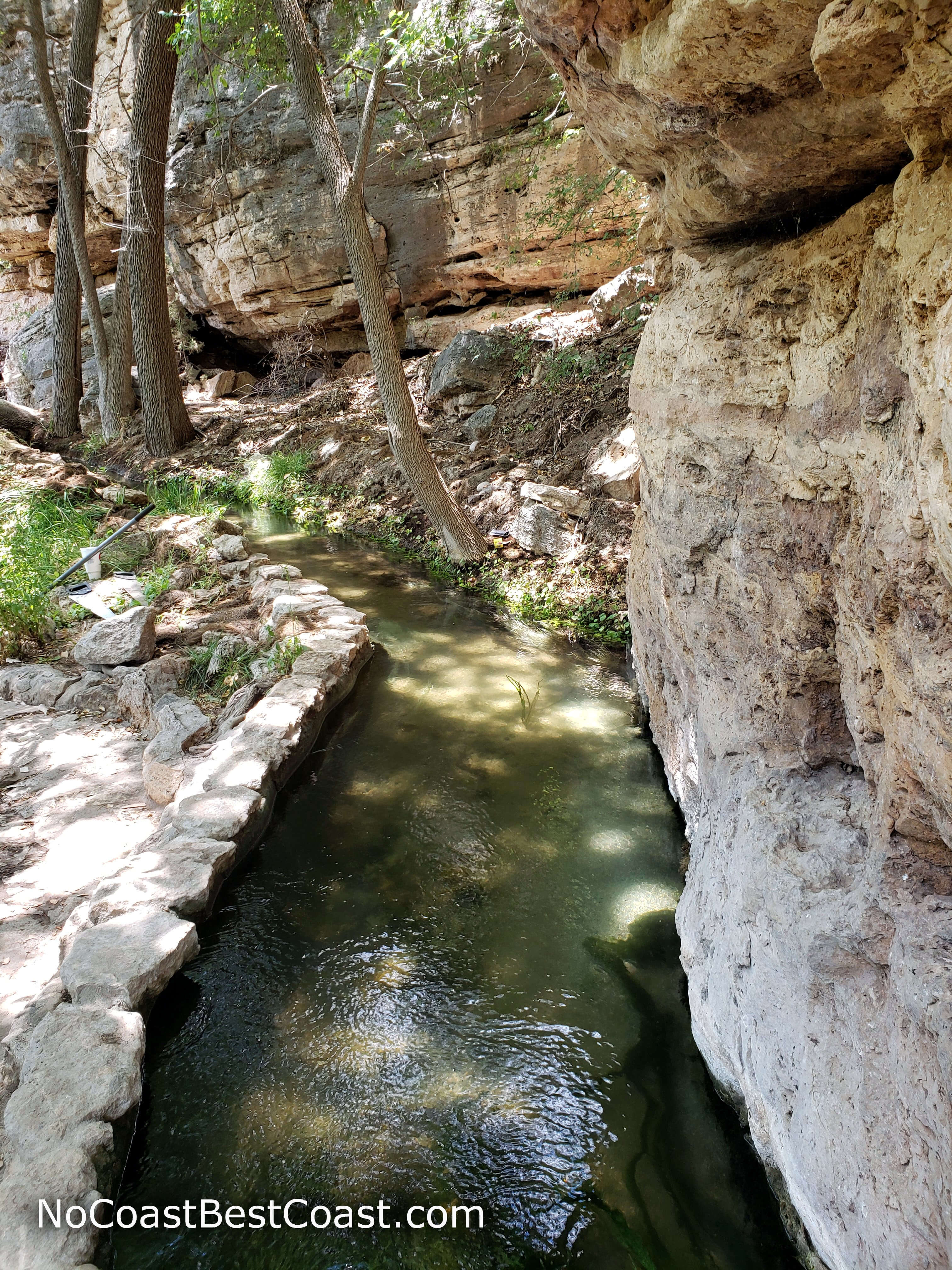
The Sinagua used canals like this to irrigate their farms
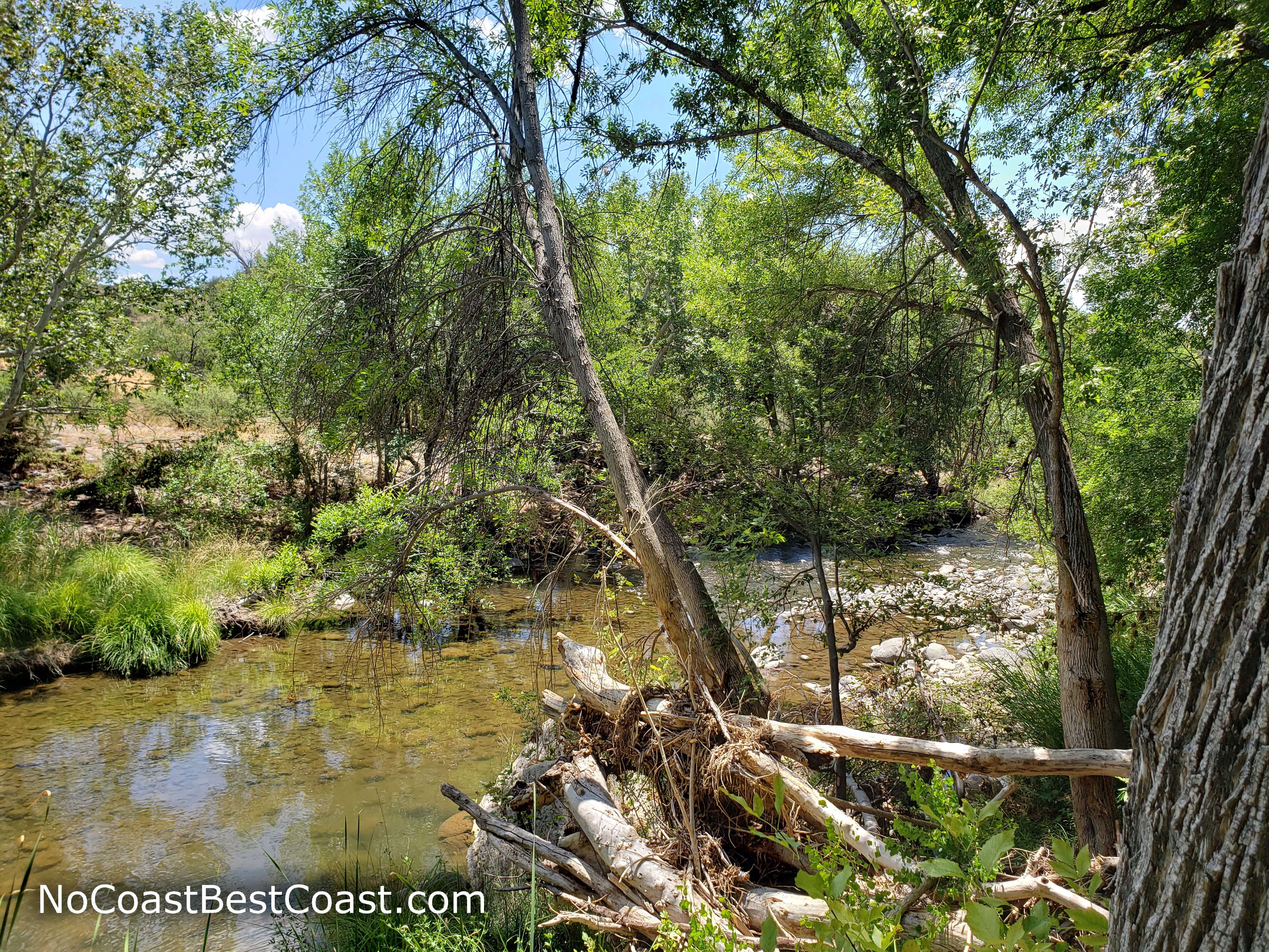
The lush banks of Wet Beaver Creek
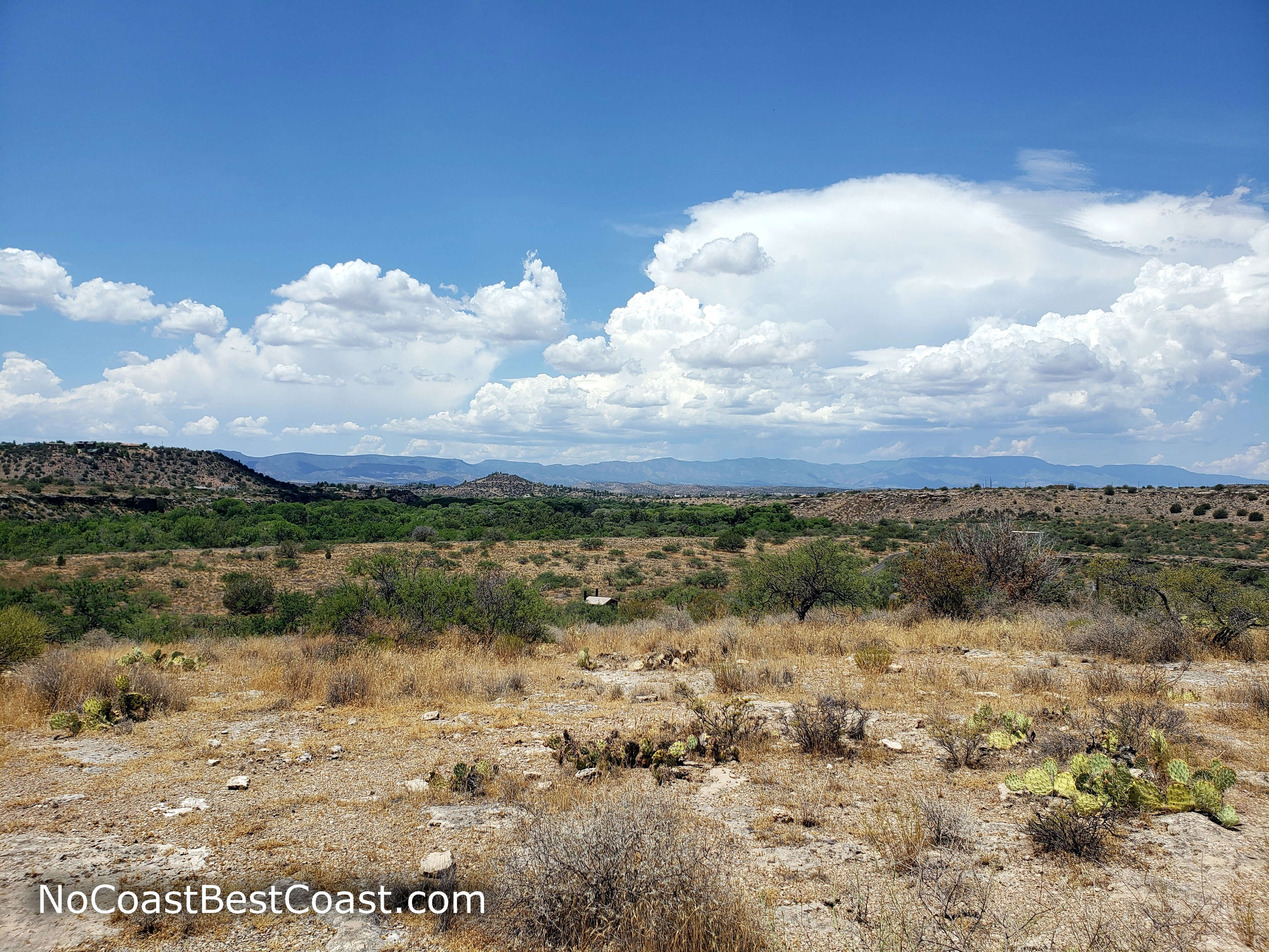
Puffy clouds above the distant desert mountains
Hiked on Thursday, July 25th, 2019 by Ricky Holzer
Important Information
Unlike many national park sites, dogs are allowed on leash! This hike is short and educational, making it perfect for the whole family -- just note there are stairs involved. While the park is open all year, summer afternoons should be avoided due to the oppressive heat and lack of shade. No matter when you go, bring water and wear sunscreen! This is a prime stop along Interstate 17, so expect to see people when you visit, though fewer visit here than Montezuma Castle.
Directions
From Phoenix, take Interstate 17 north towards Flagstaff. Take the exit for County Road 30/Montezuma Well, then turn right. Continue straight through town, then turn right onto Montezuma Well Road after the sign for the park. Park at in the lot at the end of the road.
Google Maps Directions
Parking, Fees, and Facilities
Parking is free at Montezuma Well! There are pit toilets and a small, staffed building near the lot.
Nearby Hikes
Montezuma Castle National Monument, Arizona
★★★★☆(4/5)
Coconino National Forest, Arizona
★★★★★(5/5)
Sunset Crater Volcano National Monument, Arizona
★★★☆☆(3/5)
Sunset Crater Volcano National Monument, Arizona
★★★★☆(4/5)